Happy Christmas, of course!
December 22, 2023 § Leave a comment
This year has been strange for me, as osteoarthritis in my left knee has kept me from most walking. I’ve now got a new half-knee, however, which seems to be working well. Things are looking up!
Sent from Outlook for Android
The strange hills
January 12, 2023 § Leave a comment
I was walking once in the hills. The track I was on was joined by another track coming in from the right. On this there was another walker. We greeted each other and walked along together. He claimed I was someone from his past, but I was sure I’d never met him before. As we walked along he described to me the track he’d been following before we met. Eventually we came to a fork in our track. There we parted. He went to the left and I went to the right. I never saw him again. The track I now was following was remarkably reminiscent of the one my former companion had described to me. I walked along it until eventually it was joined by another track coming in from the left. On this there was another walker. We greeted each other and walked along together. I was sure he was someone from my past, but he claimed he’d never met me before. As we walked along I described to him the track I’d been following before we met. Eventually our track forked, and at this fork we parted. I went to the left and he went to the right. I never saw him again.
After Hans Reichenbach, The Philosophy of Space and Time, 1958, Dover Publications Inc, New York, pp 141-142.
And yet another Christmas…
December 17, 2022 § Leave a comment
This past year has been strange, for various reasons, and one of the things that got lost in this strange year is my habit of blogging. Mind you, some people may have relished this, for some of the posts were getting more and more esoteric and apparently less and less walking related. But, anyway, it’s almost the end of the year, so a post of the old and familiar type will probably not go amiss. It’s my final Going It Alone article, which appeared in the April 2022 edition of Strider. Somehow it never got posted.

Strider, Number 152, April 2022
As always, to make the article legible simply click on the photo. If that doesn’t work, here’s the text:
“Designing a series of articles for a magazine – and I plan this article to be last in this series – is in one respect like designing a course of lectures. Into all but the final lecture you deliberately build a hook. You want your listeners always to leave asking “Yes, but what about?” The answer of course is “Come back next time!”
In the previous article in this series I identified the two kinds of problem that the go-it-aloner can be faced with on a long-distance walk: there are problems you can solve and there are problems you can’t solve. The hook built into that article is simply the question “What do you do, alone and miles from anywhere, if the problem facing you is one you need to solve but can’t solve?” Clearly things can go wrong when you’re going it alone – in some cases very seriously wrong.
It’s common wisdom that the best way to get out of a hole is to not get into it in the first place. The best way to solve a potentially serious problem would seem therefore to be to remove entirely the possibility of that problem arising. That, however, is a course of action no go-it-aloner will want to take. If you seek to eliminate the possibility of every potentially serious problem arising on a walk you’re planning, you’ll never leave home. By the same token, if you spend all of your walking time studiously avoiding everything that could possibly lead to a potentially serious problem, you’ll never get anywhere.
A more realistic course of action is to seek to minimise the disruption to your walk that potentially serious problems can cause. You do this when you’re planning the walk and also when you’re carrying it out. Whenever you identify a potentially serious problem you balance its severity (this is referred to as the danger) against the chance that it will actually arise (this is referred to as the risk). If the danger associated with the problem is low, irrespective of how low or how high the risk is, that problem is unlikely ever to disrupt the walk. You can effectively disregard it. If the danger is high but the risk is low, disruption certainly is possible, even serious disruption. The likelihood of disruption is nonetheless small, so you’ll probably decide to carry on. If the danger associated with a problem is high and the risk is also high, then you ought probably to ask yourself if you really do want to go ahead.
The words ‘danger’ and ‘risk’ are used in this context with very specific meanings. It’s therefore helpful to give a couple of examples of how this balancing of danger and risk can work in practice. The setting for the first example is Spitsbergen; the problem is that there are polar bears living there; the danger is that they will kill you. That counts – in my book at least – as serious disruption! The situation in Spitsbergen today is that the bear population is relatively large. Anyone moving outside a fenced area is strongly advised to carry a gun, and tented camps commonly post sentries. This is sensible, because the risk of being killed is otherwise unacceptably high. Now flash back more than fifty years to a group of student geologists working for several weeks in southern Spitsbergen. Four young men, two small open boats, two sledges, no radio, and a single gun – an 1896 Steyr bolt-action rifle. We weren’t always together when we were working, we camped always without sentries, and the rifle usually stayed in the mess tent. Our behaviour was not in any way irresponsible or unsafe. The danger involved in being killed by a bear was the same then as it is today, but the bear population then was relatively small. The risk of being killed was therefore acceptably low.
The second example is set closer to home, on the Ceredigion Coastal Path immediately north of Aberystwyth. You have two choices there for the section to Clarach: you can stay on the cliff-top path over Constitution Hill or you can take the geologically interesting route along the beach and spend a little time getting to know the Aberystwyth Grits. It’s your choice. The beach route has a problem, however, in that the coastline here is macrotidal, i.e., the tidal range is more than four metres. There are two cut-off points on the beach route, and you mustn’t get trapped between them on a rising tide. Getting trapped by the tide under an effectively unclimbable cliff is never a recipe for longevity, especially if the rocks and boulders at the base of the cliff are likely to be wet and slippery and the cliff itself is not everywhere stable. What is the risk of getting trapped? Look at the tide tables! If you take the beach route only on a falling tide or at low water you have next to no chance of getting trapped. If you cross one of the cut-off points on a rising tide and have insufficient time to clear the danger area, then you are certain to be trapped. You are in that case being extremely foolish. Don’t expect to be rescued. The emergency services are not there to compensate for your foolishness. This conscious balancing of danger and risk allows walks to be planned and carried out with the minimum of disruption. At the same time – because you get to set the levels of danger and risk that you are prepared to accept – it lets you make your walks your own. That is what going it alone is all about. You make the decisions and you take the responsibility for them. You get the enjoyment that results when things go right, and you accept the consequences when things go wrong. You know what you want to do, you know what you can do, and you know what you probably can’t do. So go ahead! Go it alone!”
Finally, to everyone who’s reading, a joyous Christmas and a wonderful New Year.
Continuity
January 20, 2022 § Leave a comment
Firstly, the documentation for the ants’ nest program is now on the ‘Software’ page at the left-hand side of the blog. This tells you how to download the program and how to run it. Have fun. I’ll be coming back to it in a couple of posts’ time.
Secondly, the flaws in those two magnificent films. First The Big Country. Play the clip (https://app.box.com/s/7k8tfgjmibi6au7khi152nar34hw6kia) and stop at 2:44. You’re looking down on the settlement, with the stagecoach coming into it fast from the top-right of the picture. There’s also a carriage drawn by a single horse coming into the settlement from the bottom-left. At 2:50, three horsemen ride in from the bottom-left of the picture and overtake that carriage. Now go on to 2:57. You’re now in the settlement looking at the stagecoach as it draws in. The three horsemen are now overtaking the stagecoach and coming straight towards you. To be able to do this they would have had to have zipped from one side of the settlement to the other at warp speed and changed direction 180 degrees. Oh!

The three horsemen
Now to Lawrence of Arabia. Play the clip (https://app.box.com/s/oen791247pzp7qcv7n67w6yvomb5cmkp) and stop at 1:39. You’ve been watching Lawrence prepare his beloved Brough Superior SS100 before the fatal crash. He’s checked it, he’s polished it, he’s turned on the fuel, he’s put on his goggles, he’s grasped the handlebars, and he’s just kick-starting it. Now play the clip further. There’s first the continuation of the kick-start, then Lawrence mounts the bike, pushes it off its stand and rides away. The flaw is of course that up until the kick-start the surface on which the bike is standing is apparently a concrete slab – possibly a garage floor. Then, instantaneously, it becomes a gravel driveway. Oh!

The kick-start
Each of these flaws is a continuity flaw. It makes the film’s story not cohesive. This can be disconcerting for the audience. In some cases – All is Lost – it can be extremely disconcerting. You’ll find a brief introduction to film continuity in https://beverlyboy.com/filmmaking/what-is-continuity-in-film/
Continuity isn’t just something that film makers are concerned about. Scientists need to be concerned about it too – geologists perhaps more than most. Why? Come back next time!
Perhaps I’m not so bad after all!
January 5, 2022 § Leave a comment
That video clip you downloaded last time – you did download it, didn’t you? – has some great music in the background – Jerome Moross’ brilliant theme for William Wyler’s The Big Country. That’s a magnificent film, with its memorable opening sequence of the stagecoach crossing the prairie. Check it out at https://app.box.com/s/7k8tfgjmibi6au7khi152nar34hw6kia
Clearly this film’s got nothing at all to do with ants, so you’re naturally wondering why I’m referring to it here. The reason is simply that a couple of days ago I wanted to see that opening sequence again. As I was playing it I was thinking back to that algorithm of mine that I’d thought was flawless but turned out not to be. I looked at that piece of Wyler’s magic and thought, “This, at least, is flawless”.
And then of course I found a flaw – a not insignificant one. It’s blindingly obvious once you see it. How on earth did Wyler – truly one of the great directors, a man with a reputation as a perfectionist – how on earth did he let that get through? Look at the sequence for yourself and find the flaw! Hint: you’re not looking for something stupid like the white car parked on the side at the Battle of Stirling Bridge, in Braveheart.
The Battle of Stirling Bridge – from Braveheart
OK, so Wyler wasn’t infallible. But David Lean surely must have been – the man who was perhaps the greatest director of all. Think Brief Encounter; think Bridge on the River Kwai; think Doctor Zhivago; think Lawrence of Arabia. I went straight to that brilliant opening sequence in Lawrence – the motorbike ride along the country lane and the ensuing crash – and again I thought, “This has to be flawless”. Check it out at https://app.box.com/s/oen791247pzp7qcv7n67w6yvomb5cmkp
Did I say there’s a flaw there too? And did I say that it’s also obvious? And am I wondering how Lean could have let that one through? Look at the sequence and find it for yourself!
Let’s make this a competition! Contact me with details of the flaws. There won’t be any prize for the winner, but all of the losers will be forced to sit through a screening of All is Lost.
The Ants’ Nest Problem (4)
December 27, 2021 § Leave a comment
You surely know the story! There you were, working contentedly away on some project. Then, for whatever reason, you broke off to do something else – and that something else went on and on, and on and on, and on and on. The project you’d been working on stayed stuck on the back burner for an almost interminable time. Eventually you got back to it, but when you did you found you’d lost your thread. That’s where I’ve been with the Ants’ Nest Problem. I’ll try and pick up that thread now, as best I can. Here goes…
How can the Voronoi diagram be used to model how the ants in the nest move around without always colliding with each other? No problem! Remember, from last time, that each ant has a neighbourhood outside of which it never trespasses, and that this neighbourhood is defined by the Voronoi polygon constructed around the ant’s position. Each ant moves along whichever path it wants to take (determined by the parameters of the random walk), and it continues moving either (1) for a preset time step, or (2) until it reaches the edge of its neighbourhood, whichever comes first. The polygons in the Voronoi diagram are non-overlapping, therefore collision is impossible. The Voronoi diagram is recalculated at the end of the time step using the new ant positions, then the next time step begins. Like all really neat scientific models, this model is both reasonable and simple.
The model does nevertheless have a potentially serious difficulty, one that unfortunately is inherent in a lot of real-world geometric computing. Those of you who don’t do geometric computing can skip the next paragraph without missing anything critical.
The algorithm I use to construct the Voronoi diagram is one I developed about thirty years ago: https://app.box.com/s/cb9bvyu6kvf784xepggz8tfdvvck2fy7. It’s straightforward, it’s highly efficient, and it never fails. Or so I used to think. Sadly, however, I’ve found one instance in which it does fail. Here’s the context in which this failure occurs. The nest being modelled is square and has 270 ants. Potential edge effects are got rid of by wrapping the nest top-to-bottom and left-to-right, i.e., by surrounding it with eight identical copies. The Voronoi diagram has accordingly to be constructed for 2430 ant positions each time – a thoroughly manageable number that wouldn’t usually give any difficulty. The wrapping of the nest makes the x and y coordinates of the ant positions exactly cyclic, however, with the result that adjacent sides of the Delaunay triangulation can readily be effectively collinear. The precision with which the computer stores the position coordinate values will then be insufficient to allow the Voronoi diagram to be constructed correctly, at least in some situations. This is likely to be true irrespective of the construction algorithm used.
Am I going to spend the next few months of my life trying to get this algorithm of mine to trap this potential difficulty? I don’t think so!
To see that the model does in fact work, and to appreciate a little of what it can do, download this video clip: https://app.box.com/s/78i6fygir41icay5opubhymq21hsup5n
Try playing it. It shows three runs of the model, each run having approximately 1000 time steps. Here’s a snapshot to help you with what you’re seeing.

The ants’ nest
You’re looking directly down onto the nest, which is shown bounded by the (very faint) grey lines. You see immediately the top-to-bottom and left-to-right wrapping. So everything that goes out at the top comes back in at the bottom etc. The coloured discs represent the individual ants. A green disc is an ant that is fully separate from every other ant and can therefore move freely in any direction. Two or more red discs together are ants that are clustered: they can move individually, but they can’t move any closer to each other.
Each of the runs has the same number of ants (270), and most of the random walk parameters are the same (direction continuity = 2; maximum absolute direction increment = 10; standard deviation of step length increments = 0.01). The ants in the first run have no preferred movement directions, i.e., they are all moving truly at random. The ants in the second and third runs each have a preferred movement direction: half of them want to move from west to east, half want to move from south to north. The ants in the second run have no directional bias, either towards their preferred direction or away from it. The ants in the third run have a bias towards their preferred direction, i.e., they try always to move closer and closer to that direction.
Now play the clip again. The ants in the first run move very freely. There are a few clusters, always very small ones, and these clusters break up relatively quickly. The ants in the second run also move very freely, and you can clearly see the two preferred movement directions. There are now more clusters, but they’re still relatively small and relatively short-lived. The ants in the third run find movement much more difficult: they cluster together more and for longer periods.
So what’s the recipe for moving freely in an ants’ nest? Move at random. If you want to move on average in a particular direction, don’t always try to move in that direction; be prepared to move away from it at random, then come back to it later.
Two final points. Firstly, the ants’ nest program will be posted soon: look for it in the ‘Software’ page on the left-hand side of the blog. Secondly, there is a reason for the soundtrack on the video clip you downloaded – other than of course that I like Wyler’s film. Come back next time!
…and a present!
December 23, 2021 § Leave a comment
It’s a present to give you relief from the beer (Harveys, of course), the chocolates, the games you never really thought you’d get, the clothes you can’t imagine wearing, the books you swore you’ll never read, and so on. So what is it? The latest Strider, with yet another Going It Alone article! You always wanted that, didn’t you?
Strider, Number 151, December 2021
As always, to make the article legible simply click on the photo. If that doesn’t work, here’s the text:
“There’s no evidence – at least none that I know of – that Rabbie Burns, the Bard of Ayrshire, was ever a go-it-aloner. One sentence of his stands nonetheless as the go-it-aloner’s maxim – “The best-laid schemes o’ mice an’ men gang aft agley.”
So there you are, somewhere on that long distance walk you so carefully planned, and something goes wrong. It could be something incapacitating (a broken leg); it could be something difficult (a key part of your kit gets damaged in a storm); it could be something inconvenient (a landowner has closed the permissive paths through his estate); it could be something you missed in your planning (the bus to today’s start point runs only on school days, and today is a Bank Holiday); or it could be something unforeseeable (the guards on your connecting Scotrail train have just decided to go out on strike). What on earth do you do now?
You can’t plan for every eventuality and you certainly shouldn’t try. Therefore, realistically, you shouldn’t ever be surprised if something goes wrong, or, at the very least, if something doesn’t go exactly according to plan. What you have to do then, instead, is to come up with an acceptable solution to whatever problem it is that you’re now facing.
One of my walking companions once asked me what go-it-aloners do if something goes wrong in the middle of a walk, alone and miles from anywhere. My answer – and I think it’s one that other go-it-aloners will subscribe to – was simply that there are two kinds of problem you can be faced with on a walk: there are ones you can solve and there are ones you can’t. If the problem you’re faced with is of the first kind, you solve it; if it’s of the second kind, you don’t. In answering in this way I deliberately side-stepped the matter of what the problem in question might be. I did this in order to make clear that what is always of fundamental importance to the go-it-aloner is that problems that need to be solved and that can be solved are solved. Go-it-aloners are problem solvers: they have to be.
How does this problem solving work in practice? More to the point, bearing in mind the variety of problems that might arise on a long distance walk, how can it possibly work? Surely go-it-aloners are not multi-talented superbeings capable of seeing off each and every potential disaster! No, of course they’re not; they’re human and they recognise their limitations. Therefore, first of all, they’re prepared for all those routine problems, usually small ones, that are likely to crop up on a walk of any kind (cuts and bruises and blisters, for instance). Secondly – and this is the critical point – they generally have with them a backup of everything they think important.
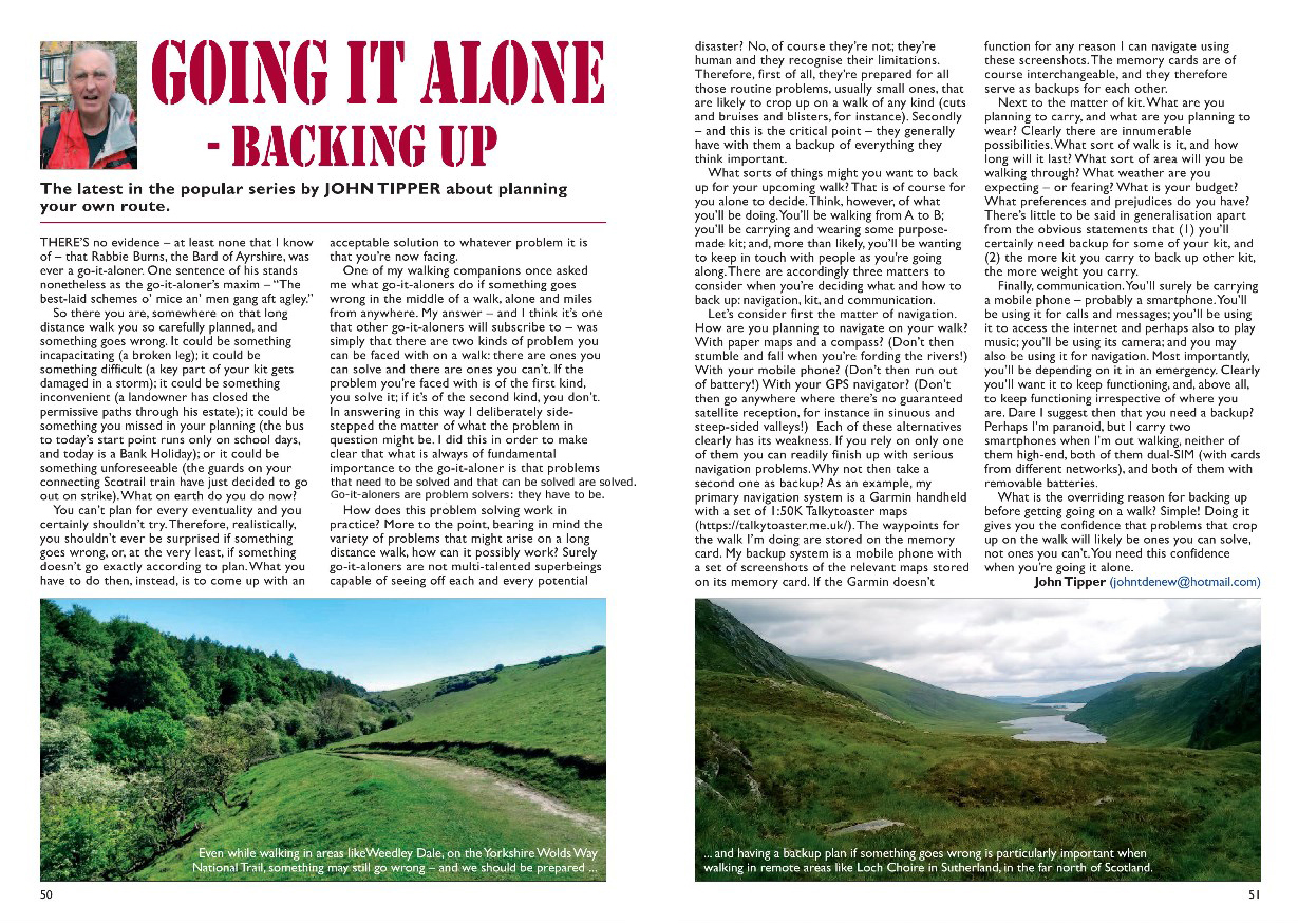
What sorts of things might you want to back up for your upcoming walk? That is of course for you alone to decide. Think, however, of what you’ll be doing. You’ll be walking from A to B; you’ll be carrying and wearing some purpose-made kit; and, more than likely, you’ll be wanting to keep in touch with people as you’re going along. There are accordingly three matters to consider when you’re deciding what and how to back up: navigation, kit, and communication.
Let’s consider first the matter of navigation. How are you planning to navigate on your walk? With paper maps and a compass? (Don’t then stumble and fall when you’re fording the rivers!) With your mobile phone? (Don’t then run out of battery!) With your GPS navigator? (Don’t then go anywhere where there’s no guaranteed satellite reception, for instance in sinuous and steep-sided valleys!) Each of these alternatives clearly has its weakness. If you rely on only one of them you can readily finish up with serious navigation problems. Why not then take a second one as backup? As an example, my primary navigation system is a Garmin handheld with a set of 1:50K Talkytoaster maps (https://talkytoaster.me.uk/). The waypoints for the walk I’m doing are stored on the memory card. My backup system is a mobile phone with a set of screenshots of the relevant maps stored on its memory card. If the Garmin doesn’t function for any reason I can navigate using these screenshots. The memory cards are of course interchangeable, and they therefore serve as backups for each other.
Next to the matter of kit. What are you planning to carry, and what are you planning to wear? Clearly there are innumerable possibilities. What sort of walk is it, and how long will it last? What sort of area will you be walking through? What weather are you expecting – or fearing? What is your budget? What preferences and prejudices do you have? There’s little to be said in generalisation apart from the obvious statements that (1) you’ll certainly need backup for some of your kit, and (2) the more kit you carry to back up other kit, the more weight you carry.
Finally, communication.You’ll surely be carrying a mobile phone – probably a smartphone. You’ll be using it for calls and messages; you’ll be using it to access the internet and perhaps also to play music; you’ll be using its camera; and you may also be using it for navigation. Most importantly, you’ll be depending on it in an emergency. Clearly you’ll want it to keep functioning, and, above all, to keep functioning irrespective of where you are. Dare I suggest then that you need a backup? Perhaps I’m paranoid, but I carry two smartphones when I’m out walking, neither of them high-end, both of them dual-SIM (with cards from different networks), and both of them with removable batteries.
What is the overriding reason for backing up before getting going on a walk? Simple! Doing it gives you the confidence that problems that crop up on the walk will likely be ones you can solve, not ones you can’t. You need this confidence when you’re going it alone.”
Thanks, Santa.
Christmas Greetings!
December 22, 2021 § Leave a comment
It’s again that most important time of the year. So it’s all best wishes for Christmas and the New Year from theendtoendblog, to whoever might still chance to be reading.
And for those of you who still are there, here’s a rather special picture.

The Midnight Sun
I took this photo in the late summer of 1968, lying face down on the beach WNW of Bautaen, in Hornsund, Spitsbergen. I was looking through the ice block directly north, for the sun was then at its lowest point in the northern sky. The hills on the left of the picture are on the other side of Brepollen, immediately to the west of Hornbreen.
A long wait
November 11, 2021 § Leave a comment
For all you dedicated readers of theendtoendblog, this has been an unconscionably long wait. Sorry!
The reason for the lack of recent posts – at least the primary one – is that Felicity and I have been involved here in a major piece of building work. I’ve been concentrating heavily on this, as opposed to ‘normal’ things like walking and blogging. The main part of the work is now finished (although work of this type is of course never truly finished), therefore there should be time in the next few weeks to get back to normality. I hope…
Strider, Number 150, August 2021
I’ll start by posting the latest Strider article. As always, to make the article legible simply click on the photo. If that doesn’t work, here’s the text:
“I suspect – although naturally I can’t prove it – that go-it-aloners are thoroughly normal people. We plan as best we can and as thoroughly as we see fit, we trust that our plans will work, and we worry about what we’ll do if they don’t. Some of us plan more than others, some of us trust more than others, and some of us worry more than others, as is to be expected. As is also to be expected, we tend not to stick rigidly to our plans, even if we’ve invested large amounts of time and energy in developing them. Some of the changes we make are the trivial ones that everyone makes as they’re walking along – deciding to take this short cut, for instance, instead of the path marked out beforehand; others, in contrast, are considerably more substantial; a few may even be critical. It’s surely fair to say that no matter how carefully and how thoroughly we plan our routes, they usually end up being different. That’s normal.
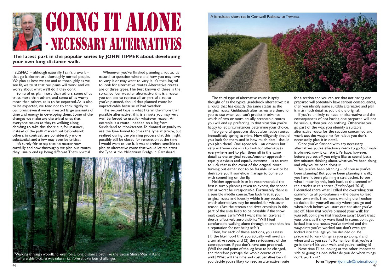
Whenever you’ve finished planning a route, it’s natural to question where and how you may have to vary it or may want to vary it. It’s then logical to look for alternative routes. Alternative routes are of three types. The best known of these is the so-called foul weather alternative: this is a route you can use to replace all or part of a route you’ve planned, should that planned route be impracticable because of bad weather. The second type is what I term the ‘more than possible alternative’: this is a route you may very well be forced to use, for whatever reason. An example is a route I needed on a leg from Sunderland to Monkseaton. I’d planned originally to use the Tyne Tunnel to cross the Tyne at Jarrow, but realised during the planning process that this might possibly still be closed for renovation at the time I would want to use it. It was therefore sensible to plan an alternative route that would let me cross the Tyne at the Millennium Bridge in Gateshead. The third type of alternative route is aptly thought of as the typical guidebook alternative: it is a route that has exactly the same status as the original route. Guidebook alternatives are there for you to use when you can’t predict in advance which of two or more equally acceptable routes you will end up preferring. In that situation you’re happy to let circumstances determine your choice.
Two general questions about alternative routes immediately spring to mind. How diligently should you look for them, and in how much detail should you plan them? One approach – an obvious but very extreme one – is to look for alternatives everywhere and to plan them all in the same detail as the original route; another approach – equally obvious and equally extreme – is to trust to luck that in the event of the original route turning out either not to be feasible or not to be desirable you’ll somehow manage to come up with something on the fly. Neither approach is to be recommended: the first is surely planning taken to excess, the second can at worst be irresponsible. Fortunately there is a sensible middle course. You look first at your original route and identify within it any sections for which alternatives may be needed, for whatever reason. (Are the stream and river crossings in this part of the area likely to be passable if the snow melt comes early? Will I want this hill traverse if there’s effectively zero visibility? Will I feel comfortable walking alone through an area that has a reputation for not being safe?) Then, for each of these sections, you assess (1) the likelihood that you actually will need an alternative route, and (2) the seriousness of the consequences if you don’t have one prepared. (Will the end point of the leg have to be changed, and therefore perhaps the whole course of the walk? What will the time and cost penalties be?) If you decide you’re likely to need an alternative route for a section and you can see that not having one prepared will potentially have serious consequences, then you identify some suitable alternative and plan it in as much detail as you did the original. If you’re unlikely to need an alternative and the consequences of not having one prepared will not be serious, then you do nothing. Otherwise you go part of the way: you identify a suitable alternative route for the section concerned and work out the waypoints for it, but you don’t necessarily plan it in detail.
Once you’ve finished with any necessary alternatives you’re effectively ready to go. Your walk is planned; now it can start. Perhaps, however, before you set off, you might like to spend just a few minutes thinking about what you’ve been doing and why you’ve been doing it. Yes, you’ve been planning – of course you’ve been planning! But you’ve been planning a walk; you haven’t been planning a straitjacket. To see what I mean by this, look back at the second of the articles in this series. I identified there what I called the overriding trait common to all go-it-aloners – the desire to lead your own walk. That means wanting the freedom to decide for yourself exactly where you go and when, both before you start out and after you’ve set off. Now that you’ve planned your walk for yourself, don’t give that freedom away! Don’t treat your plans as if they were fixed in stone; don’t get locked into the routes you’ve devised and the waypoints you’ve worked out; don’t even get locked into the legs you’ve decided on. Be prepared to vary things as you go along, if and when and as you see fit. Remember that you’re a go-it-aloner! It’s your walk, and you’re leading it!
Next time I’ll be looking at the other important side to going it alone. What do you do when things don’t work out?”
The Ants’ Nest Problem (3)
May 17, 2021 § Leave a comment
As I said earlier, this problem of the ants and their nest has two parts. For each of these there is a model, unsurprisingly. The first model outlines a way in which an ant can determine for itself the sort of path it will take; the second model shows how the ants can move around in the nest without continually colliding with each other. So far I’ve given details of the first of the models; it’s time now to deal with the second.
This second model is based on the simple idea that each ant deliberately restricts its movement always to its own particular neighbourhood; it never trespasses on adjacent neighbourhoods. “Neighbourhood”, you say. “Haven’t we heard that before?” The answer is of course that you have, in ‘The fashionable honeycomb’ (29 October 2020). Here’s the diagram I used then to illustrate three different types of neighbourhood.

From left: equilateral triangle mesh, square mesh, honeycomb mesh
Focus on the honeycomb mesh. One of its particularly attractive properties is that each of its cells is what is called a Voronoi polygon. (Many of you, I know, will want to read about this in the original French, so here’s the reference: Voronoi, Georges (1908) Nouvelles applications des paramètres continus à la théorie des formes quadratiques. Deuxième mémoire. Recherches sur les parallélloèdres primitifs. Journal für die reine und angewandte Mathematik 134: 198–287.) A Voronoi polygon is a polygon in which all of the points within it are closer to its centre – the solid black dot in the middle of the red hexagon – than they are to the centre of any other polygon. That’s clearly not true for the cells in the other two meshes.
OK, now to generalise things. The points at the centres of the Voronoi polygons that form the honeycomb mesh are regularly spaced: that’s why those polygons are identical in their size and shape. Voronoi polygons can nonetheless also be constructed for points that are not regularly spaced. They will of course then be different in size and shape. Here’s an example.

The Voronoi diagram (dashed lines) and Delaunay triangulation (solid lines) for a set of 15 data points (black discs)
Focus on the irregular pentagon in the centre of the diagram. It’s a Voronoi polygon. All the points within it are closer to the data point at its centre than they are to any of the other data points. That polygon is surrounded by five other Voronoi polygons. The data points at the centres of these are referred to as the Voronoi neighbours of the pentagon’s data point. Connecting together all of the Voronoi neighbours in the data set gives what is called the Delaunay triangulation. (Yes, here’s the original French for those of you who are desperate for it: Delaunay, Boris (1934) Sur la sphère vide. A la mémoire de Georges Voronoï. Bulletin de l’Académie des Sciences de l’URSS. Classe des sciences mathématiques et naturelles. 1934: 793–800.)
Back to the nest. Each ant is a data point; the Voronoi polygon for that point defines the ant’s neighbourhood; the Voronoi polygons surrounding that neighbourhood define the adjacent neighbourhoods. Simple really, but please pardon my French!
The Ants’ Nest Problem (2)
May 4, 2021 § Leave a comment
This post is short and sweet. OK, it’s short!
You were promised a program to experiment with – DRWALK. Here it is. You can get the documentation for it using the link in the ‘Software’ page on the left-hand side of the blog. This tells you how to download it and run it.
The pictures in the previous post gave some idea of the differences you can expect between random walks with correlated steps and random walks with uncorrelated steps. It seems to me pretty clear that the sorts of walks that ants do are best modelled using walks with correlated steps. Don’t believe me? Well now you can use DRWALK to see for yourself. Go on, try it!
Convinced? I hope so. Now try systematically varying the parameters for a walk that has correlated steps. This next picture shows the results of one such experiment.

A random walk with correlated steps, in ten consecutive parts (a – j). Each part has 1000 steps, starting at the point marked with a violet disc.
Each of the ten parts of this walk has a different combination of parameter values. These are summarised in the screenshots in the following way: ‘Continuity’ / ‘Maximum increment’ / ‘Bias’ / ‘Step length standard deviation’. Here’s the story: (a) low continuity and low maximum increment, therefore the step directions are concentrated around the starting direction; (b) maximum increment is increased, therefore the step directions are more spread out; (c) continuity is increased, therefore the step directions are less spread out; (d) maximum increment is decreased, therefore the step directions are concentrated around the direction being travelled at the start of that part of the walk; (e) bias away from preferred direction, therefore the walk turns slowly towards the E-W direction; (f) bias towards preferred direction, therefore the walk turns slowly towards the W-E direction; (g) maximum increment increased, therefore the walk turns faster towards the W-E direction; (h) continuity decreased, therefore the step directions, though they are concentrated around the W-E- direction, are more spread out; (i, j) step length standard deviation increased, therefore more possible variation in the distance covered.
Did I say short?
The Ants’ Nest Problem (1)
April 26, 2021 § Leave a comment
Some readers of theendtoendblog were surely convinced it would never happen: “He’s been promising us results from this ants’ nest work for an awfully long time and nothing ever comes. Typical!”
Well, sorry to disillusion you, but it’s showtime!
Two posts ago I introduced you to what for me is an intriguing little problem (‘Searching for a model’, 2 March 2021). The situation is as follows: (1) a large number of ants are moving simultaneously across the surface of a nest; (2) their overall movement pattern is presumably systematic (for instance to transport materials from one part of the nest to another), but there are no obvious regularities in the paths taken by the ants individually; (3) the ants manage to avoid colliding with each other. The problem – ‘The Ants’ Nest Problem’ – is to try to understand why and how the ants move as they do. (If you’re thinking you’ve already read a post about something that sounds suspiciously similar, yes you’re right. Check out ‘Models, and walking of course!’, 21 August 2020.)
The first step in addressing a problem like this is of course to come up with ideas about what is going on in the system concerned. Two ideas seem promising in this present case. The first of these is that each ant is continually deciding for itself which path it will take in the immediate future; it is doing this on the basis of information on (1) how it is moving at the time, (2) any preferred movement direction, and (3) its position relative to its neighbours. The second idea is that every one of the ants restricts its movement to its own particular neighbourhood; it never trespasses on adjacent neighbourhoods. (And yes, you are remembering correctly. You did read once before about the meaning and significance of trespass. Check out ‘Trespass!’, 13 January 2018.)
OK, those are the ideas; now to express them in a model. I’m going to deal with this in several posts: first I’ll cover how an ant decides on its path, then I’ll cover how it avoids trespassing.
It’s surely not unreasonable to suggest that any model for the movement of these ants should be a stochastic one. Firstly, the ants are behaving as separate entities; there is no Grand Old Duke of York directing them, nor is there an overall Master Plan that they have to follow. Secondly, the ants are living things; they are not inanimate physical objects. The movement of the ants will be modelled here as a random walk. (Yes, it is indeed déjà vu all over again! Check out ‘Walking at random’, 8 August 2020.)
There are in principle two types of random walk. One type – this is the one I described in that earlier post – has steps that are uncorrelated both in length and in direction. The other has steps that are correlated: the length of a step in a walk is obtained by adding a random increment to the length of the immediately preceding step, the same holds for the step direction. Within each of these types there is effectively unlimited variability. You can choose at will the frequency distributions you want, either for the step length and the step direction (for walks of the first type) or for the step length increment and the step direction increment (for walks of the second type).
An example or two wouldn’t be a bad idea, would it? And then perhaps a program to experiment with. OK, here goes. First the examples.
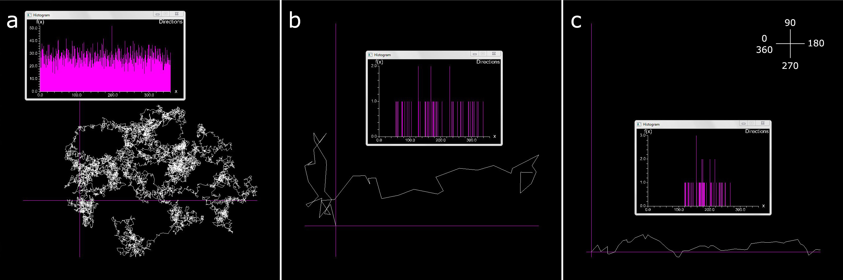
Random walks with uncorrelated steps: (a) no preferred direction, 10000 steps; (b) preferred direction, low directional continuity, 50 steps; (c) preferred direction, high continuity, 50 steps. Inset (top right) shows direction coordinate system.

Random walks with correlated steps and preferred direction, all for 10000 steps: (d) no bias; (e) no bias; (f) bias away from preferred direction; (g) bias towards preferred direction; (d, f, g) high directional continuity; (e) low continuity
What you’re looking at in each of these seven screenshots is a plot of a 2D random walk that started at the intersection of the purple lines. In each of the plots there is also a histogram of the step directions. The plots come from a program – DRWALK – that I’ll be introducing in the next post and that you can then experiment with. The walks in these plots are clearly different in their character; this is unsurprising because they were deliberately generated using very different frequency distributions. DRWALK controls the form of the distributions in five ways. Firstly, it controls the type of walk: uncorrelated or correlated. Secondly, it controls whether or not the walk is to have a preferred movement direction; this direction, if it is required, is fixed to be west-to-east, i.e., 180° in the coordinate system illustrated in the inset in (c). Thirdly, it controls the directional continuity, i.e., the degree to which the direction taken at any particular step follows either the preferred direction (for uncorrelated walks with a preferred direction) or the direction of the previous step (for correlated walks). Fourthly, it controls the degree to which the direction of a step is biased either towards or away from the preferred direction; this control applies only to correlated walks. Fifthly, it controls the mean and standard deviation of the step lengths or step length increments.
OK with all that? If so, great! If not, come back next time. You can then download DRWALK and play around with it to your heart’s content.
For anyone who’s been wondering…
April 13, 2021 § Leave a comment

Strider, Number 149, April 2021
Yes, theendtoendblog is still alive and well! First, there’s a new Strider article; then there’s progress in the matter of the ants. As always, to make the article legible simply click on the photo. If that doesn’t work, here’s the text:
“The immediately preceding articles in this series have dealt with three of the steps necessary in planning any substantial long distance walk: (1) breaking the walk into legs, (2) deciding, at least provisionally, on the routes for the legs, and (3) waypointing the routes. Wait! Don’t get your boots out yet! There’s still work to do! Those routes have first to be checked to see if they’re really what you want; then alternatives have to be prepared for sections for which alternatives are necessary. This work is going to take time – there’s no hiding that fact. It’s nonetheless going to be time well spent. Imagine that the walk you’re planning is one that’s going to take you out into the wild blue yonder, alone, for a month or more, and is not going to come cheap. It’s better to spend a little more time beforehand planning that walk than to spend a lot more time afterwards – either on the walk itself or after you’ve got back home – regretting the fact that you didn’t.
It’s at this point, before you start on this remaining work, that you’re going to have to make a critical decision. Which working methods are you now going to use? Are you going to work with guidebooks and maps on paper, or are you going to work on the computer? Both approaches are capable of giving satisfactory results and in the end it’s your decision. The essential difference between them is of course that a computer-based approach will be very much quicker than a paper-based one. I’m going to make three assumptions here: firstly, that you’ve decided to work on the computer; secondly, that your computer runs under Windows; thirdly, that your principal data formats will be .gpx and .kml.
Let’s see what’s involved in checking a route. For an example – this is an extremely straightforward one – look at the Google Earth image I’ve prepared. It shows part of a waypointed route along the Pembrokeshire Coastal Path, starting at the Copper Mine (the westernmost point of mainland Wales, southwest of St David’s) and finishing at Newgale. The checking process I use has four distinct steps; I’ll run through them in turn for this example.
The first step involves making a .gpx file of the waypoints. The software I use to do this is the GPS Route Planner available on WalkHighlands (https://www.walkhighlands.co.uk) and WalkLakes (https://www.walklakes.co.uk/). This program uses the 1:25K OS maps as its base and readily lets waypoints be inserted in the order of their decreasing importance, exactly as I described in my last article. Once you’ve inserted the waypoints you get estimates of the route length (17.3 km for the Pembrokeshire example) and the total height gain. The length estimate gives you a very rough lower bound for the time you’ll need to cover the route (3:28). You can ignore the height gain estimate because it assumes you’ll always be walking in a straight line from one waypoint to the next. At the end of the step you save your file.
The second step uses the route planning software again, but this time to fill out the route between the waypoints. This involves inserting an intermediate point at every change in route direction that you see on the map, no matter how small, and at every significant change of slope. There will be a lot of these points to insert – the Pembrokeshire route has 663. Don’t worry! With practice you’ll find they go in like a rocket; filling out the Pembrokeshire route took me less than half an hour. At the end of this step you’ll get a fresh estimate for the route length (20.9 km) and at last a usable estimate for the total height gain (797 m). From these two estimates you calculate the Naismith time in the conventional way (5:29). At the end of the step you again save your file. This time you make two versions of it – one in .gpx format and one in .kml format.
The third step is where the fun begins. Start Google Earth and load that .kml file. Now examine your route in detail on Google’s aerial mosaic. Look at it from above; look at it from the side; look at it obliquely; fly along it if you will, using the ‘Play Tour’ control. Some of the points you inserted in the previous step will certainly turn out to be wrongly positioned, either because of errors you made in inserting them or because of changes on the ground since the OS map was made. Reposition these points using the Google Earth path editor. Look for features visible on the Google Earth image that weren’t on the map and that can sensibly be incorporated into your route. Modify the route to incorporate them, again using the path editor. Check the types of ground surface your route will take you over. Will you be mainly on Council-maintained paths, for instance, with occasional climbs up grassy hillsides, or will you be trekking across His Lordship’s grouse moor with now and then some serious scrambling? There’s a mass of ground surface information visible in every Google Earth image, as in every aerial photograph, and you can supplement it if necessary using ground truth photographs, for instance from Geograph (http://www.geograph.org.uk/). This information is especially important because it greatly affects your estimate of the time you’ll need to cover the route. At the end of the step you save your modified route as a new .kml file.
The final step involves first converting this new .kml file to .gpx, for instance using KML2GPX (https://kml2gpx.com/?results). Then you load this file into the route planning program you were using earlier. This gives you length and height gain estimates for your modified route, together with a best estimate of the Naismith time.
Is this modified route satisfactory? Is it really what you want? Good! All that then remains to be done is to prepare any necessary alternatives. I’ll deal with that next time.”
And the ants? I’ve now found what seems to be a very reasonable model for the ants’ nest, which produces some fascinating results. The development and implentation of this model has required the solution of a few not insubstantial problems in geometric computing, so that’s why you haven’t heard much from me recently. Now, however, it’s showtime – well almost! Expect (D.V.) something in the next few days.
Searching for a model
March 2, 2021 § Leave a comment
A model? No, silly, not that kind of model! The model I’m searching for now is a scientific model – one that will help me understand the ants’ nest – another of those stochastic spatial processes I referred to last year (‘Another stochastic process – this time with thanks to David Attenborough’, 20 July 2020).

The ants nest on the Feldbergsteig
What so interested me in this process then – and this is the reason that I’m now searching for a model of it – is that it involves a large number of random walks taking place simultaneously over the same area. Each ant has its own walk, but those walks cannot of course be entirely independent of each other. Look at the film of the nest (https://app.box.com/s/1k8qsavsb1i4rdjc47a33843zgssx5p1). You’ll see that all the ants always in some way avoid collisions. The model I’m looking for must therefore allow for multiple random walks and at the same time incorporate what programmers refer to as collision detection and avoidance.
Dare I describe this rather ominously named field as being now a thoroughly standard one? Yes, because in the very great majority of situations the collisions to be detected and avoided are between inanimate physical objects. These obey the laws of physics, therefore they can be simulated readily using what are termed ‘physics engines’. A helpful overview of some of these is given in https://gdbooks.gitbooks.io/3dcollisions/content/Chapter7/engines.html, and a must-view example of one of them being used (https://pybullet.org/wordpress/) is in https://vimeo.com/373725595.
So why don’t I just put the ants into a physics engine and see what comes out? Simple! The ants are not inanimate physical objects, nor are their walks the deterministic paths that physics engines require them to be. There is animal behaviour involved, there is randomness, and – not least – there is for me the challenge of putting all this into a simple and usable computational framework. I’ve made a lot of progress over the past month but there’s still much to do. I’ll keep you informed.
Until then, you might like to check out Rex’s approach to the problem: https://www.dropbox.com/s/fnms8pkvhvrva09/Antz%20Pantz.mp4?dl=0
For your bookshelf
January 27, 2021 § Leave a comment
To those who might be asking why there’s not been even a hint of a post in the past few days, I would respond: “I’ve been sailing round the world with Slocum”.
One of the fixed points in the calendar, in the years we were in Canberra, was the Lifeline Bookfair. This raised – and it still raises – a major portion of the funding needed to keep Lifeline Canberra’s local crisis support service running: https://www.lifelinecanberra.org.au/lifeline-canberra/. The Bookfair worked as follows. You turned up on the day, at the Albert Hall on Commonwealth Avenue – not too late as otherwise all the good stuff would have gone – and you left a couple of hours later with boxes and bags full of books of all sorts, some of which you quickly got rid of, some of which you eventually got round to reading, and some of which you simply shelved for later.

Sailing Alone Around The World. Reprint Society Edition, 1949
At one of the fairs I picked up a copy of Sailing Alone Around The World, knowing only that it dealt with the first single-handed circumnavigation of the globe, by Captain Joshua Slocum. It fell into the ‘shelve for later’ category and so duly remained unread, sitting sandwiched on a shelf between Alan Villiers’ By Way Of Cape Horn and Thor Heyerdahl’s The Kon-Tiki Expedition. Two weeks ago, wanting something fresh to read, I opened it for the first time.
What a book! I’d expected a dry and tedious account of a long and at times surely monotonous voyage. What I found instead was an enthralling story of an amazing adventure. Leaving from Boston, in April 1895, Slocum crossed the Atlantic to Gibraltar, crossed it again to Brazil, crawled down to the tip of South America, fought his way twice (!) through the Strait of Magellan, crossed the Pacific to Australia then the Indian Ocean to South Africa, then finally hauled his way back up and across the Atlantic to Boston and home. He reached there in July 1898. What a voyage!

The Spray. Reprint Society Edition, p. 165.
The story has a hero – Slocum of course. It also has a heroine – the Spray, the small nine-ton sloop that Slocum was given and that he then rebuilt. This hero and this heroine were ideally suited to each other: the hero with his experience and his courage, the heroine with her strength and her extraordinary sailing capabilities. Slocum was clearly never in any doubt of the debt he owed to the Spray. He gives credit always to her. He never seeks to put himself forward even when describing events that would strike terror into any normal person’s heart.
Slocum’s voyage took place in a world that for us today is foreign, a world that seems in so many respects to have been simple and direct. Slocum writes about this simple and direct world in a simple and direct way. That is his book’s charm. If you haven’t ever read it, now’s the time.
…sorted
January 16, 2021 § Leave a comment

theendtoendblog’s image of a black hole
That’s an amazing image, isn’t it? Clearly a black hole isn’t something associated with an overheated ring donut; it’s a coloured cube. The three visible faces of this cube are of different colours – red, green and blue. That’s it! We’ve successfully imaged a black hole! What’s next on the agenda?
Not so fast! What was all that in the previous post about pictures not being pure unalloyed fact? About scientific data always being interpreted according to some model? Was there a model driving our interpretation of this image? If so, what was it?
Of course there was a model! And to work out what it was you’ve only got to think of how the image was collected (allegedly) and then interpreted. The collection was done at night using the most basic of smartphone cameras, one without a flash facility. The light captured by the camera had therefore to have come from whatever object it was that was being imaged. The interpretation of the image was done simply by looking at how the cube appeared. The top face appeared red, so naturally we thought it must be red; the right-hand face appeared green, so naturally we thought it must be green; the left-hand face appeared blue, so naturally we thought it must be blue. The model we were using – and we were using it instinctively – has as its principal hypothesis the idea that the cube’s faces are light emitters. They’re like coloured light bulbs: a red bulb emits red light, a green bulb emits green light, a blue bulb emits blue light.
There is an alternative model. This has as its principal hypothesis the idea that the cube’s faces are light reflectors, and in particular that they reflect light diffusely: see https://en.wikipedia.org/wiki/Lambertian_reflectance. This means that a face will automatically assume the colour of any light that is incident on it, irrespective of the direction from which it is viewed. This reflective cube would have appeared uniformly grey if we’d captured our image of it using a camera with a flash; the brighter the flash, the lighter the grey would have been. Our camera had no flash, however, so how was it that the cube was visible? Moreover, how could it appear coloured? The simplest possibility would be for it to have three associated external light sources – one red, one green and one blue – and for these sources to be fixed so that each is shining directly down onto a different face. The face onto which the red source is shining would be illuminated principally with red light; it would reflect this to the camera and therefore would appear red. The same would go for the other faces: the face onto which the green source is shining would appear green, the face onto which the blue source is shining would appear blue. Just as in the image.

The reflective cube without external light sources. L: no flash. M: weak white flash. R: bright white flash.

The reflective cube imaged for the external light sources singly
There are thus two equally legitimate models that can be used in interpreting the image, both of which work. They have radically different principal hypotheses. The second model has also an auxiliary hypothesis, namely that the external light sources exist. Which model should you choose? You takes your pick! Based on the image alone, there is no way to say. The first model is simpler – it has no auxiliary hypotheses – therefore KISS would recommend it: look once again at theendtoendblog’s ‘Ten Point Guide to Safe Modelling’. It is probably this model that most people looking at the image would think of first. Ultimately, however, it’s up to you to decide. You do this on the basis of your assessment of the models’ relative credibility. How you make this assessment is also up to you.
What a day! A black hole imaged and an irrelevancy sorted.
An irrelevancy…
January 14, 2021 § Leave a comment
One thing I like to do when composing the posts on this blog is to insert passages and references that seem irrelevant to the matter at hand. OK, so you’ve noticed! Why do I do this? Is it to frustrate you, my readers, and thereby to reduce the blog’s readership? Surely not! In fact it’s for a diametrically opposite reason, namely that I want to intrigue you, to get you to ask yourselves how on earth that passage or that reference possibly could be relevant, if not to the matter immediately at hand then perhaps to something important that’s coming up later.
One such passage was in the post ‘2019, with vivid memories from 1984’ (3 November 2020). Here it is:
April 10th saw scientists from the Event Horizon Telescope project announcing the first ever image of a black hole, one located in the centre of the Messier 87 galaxy. (Once again, this time for all of you who’ve simply forgotten: (1) the Event Horizon Telescope is a large telescope array consisting of a global network of radio telescopes; (2) Messier 87 – also known as Virgo A or NGC4486 – is a supergiant elliptical galaxy with about 1 trillion stars, in the constellation Virgo.)
What on earth has that passage got to do with the price of fish?
Check out this link: https://www.eurekalert.org/pub_releases/2019-04/nsf-acf040919.php. There you’ll find the scientists involved in the Event Horizon Telescope project trumpeting their success. There too you’ll find a video showing ‘the first direct visual evidence of a supermassive black hole and its shadow’. Here are two stills from that video.

The EHT black hole picture. L: original image. R: captioned image from video. Picture credit: NSF, Event Horizon Telescope collaboration et al.
Not being a hot-shot astrophysicist I can’t comment on what the first image shows; to me it looks suspiciously like an overheated ring donut. I can, however, comment on the second image, particularly on its caption. ‘Not simulation or conjecture…’ – you jest of course! The scientists and their paymasters are here selling you the idea that this picture is pure unalloyed fact. It isn’t! Like all scientific data – no matter how precise those data are and how carefully they are collected – the data used to construct this picture were subsequently interpreted. Critically, they were interpreted according to some model. That is how science is done. Remember what Medawar wrote: see ‘Truly magnificent stuff!’, 19 August 2020. If the model being used is altered, for instance by adding or removing auxiliary hypotheses or by varying the number and the values of its parameters, then the interpretation of the data necessarily changes. It is impossible to appreciate an interpretation of any scientific data without first knowing the model by which that interpretation was made. Sorry, astrophysicists, but that applies to your data too!
We really could do with an example here, couldn’t we? Fortunately there’s one readily at hand. It’s based on data that I believe pre-date those used to construct the EHT black hole picture. These earlier data were collected one starry night as theendtoendblog was meandering home after a pleasant evening with Arkwright at The Three Ferrets, with of course the obligatory John Smith’s (https://www.youtube.com/watch?v=UuVY6p6zdkI&feature=emb_logo). They were collected using the camera on a Nokia smartphone, this being a cheaper and suitably portable alternative to the otherwise unwieldy ‘planet-scale array of eight ground-based radio telescopes’. (If you believe any of this, you’ll believe anything!)
theendtoendblog’s image of a black hole
Here then is theendtoendblog’s image of a black hole. What is it exactly? It’s certainly not an overheated ring donut. Send your answers to theendtoendblog. Say firstly what it is that you think you’re seeing; then say what model it is that you’re using in making that interpretation. I’ll give you theendtoendblog’s answer next time. It may surprise you.
Now to Venice
January 10, 2021 § Leave a comment
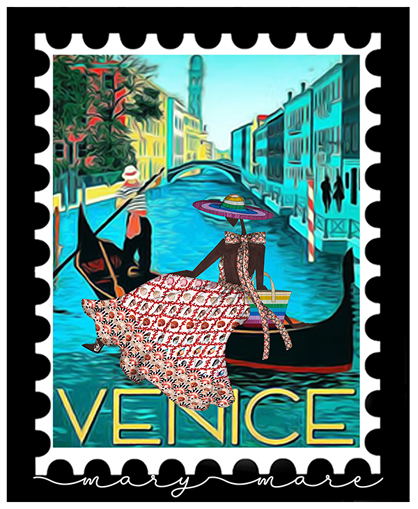
Venice, from the Mary-Mare collection. Photo credit: Mary Katrantzou
Obviously we won’t be staying too long in Monte Carlo. This is because we need to get across to Venice for a bit of shopping. Initially we’ll take the coastal route, a part of the Camino de Santiago. Then we’ll cross the Lombardy Plain to Milan to check out the High Fashion scene – think back to 2013 (‘Models, and walking of course!’, 21 August 2020). Finally we’ll head down to Venice, again on part of the Camino.
I spent a good deal of time in the summer of last year discussing the matter of spatialness. I stressed then that you can’t study spatial patterns correctly – no matter what they are – if you ignore the fact that they are inherently spatial. I even devised a test to demonstrate this (‘Spatialness for Fashionistas 101’, 1 June 2020), which everybody duly failed (‘The test solutions, the take-home message, and some great music’, 3 June 2020). In the past few weeks I’ve been looking at something completely different – averaging. I’ve stressed that it’s necessary always to be wary of what averaging can do. These two themes – spatialness and averaging – come together in this present post.

Izabel Goulart at the 75th Venice Film Festival L: original picture. R: grayscale version
OK, we’ve arrived in Venice. The photographers are waiting, understandably. They’re nonetheless a bit frustrated – you can see this on their faces – because this stunningly dressed lady keeps getting between us and their cameras. She is stunningly dressed, isn’t she? It’s a metallic silver pleated gown, from Alberta Ferretti in case you’re wondering. Look at that fabric! Look at the detail in it! Now step back and look at the grayscale version of the picture. There are four recognisably distinct parts there – the gown, the carpet, the photographers, and the background – and each of these parts has its own peculiar spatial pattern. What would happen to this picture, and to these patterns, if we were to apply some sort of spatial averaging filter to it? (If you’re not happy about what this means, look at the bottom of this post. There you’ll find a brief explanation of what’s going on.)

The results of the spatial averaging exercise
Each of the images in this diagram shows the result of applying a spatial averaging filter to the original grayscale picture. All but one of the images are steps in a sequence (1→2→3→4→5→6→7). The size of the neighbourhood over which the averaging is carried out for any of these seven sequence images is indicated by the white circle in the image’s top left-hand corner. These neighbourhoods increase in area by a factor of 4 at each step; the neighbourhood for the first image is approximately 4 pixels in area, the neighbourhood for the second is approximately 16 pixels in area, and so on. Image 8 is different from the others in that it is not formally part of the sequence. It should nonetheless be thought of as the sequence’s end-point. It shows the average greyness of the original grayscale picture.
Now be honest! The detail in the fabric of the gown is already lost in the very first image, i.e., with only the smallest amount of averaging; the second image is an acceptable representation of the original picture as a whole, but it isn’t acceptable for the gown and the photographers; the third and fourth images are sufficiently blurred that you wouldn’t want them in your photo album; the fifth image is recognisable as a version of the original picture only because you know what that original picture is; the sixth, seventh and eighth images could be anything. This is spatial averaging at work. It destroys spatial pattern, irrevocably. Averaging over even the smallest of neighbourhoods is sure to destroy fine-scale patterns. The larger the neighbourhood, the more complete the destruction will be.
The take-home message for this post is very similar in intent to that for the previous post. Firstly, again from theendtoendblog’s ‘Ten Point Guide to Safe Modelling’:
Beware of averaging.
Secondly – more specifically:
Spatial averaging destroys spatial pattern, irrevocably. Therefore never plug spatially averaged values into models of spatial processes, for instance to provide estimates of parameters.
Thirdly, enjoy Venice.
Each pixel in a grayscale image has an associated greyness value; this lies between 0 (= black) and 255 (= white). Spatial averaging involves replacing the greyness value of a pixel by a weighted average of the greyness values of all of the pixels in that pixel’s neighbourhood. This replacement is done simultaneously for each and every pixel in the image. The weights used for the averaging can be set in various ways. One possibility is to make them all equal: the new greyness value for the pixel on which the neighbourhood is centred is then the arithmetic average of the original greyness values. Another possibility is to make the weight used for a pixel depend in some way on the distance between that pixel and the neighbourhood’s centre pixel. This is commonly done using what is termed Gaussian blurring: https://www.adobe.com/ie/creativecloud/photography/discover/gaussian-blur.html#
Monte Carlo Revisited
January 6, 2021 § Leave a comment

Monte Carlo, from the Mary-Mare collection. Photo credit: Mary Katrantzou
Our previous visit to Monte Carlo (‘That white tuxedo … at last!’, 26 November 2020) furnished an example of how Monte Carlo simulation can be used to investigate the behaviour of models whose behaviour cannot be determined analytically. The model used in the example was the bushfire model (BUSHF1), and the object of the investigation was to see how variation in fire ignition capability affects mean instantaneous fire size and mean fire lifetime. (Yes, of course I’m going to be precise here: ‘mean’ means ‘arithmetic mean’.) The conclusion drawn from the simulation was that there seems to be some sort of tipping point in the model’s behaviour at an ignition capability of around 0.35. Fires with ignition capabilities less than 0.35 burn out naturally, some much quicker than others; fires with ignition capabilities greater than 0.35 rarely burn out naturally. The fires in the first group are not really dangerous; they may be inconvenient and therefore sensible to fight, but if all else fails they can be left to themselves. The fires in the second group are the dangerous ones; if they are not fought – by whatever means are possible – then they will consume much of what lies in their path.
Let’s assume now that we’ve been approached by Dodgy Brothers GmbH, a company that is seeking to become established in the field of bushfire prediction and control. They’ve come across the BUSHF1 program – perhaps by downloading it from theendtoendblog – and are interested in having us use it to estimate mean fire sizes for fires with known ignition capabilities. Yes, we can do that, and we accordingly design a suitably comprehensive programme of work. Naturally we quote our usual consultancy rates. We are rebuffed – unsurprisingly given Dodgy Brothers’ cheapskate reputation. They don’t want the work we’ve proposed; instead they want just two numbers – an estimate of the mean fire size for fires with ignition capabilities in the range 0.30 to 0.35, and an estimate of the mean fire size for fires with ignition capabilities in the range 0.35 to 0.40. They tell us we should get these estimates by running BUSHF1 for two ignition capabilities – 0.325 and 0.375. Their logic in saying this is that 0.325 – the arithmetic mean of 0.30 and 0.35 – is a best guess for the ignition capability of fires in the first group; similarly 0.375 – the arithmetic mean of 0.35 and 0.40 – is a best guess for the ignition capability of fires in the second group. “Always use the best guess for a model’s input,” they say, “then you automatically get the best guess for the model’s output. Best guess in, best guess out – that’s the rule!”
Oh dear!

Monte Carlo simulations illustrating Jensen’s Inequality
This diagram summarises the results of four further Monte Carlo simulations run using BUSHF1. The histograms are for the fire size at a timestep. The left-hand histograms (green annotation) are for fires in the first group of ignition capabilities (0.30 to 0.35); the right-hand histograms (red annotation) are for fires in the second group (0.35 to 0.40). The upper histograms are for fires having the best guess ignition capabilities (0.325 and 0.375); the lower histograms are for fires having ignition capabilities spread evenly across the ranges 0.30 to 0.35 and 0.35 to 0.40. The calculated mean fire size for fires having the best guess ignition capability is not a good estimate of the true mean fire size. For fires in the first group it is an underestimate (16.56 against 19.40); for fires in the second group it is an overestimate (58.50 against 54.84).
This underestimation and overestimation is not specific to this example. It follows automatically from what mathematicians call Jensen’s Inequality: https://en.wikipedia.org/wiki/Jensen’s_inequality#:~:text=In%20mathematics%2C%20Jensen%27s%20inequality%2C%20named%20after%20the%20Danish,equal%20to%20the%20mean%20applied%20after%20convex%20. Savage termed this ‘The Flaw of Averages’ – a name that has stuck; see ‘Two Questions’, 3 December 2020.
To appreciate what’s involved in this, look at the inset plot at the top of the diagram. The relationship between mean fire size and ignition capability is convex-down to the left of the tipping point (green annotation) and concave-down to the right (red annotation). The mean value of a function that is convex-down is necessarily greater than the value of the function evaluated at the mean input (therefore 19.40 > 16.56); the mean value of a function that is concave-down is necessarily less than the value evaluated at the mean input (therefore 54.84 < 58.50). The only situation in which the mean value of a function can be guaranteed to be equal to the value of the function evaluated at the mean input is when the function is strictly linear over the range involved – a highly unlikely situation for any even halfway realistic model of a natural system.
The take-home message? Firstly, from theendtoendblog’s ‘Ten Point Guide to Safe Modelling’:
Beware of averaging.
Secondly, from an article on rock property estimation by two Stanford University petroleum geophysicists (Mukerji, T. and Mavko, G., 2008. The flaw of averages and the pitfalls of ignoring variability in attribute interpretations. The Leading Edge 27, 382-384 – once again I’m sorry that for copyright reasons I can’t provide you with direct access to the paper):
‘When there is variability and nonlinearity, calculations using single-point values are almost worthless. …Calculations based on a single “best guess” input may not give the “best guess” output. …One should not expect to get even correct average results using average values of inputs. …Simple simulations to account for the variability can be easily performed. Monte Carlo simulations…help to avoid the flaw of averages.’
Thirdly, enjoy Monte Carlo.
Fourthly, steer well clear of Dodgy Brothers.
Plans, and music
January 2, 2021 § Leave a comment
I can imagine what you’re thinking: “We’re hardly into the new year and already he’s posting. Hopefully he’ll get back to some serious walking rather than all that strange stuff he gave us last year.”
No such luck. There’s probably going to be a mixture of types of post – I write ‘probably’ because I can’t ever say what’s coming up next in this blog. (You didn’t really think this blog was planned, did you? More fool you!) The posts directly related to walks and walking will likely be limited in number. This is because (1) it’s winter time for the next two months, with snow and ice up on the Schwarzwald, (2) there are movement and accommodation restrictions in most of the areas I would like to walk in, and (3) the rebuilding work on our house is scheduled to start in mid-June, therefore I will have to be here at home for most of the summer and autumn. But keep the faith! Walking is not over – at least I hope not. (Oh, and there are of course more Strider articles sitting in the editor’s inbox.)
As to ‘that strange stuff’ – that’s certainly going to be continued. First there’ll be another visit to Monte Carlo; then some more about the meaning of average (pun intended); then a look at some of those other points in theendtoendblog’s ‘Ten Point Guide to Safe Modelling’; then… That should take me through ‘til March, which will mark the anniversary of a year’s rather special wandering. I’ve got a feeling this wandering will have been worth it. Once more, keep the faith!
Now to the promised music, to a link that Gisela sent me on Christmas Day. It’s a new recording of the Hallelujah Chorus, sung (remotely) by 350 voices and set in that most magnificent of Barcelona churches – Santa Maria del Mar. To see and hear this makes my heart soar.
Looking forward
December 24, 2020 § Leave a comment
Here, from theendtoendblog, are my very best wishes to you all, whoever you are and wherever you are, for Christmas and the New Year.
I’m looking forward to this coming year, to walking and to not walking, sometimes near and sometimes far, sometimes alone and sometimes in the company of my family and friends. Also, needless to say, to blogging!
Different words
December 19, 2020 § Leave a comment
theendtoendblog has striven always to be both correct and consistent in its use of language, albeit according to its own idiosyncratic lights. This latter freedom has let me insert dubious expressions into posts that otherwise would have been grammatically and syntactically exemplary. It has also let me be unreasonably critical of passages I’ve come across elsewhere, both in my native language and in German. Incorrect? Inconsistent? Moi? Surely not!
Many readers of this blog will take issue with me on this, especially in view of some of my more recent posts – I refer here to the ones that are liberally sprinkled with the words ‘average’ and ‘mean’. It’s not at all easy to see in these posts why I use one of the words in one place and not in another. Is this me being incorrect, or is this me being inconsistent, or is it simply me being lazy? Is there in fact any difference in meaning between the one word and the other? (N.B.: Here I’m considering only situations where ‘average’ and ‘mean’ refer to quantities such as size or amount, e.g., ‘the dress was of average length’ or ‘the mean weight was 20 kilogrammes’.)
There are three ways to clear up questions about the meanings of words. The first is to go to a reputable thesaurus, e.g., https://www.merriam-webster.com/thesaurus; the second is to carry out an internet search; the third is to do both. All three have their drawbacks. (1) The drawbacks involved in using a thesaurus are twofold: firstly, you spend large amounts of valuable time learning more about the possible meanings of the words you’re interested in than you ever wanted to know; secondly, you realise that anything is possible for the creative lexicographer. Synonyms, for instance, need not be synonymous; they can sometimes ‘differ in nuance’, where nuance means ‘subtle distinction or variation’ and subtle means either ‘delicate and elusive’ or ‘difficult to understand or perceive’. It’s all suspiciously reminiscent of ‘a petit soupçon of je ne sais quoi’ – with my apologies to the late JY. (2) The drawbacks involved in an internet search – for instance a search for ‘difference between average and mean’ – concern the credibility of the sites you reach and the answers you obtain. There are no official standards of credibility on the internet, obviously, so it’s up to you to decide what to believe. (3) The drawbacks involved in going to a thesaurus and at the same time carrying out an internet search concern the decision you have to make when the answers from your sources conflict. Do you opt for the answer from the thesaurus, purely because that thesaurus has a name and a reputation, or do you choose a more convincing answer from a completely unknown internet site? Once again, it’s up to you.
The relationship in meaning between the words ‘average’ and ‘mean’ is not at all difficult to understand. It’s therefore astonishing that lexicographers and internet site authors have managed so consistently to make such a pig’s ear of explaining it. The key to understanding the relationship is to recognise that both words are used routinely in two fundamentally distinct ways. Each is used as a general descriptor, and each is used with a precise mathematical definition. It is not possible to determine from the word itself the way in which it is being used; that can only be determined from the context in which it appears. The words, when each is used as a general descriptor, are synonyms pure and simple; they can therefore replace each other in the same sentence. The same holds also when each of the words is given the same mathematical definition. That’s it!
Some examples? Why not?
(1) The words ‘average’ and ‘mean’ are used in the following passage as general descriptors.
‘From Hargill Bridge I walked up and across the grouse moor south of Hagworm Hill. The moor here is a mosaic of patches of burnt and non-burnt ground. The burnt patches have a mean diameter of about 30 metres. My average speed was approximately four kilometres per hour.’
or equivalently
‘From Hargill Bridge I walked up and across the grouse moor south of Hagworm Hill. The moor here is a mosaic of patches of burnt and non-burnt ground. The burnt patches have an average diameter of about 30 metres. My mean speed was approximately four kilometres per hour.’
(2) The words ‘average’ and ‘mean’ are used in this next passage with a precise mathematical definition – in this case the arithmetic average and arithmetic mean.
‘The circles and stars show the average values of mean fire size and mean fire lifetime, as obtained from the various realisations. The stars indicate that for two values of ignition capability not all the fires burned out; the average mean lifetimes could then be calculated only for the fires that did burn out.’
or equivalently
‘The circles and stars show the mean values of average fire size and average fire lifetime, as obtained from the various realisations. The stars indicate that for two values of ignition capability not all the fires burned out; the mean average lifetimes could then be calculated only for the fires that did burn out.’
So, in those recent posts I referred to, was I being incorrect, or was I being inconsistent, or was I being lazy? Perhaps I just wanted to use different words.
Wow!
December 17, 2020 § Leave a comment
This is eat-your-heart-out-David-Attenborough time.

Die Wanderer, by Andreas Hösch. Photo credit: Andreas Hösch
Yesterday saw another walk from home to Sasbach, this time along a route that takes me up and over the grasslands. It was excellent weather for walking – clear, dry and cool – but the paths were in places still muddy after the recent rain. All in all, nothing special. Then, just as I passed the statue ‘Die Wanderer’, shortly before Vogelsangpass, I saw a sudden flash of colour. The bird – I estimate it was perhaps 20 to 25 centimetres long – flew out from the bushes no more than three or four metres from me then down into the vines and away. And what colour it had! Bright green and bright orange – bear in mind that it was flying downhill from me, so these were the colours I could see on its back and side.
What was it? There’s nothing native with those colours in those places (especially the orange). So it has to be exotic. Something that’s escaped, presumably from a home or a pet store or in this case even from Mundenhof. What’s my bet? A parrot! I’ve lived in Australia for long enough to know what parrots look like. That was a parrot!
Eat your heart out, David Attenborough.
The next article
December 6, 2020 § Leave a comment

Strider, Number 148, December 2020
December doesn’t just mean snow; it means also a new Strider article. This is now the tenth in the series. As always, to make the article legible simply click on the photo. If that doesn’t work, here’s the text:
“There is certainly no one best way to plan a long distance walk. Every go-it-aloner surely has their own individual planning strategy, as is only right. One will follow a particular interest, another will focus on a particular area, another will use particular sources of information, and so on. These strategies will all be different in detail. They will nonetheless have certain critical functions in common. One of these is waypointing – the insertion of waypoints into the route being planned.
What is a waypoint? Put simply, it’s a point on your way. It’s a special point, however, in that it’s a point through which you deliberately intend to pass. This may be either (1) because you must pass through it (for instance, the only bridge across a major river), or (2) because it makes practical sense to pass through it (for instance, a village in the back of beyond that has a shop or a pub), or (3) because it will be convenient to pass through it (for instance, a point on an LDP you’re following). All the waypoints on a route are essential – they’re the points defining that route. They’re nonetheless not all equally important. It’s logical therefore, when you’re planning a route, to insert the waypoints into it in the order of their decreasing importance.
For an example of how this can be done, look at the map I’ve prepared. It covers another of the legs on Three Pierheads, this time the one from Brompton-on-Swale to Barnard Castle. The most obvious feature of this leg – you can check this on the LDP Directory and on the relevant 1:25K OS maps – is that there are no defined paths of any sort connecting the two end points, other than in the most roundabout fashion. The go-it-aloner has therefore to design and waypoint a route from scratch. Let’s try it!
The first waypoints to insert are the two end points (A and B on the map). Join them. There, in front of you, is the first big problem – the River Greta. Just like those rivers in Cumbria that I referred to in my previous article, the Greta has hardly any bridges. The only one that makes any sense on a route from Brompton-on-Swale to Barnard Castle is the footbridge at Brignall Mill (C on the map); this is therefore the next waypoint to insert. The route is now made up of two disjoint sections: A‑C and C‑B. Take A‑C first and join its two end points. There’s the next problem – Feldom Ranges – an MOD training area with very restricted access. Fortunately, there’s a convenient PROW that lets it be crossed; the entry and exit points of this PROW are accordingly the next waypoints to insert (D and E on the map). (It is sensible also to insert waypoints along this PROW to help you stick to it, especially in the trackless area southwest of E.) Now join A to D. The only way to reach D is via the access road from Marske; Marske is therefore the next waypoint to insert (F on the map). Now join A to F. Clearly you’ll want to avoid crossing and recrossing the Swale, so staying north of the river and passing through Richmond makes a lot of sense. Richmond – which will also be the last place for a cup of tea for the next 25 kilometres – is therefore the next waypoint to insert (G on the map). Now focus on section G‑F. This is part of the Three Dales Way, an LDP marked on the 1:25K OS map. All the information you need to insert waypoints into this section is therefore readily obtainable, either from the map or from the LDP Directory. This leaves sections A‑G, E‑C and C‑B. May I leave these to you as an exercise?
This example of waypointing is an appropriate one for routes in areas in which there are established paths. All the waypoints on routes such as these will have some sort of physical expression. There are of course other routes – ones that cross areas that are largely trackless and in which those few tracks that do exist are difficult to follow, especially in poor visibility. Many of the waypoints on routes such as these will have no physical expression; they will simply be points at which the route changes direction. An example is a route of mine along part of the Dalnavie Drove Road (http://www.heritagepaths.co.uk/pathdetails.php?path=322). (This runs north from Alness on the Cromarty Firth to Kincardine on the Dornoch Firth and provides a refreshing alternative to the usual LEJOG route through Tain.) The Google Earth image given here shows the section of the route from Braentra to Garvary, a distance of about ten kilometres. There are ten waypoints, five of which are changes of direction. The key physical waypoint is Clach Goil, a huge boulder sitting isolated in the middle of the moor. It’s a good idea not to miss it, especially if the weather is less than promising!
Waypointing begs some obvious questions, no matter how it is carried out. How many waypoints are needed? How far apart should they be, or how close together? Have I got too many? Do I need any more? All of this comes down to personal preference, but there are two useful guidelines. Firstly, keep inserting waypoints into your route until the lines joining adjacent waypoints either (1) fall along PROWs, or (2) fall along roads or lanes or tracks that look as if they are not private, or (3) fall along public roads you think you might be prepared to walk along, or (4) cross areas of open-access land that look walkable and have no obvious major obstacles. Secondly, remember that a route is defined by its waypoints; without those waypoints you cannot navigate that route. If, when you’re planning a route, you doubt you’ll be able to navigate correctly from one waypoint to the next, you need to insert another waypoint in between. Waypointing is the go‑it‑aloner’s balancing act – not too many but not too few.”
Two questions
December 3, 2020 § Leave a comment
December is the first month of winter, so it was appropriate yesterday morning (Tuesday, December the first) that I woke and found a snow-covered landscape. Appropriate certainly, but surprising too, for this past November has been unseasonally warm and sunny. It’s been ideal weather for walking the Kaiserstuhl, and this I’ve duly been doing.
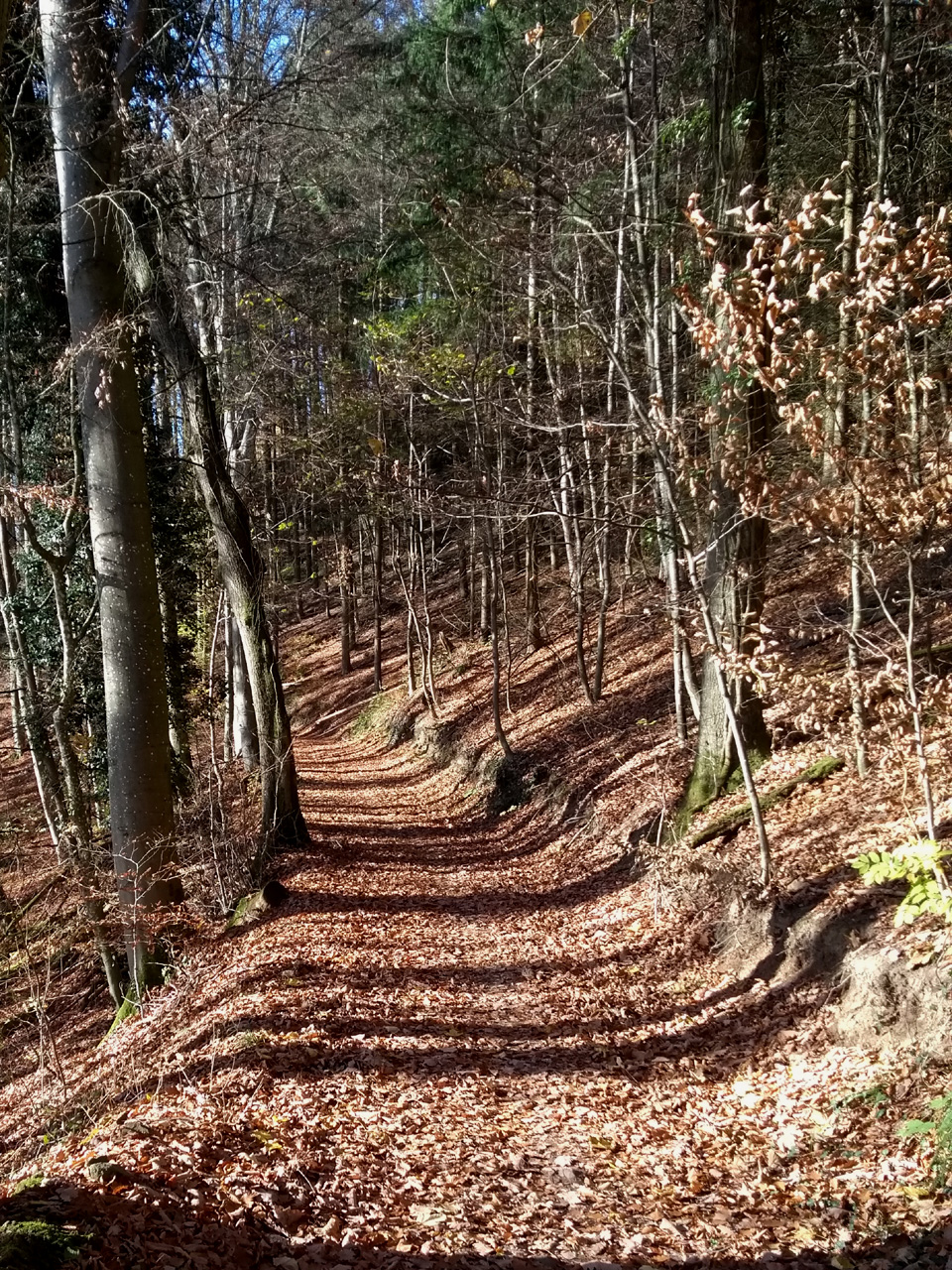
Late November on the Kaiserstuhl: the Herrenweg S of Totenkopf

Late November on the Kaiserstuhl: rose hips at the side of a Hohlweg, S of Oberrotweil
One of the many positive aspects of the Kaiserstuhl – here I’m comparing it to the Schwarzwald – is that its paths are relatively unfrequented. This doesn’t apply on sunny Sundays of course, especially on the grasslands, but generally you’ll find that Kaiserstuhl paths are more or less empty, especially those that are less well known. These include my usual route to Sasbach – just under 18 very pleasant kilometres, partly woods, partly vineyards, partly orchards, with only a few small villages on the way. I walked this route last Friday. The sun shone out of a clear blue sky, there was only the faintest trace of a breeze, and I had the paths entirely to myself.
This was exactly the kind of day I had in mind when I wrote in a previous post about what I call the second side to wandering (‘Thinking’, May 2, 2020):
“A question comes to you, or an idea, triggered by chance perhaps, by something you’ve just seen or by something you’ve remembered; you turn it over repeatedly in your mind; it won’t go away; you argue with yourself; paths of thought open up and link with others you can remember following before; some of these are dead ends; others lead to bridges you cannot cross or gates you cannot open, at least not immediately; others lead into mires through which there are no tracks; some bring answers you are satisfied with or solutions you can accept; others you store away in your mind for another day. This is that second side to wandering.”
I spent much of the walk last Friday pondering the question ‘Why do people do averages?’ And they do do them, we walkers included! Look, for instance, at how a walker would summarise that Friday walk. Here’s the summary from BaseCamp:
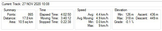
Garmin summary data for walk to Sasbach
My average speed on Friday was 4.85 km per hour; this is given by the total distance divided by the actual moving time. Not bad, especially when you recognise that there were 436 metres of total ascent involved! The Naismith time would have been 4 hours and 17 minutes, so I was 17% faster than Naismith. Now look at the speed plot, again from BaseCamp. I’ve annotated this.
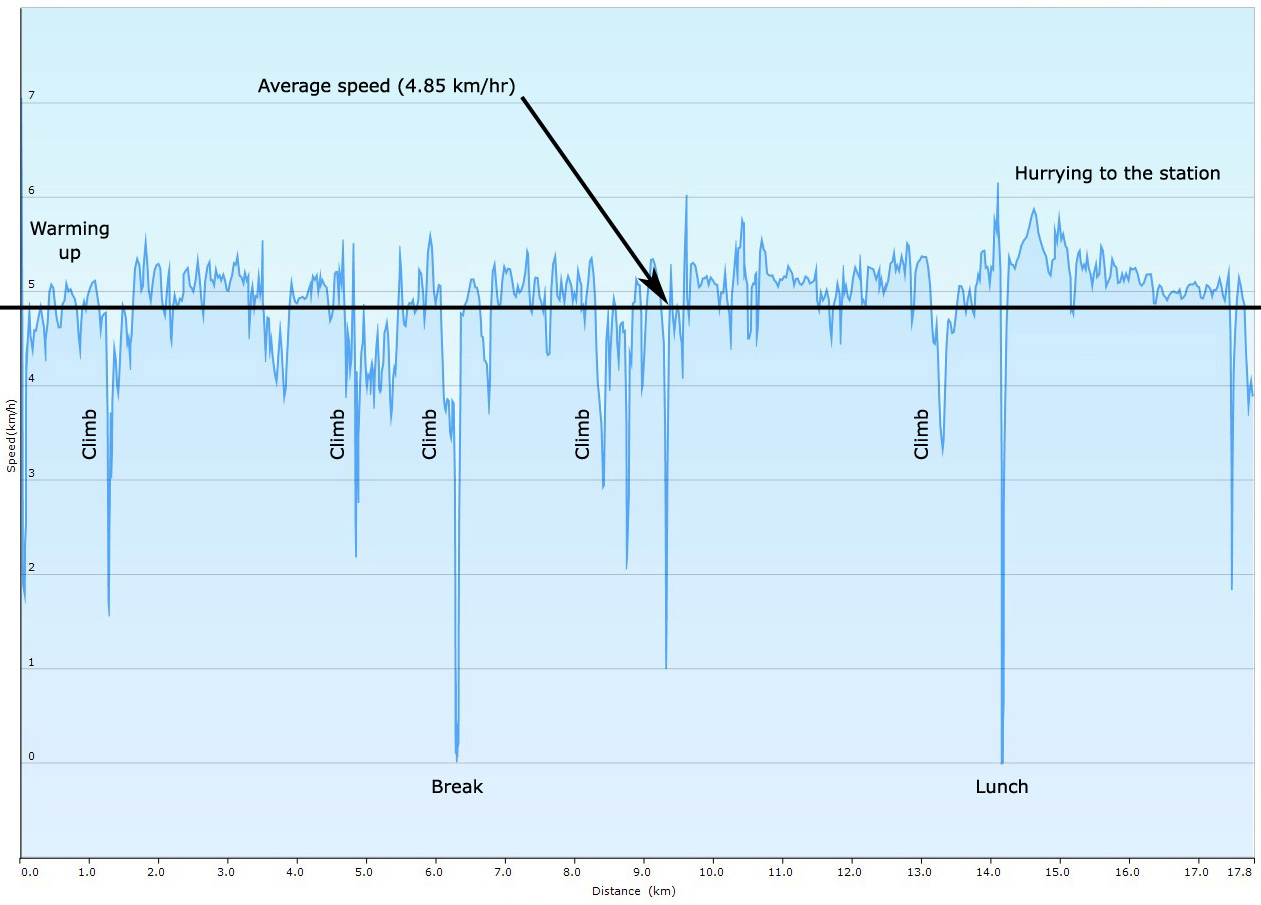
The walk to Sasbach
Three things are abundantly clear from this plot: firstly, I was walking for most of the time at fractionally more than 5 km/hr; secondly, there were times I was walking faster and times I was walking slower; thirdly, I was hardly ever walking at the calculated average speed. So what does this calculated average speed say about this walk? Not much! And, to generalise, what do many average values probably say about whatever it is that they’re averages of? Again, not much. Why then do we do averages? I would suggest there are two reasons. Firstly, we’ve been schooled into believing that averages automatically say something significant; secondly, averages – especially arithmetic averages – are childishly easy to calculate.
I’ve had my doubts about averages for a long time now. There are many reasons to be wary of them. One of these – Savage’s so-called ‘Flaw of Averages’ – is especially relevant in the context of the sort of modelling we’ve been doing here in the past few posts. I’ll be coming back to it next time. Meanwhile some background reading wouldn’t hurt:
https://web.mit.edu/ardent/www/Real_opts_papers/flaw_of_averages.pdf for those of you who, for some inexplicable reason, chanced to miss the original article in the San Jose Mercury News in 2000;
https://hbr.org/2002/11/the-flaw-of-averages for those who missed the follow-up article in the Harvard Business Review in 2002;
https://b-ok.cc/book/1305815/d1f802 for those of you who want the full monty. (Whether or not you should access this particular copy of the book is a matter for you to decide. If your conscience troubles you there’s always the alternative of buying the book, for instance from Amazon.)
I hurried into Sasbach at the end of my walk on Friday, afraid I would miss the train and this time have an hour to wait. I’d got my timings wrong, however, and was there at the station with time to spare. Time enough indeed to ponder a second question: ‘How is it that the Deutsche Bahn is incapable of writing station notices in even half-way correct German?’
That white tuxedo … at last!
November 26, 2020 § Leave a comment
The white tuxedo is certainly an impressive piece of kit; it’s nonetheless not one that’s overly well suited to long-distance walking. If you do happen to be carrying one in your rucksack you’ll always be able to accept even the most formal evening invitation. However, you’ll then be faced with the well-nigh insuperable problem of hanging the thing up afterwards in your little one-man tent.
As to the style of tuxedo you might choose to carry, look here for advice: https://www.gentlemansgazette.com/tuxedo-black-tie-guide/basics-101/tux-style-features-basics/. Above all, avoid anything that can remotely be called ‘trendy’. That means in particular avoiding anything that’s short and tight and leaves a nasty triangle of shirt exposed immediately above the trouser waist band. Sorry, all you Hollywood celebs at all your glittering prize ceremonies, but most of you, quite simply, are not properly dressed. You’ve forgotten Lagerfeld’s maxim: “Trendy is the last stage before tacky”.
So where might you wear this tuxedo? One possibility is that your walk takes you through Casablanca, where Rick Blaine invites you to an evening of French Roulette at his Café Américain. He’ll certainly not object to you taking him as your style model.

Casablanca
Another possibility is that Blofeld orders you to shadow 007 as you’re walking through Monaco. Naturally you’ll visit the casino: https://www.mayfaircasinos.com/magazine/history-of-the-casino-de-monte-carlo/

The Casino de Monte Carlo
OK, gentle reader, it’s time for a confession. I’ve deliberately brought you to Monte Carlo, obviously, but with an ulterior motive. For I’m not at all interested in the casino in Monte Carlo, or indeed in any other casino; I’m interested instead in what is termed the Monte Carlo method. This is a computer simulation technique that lets scientists study models whose behaviour cannot be determined analytically. The Monte Carlo method is based on the premise that in almost every model there is some possibility of chance variation; there are exceptions of course for models that are strictly deterministic and completely specified. This chance variation arises (a) because some or all of the parameters in the model concerned are not known with certainty, or (b) because the model is inherently stochastic. The existence of this chance variation means that there are multiple possible versions of the model, albeit ones that hardly differ from each other in their behaviour. These versions of a model are termed ‘realisations’. To use the Monte Carlo method you create a set of realisations of whatever model it is you’re working with. You do this by a sometimes complex randomisation procedure that takes into account the probability distributions associated with the chance variation. From the range of behaviour that the realisations exhibit you can then determine (a) how the model will generally be expected to behave, and (b) what the effects of the chance variation are.
If you’ve come round to thinking that the Monte Carlo method clearly has a lot to do with Point 9 in theendtoendblog’s ‘Ten Point Guide to Safe Modelling’, you’re absolutely right! If you then want to delve deeper into the method and its history, here’s an article written by one of its pioneers: https://library.lanl.gov/cgi-bin/getfile?00326866.pdf. If you want to delve deeper still, read Ripley’s Stochastic Simulation. There’s a copy here: https://b-ok.cc/book/540817/2bbb45. (Whether or not you should access this copy is a matter for you to decide. If your conscience troubles you there’s always the alternative of buying the book, for instance from Amazon.)
Let’s now look at an example of the method in action. It’s a simple exercise that takes the bushfire model developed here (BUSHF1) and looks at the effect that variation in the ignition capability of a fire has on two important statistics – (1) the mean instantaneous fire size, and (2) the mean fire lifetime. The instantaneous size of a fire is measured by the number of cells burning at any one time; the lifetime of a fire is measured by the time it takes for a fire to burn itself out everywhere. The details of the simulation are as follows: (1) the initial configuration is always a uniform field with the fuel having the maximum possible combustibility (= 1.0), (2) the dwell time is always set to 1, (3) the ignition capability varies in the range 0.30 to 0.40, (4) 30 realisations were used for each value of ignition capability between 0.30 and 0.37, (5) 10 realisations were used for each value of ignition capability between 0.38 and 0.40. Here are the results and the conclusions drawn from them:

The Monte Carlo exercise for BUSHF1. Left: the results. Right: the conclusions.
The circles and stars show the average values of mean fire size and mean fire lifetime, as obtained from the various realisations. The stars indicate that for two values of ignition capability (0.36 and 0.37) not all the fires burned out; the average mean lifetimes could then be calculated only for the fires that did burn out. None of the fires for values of ignition capability greater than 0.37 burned out; therefore average mean lifetimes could not be calculated.
There are clearly four ranges of ignition capability. These give: (A) small fires that burn out very quickly; (B) larger fires that take longer to burn out but still all do so; (C) large fires that burn for a long time and sometimes burn out naturally; (D) extra-large fires that burn for ever – or at least until they run out of fuel. The transitions from range A to range B and from range C to range D are gradual; the transition from range B to range C is relatively abrupt. The ignition capability 0.35 therefore seems to mark some sort of tipping point in the model’s behaviour.
“Could this be why he set 0.35 as the default value in the BUSHF1 program?” Oh ye of little faith!
Bushfires 101: the safety guide
November 19, 2020 § Leave a comment
Good morning once more! Welcome to the final lecture in Bushfires 101. Then again, knowing how this wanderer’s mind works, it may very well turn out not to be the final lecture. Only time will tell.
The titles of the previous three lectures formed a readily understandable sequence: first there was ‘Bushfires 101: the theory’, then there was ‘Bushfires 101: the model’, then there was ‘Bushfires 101: the programs’. The title of this present lecture – ‘Bushfires 101: the safety guide’ – doesn’t seem to fit, does it? Yet it does fit, because the topic I’m going to be covering now, in the context of the bushfire model I’ve introduced here, is a critical one for every scientist who builds and uses models. It concerns what I’ve sometimes referred to, perhaps a little too mysteriously, as the safety aspect of scientific modelling. Here then, for what it’s worth, is a brief summary of theendtoendblog’s ‘Ten Point Guide to Safe Modelling’.
- Never forget that there is a world of difference between the model you’re working with and the system you’re modelling. The model is simply a practical expression of a particular set of ideas about that system. If the ideas and the expression of them in the model are both correct, the model and the system will behave identically; if not, they won’t. (See ‘Truly magnificent stuff!’, August 19, 2020)
- Remember that there are two objectives in scientific investigation: understanding and prediction. Of these it is understanding that is paramount, always. A system is usually taken to be well enough understood once a model has been made of it that predicts its behaviour for a wide range of initial conditions. There is nonetheless never any way of knowing conclusively that that system actually is well enough understood. There is accordingly never any way of knowing if the model in question can justifiably be used for prediction. (See ‘The Objectives That’, September 5, 2020)
- In using a model to try to gain understanding of a system, don’t look only at what that model does. Look also at what it can do. Take it out of its comfort zone; push it to its limits; find out what those limits are.
- Think KISS. No, not the glam rock band! Rather the maxim due to Kelly Johnson, the American aeronautical engineer responsible for the iconic Lockheed SR-71 Blackbird: “Keep it simple, stupid—KISS—is our constant reminder”. (See https://www.businessinsider.com/history-of-sr-71-blackbird-legendary-spy-plane-2020-5?r=DE&IR=T)

The Lockheed SR-71 Blackbird. Photo credit: NASA
- KISS means firstly that you should keep to a minimum the number of auxiliary hypotheses your model contains. These are the various assumptions that need to be made in order for that model to work. The obvious auxiliary hypothesis in the bushfire model is the assumption, so far unstated, that the ignition capability of a fire that is burning in a cell is independent of the combustibility of the fuel there. This may be true, but then again it may not.
- KISS means secondly that you should keep to a minimum the number of factors that your model takes into account, therefore also the number of parameters your model needs. These factors should be independent of each other, at least as far as possible. The bushfire model has three independent factors: the continuity and combustibility of the fuel bed, the likelihood of ignition, and the time over which ignition is delayed. The model accordingly has three parameters. One of these – the initial configuration – is a compound parameter; the other two – the ignition capability and the dwell time – are simple parameters.
- All the parameters in your model must have values that either (a) are known, or (b) at the very least are both justifiable and likely. If, in contrast, the values are essentially unknown, then you’ll be faced with having to find a convincing rationale for selecting appropriate arbitrary values. Perhaps you’ll choose these on grounds of mathematical neatness, or on grounds of computational expediency, or perhaps even because of some innate desire for simplicity. I do hope not! An all-too-common pitfall is when all the members of a set of related parameters are given the same value purely because there is no convincing rationale by which they can be given different ones.
- Never under any circumstances adjust the values of the parameters in your model simply in order to maximize the agreement between that model’s behaviour and the behaviour of its parent system. This practice is commonly referred to as ‘tuning’, and parameters that can be adjusted in this way are usually termed ‘free parameters’. Modelling exercises in which free parameters are used to force a fit between a model and its parent system contribute nothing to the understanding of that system; they demonstrate only that the model concerned obeys the wishes of its maker.
- Remember always that variation in your model’s behaviour from run to run is generally to be expected, even if the parameter values are unchanged. (This doesn’t apply of course if the model is strictly deterministic.) It is accordingly essential that the range and nature of this variation always be documented. Running a model once and taking the behaviour it shows then as typical for whatever parameter combination is involved is not acceptable procedure.
- Beware of averaging.

I’ve covered some of the points in this guide already, in earlier posts. I’ll get round later to covering most of the others.
End of lecture. I need a drink.
Bushfires 101: the programs
November 15, 2020 § Leave a comment
Did you download that clip during the break? I hope so, because I’m going to be referring regularly to the run that it shows. You can think of this run as the baseline model run. The bushfire concerned is spreading out over a uniform field from an originally linear source; the fuel is everywhere perfectly combustible; the ignition capability of the fire is everywhere the same in every direction; and there is no delay in ignition. Simpler you cannot get.
I’ve implemented the model as a computer program – BUSHF1 – which you can experiment with. All the necessary program documentation is in ‘Software’, one of the pages at the left-hand side of the blog. There are full details there of how to get the program and of how to use it. Try the baseline run first, then make variations in the initial configuration, the source type, the fuel combustibility and the ignition capability. The variety of behaviour you get will probably amaze you, especially as the behaviour you get for each set of conditions will turn out not be the same every time you run the program for that set of conditions. I’ll get back to this latter characteristic in a later post, just as soon as I’ve looked out that white tuxedo I referred to in ‘Walking at random’ (August 8 2020).
It’s time now to get on to that fourth factor I mentioned last time – the strength of the wind in the area over which the fire being modelled is spreading. The assumption made in BUSHF1 that the ignition capability of the fire is everywhere the same in every direction is equivalent to assuming there is no wind. This is not very realistic, to put it mildly! I’ve therefore provided a second program – BUSHF2 – that allows there to be wind. It does this by letting you specify three distinct ignition capabilities – one for the downwind direction, one for the crosswind direction, and one for the upwind direction.
Here are some snapshots from model runs made with BUSHF2. The initial configuration is the same in each case, as also is the source type and the dwell time; the only difference is in the ignition capabilities. From left: (i – this is the baseline run) downwind ignition capability = 0.35, crosswind ignition capability = 0.35, upwind ignition capability = 0.35; (ii) downwind ignition capability = 0.35, crosswind ignition capability = 0.5, upwind ignition capability = 0.0; (iii) downwind ignition capability = 0.4, crosswind ignition capability = 0.45, upwind ignition capability = 0.0; (iv) downwind ignition capability = 0. 5, crosswind ignition capability = 0.1, upwind ignition capability = 0.15; (v) downwind ignition capability = 0.55, crosswind ignition capability = 0.15, upwind ignition capability = 0.0, (vi) downwind ignition capability = 0.55, crosswind ignition capability = 0.15, upwind ignition capability = 0.05. The differences from run to run in the sizes and distributions of the burned and unburned areas (blue and green, respectively) are clearly very considerable. Yes, and of course you’ll also get different results every time you run the program for any given combination of ignition capabilities!

Snapshots from example runs of BUSHF2. From left: (i – the baseline run), (ii), (iii)

Snapshots from example runs of BUSHF2. From left: (iv), (v), (vi)
When you download BUSHF1 from Dropbox you automatically get BUSHF2 as well. I’ll leave you to experiment with it. Try the baseline run first, then make systematic variations in the three ignition capabilities. Have fun!
Bushfires 101: the model
November 12, 2020 § Leave a comment
Good morning again! Welcome back to Bushfires 101.
The theory we covered last time led us to identify the three basic factors that control how a bushfire spreads. The first of these is the continuity and combustibility of the fuel bed; the second is the likelihood of ignition, i.e., the probability that a fire at a point will ignite fuel at an adjacent non-burning point; the third is the time, if any, over which ignition is delayed. The model we’re going to be developing takes each of these factors into account. It is accordingly more complex than any of the other models of stochastic spatial processes that you’ve so far seen here. The carbonate factory model (‘The carbonate factory’, October 9th 2020) had only a single controlling factor – the colonisation probability; the random walk model (‘Walking at random’, August 8th 2020) had two – the step length and the step direction.
Yes, in answer to that question from the back of the room, of course there is a fourth factor – the strength of the wind in the area over which the fire is spreading. We’ll be dealing with that later. For now we’ll assume the area is windless.
Let’s go through the three factors in turn.
The continuity and combustibility of the fuel bed is a compound parameter that here is termed the initial configuration. Here are some examples of different initial configurations, shown on the model’s honeycomb mesh.

Initial configurations. From left: (i), (ii), (iii), (iv)

Initial configurations. From left: (v), (vi), (vii), (viii)
The colour of a cell indicates the combustibility of the fuel in that cell, measured on a scale from 0 (non-combustible) to 1 (perfectly combustible): bright green indicates perfectly combustible fuel, darker greens indicate fuel that is less combustible, blue indicates there is no combustible fuel in the cell. The red cells at the left-hand side of each picture are the initial firefront.
The initial configurations shown in the upper diagram are: (i) uniform field, all cells with perfectly combustible fuel; (ii) random field, all combustibilities possible; (iii) random field, all combustibilities possible, 20% of cells with no combustible fuel, 80% with perfectly combustible fuel, (iv) random field, all combustibilities possible, 20% of cells with no combustible fuel, 60% with fuel with combustibilities between 0 and 1, 20% with perfectly combustible fuel. The initial configurations in the lower diagram are: (v) random field, combustibilities between 0.2 and 0.8, 20% of cells with fuel with combustibility equal to 0.2, 60% with fuel with combustibilities between 0.2 and 0.8, 20% with fuel with combustibility equal to 0.8; (vi) 2-state random field, combustibilities either 0.2 or 0.8, 40% of cells with fuel with combustibility equal to 0.2, 60% cells with fuel with combustibility equal to 0.8; (vii) 2-state field made of randomly positioned overlapping patches of maximum radius equal to five cell widths, combustibilities either 0.2 or 0.8, 60% of cells (those within the patches) with fuel with combustibility equal to 0.8, remaining 40% with fuel with combustibility equal to 0.2; (viii) 2-state field with overlapping patches of maximum radius equal to eight cell widths, 80% of cells (those within the patches) with perfectly combustible fuel, remaining 20% with no combustible fuel.
The probability that a fire at a point will ignite fuel at an adjacent non-burning point is determined (a) by how hot the fire is (Grassfires Chapter 3), and (b) by the combustibility of the fuel to be ignited. The hotness of the fire can conveniently be described by a parameter that here is termed the ignition capability – this is defined as the ability of a fire at a point to ignite the fuel at an adjacent point, given that that fuel is perfectly combustible.
The time over which ignition can be delayed is here termed the dwell time. It is analogous to what bushfire scientists usually term the smoulder time (Grassfires p. 140). Grassfires can smoulder for short periods (up to days, depending on the type of fuel), then flare up suddenly and ignite adjacent fuel; moorland fires can smoulder for weeks, especially if any underlying peat is involved.
Here are some instantaneous snapshots from model runs made with the same initial configuration (uniform field, with all cells having perfectly combustible fuel) but with different ignition capabilities and dwell times. Red-coloured cells are cells that are still burning; blue-coloured cells are cells that have completely burned. From left: (i) ignition capability = 0.35, dwell time = 1; (ii) ignition capability = 0.45, dwell time = 1; (iii) ignition capability = 0.35, dwell time = 2; (iv) ignition capability = 0.45, dwell time = 2. The difference in the fire spreading behaviour in the runs is striking, in two respects: firstly in the straightness and continuity of the firefront, and secondly in the completeness (or lack of it) of the fuel consumption.

Example runs. From left: (i), (ii), (iii), (iv)
It’s time now for a stretch break. I certainly need one. While you’re outside getting some fresh air and a coffee you might try downloading this short film clip: https://www.dropbox.com/s/yw82dxkr3d41scy/Basic%20run.mp4?dl=0 It shows the first of the four model runs.
Bushfires 101: the theory
November 6, 2020 § Leave a comment
Good morning. Welcome to Bushfires 101!
Bushfires are remarkably simple things, at least in theory. This is true particularly for grassfires – the fires that Cheney and Sullivan concentrate on in their magnificent book. (You have been reading it, haven’t you?) There are three preconditions for a bushfire to start – indeed for any fire to start: there must be combustible fuel available (for a bushfire this is predominantly plant material), there must be oxygen available to allow the various combustion reactions to take place, and there must be ignition. The second and third preconditions are usually always fulfilled in regions where bushfires commonly occur, (a) because there is almost always enough oxygen available everywhere at the ground surface, and (b) because there are usually enough potential sources of ignition. These sources can be natural ones, e.g., lightning strikes; or they can be man-made but accidental, e.g., defective power lines or cigarette butts thrown carelessly away; or they can be man-made and deliberate, e.g., forest clearance burning or arson. It is accordingly the availability of combustible fuel that determines whether or not a bushfire can start.

Brush fire at Atascadero, CA. Photo credit: The Atascadero News
Once a bushfire has started it tends to spread out laterally – it is after all a spatial process! The fire at each already burning point acts as a potential source of ignition for combustible fuel at any of the adjacent non-burning points. If the ignition is successful at those points, the fuel there starts to burn. Two questions arise immediately. Firstly, what happens if there isn’t any combustible fuel at a non-burning point, either (a) because there is no fuel there of any kind, or (b) because there is fuel there but it’s fuel that isn’t readily combustible – wet grass, for instance? Secondly, assuming there is combustible fuel at a non-burning point, is ignition inevitable? The answer to the first question is that a fire can spread from a burning point to an adjacent non-burning point only if between those points there is a continuous bed of combustible fuel. (Here I’m deliberately ignoring the possibility of spotting. You can check out the meaning of this in Grassfires, on p. 140.) The answer to the second question is that ignition is never inevitable. There is always an element of chance, for instance (a) because of the potentially variable intensity of the fire at points that are already burning, or (b) because of the potentially variable condition of the fuel at points that aren’t already burning. This non-inevitability of ignition makes a bushfire an intrinsically stochastic process.
A third, related question is now obvious. Can a fire at a point that is burning convert the fuel at an adjacent non-burning point from a non-combustible to a combustible condition? Certainly, for fires that are intense enough can drive off moisture from even the least promising of fuels. (That is why green saplings will burn on the bonfire in your back garden, albeit slowly and with a lot of smoke that annoys your neighbours. Just keep that bonfire hot enough!) The result of this fuel conversion is that ignition can now potentially take place, although it is of course delayed. The length of the delay is principally a function of the rate at which the fire is moving. Slow-moving fires consume everything they come across, especially if they are intense; fires that are fast-moving leave unburnt fuel behind, fuel that naturally is still combustible.
A bushfire is both a spatial process and a stochastic process. Who would have guessed? Why not therefore model it using a stochastic cellular automaton – one that is of course honeycomb-based, just as I promised a few post’s ago! The model I’m going to describe here is a remarkably simple one, deliberately, although it’s a deal more complex than any of the models of stochastic spatial processes I’ve introduced you to before. It’s far from completely realistic – I stress this – and it won’t make you in any way an expert on bushfires. I’ll be providing you with two programs with which you can experiment to your heart’s content. After doing this you’ll certainly understand better how bushfires can and do behave. You’ll also then be getting a feeling for stochastic spatial processes and for what modelling in science is really about.
For your bookshelf
November 4, 2020 § Leave a comment
Up to now theendtoendblog has not had a ‘Book Review’ section. That should perhaps change, if only because I now need to recommend to you – very strongly – a magnificent book I’ve recently come across. This is Grassfires. Fuel, weather and fire behaviour by Phil Cheney and Andrew Sullivan, published in 2008 (2nd Edition) by CSIRO Publishing. I’m going to be referring to it again and again in the next few posts, particularly in the immediately upcoming ones about modelling bushfires. You can read and/or download a .pdf of the book from https://b-ok.cc/book/684622/50f3ca. (Whether or not you should do this is a matter for you to decide. If you are in any doubt there’s always the alternative of buying the book, for instance from Amazon.)
Phil Cheney, the senior author of Grassfires, is the doyen of Australian bushfire scientists. He has over 50 years active experience in bushfire research, and from 1975 to 2001 was leader of the CSIRO Bushfire Research Group. He is known for his outspoken views on how to avoid and to minimise bushfire disasters, particularly in the modern Australian urban and semi-urban environment. See, for instance, Canberra: Bush Capital or Bushfire Capital, his 2004 presentation to the ACT Historical Society: https://www.bushfirefront.org.au/resources-2/historical-accounts/canberra-day-oration/
Grassfires is not an academic textbook; it is a book for everybody. It covers first the necessary fire science principles; then it uses those principles to show how bushfires start and behave; then it looks at how bushfires spread under different fuel and weather conditions; finally it considers how bushfires can be predicted and suppressed. The treatment is everywhere a more-than-satisfying combination of theory and practice, with incorporated into it the results of numerous field experiments. This is how science is properly done.
The authors write fluently and often in a pleasantly almost light-hearted style. The result is an informative yet extremely readable book. My recommendation is simple. Get Grassfires and read it!
2019, with vivid memories from 1984
November 3, 2020 § Leave a comment
Do you remember 2019? It wasn’t so very long ago! Here are reminders of a few of the happenings that made it memorable – or didn’t, as the case may be.
January 1st (at precisely 0533 UTC) saw New Horizons making a close approach to the Kuiper belt object 486958 Arrokoth. (For those benighted creatures who don’t appreciate the meaning and significance of these sorts of things: (1) UTC is Coordinated Universal Time; (2) New Horizons is an interplanetary space probe launched as part of NASA’s New Frontiers program; (3) 486958 Arrokoth is a trans-Neptunian object composed of two planetisimals joined along their major axes; (4) the Kuiper belt is a circumstellar disc in the outer Solar System.) Clearly the year’s happenings could only get more memorable – or less memorable, depending on your point of view.
April 10th saw scientists from the Event Horizon Telescope project announcing the first ever image of a black hole, one located in the centre of the Messier 87 galaxy. (Once again, this time for all of you who’ve simply forgotten: (1) the Event Horizon Telescope is a large telescope array consisting of a global network of radio telescopes; (2) Messier 87 – also known as Virgo A or NGC4486 – is a supergiant elliptical galaxy with about 1 trillion stars, in the constellation Virgo.) More memorable, or less? You get to say.
August saw what appeared to be the world’s entire media worrying about the lack of proper toilet facilities on the Malizia II, the $4 million, 18-meter high-tech yacht that then was skimming its way across the North Atlantic from Plymouth to New York, to the United Nations Climate Action Summit. (Malizia II is of course an IMOCA 60 monohull owned by the Monacan Royal Family, designed by VPLP and Guillaume Verdier, and constructed by Multiplast in France. But then you knew all that, didn’t you?) Not really memorable at all.
Now to be serious, for in September 2019 things certainly did get serious. This was the start of the main phase of what has since become known in Australia as the Black Summer, the unusually intense bushfire season that raged there until March 2020. You can follow the story from https://en.wikipedia.org/wiki/2019%E2%80%9320_Australian_bushfire_season
Why am I raising the subject of bushfires here? Two reasons. Firstly – and surely you’ve already twigged my motivation – a bushfire is a stochastic spatial process. It’s in fact the next such process I’m going to be modelling. Secondly, I still have vivid memories of my only up-close-and-personal contact with a bushfire, albeit with a fire that was ridiculously small and local compared to much of what Australia regularly suffers.
The date was Thursday, December 20th, 1984; the place was Canberra. Flicka and I had been invited by one of my colleagues to a pre-Christmas BBQ chez lui – Steaks, Snags, Salads, Chardonnay, and of course the obligatory Cold Tinnies. We’d come down William Hovell Drive, from Belconnen, and as we reached Glenloch Interchange had seen thick, grey smoke billowing up from the direction of the lake. There was a brisk south-westerly wind. As we drove east along Parkes Way, with the smoke blowing across us from right to left, we saw that the scrub and grass on the central reservation was completely alight. There was only one sensible course of action – right foot down and drive fast through. Then, as we passed directly by those flames, they jumped. In the rear-view mirror we saw that in those few seconds they’d crossed both lanes of the highway and started up the slope of Black Mountain. Naturally we feared for the Botanic Gardens. Fortunately the ACT Fire Brigade and the ACT Bush Fire Brigade soon had the situation under control. Things turned out not to be as bad as they had appeared initially. This link gives two descriptive pieces from the following day’s Canberra Times: https://trove.nla.gov.au/newspaper/article/122535614?searchTerm=bushfire%20black%20mountain
My vivid memories of a stochastic spatial process!
New email address
November 1, 2020 § Leave a comment
For some completely inexplicable reason, Microsoft has seen fit to lock me out of the email account that I’ve used here for the past five years (johntde[at]hotmail.com). Thanks, Bill!
I’ve therefore created a new address – johntdenew[at]hotmail.com
OK, there’s no prize for originality!
Trees, and a well deserved compliment
October 31, 2020 § Leave a comment
I wrote in a recent post that I was hoping in the weeks that followed for more nature, more walking, and more time away from the scientific method (‘Wise words. Thank you Fil!’, September 19th 2020). That was more than a month ago. Things didn’t quite turn out that way, for reasons I shan’t bore you with.
Yesterday I could at last get back to that milk run of mine – the 14 kilometre walk across the Kaiserstuhl to Endingen. The route I use is the most straightforward one: first up the Böselsberggasse to the Kastanienplatz, then onto the crestline path – the Gagenhart-Höhenweg – to the pass at Vogelsang, then up onto the grasslands, then finally along the Neunlindenpfad to Endingen. Yesterday it had to be different: there was serious tree-felling being carried out along the first part of the Höhenweg. A very large and very official notice warned me that in accordance with such-and-such a paragraph of such-and-such a section of the Landeswaldgesetz I would be fined for going any further.
Fortunately there was an alternative. (If you’re at all at home in the woods on the Kaiserstuhl you know there is always an alternative!) This involved taking an initially unsignposted path that leads first down towards Liliental then cuts up to Gagenhart on the far side of where the felling was being carried out. This path was magnificent to walk along yesterday, with its thick carpet of beech leaves. I could also enjoy the multiple carvings on the tree trunks, for this is undoubtedly the path on the Kaiserstuhl where the art of carving your message on a tree has been best developed and preserved. The oldest carvings I’ve ever found here date from 1934. The most elaborate – probably also from the 1930’s – is a highly detailed picture of Jesus on the Kreuzweg. How long this must have taken to cut, and with what care, I can hardly imagine. This is not your usual ‘John loves Mary’ stuff!

Left: the start of the carvings
Centre: the Kreuzweg tree
Right: the Kreuzweg tree in April 2020
Back on the Höhenweg I was accompanied by small flocks of tits and (I think) finches. These were flitting continually in and out of the understorey, which now – in mid-late Autumn – has lost much of its foliage. There’s more light along the path too, as the main canopy is also partly bare. Most noticeably, the colour palette is different from that of only a few weeks back: there are still greens, but the reds have mostly given way to browns and yellows.
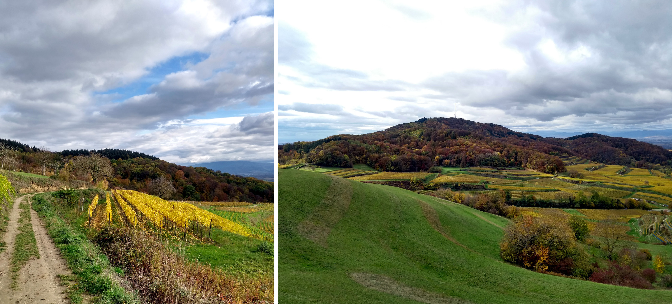
Left: looking E towards the Fuchsbuck
Right: looking SW from the grasslands towards Totenkopf
The walk on the grasslands was as good as ever, with an initially excellent view over towards Totenkopf, with the Vosges in the far distance. The sky began to cloud over, however, which persuaded me to head on fast. I reached Endingen in record time.
And the compliment? Regular readers of theendtoendblog know that I haven’t had many good words to say for the Deutsche Bahn. Understandably, I think. So what a pleasant surprise it was to run down onto the platform at Endingen, to see my train to Gottenheim about to depart (with a 30 minute wait for the next one), to wave to the driver, then to see him smile and unlock the doors to let me on. Thirty seconds later we were away. Thank you, sir!
The fashionable honeycomb
October 29, 2020 § Leave a comment
Did you get round to looking at that link I gave you at the end of the previous post (https://www.thecuttingclass.com/honeycomb-details-at-alexander-mcqueen/)? I do hope so, because there you see a superb example of the creativity and skill that exists at the high end of the fashion business. What attracts me particularly in that show is the designer’s use of one of nature’s truly fascinating patterns – the honeycomb – as the basis for an entire collection. An inspired choice!
Scientists have been interested for centuries in how the honeycomb pattern can be generated. There are two main models: https://en.wikipedia.org/wiki/Honeycomb_conjecture and https://en.wikipedia.org/wiki/On_Growth_and_Form (Ch. 7). My interest in the pattern is different. What is important for me is simply that it is a regular cellular pattern that completely fills a two-dimensional space; the cells are hexagons, obviously. There are two other patterns that do this: (1) a mesh of equilateral triangles, and (2) a mesh of squares. (Actually there are more than just these two, but they are the only ones I want to deal with here. If you feel like going further, for instance into the wonderful wacky world of Bravais lattices, click on this link: https://en.wikipedia.org/wiki/Bravais_lattice)
From left: equilateral triangle mesh, square mesh, honeycomb mesh
This diagram compares the three patterns. Focus on the orange cell in each case. The coloured cells surrounding it are its neighbourhood. Each yellow-coloured neighbour shares with the orange cell a side and two vertices; each blue-coloured cell shares with it only a vertex. The lettered arrows on the diagram indicate the distances between the centre of the orange cell and the centres of its differently coloured neighbours. The orange cell in the triangle mesh has 12 neighbours, three of them yellow and nine of them blue; the orange cell in the square mesh has eight neighbours – this is the so-called Moore neighbourhood used in the carbonate factory model – four of them yellow and four of them blue; the orange cell in the honeycomb mesh has six neighbours, all of them yellow. Clearly the honeycomb mesh is special in that all of its cells are identical: they all have the same number of neighbours, and the inter-neighbour distance is always the same. If you had to choose a mesh to use to build a cellular automaton, you’d therefore choose a honeycomb, wouldn’t you?
I would, certainly! So why then was the carbonate factory model built using a square-cell mesh? Two reasons: firstly, I wanted to lead on directly from Conway’s Game of Life; secondly, I wanted to avoid the little bit of extra programming complexity that is involved when using the honeycomb. I assure you the next model of a stochastic spatial process that you see on theendtoendblog will be honeycomb based!
All of this leads me back inevitably to the sheer beauty of the honeycomb, the fascination that it exerts on people, and therefore to the understandable motivation that fashion designers and fashion photographers have for using it in their work. Here are just three examples.

Savage X Fenty Vol. 2, 2020

Left: Photo credit Francois Nars, V Magazine 2014
Right: Photo credit Ryan McGinley, W Magazine 2016
(Please don’t ask me to identify the maker of the honeycomb-tread tyres in the last photograph!)
… and the promised cellular automaton!
October 24, 2020 § Leave a comment
It’s been a long time since the last post – much longer than I had anticipated. The result, however, has been a positive one in that you’ve all had extra time to get up to speed on cellular automata. Excellent! What more could this wanderer have hoped for?
Let’s start by looking at Conway’s Game of Life: https://playgameoflife.com. This is a deterministic automaton built using a two-dimensional mesh of square cells; it uses the eight-cell (Moore) neighbourhood. Those three characteristics – deterministic, square cell mesh, and Moore neighbourhood – make it about the simplest automaton you can possibly imagine. Its behaviour is entirely predictable for every given starting state. It’s no wonder Conway termed it a game.
The carbonate factory we’re modelling here, in contrast, is very far from a game: it’s a set of three hypotheses that help us understand how the sorts of limestone-marl sequences that Frank and his companions found on the North Somerset coast are laid down on the sea floor. The first of these hypotheses is that in waters too deep to allow light to penetrate there are no photosynthesising organisms living; there is therefore no calcium carbonate produced there and no limestone laid down. Only in waters shallower than about 200 metres can carbonate-producers survive; the probability of their not surviving at a given depth (the death probability) increases with the depth, reaching 1 at the zero-light limit. The second hypothesis is that in areas in which carbonate is produced there are always larvae of carbonate-producing organisms floating in the water. These larvae settle to the sea floor individually, some of them manage to establish themselves there, and those that do so start to produce carbonate. The probability of this happening (the birth probability) is low. The third hypothesis is that carbonate-producers that have established themselves on the sea floor colonise empty areas to which they are adjacent. The likelihood that an empty area will be colonised is proportional to the number of established carbonate-producers to which it is adjacent. The coefficient of proportionality (the per-neighbour colonisation probability) varies according to the type of organism involved.
That’s the theory behind the model. Now for the model itself. Like Conway’s game it’s a cellular automaton built using a two-dimensional mesh of square cells; it also uses the Moore neighbourhood. It’s a stochastic automaton, however, rather than a deterministic one – this is understandable when you remember that each of the three hypotheses on which the model is based has an associated probability.
I’ve implemented this model as a computer program – FACTOR – that you can experiment with. All the necessary program documentation is in ‘Software’, one of the pages at the left-hand side of the blog. There are details there of how to get the program and of how to use it. Do try it! It’s easy, it’s fun, and above all it’s instructive.
Undoubtedly there will be a few readers, especially those who aren’t enrolled in the ‘Mathematical Geology’ elective, who’d prefer simply to see the program working. I’ve therefore made a short film clip you can download and play: https://www.dropbox.com/s/pp06bch0ar1j4zc/Factory%20clip.mp4?dl=0. The picture sequence later in this post shows edits taken from that clip.
Go on! Play it! You know you want to!
The clip shows how the factory operates during a cycle of sea-level change. The factory is initially at a depth of 200 metres; you see this by the position of the vertical red bar on the death-probability graph at the bottom of the screen. Immediately above this graph is a view directly down onto the factory floor, i.e., down onto the sea floor. What you see there is a 100-by-100 mesh of cells, each of which is coloured blue-grey to indicate that only marl is being laid down. (At 200 metres the death probability is 1, therefore no carbonate-producers can survive.) As the clip plays and the water depth decreases (e.g., 198 metres) you start to see some yellow-coloured cells appear. These are cells where individual larvae have settled, where carbonate is being produced, and where limestone is being laid down. This situation is temporary, however, for the producing organisms die out almost at once as a result of there being insufficient light. This process of settlement, temporary production and dying out continues as the water depth decreases. As the clip plays further you see that the number of yellow-coloured cells starts to increase (e.g., 192 metres). This is because some of the producing organisms are now managing to survive and colonise empty cells to which they are adjacent. The amount of carbonate being produced accordingly increases at the expense of the marl; it increases ever faster as the water depth gets less (e.g., 191 metres). At 190 metres – this is the shallowest point of the sea-level change cycle – almost all of the factory is producing carbonate and only limestone is being laid down.
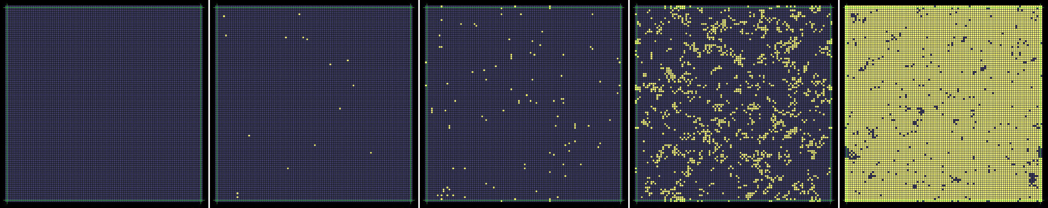
From left: starting state (200 m); temporary production (198 m); start of colonisation
(192 m); fast colonisation (191 m); shallowest water (190 m).
Now the water depth starts to increase. Initially there’s still mostly carbonate produced, but as the water gets deeper the producers find it ever more difficult to survive. (There are of course always larvae settling, but these never manage to establish themselves.) At 200 metres there is no more carbonate production; the factory is back where it started.
The final thing to look at in the clip is the stratigraphic column at the left-hand side of the picture. This shows the rock sequence being built up in time during the sea-level change cycle. Notice the relatively sharp boundaries between the beds of limestone (yellow) and marl (blue-grey), exactly as in the Blue Lias succession on the North Somerset coast.
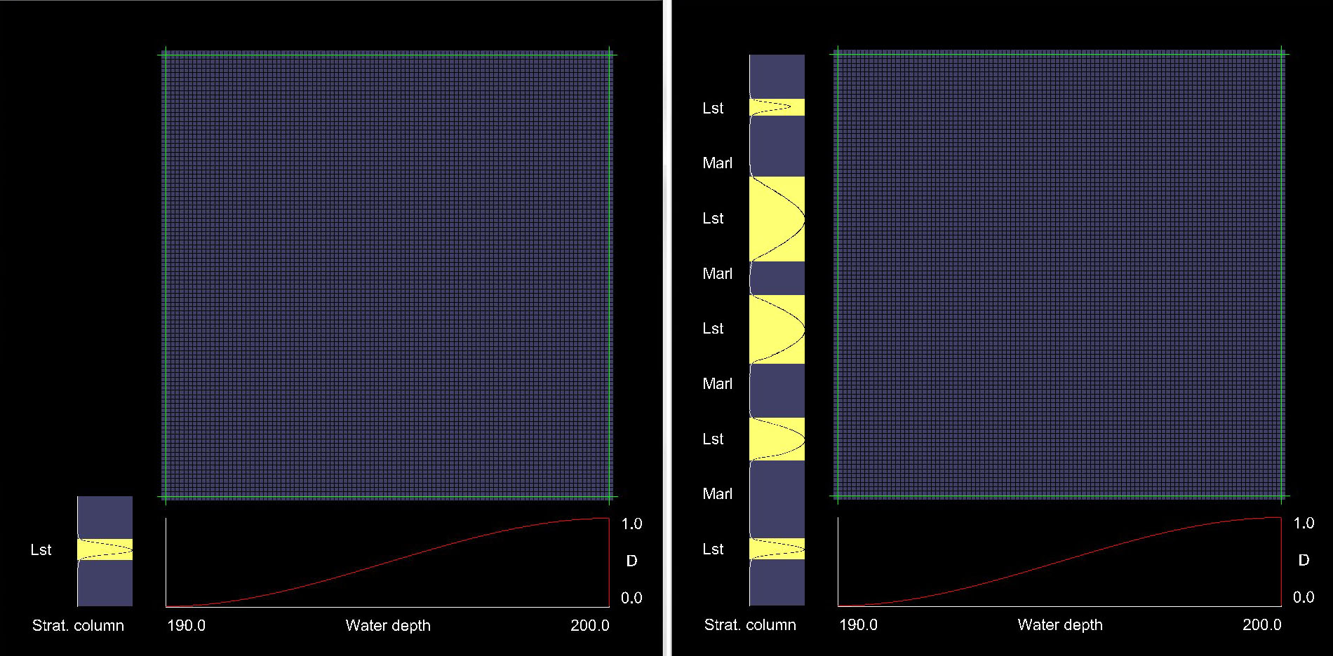
L: final state of factory after 1 cycle, with resulting stratigraphic column.
R: after 5 cycles with different colonisation probabilities (0.01, 0.05, 0.1, 0.125, 0.005)
So there it is – a stochastic spatial process modelled using a cellular automaton. Next time I’ll be showing something similar, but in a far more fashionable context! This link may whet your appetite: https://www.thecuttingclass.com/honeycomb-details-at-alexander-mcqueen/
The carbonate factory
October 9, 2020 § Leave a comment
I really am wondering what those of you who’ve been attending the ‘Introductory Geology’ fieldtrips regularly must now be thinking! A carbonate factory on the sea floor? What on Earth is he rabbiting on about? Can I get my enrolment fees back?
Let me assure you there’s nothing to worry about. I’m not expecting you to imagine some high-tech structure reminiscent of Karl Stromberg’s Atlantis – in The Spy Who Loved Me, for those of you who need reminding. The term ‘carbonate factory’, which has been used by sedimentologists for about forty years, refers simply to an area of the sea floor where large quantities of calcium carbonate are produced relatively quickly, or at least can be produced relatively quickly. This carbonate is produced mainly by photosynthesising microorganisms.
If we’re going to make a model of a carbonate factory – and we are – then clearly we’re going to have to know the factors that control where those carbonate-producing organisms are present. The most obvious suggestion – this is the one that most people put forward – is that the main controlling factor has surely to be the physical environment on the sea floor, in particular the light intensity. (The carbonate producers are photosynthesisers, therefore they need light to live.) This suggestion sounds so reasonable that very few people trouble to look for alternatives. What a pity, for it’s completely wrong! The presence of the carbonate-producing organisms is not controlled by the physical environment; it reflects instead the extent to which those organisms have colonized the parts of the sea floor where the physical environment will let them survive. (There is a fundamental ecological principle involved here, namely that the physical environment never prescribes where organisms actually live; it acts only to limit where they can survive. Organisms do not change their distributions automatically if and when the physical environment changes.) The amount of carbonate produced in a particular area of the sea floor can accordingly be very much less than would be predicted by looking only at the physical environment; this is the case whenever the relevant carbonate-producing organisms have yet to colonize that area fully. The take-home message is that it is colonization rather than the physical environment that controls the production in a carbonate factory.
Clearly what we’re going to need as a part of our carbonate factory model is a model of the colonization process – the process by which those carbonate-producing organisms spread out over the sea floor. Do I hear the sound of pennies dropping? Yes, this is yet another stochastic spatial process, albeit one that is a little more complicated than those you saw in previous posts: see ‘Walking at random’ (8 August 2020), ‘Another stochastic process – this time with thanks to David Attenborough’ (20 July 2020), and ‘Models, and walking of course!’ (21 August 2020). This new spatial process is going to be modelled here using what is termed a cellular automaton.
OK, that’s enough for now, apart of course from the obligatory recommended reading list. (You are keeping up with your background reading, aren’t you?) (1) For a general introduction to cellular automata go to https://en.wikipedia.org/wiki/Cellular_automaton. (2) For what is perhaps the most widely known cellular automaton (Conway’s Game of Life) look at the October 1970 issue of Scientific American. (3) For an online version of the Game of Life go to https://playgameoflife.com/. (4) For a paper that describes in detail the carbonate factory model we’ll eventually be producing here go to https://www.dropbox.com/s/6pzv1khph7pla6t/Tipper%201997%20Modeling%20carbonate%20platform%20sedimentation%E2%80%94Lag%20comes%20naturally.pdf?dl=0. Send complaints about this last paper directly to its author!
‘Introductory Geology’, on the North Somerset coast
September 30, 2020 § Leave a comment
It has been extraordinarily difficult this year to organise the usual range of ‘Introductory Geology’ fieldtrips. I’m pleased therefore that some of you have taken the initiative and been out in the field yourselves. Frank, for instance, with two companions, spent some time on the North Somerset coast east of Watchet, looking at the Blue Lias. These next two links give an introduction to the geology there: https://en.wikipedia.org/wiki/Blue_Lias and http://www.largeimages.bgs.ac.uk/iip/mapsportal.html?id=1001772

Blue Lias succession on North Somerset coast, east of Watchet
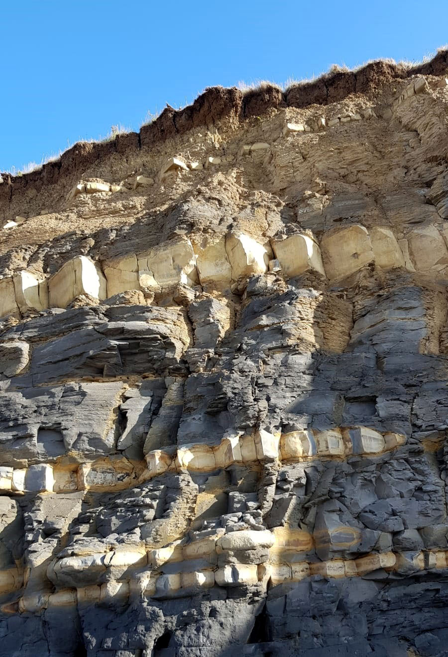
Blue Lias succession on North Somerset coast, east of Watchet
Frank sent me some outcrop photographs – thanks! They show unmistakably that the Blue Lias is a classic alternating limestone-marl succession: the limestones are the light-coloured blocky beds, the marls (lime-rich clayey muds) are the bluish-grey laminated beds. Limestone-marl successions have usually been laid down on the sea floor in water depths of no more than a couple of hundred metres. Geologists find them fascinating, and not only because they’re commonly highly fossiliferous. Why the fascination? It’s simply that there are two questions about them that always provoke controversy. Firstly, where did all the carbonate come from that makes up the limestone beds? (The clayey mud in the marl beds is generally agreed to have been brought into the area in suspension, by rivers.) Secondly, what produced the alternation?
At this point I have to make one thing crystal clear: this is a research field with a mass of literature, most of which is quite inappropriate for theendtoendblog. I’m therefore not going to make even the slightest attempt to be comprehensive. Instead I’Il give for each of the two questions the two most commonly presented answers. Question 1: either (1) the carbonate was produced by phytoplankton in the overlying surface waters and subsequently sank to the sea floor, or (2) the carbonate was produced directly on the sea floor, at the place at which it was finally preserved. Question 2: either (1) the alternation resulted from the action of post-depositional (diagenetic) processes, or (2) the alternation resulted from systematic and repeated sea-level changes associated with so-called Milankovitch cycles (en.wikipedia.org/…iki/Milankovitch_cycles). There are numerous arguments in favour of each of these answers, as you would no doubt expect; equally there are numerous arguments against. Those of you with time on your hands might like to research these further!
What’s my opinion? I’m glad you asked! Look at the photographs again, very carefully this time. You notice two things immediately: firstly the boundaries between the individual beds are remarkably even, albeit not perfectly even; secondly the limestone beds are homogeneous. It’s very difficult to conceive of how evenness like this and homogeneity like this could be produced in any subaqueous depositional system in which both major sedimentary components (the carbonate and the clayey mud) were carried together in suspension in the water. It’s equally difficult to conceive of how evenness like this and homogeneity like this could result solely from the action of diagenetic processes. Therefore 1.1 and 2.1 can both be ruled out. It seems to me most likely that the carbonate was produced in situ on the sea floor, in some sort of carbonate factory, and that the operation of this factory was controlled by sea-level change.
A carbonate factory on the sea floor? How on Earth would that work? Wouldn’t a model be nice! Now you’re talking! More next time!
N.B. I noticed there were a couple of puzzled looks earlier on when I said you could tell from the photographs that the limestone beds were homogeneous. How? Oh come on! Think back to that Lower Marine Molasse outcrop on the hillside above Marbach that we used to visit regularly on the ‘Sedimentologie II’ fieldtrip! Remember the field geologist’s rule: joints cutting directly across a bed mean that that bed is homogeneous and hard and dense, no matter what its mineralogical composition.

Homogeneous fine-grained turbidite crossed by joints. Lower Marine Molasse, 1.5 km SE of Marbach, Kanton Luzern, Switzerland
Wise words. Thank you, Fil!
September 19, 2020 § Leave a comment
The previous post was very markedly different from its predecessors: some nature, some walking, and some time away from the scientific method. I’m hoping for more of the same, especially as the weather forecasts for the coming weeks seem more to my liking. Having said that, however, I must in all fairness relate the comment that Fil made to me some years ago when I was rabbiting on endlessly about weather forecasts. Looking at me severely over his pint of Harveys – What else? – he said, “Oh for goodness sake, John, they’re only forecasts!”
He was right, of course. Weather forecasts are forecasts, no matter where they come from, and you don’t stake your life on a forecast, even on one that looks solid gold. Sometimes it’ll turn out to be 100% correct; sometimes it’ll be more-or-less right; occasionally it’ll be 100% wrong. For an example – sticking with weather forecasts – I’ll take you back to the end of June this year. Karin and I had planned a straightforward Saturday Schwarzwald walk, from Schluchsee via Riesenbühl to Lenzkirch, then via Fischbach to Aha. Just under 17 kilometres, and the weather was forecast to be fine. Everything went perfectly for the first hour, then came the first drops, then the first shower, after that it simply teemed. There were no huts anywhere for shelter, so all we could do was plod on. We were drenched. Eventually, shortly before Lenzkirch, we found a farm with a garage in which we could shelter and have lunch. I spoke with the owner, a very friendly man, particularly about the day’s weather. He assured me that in that area the weather is sufficiently local and sufficiently unpredictable that you can’t ever trust a forecast, no matter how reputedly reliable the forecaster is. “I found a dozen forecasts on the internet this morning,” he said, “and all but one said the day’d be entirely dry. That was the only correct one.” So much for forecasts! We squelched on down into Lenzkirch, wet but wiser, then caught the bus back home.
Why am I spending so much time and energy on forecasts? Could it perhaps have something to do with what I was discussing in the post before last (‘The Objectives That’)? Remember that I identified there the two objectives in scientific investigation: understanding and prediction. Prediction – despite what you may chance to read on some self-promoting internet sites – is essentially synonymous with forecasting. Therefore you should no more stake your life on a scientific prediction than you would on a weather forecast. If you do you may well get drenched – scientifically of course. It may seem that in scientific investigation it is prediction we should always be aiming at. Not so! In scientific investigation it is understanding that is paramount, not prediction. When we make models of systems we do so in order to use those models to try to gain understanding of how those systems work.
The aging year
September 16, 2020 § Leave a comment
The year is aging. A month ago we still had storks feeding in the fields by the railway line; they’ve gone. There were Bienenfresser flying over the house, especially in the evening and at dusk; they’ve gone too. Finally there were flocks of house martins, dancing in the sky then congregating on the wires; ade! Now we’re left with our year-long friends, those whose home we’re privileged to share. The buzzards, soaring and wheeling overhead; the black redstarts appearing again as if from nowhere; the tits returning from their summer up in the woods; the magpies and the crows and the collar doves; above all my favourites – the spuggies.
The wine harvest is now almost finished, some two weeks earlier than normal; this is because the weather has been exceptionally kind. The white varieties (mostly Weisser Burgunder and Grauer Burgunder) are all in; the grapes are deliciously sweet and the Öchsle values almost impossibly high (https://en.wikipedia.org/wiki/Oechsle_scale). All that’s left of the regular harvest is now the Spätburgunder; this will be a brilliant wine.
Walking continues, although at a greatly reduced intensity. I yearn for coolness and dampness and for winds that know why walkers need them.

Left: a year-long friend. Right: Bienenfresser at dusk, on the wires above the house.

Spätburgunder ready for harvesting, at the side of the Bienenfresserpfad between Leiselheim and Bischoffingen
The Objectives That
September 6, 2020 § Leave a comment
The title I’d planned for the post that got switched turned out on further consideration to be not at all appropriate. That title – ‘The Reason Why’ – was certainly catchy, and it had seemed initially to be apt. I quickly realised, however, that ‘The Objectives That’ would be far, far better. Not catchy, and I doubt if even Tennyson could have got it to scan. But ‘The Objectives That’ it has to be.
What was wrong with ‘The Reason Why’? Simple – it was effectively asking for an answer to a lazily posed question. I said I was going to use the post to discuss the reasons that scientists have for using models. There’s then really nothing to discuss! Scientists, no matter in which field they work, use models because models are accessible surrogates for the systems being studied. A model – according to the definition used here – is a practical expression of a set of ideas about a system. If those ideas and that expression are correct – which the scientist using the model naturally assumes – then the model will show exactly how the system will behave. Question answered; end of post.
I should have been more careful! What I should have said was that I was going to use the post to outline the objectives that scientists have when they’re using models in their investigations. Put simply, what do scientists seek to achieve?
Once more there’s some background reading for those of you who’d like it. This time it’s Karl Popper’s The Poverty of Historicism; you can get this on short-term loan from the Internet Archive (https://archive.org/). The pages that are relevant here (p. 130-134) are in the section entitled ‘The Unity of Method’.
Popper believed there are three objectives in scientific investigation: explanation, prediction, and testing. Which of these objectives we have at any stage of an investigation depends on what we are then trying to do – ‘on what we consider to be our problem’ (Popper p. 133). Explanation is the objective we have when we’re developing ideas about how a system functions; we’re trying then to explain that system’s patterns of behaviour. Prediction is our objective when we’re confident in the ideas we’ve developed; we’re wanting then to say how the system will behave under specified initial conditions. Testing is the objective we have when we acknowledge that our ideas are incomplete or uncertain. We observe the system’s behaviour under fresh initial conditions; then we compare that behaviour with the behaviour predicted from those ideas we previously developed. If the behaviours agree, our ideas are corroborated; if not, it’s back to the drawing board.
It seems to me to be sensible to amalgamate explanation and testing. Each, after all, is a stage in the development of that story about real life, which Medawar described so eloquently. An appropriate term for this amalgamated objective is understanding. To my mind therefore there are just two objectives in scientific investigation: understanding and prediction. Of these it is understanding that is paramount, for no scientist would ever try to predict the behaviour of a system they do not yet properly understand.
Or would they?
In asking this question I’m not attempting to denigrate scientists, either individually or generally. What I’m wanting to draw attention to is the fact that there is never any way of knowing whether or not we understand a system properly. There is therefore never any way of knowing whether or not we are justified in using our ideas about that system to predict its behaviour. In this situation – I love the German word ‘Zwickmühle’ – we generally take a pragmatic course. We declare that the system in question is sufficiently well understood once a model has been made of it that predicts its behaviour for a sufficiently wide range of initial conditions. Clearly there are lots of chickens and lots of eggs!
A route switched
August 28, 2020 § Leave a comment
Sometimes you know exactly where you’re going, then suddenly you find you’re not going there at all. I’m not talking about getting lost, which most walkers manage to do at least once in their lives. I’m talking instead about finding out after starting your journey that your route has somehow been switched. You got into a rocket labelled ‘Going to Mars’, then found out after blast-off that really it was going to Venus. (Yes, of course I could have given an everyday example, but not without more embarrassment for the Deutsche Bahn!)
I’ve just had this route-switching experience. I started off yesterday writing the next blog post and knew exactly what I wanted to say. Then, however, shortly after I’d got going, I found myself on a route completely different to the one I’d planned. I kept heading along it and it got ever more interesting. It’s therefore the basis of this post. I’ll get back next time to what I really intended to write.
In that original post I was going to discuss the various reasons that scientists have for using models. As a title for the post – catchy, I thought – I’d planned ‘The reason why’. It was that title that started the switch. Why? Tennyson, of course! Here’s the relevant passage from The Charge of the Light Brigade (1854):
“Forward, the Light Brigade!”
Was there a man dismayed?
Not though the soldier knew
Someone had blundered.
Theirs not to make reply,
Theirs not to reason why,
Theirs but to do and die.
Into the valley of Death
Rode the six hundred.
Tennyson’s poem caught the public mood as soon as it was published, and since then the juxtaposition of the words ‘reason’ and ‘why’ has always been associated with that awful cavalry charge.
I couldn’t resist a bit of internet searching. First, of course, came the pompous warnings from the guardians of English grammar: were I ever to use the phrase ‘the reason why’ in any form of communication it would indicate that I was incapable of logical thought. Then, comfortingly, came the myriad sites that all somewhere use that forbidden phrase; in using it they put the prescriptive grammarians firmly back in their boxes. Finally came the references I was looking for – two books on the Charge of the Light Brigade. The first is The Reason Why, by Cecil Woodham-Smith, first published in 1953; the second is Hell riders; the true story of the charge of the Light Brigade, by Terry Brighton, published in 2004. I’ve so far read Woodham-Smith’s book only cursorily, on short-term loan from the Internet Archive (https://archive.org/); I’m waiting for a copy of it from the library here. I’ve read Brighton’s book more fully, again on the Internet Archive. It’s a finely detailed piece of military history that comes to some rather surprising conclusions. I’ll let you discover these for yourselves.
As always with internet searches, something unexpected also turned up. It was a review of Woodham-Smith’s book written by Adam Tschorn, a senior features writer for the Los Angeles Times: https://www.goodreads.com/review/show/202027569. I’ll quote some of it for you, firstly to whet your appetite and secondly to show how it’s relevant to a post that was originally going to be about models.
‘During the men’s European runway shows this summer, I overheard a fashion editor describing a military history book he’d read. “The commanding officers in the British army at the time of the Crimean War were dandy aristocrats who were more concerned with one-upping each other with over-the-top uniforms and military regalia than they were with military strategy,” he said.
…And what uniforms they were. For example, Woodham-Smith describes the uniforms of the 11th Hussars, a regiment under the command of Lord Cardigan, as follows: “They wore overalls of cherry colour, jackets of royal blue edged with gold, furred pelisses, short coats, worn as capes, glittering with bullion braid and gold lace, and high fur hats adorned with brilliant plumes.”
…She quotes a newspaper of the day commenting on the same uniforms: “The brevity of their jackets, the irrationality of their headgear, the incredible tightness of their cherry coloured pants altogether defy description; they must be seen to be appreciated.”’
Let’s do a preliminary inspection! First, here’s a soldier of the 11th Hussars (from http://andersheintz.blogspot.com/2010/06/horan-figure-of-week-11th-hussars-1854.html).
11th Hussars, 1854. Model by Anders Heintz
Not a bad model! And to show you there’s nothing new in fashion here are two more.

Left: Balmain SS 2009 RTW. Photo credit: Vogue
Right: Milan Fashion Week 2016
They’re not bad models either! The first has the facing of the Hussars’ jacket almost perfectly; her jeans, however, will give Cardigan an apoplectic fit. The second combines the necessary brevity of the jacket with the necessary tightness of the pants, but in non-regimental colours. Cardigan will again be furious.
“Parade ready for inspection, Your Lordship!”
Honi soit qui mal y pense
August 23, 2020 § Leave a comment
It has been rumoured – to my mind not unjustly – that the producer of the ‘Walking’ video may, for various thoroughly understandable reasons, not have been focusing exclusively on the characteristics of the demonstrated walk. To those who are of that opinion I say simply, “Honi soit qui mal y pense”, or words to that effect.
Models, and walking of course!
August 21, 2020 § Leave a comment
That’s enough theory! It’s time now for a real-life example of scientific modelling.
The example I’ve chosen concerns a model of a walking process. Surprise, surprise! Not, however, the walking process of a person or even of an ant. Instead it’s the walking process used by many types of animals that live on the ocean floor. These animals move around as they forage for food, and in doing so they leave traces in the sediment across which they pass. Paleontologists find these traces preserved, and from them they try to reconstruct that foraging behaviour.
The first paper on this topic, by Rudolf Richter, is now almost a century old. Richter suggested that the pattern of the traces left by a foraging animal is determined in three ways. First there is the tendency that the animal has to turn back on itself at intervals; Richter called this strophotaxis. Then there is the tendency it has to avoid crossing other tracks, including its own; Richter called this phobotaxis. Finally there is the tendency to keep in close contact with tracks made previously; Richter called this thigmotaxis. These ideas of Richter’s would nowadays have been incorporated immediately into some scientific model of foraging behaviour. They remained as ideas, however, because there was then no way of expressing them in a suitable practical form.
Almost 40 years later these ideas were dusted off and supplemented. Then, two years after that, they were given a mathematical formulation and implemented as a stochastic simulation. This was at last a true scientific model. The creators of this model – David Raup and Adolf Seilacher – used it to investigate the ways in which different types of animals forage. Their conclusion was that a wide variety of foraging patterns can readily result from the same basic behaviour. The diagram below (taken from their paper) shows three actual foraging patterns (left) and some comparable patterns produced by the model (right).

From Raup and Seilacher (1969). Pictures at left show actual traces; pictures at right show comparable model-produced patterns.
Now for something completely different. It’s again about walking (of course) and again it features a model. Intrigued? Then read on!
A long time back, in the autumn of 2014, I did an absurdly fast walk up Belchen. This was followed, necessarily, by a painfully slow hobble down to Wiedener Eck. The muscles in and around my right knee were hurting horribly. Raj, our local physiotherapist, told me what was wrong. Roughly translated, this is what he said. “A leg has three joints. The hip joint and the ankle joint are made to move in almost any direction; the knee joint, in contrast, is specialised to move only backwards and forwards. Your hips are ridiculously tight. This means that your hip joints are moving only backwards and forwards. This means in turn that your knee joints are having to compensate. And to do this they’re having to move in directions they were never designed to move in. To get rid of the pain in your knee you have to free up your hips.”
On the training trips in the months that followed I systematically learned how to walk properly again: hips moving, and not just forwards and backwards, forearms swinging, back supple, shoulders relaxed, pace even, not over-stretching. The knee pain lessened steadily over time, as Raj said it would. I learned also during this period that when you’re trying to do something as simple as walking it helps to have an ideal before you. To see the one that I have you should look at a short video I’ve prepared. It’s called ‘Walking, in three easy lessons’, and you can download it from: https://www.dropbox.com/s/nt89y7sbau2szt6/Walking%2C%20in%20three%20easy%20lessons.mp4?dl=0
The leading lady is Andreea Diaconu, a twenty-something Romanian fashion model who is by far the best runway walker to have emerged in the past ten years (IMHO, of course). Look at the perfect balance in that walk; look at the regularity of the movements; look at the fluidity of the motion; look at the smoothness; look at the flexibility; look at the ease. Those are the characteristics of the ideal walk, even a walk – like mine – that will never be seen on a runway.
N.B. theendtoendblog is certainly not as pure as the driven snow, but it does try to avoid flagrant violations of copyright. Therefore I cannot provide you with direct access to the paper describing the foraging simulation (Raup, D.M. and Seilacher, A., 1969. Fossil Foraging Behavior: Computer Simulation. Science 166, 994-995), nor can I provide you with the background music for the ‘Walking’ video. In the latter case you shouldn’t have any difficulty, as all you have to do is locate Something ‘Bout You Baby I Like either on YouTube or in your Status Quo collection. Don’t have any Quo music? Sad!
Truly magnificent stuff!
August 19, 2020 § Leave a comment
I left you last time, at the end of that random walk, with a very general question. What on Earth are we mortals to do when faced with questions that need answering and for which there seem to be no off-the-shelf answers – at least none that are of any practical value? I’m sure this question kept many of you awake at night – or perhaps it didn’t.
Let’s reformulate the question. Suppose you’re faced with a problem that needs to be solved. How do you go about solving it? Most people would say – or at least I hope they’d say – that that depends on what sort of problem it is. Problems of one sort you approach in one way; problems of another sort you approach in another. That certainly seems reasonable to me. Now let’s make the situation specific. Suppose the problem you’re faced with is a scientific problem. How would you go about solving it? What would you actually do?
Here I sense a mixed reaction among my readers. Those who took the advice I gave in an earlier post to look at that little book of Peter Medawar’s have now got big smiles on their faces; those who didn’t, haven’t. Here’s the reference again: Induction and Intuition in Scientific Thought, American Philosophical Society, Memoir 75, 1969, 62 pp.
Medawar, in contrast to so many scientists both today and in the past, had a splendidly human view of how scientists work. He described the scientific method as follows (p. 59): “Like other exploratory processes, [the scientific method] can be resolved into a dialogue between fact and fancy, the actual and the possible; between what could be true and what is in fact the case. The purpose of scientific enquiry is not to compile an inventory of factual information, nor to build up a totalitarian world picture of natural Laws in which every event that is not compulsory is forbidden. We should think of it rather as a logically articulated structure of justifiable beliefs about nature. It begins as a story about a Possible World – a story which we invent and criticize and modify as we go along, so that it ends by being, as nearly as we can make it, a story about real life.”
What is of crucial importance in this truly magnificent passage is the order of the verbs in that final, wonderful sentence: it’s ‘invent’ first, then ‘criticize’, then ‘modify’. This is how science is done. The scientist faced with a problem starts not with data that are in some way relevant to that problem, as is so commonly believed; he starts instead with ideas about what might be going on in the parent system. These ideas are next examined critically, and they are modified as seems fit; if necessary they are replaced, either partially or completely. This process continues inexorably until the system is believed to be well enough understood; the problem in question will then have been solved. The process is carried out using what are termed scientific models.
Every model that a scientist makes of a system is a practical expression of a particular set of ideas about that system. These ideas – they can also be dignified by the terms ‘hypothesis’ or ‘theory’, depending on the amount of evidence that exists to support them – are expressed in the model in a form in which they can readily be worked with; this form may be physical, or mathematical, or graphical, or even verbal. This is by no means the only definition of a scientific model; alternatives can readily be found in the literature. Its advantage, however, is that it is absolutely straightforward. There is no place in it for waffle about subtle but supposedly significant differences between models of different types; nor is there place for delicately teased out distinctions between ‘models’ and ‘simulations’ and ‘scenarios’; nor is there place for details that ultimately are only of secondary importance, for instance details about different types of parameterization. The definition says simply that I – the scientist – am studying a system, that I have developed certain ideas about it (for example, about its structure and function), and that I have chosen to express these ideas in some particular practical form. If my ideas and my expression of them are both correct, the system and the model will behave identically. I can then justifiably use the model to investigate how the system behaves.
And what have models to do with walking? Watch this space!
Walking at random
August 8, 2020 § Leave a comment
Time goes on and walking continues. theendtoendblog continues too, in all of its directions.
I’ve had some especially welcome feedback in the past few weeks. Feedback is always welcome, of any sort, but it’s especially welcome when it lets me see what this blog’s readership is. There are evidently several disparate groups of readers. Firstly there are readers who stick largely to the walking-related posts (“At last another Strider article!”); then there are readers who are more than just slightly intrigued by the ever-more-numerous non-walking posts (“I’m still following you, at least in part!”); then there are readers who enjoy stories (“I liked that Dickens post!”) and who are not averse to a bit of not always entirely standard English; then there are readers whose interests I somehow manage accidentally to hit (“Those dresses!”); finally there are my long-suffering family and friends. I’m pleased at this variety. Clearly I must be doing something right.
What’s on the menu today? How about a random walk? That certainly sounds appropriate, particularly in view of some of my recent posts. Perhaps, however, I should check first how those various groups are likely to react. Group 1: “He’s going to go up into those Schwarzwald valleys at the back of St Märgen where there’s no satellite signal.” Group 2: “Better look up ‘Lévy Flight’ in Wikipedia.” Group 3: “Charles Dickens again, for sure, but this time The Pickwick Papers.” Group 4: “It’ll be that cat, just like last year at the Dior show in Marrakech (https://www.youtube.com/watch?time_continue=1&v=polDHxIxRZM&feature=emb_logo).” Group 5: “Knowing how his mind works it could be anything!” Obviously I won’t please everybody.
Let’s assume for simplicity that this random walk I’m talking about is a walk I could actually carry out. That means it’s a two-dimensional spatial process. I’ll proceed as follows. Firstly I’ll go to my starting point; then I’ll choose the direction I’ll walk in and the length of step I’ll take; then I’ll step off. Then, immediately, I’ll stop. I’ll choose afresh the direction and the step length; then I’ll step off again – and stop. I’ll repeat this procedure as many times as I like, then I’ll head off home.
This walk I’ve carried out is a true random walk. This is because (1) each step is deliberately made independent of all of the steps that preceded it, and (2) the step directions and step lengths are independent of each other and are chosen at random. The two stochastic processes I referred to in recent posts, though they certainly give the impression of randomness, are not true random walks: the path that an ant takes in its nest is never a series of independent steps, and the step lengths and directions that Daniel Quilp used were certainly not ones chosen at random. The message is clear – not every walk that seems to be random actually is a random walk. What then does a true random walk look like? The answer is that that depends on the probability distributions from which the step directions and lengths are drawn. The simplest situation to visualise is one in which every direction is equally likely and in which the step lengths are drawn from a one-sided standard normal distribution. Here’s an example of such a walk; it starts out from the centre of the purple cross. If you want a video showing how it develops, you can download it at: https://www.dropbox.com/s/5xb8qzwsaggylj8/Random%20walk.mp4?dl=0

A random walk of 10000 steps
What can we say about this particular walk? Two important things perhaps. Firstly, it spends remarkably little time in the immediate vicinity of the starting point; secondly, it is not even close to being radially symmetric about that point. Immediately there are questions. Is this behaviour typical of this type of random walk? How about walks using different probability distributions or different rules? Now you’re asking! Fortunately there are exceptionally talented people about – they’re called mathematicians – who’ve dedicated their entire lives to providing answers to questions like these. There is accordingly a mass of literature that will tell you everything you always wanted to know about things such as the form of the characteristic function of a Holtsmark distribution. Now comes the bad news. Exceptionally talented people tend often to inhabit planets that are light years away from the Earth on which mere mortals dwell. The answers that they provide to the questions that mortals ask are therefore commonly idealised to such an extent that they are at best of limited practical value.
What then are we mortals to do when we’re faced with questions that need answering, for instance questions about some particular stochastic process that’s now of interest to us? I’ll come back to that next time. Meanwhile I’ll look out my white tuxedo. We’ve got a visit to make.
Time for the next one
August 2, 2020 § Leave a comment
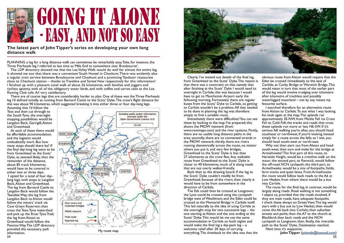
Strider, Number 147, August 2020
Yes, the latest Strider article is out. As always, to make the article legible simply click on the photo. If that doesn’t work, here’s the text:
“Planning a leg for a long distance walk can sometimes be remarkably easy. Take, for instance, the Three Pierheads leg I referred to last time as ‘Mile End to somewhere near Broxbourne’. The LDP directory showed me that the Lea Valley Walk would do well for almost the entire leg. It showed me too that there was a convenient Youth Hostel in Cheshunt. There was evidently also a regular train service between Broxbourne and Cheshunt and a promising Tandoori restaurant close to Cheshunt station – thanks to Traveline and Street View respectively for this information! I finished up with a pleasant canal walk of about 26 kilometres, with families and joggers and cyclists aplenty, with all of the obligatory water birds, and with coffee and carrot cake at the Lea Rowing Club cafe. All very satisfactory.
There are of course legs that are considerably harder to plan. One of these was the Three Pierheads leg I’d defined initially as running from Barnard Castle to the Scots’ Dyke. The crow’s flight distance for this was about 90 kilometres, which suggested breaking it into either three or four day-long legs. Assuming that I’d follow the Tees and then cut through to the South Tyne, the overnight stopping possibilities would be Langdon Beck, Garrigill, Alston and Greenhead. At each of these there would be affordable accommodation, and the logistics would undoubtedly work. But how many stops should there be? If the final day-long leg were to be from Greenhead to the Scots’ Dyke, as seemed likely, then the remainder of the distance, about 85 track kilometres, would have to be covered in either two or three days. I opted for a total of four day-long legs, with stops at Langdon Beck, Alston and Greenhead. The leg from Barnard Castle to Langdon Beck would follow the Teesdale Way; the leg from Langdon Beck to Alston would follow the miners’ track via Cow Green Reservoir, then cross the Tees-Tyne watershed and pick up the River Tyne Trail; the leg from Alston to Greenhead would follow the Pennine Way. The LDP directory provided the necessary path information.
Clearly I’ve missed out details of the final leg, from Greenhead to the Scots’ Dyke. The reason is that there was a constraint on this, namely that after finishing at the Scots’ Dyke I would need to overnight in Carlisle; this was because I would have to get to Manchester Airport early the following morning. Fortunately there are regular buses from the Scots’ Dyke to Carlisle, so getting to Carlisle wouldn’t be a problem. All that needed to be done in planning the leg was therefore simply to find a suitable route. Immediately there were difficulties! You can see these by looking at the map I’ve prepared; this shows the PROW network (from http://www.rowmaps.com) and the river systems. Firstly, there are no usable long distance paths in the area; secondly, there are no connected strands in the PROW network; thirdly, there are rivers running diametrically across the route, no matter where you put it, and very few bridges. Greenhead to the Scots’ Dyke is less than 27 kilometres as the crow flies. Any walkable route from Greenhead to the Scots’ Dyke is closer to 40 kilometres, much of it along roads that are not overly walker-friendly.
Back then to the drawing board. If the leg to the Scots’ Dyke couldn’t readily be from Greenhead, because of the rivers, then clearly it would have to be from somewhere in the direction of Carlisle. The Esk could then be crossed at Longtown; the Lyne could be crossed using the cyclepath bridge west of Westlinton; and the Eden could be crossed at the Memorial Bridge in Carlisle itself. This led naturally to the idea of using Carlisle as the overnight stop for two successive legs – the one starting at Alston and the one ending at the Scots’ Dyke. This would let me use the same accommodation in Carlisle on both nights and would make the final leg a day-pack leg – a welcome relief after thirty days of carrying everything. The drawback to the idea was that the obvious route from Alston would require that the Eden be crossed immediately to the east of Carlisle, at Corby Bridge or Warwick Bridge. This would mean in turn that most of the earlier part of the leg would involve trudging over kilometre after kilometre of trackless and possibly waterlogged moorland – not by any means my favourite surface.
I searched therefore for an alternative route from Alston to Carlisle. To see what I was looking for, look again at the map. The uplands run approximately SE-NW, from Mickle Fell via Cross Fell to Cold Fell; the tracks and roads that cross these uplands run more or less NE-SW. If it’s serious fell walking you’re after, you should head southeast or northwest; if you’re looking instead simply for a route across the fells, as I was, you should head southwest or northeast. Why not then start out from Alston and head southwest, then turn and make for the bridge at Armathwaite? The first part of this route, to Hartside Height, would be a crestline walk on the moor; the second part, to Renwick, would follow the off-road NCN cyclepath; the third part, to Armathwaite, would be a mix of footpaths, fields, farm tracks and quiet lanes. From Armathwaite the route would follow back roads to the A6 at Low Hesket, from where there would be a bus into Carlisle.
The route for the final leg, in contrast, would be largely along roads. Road walking is not something I object to, provided that the roads involved, if they are main roads, have adequate footpaths. I check these always on Street View. The leg would start with a bus out to Low Hesket; then would come the A6 back into Carlisle; then suburban streets and parks; then the A7 to the church at Blackford; then back roads and the NCN cyclepath to Longtown; then, finally, the riverside path to the Scots’ Dyke. Destination reached.
Next time it’s waypoints.”
Another stochastic process – this time with thanks to David Attenborough
July 20, 2020 § Leave a comment
I’ve said many times on my walks that occasionally I feel a David Attenborough moment coming on. I had one yesterday, on a walk in the southern Black Forest. There, at the side of the path, was this massive ants nest. OK, I know my wildlife cinematography is not the best, but I couldn’t resist making a short film. You can download it from: https://app.box.com/s/1k8qsavsb1i4rdjc47a33843zgssx5p1
What you’ll see in the clip is an exceptionally good example of a natural stochastic process. There’s lots and lots of chance involved here. I’m not certain that these ants know exactly what it is that they’re participating in, but I thank them anyway.
The ants nest on the Feldbergsteig
A stochastic process – with thanks to Charles Dickens
July 11, 2020 § Leave a comment
You, dear reader, have been even more than usually patient with me! In these last few posts I’ve been rabbiting on about things that seem at first sight to have precious little to do with walking. For example, (1) spatial patterns and processes, (2) spatialness and its importance, (3) deterministic and stochastic processes, and (4) randomness and chance. Now, at last, it’s time to draw things together. I’ll start by asking and answering a question; then I’ll get Charles Dickens to provide us with a fitting example; we’ll see later where we go from there.
The question I’ll ask is a very straightforward one. Can a walk (which is inherently a spatial process) also be a stochastic process – a process in which there is chance involved? Yes, certainly! For the example, go to The Old Curiosity Shop (https://archive.org/stream/theoldcuriositys00dickiala#page/n7/mode/2up), to the chapter in which we read about how the story’s villain, Daniel Quilp, tries unsuccessfully to escape from the burning shed at his derelict wharf on the south bank of the Thames, probably downstream of the Tower of London, perhaps in Bermondsey or Rotherhithe.

Quilp’s Wharf, with Tom Scott
London was known then for its fogs, and Dickens describes magnificently the atmosphere at Quilp’s Wharf (p. 418):
‘The day, in the highest and brightest quarters of the town, was damp, dark, cold, and gloomy. In that low and marshy spot, the fog filled every nook and corner with a thick dense cloud. Every object was obscure at one or two yards’ distance. The warning lights and fires upon the river were powerless beneath this pall, and, but for a raw and piercing chillness in the air, and now and then the cry of some bewildered boatman as he rested on his oars and tried to make out where he was, the river itself might have been miles away.’
Then he describes what happened (p. 423):
‘It was about eight o’clock; but the dead of the darkest night would have been as noon-day in comparison with the thick cloud which then rested upon the earth, and shrouded everything from view. He [Quilp] darted forward for a few paces, as if into the mouth of some dim, yawning cavern; then, thinking he had gone wrong, changed the direction of his steps; then, stood still, not knowing where to turn.’
Finally (p. 423):
‘” If I could find a wall or fence,” said the dwarf [Quilp], stretching out his arms, and walking slowly on, ” I should know which way to turn. A good, black, devil’s night this, to have my dear friend here! If I had but that wish, it might, for anything I cared, never be day again.” As the word passed his lips, he staggered and fell and next moment was fighting with the cold dark water!’
Quilp’s walk was truly a stochastic process, and with a very satisfying end.
I can’t resist quoting here another passage from The Old Curiosity Shop (p.33). The reason is that it describes a crossing that Quilp made earlier in the story, from his dwelling on Tower Hill on the north bank of the Thames to his wharf on the south bank. My father was born on Tower Hill, albeit about 80 years later. This passage gives a hint of what the Thames might still have been like then.
‘It was flood-tide when Daniel Quilp sat himself down in the wherry to cross to the opposite shore. A fleet of barges were coming lazily on, some sideways, some head first, some stern first; all in a wrongheaded, dogged, obstinate way, bumping up against the larger craft, running under the bows of steam-boats, getting into every kind of nook and corner where they had no business, and being crunched on all sides like so many walnut-shells; while each, with its pair of long sweeps struggling and splashing in the water, looked like some lumbering fish in pain. In some of the vessels at anchor all hands were busily engaged in coiling ropes, spreading out sails to dry, taking in or discharging their cargoes; in others, no life was visible but two or three tarry boys, and perhaps a barking dog running to and fro upon the deck or scrambling up to look over the side and bark the louder for the view. Coming slowly on through the forests of masts, was a great steam-ship, beating the water in short impatient strokes with her heavy paddles, as though she wanted room to breathe, and advancing in her huge bulk like a sea monster among the minnows of the Thames. On either hand, were long black tiers of colliers; between them, vessels slowly working out of harbour with sails glistening in the sun, and creaking noise on board, re-echoed from a hundred quarters. The water and all upon it was in active motion, dancing and buoyant and bubbling up; while the old grey Tower and piles of building on the shore, with many a church-spire shooting up between, looked coldly on, and seemed to disdain their chafing neighbour.’
Lepidopterally yours
June 28, 2020 § Leave a comment
Despite what you may think, I don’t just spend my time sitting at the computer composing posts that apparently get less and less relevant with every passing day. I still go walking, both alone and with companions, both here on the Kaiserstuhl and in the Schwarzwald. Yesterday (Saturday) was an example. I’d promised myself I’d do that milk run of mine – the 14 km back from Endingen – and despite the weather not looking too promising I started out.
The first hour out of Endingen is an uphill traipse made amusing only by the story of the road signs (‘The quick change act’, posted in June 2017). Yesterday it was warm and still and decidedly humid, and I was glad therefore to get up out of the woods and onto the crestline path. It was time then also for a five-minute break. From then on things went brilliantly, especially as the sun came out and the breeze freshened. My route for the next hour took me along the edge of the dry grasslands – the Trockenrasen – that characterise the centre of the Kaiserstuhl. There, flying everywhere, were hundreds of butterflies, particularly of a species that I’ve subsequently discovered is called the Weisser Waldportier (https://www.deutschlands-natur.de/tierarten/tagfalter/weisser-waldportier/); in English it is called the Great Banded Grayling (https://en.wikipedia.org/wiki/Brintesia). There were dozens of these wonderful things – they’re large and very distinct – and they were flitting around everywhere I looked. They were far too fast for me to photograph, so you’ll have to believe this picture from the internet (http://www.lepiforum.de/lepiwiki.pl?Brintesia_Circe).
Brintesia circe
Evidently they love this type of environment and evidently they fly from June to September. Yesterday was ideal, and I had the privilege of being there to watch them.
Lepidopterally yours etc.
Yet more interweaving…
June 25, 2020 § Leave a comment
I can readily understand it when people suggest my thought processes are not straightforward. That’s obvious whenever you read this blog. Yes, walking is of course the blog’s principal theme, but it’s far from being the only theme. And when you look back on the past five years of posts – 356 at the last count – you find that all the themes are interwoven. Thus walking is interwoven with geology which is interwoven with fashion which is interwoven with commentary which is interwoven with humour which is interwoven with music which is interwoven with philosophy which is interwoven with religion which is interwoven with language and so on. Clearly I like interweaving. Let’s do some more!

The ripple field

The dress
You’ve seen one of these pictures before – the one showing the field of sand ripples in Death Valley. I used it a few posts ago (‘Firmly back on track’) as an example of a readily discernible spatial pattern. The other picture (which shows a ribbed cotton maxi-dress available from a Manchester-based online fashion retailer catering to the teenage wallet) is – believe it or not – another example of that very same pattern. In each of the examples there is a set of more or less parallel ridges which in places bifurcate. The difference between the examples is only in the degree of parallelism of the ridges and the regularity of the bifurcation.
Now suppose you have to construct those two examples. In the one case you have a stock of meticulously prepared cotton yarn and a factory full of expensive machinery; in the other you have some grains of sand and the wind. The construction process in each case will be a spatial process (obviously, because the pattern being constructed is a spatial pattern), but the two processes will be radically different in their nature. The process involved in constructing the dress material will be completely predictable – the machinery will do exactly what you tell it to do when you start it up. In contrast, the process involved in constructing the ripple field will be largely unpredictable. What will happen at any particular point at any particular moment will depend on the availability there of moveable sand grains and on the instantaneous wind strength and direction. The first process is capable of producing sets of exactly parallel ridges with regular bifurcations exactly where they’re wanted; the second can never produce other than a set of approximately parallel ridges with irregular bifurcations.
Some of you will see where I’m going with this. It’s the distinction between processes that are deterministic and processes that are stochastic. A deterministic process – for instance the process involved in constructing the dress material – is one that always produces the same output from a given starting condition or initial state. A stochastic process – for instance the process involved in constructing the ripple field – does not always produce the same output for a given input; there is chance involved. That’s where things start to get really interesting. Watch this space!
This is for anyone from Missouri
June 6, 2020 § Leave a comment
The titles of the posts in this blog are not always full of promise; the posts themselves are nonetheless often full of promises. Thus three posts ago (‘Firmly back on track’) I promised you (1) a computer program that would let you randomise images, and (2) a test you were bound to fail. You had that test in the subsequent post (‘Spatialness for Fashionistas 101’) and you had the solutions for it in the post after that (‘The test solutions, the take-home message, and some great music’). So where’s that promised program? Don’t fret! It’s here. theendtoendblog keeps its promises!
You’ll find full documentation of the program – CODING – in ‘Software’, one of the pages at the left-hand side of the blog. There are details there of how to get the program and of how to use it.
Which leads back automatically to the title of this present post, for you’re surely asking yourself what on earth an image randomising program could have to do with Missouri. Hint: check out the meaning of the phrase “I’m from Missouri”. Got it? Yes, it means simply “Show me!” You’ve had those images of the fabrics and you’ve seen the spatial patterns from which they were obtained. Now you need to be able to prove for yourself that you can go from one to the other and back again. Spatialness out; spatialness in. This is what the program does. Moreover, it will do it for any image you give it. (There are a few restrictions but not many: these are given in the program documentation.)
No, I won’t describe the algorithm the program uses, nor will I give you the program’s source code.
Have fun!
The test solutions, the take-home message, and some great music
June 3, 2020 § Leave a comment
That test wasn’t too difficult, was it? Here are the solutions. For each fabric there is, from left to right, (1) the image you were given, (2) the spatial pattern, and (3) the source picture. I’ve indicated the designer of the fabric and the date, insofar as I can identify these.
First the three ‘stripes’…

A: Moschino Fall 2020 Ready-to-Wear

F: Elisabetta Franchi Fall 2020 Ready-to-Wear

J: Saint Laurent Spring 2014 Ready-to-Wear
…then the three ‘patches’…

B: Versace Fall 2018 Ready-to-Wear

E: Balmain 2012

L: Zimmermann Fall 2019 Ready-to-Wear
…then the three ‘meshes’…

G: Unknown designer 2010

I: Unknown designer 2018

K: Mulberry 2016
…and finally the three ‘grids’…

C: A.L.C. 2015

D: Emanuel Ungaro Fall 2013 Ready-to-Wear

H: Atelier Versace Spring 2015 Haute Couture
How did you do? Not very well? Oh, sorry, but I forgot to tell you that in every case I’d randomised the image of the original spatial pattern. The images you were given were therefore ones in which there was absolutely no spatialness. It’s not surprising you couldn’t identify the patterns correctly.
N.B. Some of you undoubtedly thought that this was a multiple-choice test and therefore that you could pass (or at least get close to passing) by choosing your answers at random. No such luck! Yes, it was indeed a multiple-choice test, but it was one in which you were told in advance the actual number of patterns of each type. Let’s set the pass mark at better than 50%, i.e., more than 6 correct out of 12. The chance of you passing by choosing your answers at random is then less than 1 in 50; the chance of you doing reasonably well (more than 9 correct out of 12) is less than 1 in 10000. If you say you recognised all the patterns correctly, then either (a) you are the next Karl Lagerfeld, or (b) you are phenomenally lucky, or (c) you are telling porkies.
The take-home message is a very simple one: you can’t study spatial patterns correctly – no matter what they are – if you ignore their inherent spatialness. You can no more take the spatialness out of a spatial pattern than you can take the honky tonk out of the girl. Which of course leads some of you to reach out for your old Brooks & Dunn cds. Or at the very least to load the appropriate video: https://www.youtube.com/watch?v=Si0azctmJDc.
I promised you some great music!
‘Spatialness for Fashionistas 101’
June 1, 2020 § Leave a comment
Those of you who’ve been conscientiously enrolling in ‘Introductory Geology’ will be fully aware of the necessity of selecting suitable subsidiary courses. I’ve taken the liberty of pre-enrolling you now in one that really is a must – ‘Spatialness for Fashionistas 101’. I hope you don’t mind.
I say ‘pre-enrolling’ because there’s a small catch: you’ve first got to take a short aptitude test. Don’t worry, it’s a straightforward multiple-choice test. You’re given a set of twelve pictures and you have to identify the patterns in the fabrics that are shown there. There are four possible types of pattern: stripes, patches, meshes and grids. In the twelve pictures there are three examples of each pattern type. The pictures are all either runway shots or photo-ops, therefore they are of fabrics that are being worn. Don’t expect then that the patterns will be absolutely regular or that they will be absolutely standard. To get you started, here are some examples to show how they might appear.
And now here are the pictures:

A

B

C

D

E

F

G

H

I

J

K

L
OK, that doesn’t look too difficult, does it? Remember that there are three examples of each of the four pattern types. Write the pattern type against the picture’s index letter. Hand in your paper as you leave the exam room. I’ll have the results for you in the next post.
Best of luck!
Firmly back on track
May 27, 2020 § Leave a comment
“He must be off wandering again, mustn’t he? There’s been not a flicker of life here since he got back from that detour.”
I assure you to the contrary, dear reader. I’ve been very firmly back on track!
When I left you after coming back from the detour I made the following assertion: ‘In studying spatial patterns and spatial processes you have always to bear their inherent spatialness in mind. If you don’t, you’re wasting your time.’ Assertions as stark as this demand clear and convincing justification, especially when they’re made by scientists. It’s hardly surprising then that I’ve spent an inordinate amount of time recently in devising just such a justification. It’s that that’s kept me from blogging.
To see what I’ve been doing, look for the spatial pattern in these next two pictures. It’s easy to see in the first one. What you’ve got there is a beautiful field of aeolian sand ripples. They’ve got a wavelength of about 10 cm, they bifurcate irregularly, and their crestlines are more or less parallel. Spatial patterns like this get geologists quite excited! Now look for the pattern in the second picture. Is there one? Not really. The most you can say is that the picture is made up of a set of predominantly yellowish-brown points, some of them darker and some of them lighter. There’s no obvious rhyme or reason in the colours.

A walker in Death Valley

Where’s the pattern?
Each of the pictures is 680 pixels wide and 900 pixels high; therefore each is made up of 612,000 pixels. The colour of a pixel is determined by mixing three components – red, green and blue – with the strength of each component being given by an integer value in the range 0 to 255. The number of possible colours for a pixel is therefore 2563 (= 16,777,216). Clearly there are shedloads of ways to draw a picture. With this in mind, let’s get suspicious. Let’s ask, for instance, why both these pictures have the same overall colour. Yes they do! Moreover, they have identical pixel sets: this means that for every pixel of a given colour in the first picture there is a pixel of that very same colour in the second picture. The only difference between the pictures is in how those pixels are positioned.
Let’s check this with Mister Preview. Remember him, from 1971, from the Morecambe and Wise Christmas Show? If not, it’s time to make his acquaintance: https://www.youtube.com/watch?v=R7GeKLE0x3s. The memorable lines (10:49 onwards) are:
André Previn: “But you’re playing all the wrong notes.”
Eric Morecambe: “I’m playing all the right notes, but not necessarily in the right order.”
It’s just like that with the pictures: the pixels are right but they’re not in the right order.
So what’s happened? Simple! I’ve taken the Death Valley picture, with its readily discernible spatial pattern, and I’ve randomised the positions of the pixels. (I’ll be showing you next time exactly how I do this, with a computer program for you to use and a short test that you’re bound to fail!) What this randomising does is to remove the spatialness from the picture. In doing this it necessarily removes all traces of any spatial patterns. As I said before: ‘In studying spatial patterns and spatial processes you have always to bear their inherent spatialness in mind. If you don’t, you’re wasting your time.’
I can feel a detour coming on
May 5, 2020 § Leave a comment
The take-home message at the end of the previous post (‘Thinking’) was that geologists, when they find a spatial pattern, try always to identify the process responsible for the pattern’s development and change in time. They do this by reasoning in a manner similar to what I’ve called the second side of wandering.
Did you ever get round to looking at that book of Medawar’s? I do hope so, because it’s a beautifully succinct summary of the way in which scientists work – or at least of the way in which they should work. The only problem is that it’s so convincingly written that once you’ve read it you’re tempted to think there’s nothing at all special to scientific reasoning. Medawar even describes the scientific method as ‘a potentiation of common sense’, that is, as enhanced common sense. Perhaps he’s right. I’d urge a little caution, however, particularly when it comes to things spatial. The reason is that spatial phenomena, both patterns and processes, are more complex than they seem. There are therefore pitfalls aplenty for the unwary.
What makes spatial phenomena complex? Simply their inherent spatialness! What on earth is that? You don’t know? Then look it up in a standard dictionary! Didn’t find anything, did you? Don’t worry, I didn’t either. Linguee assured me that spatialness could be a nominalisation, and every one of the learn-English-with-me-by-enrolling-for-my-online-course websites that I consulted told me that nominalisations are bad, always. So evidently ‘goodness’ is bad. Oh dear! Fortunately spatialness is a word that today’s geographers have no problem understanding, even though it has yet to make it into the dictionaries and even though the grammar deities disapprove. Spatialness is about place and position, and about relationship as a function of nearness. Sounds familiar? I hope so, because we’ve been this way before, on the Side-to-Side (17 May 2017). It’s Tobler’s Law again: ‘Everything is related to everything else, but near things are more related than distant things’. In studying spatial patterns and spatial processes you have always to bear their inherent spatialness in mind. If you don’t, you’re wasting your time.
Sorry for the brief detour into the poisoned fairyland of English grammar. I was wandering!
Thinking
May 2, 2020 § Leave a comment
In my previous post (‘Wandering’) I tried to give you some idea of what I think of as wandering. Naturally I did this in the context of walking, using posts that are directly walk-related. There is, however, a second side to wandering. It’s important too.
I wrote some time ago that the most wonderful thing about walking, especially long distance walking and especially when you’re alone, is that you have so much time with so little distraction. You have time to see, you have time to hear, you have time to sense, and above all you have time to think. Sometimes – perhaps usually – you’ll be thinking about the area you’re walking through; sometimes you’ll be thinking about the people you’ve met or the plants and the animals and the landscape; sometimes you’ll be looking back to what’s just happened; sometimes you’ll be wondering what’s waiting over the next crest. Sometimes, however, you’ll be thinking about something else entirely. A question comes to you, or an idea, triggered by chance perhaps, by something you’ve just seen or by something you’ve remembered; you turn it over repeatedly in your mind; it won’t go away; you argue with yourself; paths of thought open up and link with others you can remember following before; some of these are dead ends; others lead to bridges you cannot cross or gates you cannot open, at least not immediately; others lead into mires through which there are no tracks; some bring answers you are satisfied with or solutions you can accept; others you store away in your mind for another day. This is that second side to wandering. It too is neither aimless nor random.
I’ve got four examples of this second side to wandering: three are from previous posts and one is new.
The first two of these examples concern lines from the Lord’s Prayer: “And forgive us our trespasses, As we forgive them that trespass against us” (‘Trespass!’ 13 January 2018) and “And lead us not into temptation, but deliver us from evil” (‘Anything but!’ 24 January 2018). Each of these posts was a product of me walking along and thinking about something else entirely. I was questioning the wording that Tyndale used in his translation of the New Testament, which was later taken as a basis for the 1662 Book of Common Prayer. Why did he use ‘trespasses’ instead of ‘sins’ or ‘debts’, and why ‘but’ instead of ‘and’ or ‘however’ or ‘rather’? Simple questions that puzzled me for kilometres. In the end, pleasingly, I came to some very satisfying answers.
The third example (‘The Bourne Question’ 13 June 2019) concerns landform development, a topic that is of considerable interest to me as a geologist. It’s hardly surprising that something as unexpected as The Bourne should have got me thinking. You remember the problem?
‘…how can it be possible for a gully of the size and shape of The Bourne to remain in existence in its close-to-original state for more than four hundred thousand years? Surely it should by now have been filled up with a mixture of sediment slumping down from its sides and sediment washed in from the adjacent higher land. More importantly, surely it should by now contain thick deposits of decomposed plant material – the remains of all the trees and other plants that must have grown in the gully and by now would have been converted mostly to peat. But The Bourne hasn’t been filled up, nor, apparently, does it contain peat deposits. Why not? I’m still puzzling this out!’
Almost one year on and that’s still the state of play. So in this field I’m still out there wandering. If any of you want to join me in it, please feel free!
The fourth example of this second side to wandering – the new example – is based on another topic that interests me as a geologist, namely what are termed spatial processes. Stop! Don’t switch off! Let me explain!
Look down from above onto a part of the Earth’s surface – we’ll assume the area concerned is a rural one. You see the farmhouses there? Draw a diagram of their positions, representing each house by a point. Now do the same for the roads. Draw out their positions, representing each road by a line. Finally draw out the positions of the fields: use lines to represent the boundaries and give each enclosed field a distinct colour. Each of these diagrams shows a pattern – the pattern of the farmhouse positions, the pattern of the road positions, and the pattern of the field positions. These patterns are examples of what are termed spatial patterns. (For completeness we term them two-dimensional spatial patterns.)
Now look back at the history of that area. The pattern of the farmhouse positions will certainly have changed in time as farms were subdivided or amalgamated and new houses were built. There will also have been changes in the patterns of the road positions and field positions. The processes by which spatial patterns such as these develop and change in time are termed spatial processes. There, that wasn’t too unpleasant, was it?
The reason that geologists are interested in spatial processes is that geology is a spatial science. It is, moreover, a science that is concerned with time. When a geologist like me walks through an area and sees the landforms and the outcrops and the rocks of which they are composed, he looks immediately for any spatial patterns that are there. When he finds one he tries to work out how it formed in time. He looks therefore for one or more spatial processes that could have produced that pattern. What are the thought processes involved in doing this? Hmm, they sound to me suspiciously like the second side to wandering!
Next time I’ll go further with this example. Those of you who’d like a little background reading beforehand might care to get hold of Peter Medawar’s Induction and Intuition in Scientific Thought (American Philosophical Society, Memoir 75, 1969, 62 pp).
Wandering
May 1, 2020 § Leave a comment
Most of the blogs I come across seem to have something somewhere that’s labelled ‘About’. Sometimes this is a potted biography of the blogger; sometimes it’s a political or social manifesto; sometimes it’s a sales pitch; sometimes it’s a mysterious statement that really doesn’t tell you anything. My ‘About’ falls firmly in this latter category: ‘A wanderer in many senses of the word, with interests in many directions and at last some time to pursue them’.
What on earth is this saying? Clearly it depends on the meaning of ‘wander’. The Collins English Dictionary gives five definitions:
1. to move about without any definite purpose or destination
2. to proceed in an irregular course
3. to go astray, as from a path or course
4. (of the mind, thoughts, etc) to lose concentration or direction
5. to think or speak incoherently or illogically
These definitions have a common thread – the idea that wandering is an essentially aimless or random pursuit. In my view this is wrong, at least for me. Yes, I may seem sometimes to move about without any definite purpose, but that’s because you haven’t recognised the purpose. Yes, I may seem sometimes to proceed in an irregular course, but that’s because you haven’t recognised why that irregularity exists. Yes, I may seem sometimes to go astray, but that’s because you haven’t recognised the route. Yes, I may seem sometimes to lose concentration, but that’s because I’m focussing on something else entirely. And yes, I may indeed seem sometimes to think or speak incoherently or illogically, but that’s because we’re on different wavelengths. I assure you most sincerely that my wandering isn’t in any way aimless or random.
The easiest way to get some idea of what I think of as wandering is to look at what I’ve posted here on the blog in the past five years. Here are a few snippets, all of them directly walk-related.
Variety – the key characteristic [8 January 2015]:
“The great thing about a LEJOG is that the route is not prescribed, other than that you start at Lands End and end at John o’Groats. The route I am planning to take is above all varied: coastal, inland, defined trails, cliffs and beaches, moors, towpaths, rivers and lakesides, bridges and viaducts, disused railways, classic geological localities, forests, wildlife, a part of England where my family lived 250 years ago, two Munros in Scotland, drove tracks, mining areas, Roman and military roads, towns, even the odd city, and one day off to go gliding!”
The readiness to change when change is necessary [26 June 2016]:
“It didn’t take me long to realise that a change of plan was necessary. This was because the path network in the woods above Evanton is not readily navigable – a polite description. There are paths marked on the map that clearly haven’t been walked in a month of Sundays, and there are paths and forest roads that clearly are used regularly but aren’t marked on anything. Discretion dictated that I head back down, to try to go around the problem.”
Glitches are inevitable [14 May 2015]:
“Forgetful? Oh yes, I almost forgot. I was 3.5 kilometres into my day this morning when I realised I’d forgotten my water bottles; they were back at the B&B. I was lucky that a delivery truck was passing whose driver agreed to take me back into Marshfield. That meant I only had to walk those 3.5 kilometres twice.”
Detours are valuable, particularly ones to sites of special interest [11 May 2018]:
“What I did today was cut about nine kilometres off what otherwise would have been an appallingly long tomorrow. I walked from Whaley Bridge to Thornsett then got the bus back. Tomorrow I’ll bus out to Thornsett then start from there. Actually that’s not strictly true. Yes, I did walk to Thornsett, but I then made a detour to see the Mass Trespass site at Hayfield – I blogged about this a few months ago. It was thus from Hayfield that I bussed back to Whaley Bridge.”
Keep weighing up the options, again and again [3 May 2018]:
“I looked again at the map, trying to devise alternatives that would get me successfully from Bwlch to Hay on what was evidently going to be thoroughly wet day. Plan A (my original plan – a high-level route across the Black Mountains) was surely not going to work. Plan B (a short section over the hills immediately north of Bwlch followed by roads from Talgarth to Hay) seemed better. Plan C was roads alone – back lanes where possible.”
The foul-weather alternative – always a good idea [15 June 2016 and 22 May 2017]:
“We [Martin and I] decided therefore to give Ben More a miss and to take instead what I’d planned as the foul-weather alternative – walking down the glen to Inverlochlarig then up through the pass on the west side of Ben More.”
“I was wondering more and more whether I should try to go directly over Dartmoor to Lydford, or whether the foul-weather alternative along the lanes to Okehampton would be more sensible. An important decision, because risking being caught in bad weather in the middle of Dartmoor, alone, is not a good walking strategy.”
Don’t be frightened of problems [15 April 2017]
“Of course there’s always my innate apprehensiveness, but that’s just me – there’s always something that might go wrong. Interestingly, Kerstin, who accompanied me on one of last week’s walks, the Westweg leg from Kalte Herberge to Wilhelmshöhe, asked me what I’d do if something went really wrong in the middle of a walk, alone and miles from anywhere. My only answer was to say that there are two kinds of problems – ones you can solve and ones you can’t. If the problem that comes up is of the first kind, you solve it; if it’s of the second kind, you don’t.”
Big problems have to be faced, and big decisions have to be made [6 June 2015]:
“I’m now planning to stay here in Crosby – a million thanks to Ian and Janet – until the day on which I’d originally planned to walk from Rookhope to Hexham. Karen will then pick me up here on her way up to Hexham so that we can walk together as planned from there to Jedburgh. I’ll then go on alone to Norham, to Jill and Neil. If all goes well with my leg – and this changed plan allows me nine more days to rest it here in Crosby – then I’ll continue on to Edinburgh as originally planned. I’ll decide there about going further. The missing bit between Haworth and Hexham I’ll fill in afterwards, either later this year or perhaps next year. That is Plan B.”
Some problems can be seen well in advance and therefore be planned for [24 July 2017]:
“Look at the result! Every single one of those footpaths and bridleways and minor roads has now been cut between the motorway exit at A and the motorway bridge at B, a distance of more than five kilometres. This certainly is severe severance. To get from R to T on foot you now have three choices. You can walk via minor roads to the motorway bridge at B, then to the northern river bridge; this adds about six or seven kilometres to your journey. Or you can walk along the trunk road from R all the way to the northern river bridge; there’s no footpath or cyclepath of course and you’ll have the added pleasure of walking through the motorway exit at A. Or you can use the southern river bridge instead; the segments of trunk road that you’ll have to walk along are seriously busy and of course have no footpaths or cyclepaths, and again there’s a motorway exit to walk through.”
Other problems crop up unexpectedly at the very last minute [27 May 2018]:
“The bad news came on Wednesday afternoon. Alastair called to say they had a safety issue with those escalators – they are effectively museum pieces – and would only be able to let me through the tunnel via the lifts. “And I know that won’t work for you”, he said. (I’d explained to him previously that walkers like me are not permitted to use any forms of mechanical transport.) The upshot was that I had to use the Millennium Bridge alternative. It was a very long way round!”
For instance when your ever-faithful equipment suddenly fails [28 April 2019]:
“Maps OK, but no waypoints. Absolutely none. Nowhere. All gone. Which was a problem, of course, because it meant I couldn’t navigate effectively using the Garmin alone. I had therefore to use the screenshots of the maps on my phone instead.”
Aimless or random my wandering certainly is not!
Number 8
April 28, 2020 § Leave a comment
Here’s the latest Strider article.

Strider, Number 146, April 2020
To make the article legible, simply click on the photo. If that doesn’t work, here’s the text.
“In one of the early articles in this series I referred to the simple but critical desire that motivates so many go-it-aloners – the desire to lead your own walk, to decide for yourself exactly where you go and when, both before you start out and after you’ve set off. The subsequent articles – on information sources, on maps, on Google Earth, on ground truthing – gave overviews of some of the tools that go-it-aloners who are motivated in this way are likely to use in planning their walks. Now, finally, it’s time to get down to detail, to illustrate how these tools actually can be used.
As I write this, in the late summer of 2019, I’m in the middle of a long distance walk. This walk – I call it ‘Three Pierheads’ – started at the ferry terminal in Portsmouth; it is to end, God willing, in Peterhead, with Oban on the way. I walked the first part earlier this year, ending up at the Scots’ Dyke on the A7 north of Longtown; the second part, which is still not fully planned, may have to wait until 2021. Why this strange route? There are various reasons, none of which are relevant here. All that is relevant is that in starting out to plan this walk I gave myself a start point, an end point, several fixed points I wanted to visit on the way, and several areas I wanted to walk through. I also had constraints on when I could start and on when I would have to reach some of those intermediate fixed points.
The strategy I used in planning Three Pierheads – this is the strategy I always use – is a divide-and-conquer strategy. It doesn’t try to plan a walk as a whole, but instead breaks it down into distinctly separate legs, each of which is then planned more or less independently. The strategy is also a multi-pass strategy. It doesn’t try to complete the planning of a leg in one single go; instead it comes back to it again and again, as often as is necessary. The legs for Three Pierheads were defined initially by the set of fixed points I’d given myself; for instance there was a leg from Mile End, in Tower Hamlets, to Cambridge, and one from Barnard Castle to the Scots’ Dyke. For each of these legs I estimated the walking distance and hence the number of walking days. This allowed me to position, very roughly, my potential overnight stops. It also let me reformulate the legs on the basis of these stops, thereby shortening them to include only what I thought I would want to cover in a day. The leg starting at Mile End accordingly became ‘Mile End to somewhere near Broxbourne’.
For each of these day-long legs there were then routine questions to answer. Firstly there were questions about accommodation. (Is there affordable accommodation at or near the potential stopping point? Is this accommodation bookable in advance? If not, is it likely I can just turn up and find something? Can public transport be used to reach accommodation elsewhere?) Then there were questions about paths. (Are there existing long distance paths in the area? Are these usable directly, either in whole or in part, or will it be necessary to develop a new path from scratch?) Finally there were questions about logistics. (Are there any obvious sources of food at the stopping point or along the way? Are there shops there that may be open, or will it be necessary to carry supplies?) If all the answers were satisfactory and everything seemed to fit together, the leg was ticked off – at least for the first pass.
That fortunate state of affairs was the exception for Three Pierheads, as indeed it usually seems to be. For most of the legs there were either questions that couldn’t be answered satisfactorily or answers that indicated that the overnight stopping point would probably have to be changed. The first of these alternatives exposes just how remarkably difficult it is to get adequate answers to straightforward questions, even today and even with the internet. That ‘information jungle’ I referred to in an earlier article is certainly alive and well. As an example, take the question about affordable accommodation. Are you a backpacking go-it-aloner looking simply for a place to pitch your one-man tent? There are campsite directories galore that you can go to, but most of these turn out in the end to be aimed primarily at either families with caravans or groups of thirty-somethings planning glamping weekends. It’s the same if you’re looking for a simple B&B. Once again there are a host of information sources, and once again you’ll come away frustrated. You don’t really need to have Derek and Jessica welcoming you to the comforts of their luxury home; all you want is a bed for the night.
There are of course information sources that do work well. I’ll single out two. The first is our very own LDP directory (https://www.ldwa.org.uk/ldp/members/search_by_path.php); the second is Traveline (https://www.traveline.info/, or https://www.travelinescotland.com/ in Scotland). It’s difficult to heap too much praise on the LDP directory. If you want to find out if there are long distance paths in the area you’re planning to walk through, if you want to find out how these paths are linked together and how they link into the PROW network, and if you want to download detailed information about these paths in digital form (for instance as .gpx files), then the LDP directory has undoubtedly to be your first port of call. I’ll be referring to it again in later articles. About Traveline I’m equally enthusiastic, especially as I live and walk now in a country – Germany – in which there is no comparable countrywide source of public transport information. Traveline doesn’t just help you plan your immediately upcoming journey, for instance from the day’s stopping point to the hostel you’ve booked in the nearby town. It also gives you comprehensive timetable information and links to the individual transport operators. Excellent.”
R.I.P. Kenny Rogers
March 21, 2020 § Leave a comment
This blog has now been running for just over five years. As I was getting it going I listed various items I would be taking with me on my walks and others I wouldn’t. Among the latter was a set of headphones. My justification then – and I still subscribe to it – was that I didn’t want to be cutting myself off from all those wonderful natural sounds that are around on every walk. I didn’t want to be trapped in my own little world, of music (even great music) or whatever.
I’m human of course, which means that music is inevitably a part of my life. Sometimes I wake with a song in my mind and find it trapped there for the whole day; sometimes there is something in the day that brings a particular piece of music into it – Nimrod, for example, as I climbed up Whitestonecliffe; sometimes the music simply happens.
Kenny Rogers has just died. The short obituary on the Welt website (https://www.welt.de/kultur/article206695453/Zum-Tod-von-Kenny-Rogers-Die-Wahrheit-seiner-Songs-war-den-meisten-Deutschen-zu-viel.html) puts things perfectly: “Kenny Rogers war der Country-Sänger, der so schonungslos wie keiner mit dem Leben abrechnen konnte.” I’ll leave the translation to you!
“Ein Mann sitzt zu Hause im Rollstuhl. Aus dem verrückten Krieg in Korea oder Vietnam oder wo auch immer ist er als Krüppel heimgekehrt. Und nun hört er, wie seine Frau sich hübsch macht. Ihre hohen Hacken klappern auf der Holztreppe draußen. Weg ist sie. Und der Mann, der natürlich versteht, dass seine junge, hübsche Frau mit ihrer Liebe irgendwo hinmuss, wird von mörderischem Hass auf sie verzehrt. Käme er bloß an seine Pistole, er würde sie erschießen: ‘Ruby, Don’t Take Your Love To Town’.”
That’s some of my music.
https://www.dropbox.com/s/n4ek1ciq83eefs2/Hakan%20Akkaya%20FW%202014.mp4?dl=0
Greetings, an explanation, some answers, and some plans
December 19, 2019 § Leave a comment
First of all – and this is by far the most important part of this post – greetings and good wishes to all of you everywhere for Christmas and the New Year, from theendtoendblog.
Secondly, an explanation for those of you who’ve been waiting impatiently for news of the next Lejog Blog bouquet festival – for many of you undoubtedly the pinnacle of a frantically busy social year (or a franticly busy one if you so wish). There you are, on tenterhooks, preening yourself in the latest Saint Laurent, and the invitation doesn’t come. What on earth has happened? Simple really! The walk I carried out this year, on which I had such great company and support, is only half of what, God willing, it finally will be. This year it was Portsmouth to the Scots’ Dyke; the remainder, from the Scots’ Dyke to Oban and then to Peterhead, is still for the future. It’s at the end of the whole walk that the festival will occur.
Thirdly, some answers to questions posed on several of the Christmas cards received here in the past few days. For instance: “Are you still walking?” (Yes), “Is there anywhere in Britain you haven’t yet walked?” (Yes, obviously), “When are you coming over next year?” (I’m not). Let me explain!
Felicity and I are planning to have some work done on our house next year. A new roof, a new facade, and new windows. I’m planning to do the project management myself, which means that much of my time will be taken up with this. There’s certainly not going to be any possibility of preparing and then slotting in a long walk in Britain. What may be possible, however, is to get started on another walk plan that’s been running around in my mind for a little while now. This is ‘Königstuhl to Kaiserstuhl’, a sort of von Lejog. I plan to do it in sections of a few days at a time, spread probably over two or three years. It would seem likely that some of these sections could be carried out this year once the building work is largely over. The logistics for this walk are not going to be nearly as critical as they are for my usual British walks, particularly because all of the access transport will be overland within Germany.
I’ve already run this idea past several of my walking companions here. It looks very much as if I’m going to have company! Needless to say, you’re all invited. Watch this space for more news.

Königstuhl to Kaiserstuhl: the first plan
Going up in the world
November 23, 2019 § Leave a comment
There’s a new Strider out, with the next of my articles. I see there in the ‘Contents’ that I’m no longer listed under ‘News and Features’. I’m now under ‘Regulars’, so I must be doing something right!

Strider, Number 145, December 2019
To make the article legible, simply click on the photo. If that doesn’t work, here’s the text.
“So you’re a go-it-aloner planning your next long-distance walk. It’s to start here and end there, and, for whatever reasons, it’s to go through these particular parts of the country. That was easy, wasn’t it? Thinking of the idea always is. Now, however, you’ve got to develop that idea into a walk that you can realistically carry out given the constraints you have, for instance of time and money. That’s nowhere near as easy.
There are three questions you’ll find yourself asking again and again as you develop the idea – as you fit the possible paths together, as you set up the logistics, as you arrange the stops, and so on. The first is ‘Where do I go next?’; the second is ‘How do I best get there?’; the third is ‘What will it be like?’ The answers to the first two questions come obviously from maps and from tools such as Google Earth – I dealt with these in previous articles. The third question is different, completely, for it deals with what is commonly termed ‘ground truth’. You’re seeing some feature on a map or on Google Earth – or indeed on any type of remotely sensed image – and you’re asking yourself ‘What is that really like, on the ground?’
This question is critically important for go-it-aloners. Just think of some of the possibilities: a footbridge that’s marked on a map as passable but turns out to be gated, a river crossing that’s suicidal except at the lowest of flows, a hillside track that crosses some clearly unstable landslips, a winding country lane with high embankments and no footpaths. It’s certainly better to find out about things like these as your walk is being planned, rather than to stumble across them during the walk itself. Fortunately for the go-it-aloner there are well-established sources of ground truth. These don’t by any means provide ground truth everywhere, nor are they ever a substitute for being on the ground yourself; they are nevertheless better than nothing.
The conventional – dare I say old-fashioned? – approach to ground-truthing is to ask an expert. This can mean searching through guidebooks and walk reports for the area concerned, or it can mean contacting someone who’s actually been there. Using guidebooks and walk reports is a sensible strategy provided (a) that these are available for the area you want and are written in sufficient detail, (b) that they are up-to-date, and (c) that you can easily get hold of them. This strategy is unlikely to be successful if the walk you’re planning goes through areas that are not usually walked. The strategy of contacting someone who’s been in the area begs the questions ‘Who can that be, and how do I contact them?’ Firing off emails to people you think may be able to help may produce helpful answers; then again it may not. It’s worthwhile remembering that other people – even other go-it-aloners – have priorities too, and that these won’t necessarily include answering what seem to you to be thoroughly reasonable questions. But don’t give up! I think back fondly to the time when I was looking for a way around the broken-down bridge on Ca na Catanach. The obvious person to contact was the RSPB Ranger at Forsinard, who duly told me about the alternative. Thank you, Paul!
The more modern approach to ground-truthing involves searching on the web for geographically located photographs. There are specialist websites that help you do this, the best known probably being http://www.geograph.org.uk/. There are also geographically located photographs on mapping websites and on many walk-related blogs. What is impressive about the specialist websites – and this is what makes them the preferred source of ground truth for many go-it-aloners today – is the density of their photo coverage. Geograph, for instance, has an average inter-photo spacing of about 200 metres over the whole of Britain. It would seem, at least at first sight, that somewhere out there there must always be photos of the places you want to go and the paths you want to walk.
Of course there is a down side. Firstly, the only photos on websites such as Geograph are ones that people want to take; there tend therefore to be lots of photos of famous and/or visually attractive subjects. Secondly, there is excellent coverage on these websites only in areas that are well visited; the coverage in areas where fewer people go – and this may be exactly the sort of area that you’re planning to walk through – is often mediocre at best. Thirdly, the photos on these websites are indexed by the locations from which they were taken, not by the areas that the photos themselves show; it can therefore sometimes be remarkably difficult to get an adequate feeling for what the index location of a photo really is like. Fourthly, there is no guarantee that the given photo locations are correct, or that the given photo directions are correct, or that the photos are correctly captioned and dated. The rule when using websites such as these as ground truth for a walk has to be ‘be cautious’.
Finally, there is one special source of photographic ground truth that is invaluable in some circumstances – Street View. Street View is one of the controversial features of Google Earth, and in some countries – for instance here in Germany – its use is deemed to be a violation of personal privacy. There’s no such problem in Britain, however, which is fortunate for go-it-aloners who walk there, especially as Google appears to have sent its camera-cars down even the remotest country lanes. What do you get from Street View? Firstly – this is relevant wherever your route involves road walking – you get an idea of how pleasant or unpleasant that walking is liable to be – or how dangerous. Secondly, you get to look sideways from the roads: you get to see the adjacent countryside, to look down the paths and the entryways, to read the signs and the fingerposts. What don’t you get from Street View? Obviously you see nothing that isn’t visible from a road.”
The answer that wasn’t and the answer that is – or at least I think it is
November 13, 2019 § Leave a comment
I thought I’d solved that blog readability problem. Changing the ‘Number of posts’ control seemed to be the answer. I therefore put up a post to tell everyone about it (‘I really am very annoyed – WordPress please take note!’), logged out of the WordPress system, then went downstairs for a well-deserved cup of coffee.
But of course that wasn’t the answer. The following morning, because there was still something niggling in the back of my mind, I tried the blog again, this time without first logging in. The problem was still there. I therefore logged in and went to the ‘Settings’ page for the blog. Sitting there at the bottom was this notice: ‘Infinite Scroll Behavior. This option has moved. You can now manage it here.’ Clicking on here led me to a completely separate ‘Settings’ page, one that otherwise isn’t readily reachable. On this page there is a button to enable or disable infinite scrolling, i.e., to let you scroll down through the blog as far as you want. Infinite scrolling was already enabled, so I should have been able to start at the top and scroll continually down. I checked and I could. Great! I logged out and checked again. Lo and behold, I couldn’t. Not so great.
Clearly the problem had something to do with whether or not I was logged in. The WordPress forum was the obvious place to go to for an answer. Sure enough, someone else (http://wooskieatstvrestaurants.wordpress.com/) had reported the same problem, and only a few days earlier: https://en.forums.wordpress.com/topic/infinite-scroll-works-logged-in-but-not-as-a-visitor/. The answer, according to WordPress, was that an ad-blocker on my browser (Firefox) might be interfering with the infinite scrolling. The only difficulty with this – yes you’ve guessed – was that I don’t have any ad-blockers installed! So that couldn’t possibly be the answer. Back to the drawing board.
To cut a long story short, the answer turns out to be in the ‘Browser Privacy’ settings in Firefox. If you have them on ‘Standard’, infinite scrolling works; if you have them on ‘Custom’, as I had, it doesn’t. Of course you can always use another browser.
I think another cup of coffee is in order.
I really am very annoyed – WordPress please take note!
November 9, 2019 § Leave a comment
Every so often I refer someone new to this blog. Sometimes it’s because they’ve shown an interest in the walking I do; sometimes it’s because I think there’s a post on the blog – or posts – that would be of interest to them. In every case I hope they’ll be able, if they wish, to read what I’ve written. Seems logical, doesn’t it?
But what if they can’t?
Earlier this week I referred Brian to the blog. He’s a former colleague from Canberra, and I hoped he’d be able to shed some light on the landscape problem I described in ‘The Bourne Question’. This was posted on 13th June and referred to an earlier post from 8th May. Unsurprisingly, I wanted to read through those two posts again to make sure there wasn’t something I’d overlooked. I therefore scrolled back through the blog, starting off at the top – August, July, June, etc. No problem, until 27th May. I was blocked; I couldn’t get back any further. I tried clicking on ‘May 2019’ in the blog Archives on the right-hand side panel. This started me off earlier, at 31st May, but once again I got blocked, this time at 24th May. I’d never had this difficulty before. What on earth was going on?
It turns out that WordPress have, unbeknown to me and presumably also to most of their other users, inserted a control in their blog settings that limits the number of posts visible from any given starting point. The default value they’ve chosen is 10, meaning that anyone trying to read the blog, as I was, would see only the ten latest posts counted back from wherever the start point was. I’ve now reset this value to 150, which is the maximum WordPress will allow. This should make all of the blog readable again, because there are never even close to 150 posts in a month.
Needless to say, I won’t be sending WordPress a Christmas card this year. I can see why they would want to limit the number of visible posts in this way: it reduces their server load. But if you’re going to change your product substantially – and making most of a blog unreadable certainly is a substantial change – then you have an obligation to notify your users.
No argument.
Naismith revisited – but downhill this time
August 27, 2019 § Leave a comment
A few weeks ago I wrote about the Naismith Rule (https://theendtoendblog.wordpress.com/wp-admin/post.php?post=4979&action=edit). Remember it? If not, here it is: ‘…allow 1 hour for every 3 miles (5 kilometres) forward, plus an additional hour for every 2000 feet (600 metres) of ascent’.
This basic form of Naismith considers two things only – distance and ascent. There are modifications to it that also consider descent, but like most walkers I don’t bother to use them. The reason is simply that they’re complex and mostly unnecessary. For instance, there are the so-called Langmuir corrections (https://en.wikipedia.org/wiki/Naismith%27s_rule): ‘…subtract 10 minutes for every 300 meters of descent for slopes between 5 degrees and 12 degrees but add 10 minutes for every 300 meters of descent for slopes greater than 12 degrees’. Am I going to spend time measuring slopes to 1-degree precision in order to change the time estimate for a walk from 8 hours to 7 hours and 40 minutes? Probably not!
There is nonetheless an important truth buried in all that complexity, namely that gentle downhill slopes do speed you up and steep downhill slopes do slow you down. I’ve seen that clearly in two recent walks here.

From top: Hinterzarten to Kirchzarten speed; Hinterzarten to Kirchzarten elevation; Wiehre to Kirchzarten elevation; Wiehre to Kirchzarten speed
The first walk was from Hinterzarten up to the Hinterwaldkopf, then down to Kirchzarten; the second was from Freiburg-Wiehre up Schauinsland, again finishing at Kirchzarten. These walks were very different in character in that the first was substantially downhill and the second was not – Schauinsland is a full-blooded von Munro! Moreover I walked the first alone and had Karin for company on the second.
To appreciate this downhill thing look first at the Garmin elevation profiles – I’ve Photoshopped them to give the same vertical exaggeration. The final downhill parts (marked with the black lines) are of more or less the same length and have more or less the same average slope – about 1 in 9. Look next at the associated speed graphs. On the downhill part of the first walk I was averaging almost 5 km/hr; on the downhill part of the second walk we were averaging barely 3.5 km/hr. Now check out the two coloured intervals. The green interval (on the first walk) marks a section of beautifully even downhill track with a slope of about 1 in 7.5 – I was almost running. The red interval (on the second walk) marks a short section of partly gravelled forestry roads with a slope of about 1 in 4.5 – we didn’t manage even 3 km/hr there.
So downhill slope certainly does have an effect. But am I going to invest all that extra time in detailed slope measurement? Sorry, but the answer is still ‘No’.
More are planned!
July 24, 2019 § Leave a comment
Here’s the latest Strider article. Despite what you read on the heading, there are more articles planned. Evidently, so the Editor tells me, they’re proving popular.

Strider, Number 144, August 2019
To make the article legible, simply click on the photo. If that doesn’t work, here’s the text.
“What is it that makes Google Earth so extraordinarily valuable, particularly to go-it-aloners, and this despite its evident shortcomings? The answer is that it operates in 3D. It can accordingly provide some critical guidance that go-it-aloners often need.
The basic type of information that go-it-aloners need when planning their walks is always information about position. I referred to this at length in an earlier contribution, when I was writing about maps. The aspects of position I discussed then are essentially 2D in their nature. It made good sense therefore to discuss them in a map context, because maps themselves are essentially 2D things. Position – here is meant position on the ground surface – is of course more than just a 2D variable. It has a third dimension – elevation. Maps, though they are excellent for 2D work, are not ideally suited to handling 3D positional information. Google Earth is.
The last thing I want to do here is create an impression that maps have nothing to say about elevation. Of course they do! Any map with contours and spot heights has elevation information on it, and all walkers surely can read this. Or can they? In fact it’s not nearly as easy to get elevation information from a map as it’s usually made out to be. This is because elevation information on maps is discontinuous. Contours give elevation information only along the contour lines themselves, and spot heights give it only at the spot height points. To get elevation information away from a contour line and away from a spot height point you have to interpolate. Usually you do this mentally, but in order then to do it properly you have to visualise the topography of the area correctly. This is where Google Earth helps.
For a simple illustration, imagine planning a short walk over part of the Black Mountain. It’s to start at the old limestone quarries at Foel Fawr and finish at the hostel at Llandeusant. The obvious route is the Beacons Way, but this runs up the spine of Garreg Las. You’ve decided against this, perhaps because you want something more rewarding than a traipse up a dip slope of Millstone Grit. You’ve planned instead to head across Cefn y Truman to the ruined sheepfold in the Sawdde Fechan valley, then to cut up the west flank of Garreg Las to the cairn at the top. From there you’ll head north to the trig point on Carreg Yr Ogof, then on to Llandeusant.
It’s in visualising the topography of the west flank of Garreg Las that Google Earth will help you first. To see how successfully it does this it’s worth trying to visualise this topography beforehand using only the relevant 1:25K OS map. (You can access this map on various sites, for instance http://www.walkhighlands.co.uk/.) The clear impression you get from the map is that the west flank of Garreg Las is nowhere steep; it’s also nowhere completely even. Equally clearly there are no obviously preferred routes from the sheepfold to the cairn, at least none you can identify on the map.
Now check Google Earth. Start it, making sure there’s a tick in the ‘Terrain’ checkbox, then centre the picture on (latitude 51.8585, longitude ‑3.7954) – you do this by typing these values into the ‘Search’ box. You now have a view directly down onto that sheepfold. Next use the navigation controls in the top-right corner of the screen to adjust the eye altitude to about 700 metres, the camera tilt angle to about 45°, and the view direction to about N20°E. You now have an oblique view down onto the west flank of Garreg Las. You can modify this view as you want, using the navigation controls.
The most obvious topographic feature you see in the picture is the slope band. This is in the centre, stretching directly away from you and tracking diagonally uphill. The slope has about 20 metres of relief across it – you can measure this using the elevation indicator in the bottom-right corner of the screen. It also has pronounced breaks at its top and bottom; these aren’t readily recognisable on the map. The slope band is more or less continuous until about (latitude 51.869, longitude ‑3.785), where it is offset by a fault. There would seem to be two main alternative routes from the sheepfold to the cairn. Either (1) you keep below the lower slope break until you reach the line of the offset, then you turn east, climb the slope and head to the cairn, or (2) you keep above the upper slope break until you reach the line of the offset, then you turn east and head to the cairn. Which alternative you choose is up to you; Google Earth has simply helped you recognise them.
Your plan once you get to the cairn on Garreg Las is to follow the Beacons Way to the trig point on Carreg Yr Ogof, then to drop directly down to Carn y Gigfran. From there you’ll cross back to the Beacons Way on Rhiw Fer, then follow it through to Llandeusant. You used the OS map to check the part from the trig point to Carn y Gigfran and couldn’t see any difficulties. The contours show a short steep slope from 585 metres down to 550 metres followed by a long gentle slope down to 540 metres. Carn y Gigfran lies close to the end of this. Everything should go smoothly.
Again it’s sensible to check Google Earth. This time centre the picture on (latitude 51.880, longitude ‑3.777). Adjust the eye altitude to about 1100 metres but keep the vertical view. Now measure the elevations within that area with the long gentle slope. They’re not what you thought they would be. There’s a substantial hollow there, with almost 5 metres of relief – not at all what a go-it-aloner wants to stumble across unexpectedly on a wet and foggy evening. The map couldn’t show this hollow because it lies completely between two contour height values. Google Earth could show it, and it did.”
The Naismith Rule
June 20, 2019 § Leave a comment
First things first. I’ve added the record for the Three Pierheads Part 1 to the appropriate side page. All the usual items are there: the numerical statistics, the track files for you to download if you wish (or if you’ve got nothing better to do), and a map of the final track. Phew!
Now to the actual subject of this post – the so-called Naismith Rule. In preparing the numerical statistics for a walk I always calculate the ratio of my time to the Naismith time. I’ve mentioned this previously, but here it is again for anyone who’s forgotten: allow 1 hour for every 3 miles (5 kilometres) forward, plus an additional hour for every 2000 feet (600 metres) of ascent. The background to the Naismith Rule is to be found at https://en.wikipedia.org/wiki/Naismith%27s_rule. There you’ll also find details of the various modified versions.
The Naismith Rule first came out in print in September 1892, in the Journal of the Scottish Mountaineering Club, volume 2, number 3. Reporting on a walk from Crianlarich, Naismith wrote: “Distance, ten miles; total climb, 6,300 feet; time, six and a half hours (including short halts). This tallies exactly with a simple formula, that may be found useful in estimating what time men in fair condition should allow for easy expeditions, namely, an hour for every three miles on the map, with an additional hour for every 2,000 feet of ascent.” Note carefully: 1892, men in fair condition, and easy expeditions. Naismith’s walk from Crianlarich was to Cruach Ardrain, Stob Binnein and Ben More, all of which are Munros!
I use this original Naismith Rule to estimate the time I should have expected to have taken for walks I’ve done – or at least I use it for walks on which I’ve had my Garmin running. I download the track file for the walk, then BaseCamp gives me the total distance covered, the total ascent, and the total moving time. From these I calculate the Naismith time. Usually I’m about five or ten percent quicker than Naismith. That’s not unexpected of course, for three reasons: (1) my kit is considerably more practical than that which Naismith would have used, (2) my legs are long, and (3) my walks are an awful lot easier than Naismith’s ‘easy’ ones.
So why the need for a post? Simple! Have a look at the comparison statistics at the bottom of the numerical statistics page. First the average moving speed (km/hr): LEJOG 4.66; Side-to-Side 4.67; Corner-to-Corner 4.76; Three Pierheads 4.77. Then the ratio of my time to the expected Naismith time: LEJOG 0.93; Side-to-Side 0.91; Corner-to-Corner 0.90; Three Pierheads 0.95. I’ve evidently been walking faster this year, but the ratio of my actual time to my expected time has got worse. The explanation is that my walking speed on the flat is almost exactly Naismith (5 km/hr), but my climbing speed is significantly better than Naismith (for 600 metres of total ascent I need much less than an hour). This year I’ve been doing a lot of walking on the flat – the Fens and the Thames Path for instance – therefore this year it’s my walking speed that’s been the dominant factor in determining the Naismith ratio. (Littleport to King’s Lynn, for instance: 185 m ascent in 40.6 km, with a Naismith ratio of 1.02.) It’s only been on days with a lot of total ascent that my higher climbing speed has pushed the ratio down. (Brompton-on-Swale to Barnard Castle, for instance: 933 m ascent in 36.7 km, with a Naismith ratio of 0.89.)
The take-home message? Use the Naismith Rule, but use it with care. Relating actual walk times to expected Naismith times isn’t a bad idea, but you should only compare these times for walks over comparable countryside.
The Bourne Question
June 13, 2019 § Leave a comment
No, this is not some puff for another of those interminable Bourne outpourings. I’ve neither read the books nor watched the films, nor do I plan to do so. Whatever rings your chimes, or doesn’t, as the case may be.
You’ll remember – especially those of you who were sensible enough to come along on the Hertfordshire field trip on Monday May 6th – that I was fascinated then by The Bourne, the gully alongside which I walked on my way from Broxbourne to Ardeley. I wrote then (see ‘Definitely not a pub quiz question’, posted on May 8th):
“The path through the fields northwest of Wadesmill follows what locals evidently call The Bourne. This is a steep-sided gully that in places is 20 metres across and up to 10 metres deep. It’s lined by trees and mostly difficult to see into. To some extent it is reminiscent of the Hohlwege on the Kaiserstuhl, but it is much longer and very much flatter. How did it form, and when? Man-made or natural? I’m still thinking about it, running through the various possibilities. So far I haven’t come across any explanation that completely convinces me.”
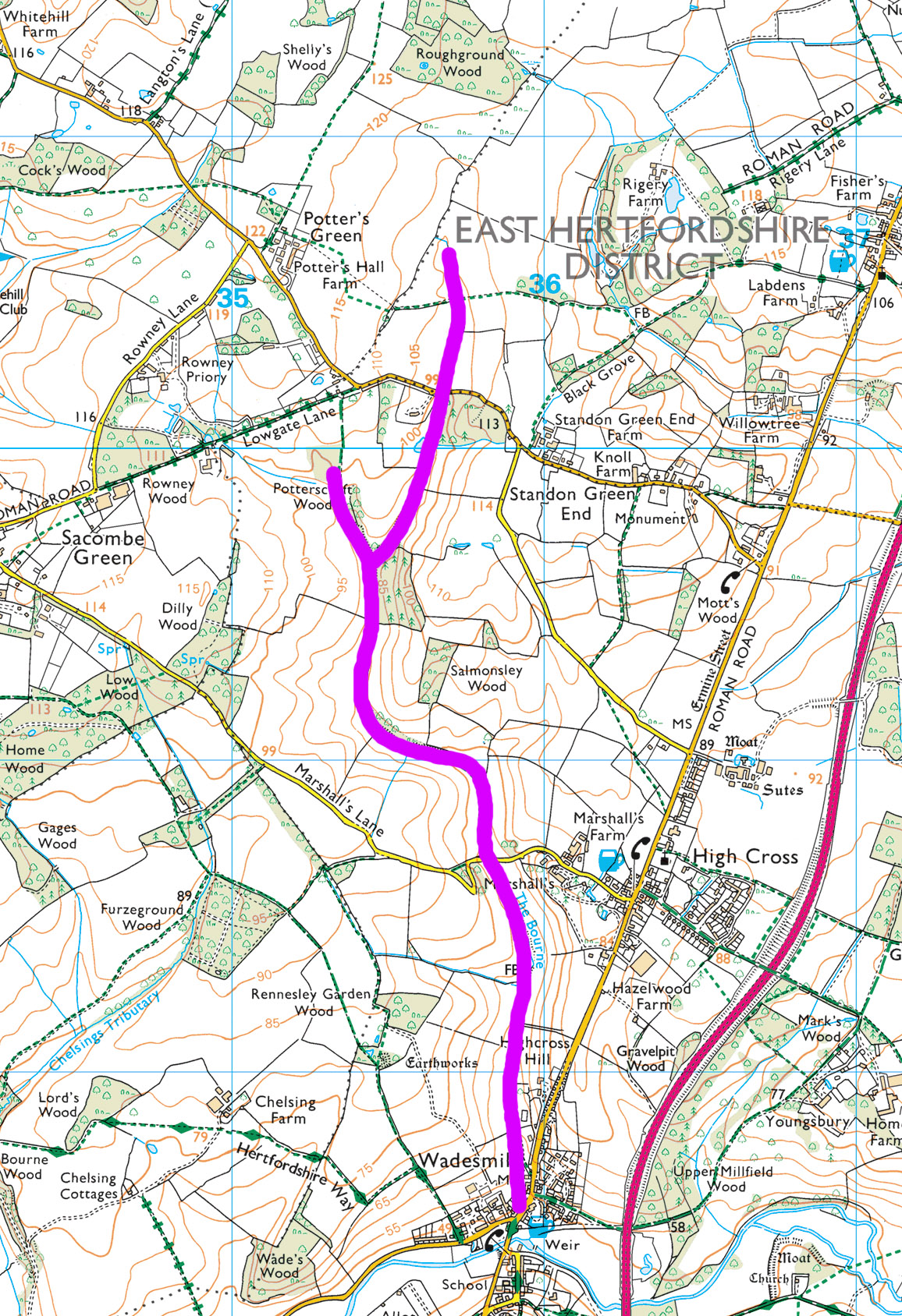
The Bourne. Map squares are 1 km; contour interval is 5 m.
I spent a deal of time in the following days mulling this question over in my mind. It was easy to rule out the idea of The Bourne being essentially man-made. Clearly it has been man-modified to some extent: firstly, the fields at its sides are cultivated, which must of course affect the surface water drainage; secondly, the bridge at Marshall’s Lane restricts any flow of water in the gully bottom there; thirdly, the confluence with the River Rib at Wadesmill is entirely artificial. That, however, is all. The Bourne was formed by natural surface processes.
Which of course leaves only the matter of how and when!
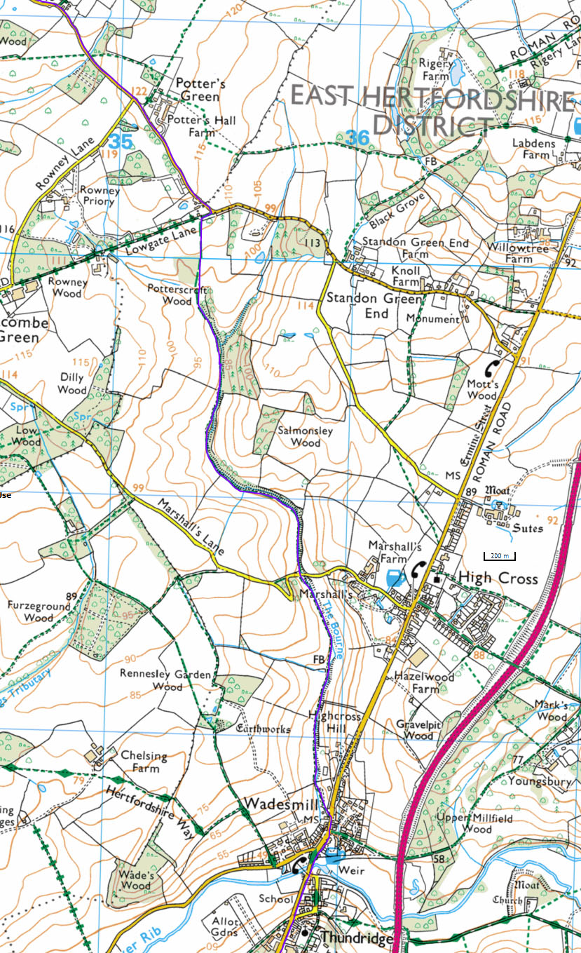
Path up The Bourne, from Wadesmill to Lowgate Lane
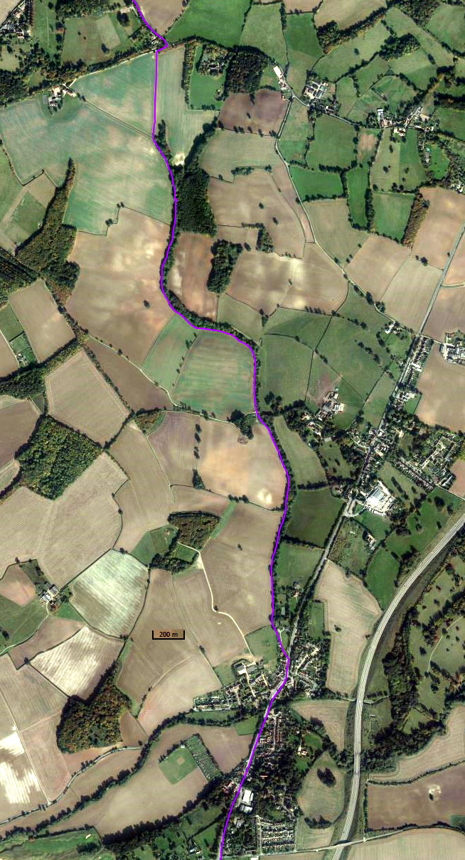
Path up The Bourne, from Wadesmill to Lowgate Lane
The path alongside The Bourne is for the most part a gentle and steady climb. It is more than two kilometres long from the road at Wadesmill to the farm track at Lowgate Lane, and over this distance it is relatively straight, as is The Bourne itself. Yes, there are two obvious single bends, but the path and The Bourne don’t meander, as for instance would many a normal stream or river in similarly undulating countryside. The curious feature of the path is that it crosses no side gullies; thus The Bourne has no significant tributaries on its western side. This is evidently the case on the eastern side as well.
It is more than anything else this lack of side tributaries that points to The Bourne’s probable origin, for gullies as deep as The Bourne, as narrow as The Bourne, and as steep-sided as The Bourne, can only be cut by quantities of continually flowing fast-moving water. The lack of side tributaries is an indication that all of this water was supplied at the gully heads, with the result that the erosive action of the water was just as great there as it was further downstream. It is accordingly unsurprising that The Bourne today is just as deep upstream as it is downstream, and just as narrow, and just as steep-sided.
“OK”, you say, “but look at the topographic map! How can it have been possible for quantities of fast-moving water to be supplied continually at the heads of a gully when those gully heads – the two heads of The Bourne – are both now almost at the top of a hill? Water doesn’t collect in quantities at hilltops!” That’s right, but what if the land surface in this area were at that time to have been close to the margin of a major wet-based ice sheet. (Wet-based? Oh, do please keep up!) Immediately underneath and in front of this margin would have been a system of drainage channels; these were carrying away the large quantities of melt-water that would have been flowing out from under the ice. (I still have vivid memories of crossing one such channel in the summer of 1968, on the southern flank of Hornbreen, in southern Spitsbergen.) The flow in these channels would have been extremely fast-moving and therefore highly erosive. The channels would consequently have been straight and narrow. They would probably also have been relatively deep, given that the bedrock in this area is the London Clay (LC), the Woolwich and Reading Beds (WRB), and the Upper Chalk (UCk). The Bourne is simply a remnant of one of these glacial drainage channels.
I was pleased to come back home and find that the geologists of the British Geological Survey had reached a similar conclusion. You can see this on the simplified solid geology map given on the 1:50,000 Hitchin sheet (http://www.largeimages.bgs.ac.uk/iip/mapsportal.html?id=1003310).

Southeast corner of Hitchin sheet showing glacial drainage channels (arrowed). The Bourne is the forked channel in the lower centre. Contains BGS material © NERC 1995
Problem solved? Yes, but no!
The ice sheet involved here – the Anglian Ice Sheet – was the most south-reaching of the Pleistocene ice sheets in Britain. It came into being about 478,000 years ago and had gone completely by the end of the Anglian Stage, about 424,000 years ago. Evidently – assuming that the BGS interpretation is correct – The Bourne was formed more than four hundred thousand years ago.
You see the difficulty here, for how can it be possible for a gully of the size and shape of The Bourne to remain in existence in its close-to-original state for more than four hundred thousand years? Surely it should by now have been filled up with a mixture of sediment slumping down from its sides and sediment washed in from the adjacent higher land. More importantly, surely it should by now contain thick deposits of decomposed plant material – the remains of all the trees and other plants that must have grown in the gully and by now would have been converted mostly to peat. But The Bourne hasn’t been filled up, nor, apparently, does it contain peat deposits. Why not? I’m still puzzling this out!
All tidied up … well almost
June 10, 2019 § Leave a comment
This is simply another of those routine posts. It’s to tell you that I’ve tidied up the blog posts made on this first part of Three Pierheads. Yes, I know many of you have read all this before, but there are several new readers who haven’t. So this (quoted largely from the analogous post last year) is for them.
“I’m sure most readers of theendtoendblog appreciate that all of the posts in it describing my long-distance walks were created originally in computationally non-optimal situations. There I was, pecking away one-fingered on my little smartphone, either when I was sitting in a pub having a meal in the evening, or when I was back at the B&B or the bunkhouse, or when I was lying half awake in my tent. I don’t have access to a computer of any sort when I’m walking, nor do I have continual access to WiFi. This means I can’t readily use blog-editing software. The posts you get to read – those you get sent as emails – are therefore best described as raw.
These raw posts are all tidied up when I get back home. That doesn’t mean simply that typos are corrected and grammatical errors removed. It means also that photographs are processed (or in some instances are replaced or deleted), that track files are edited and screenshots of them made and loaded, and that links to videos and voice recordings are inserted. It’s a lot of work, but work that’s worthwhile in the end. What you finally have on the blog is a fuller and far more readable account of how the walk in question went.
Now to the important point: WordPress doesn’t send you out an email every time a post gets tidied up! Thank goodness, as otherwise everybody’s inboxes would rapidly fill up. The down side, however, is that if you do want to find out more about how a particular walk went – and obviously many of you do – you have to read the blog itself. Go on, try it! You know you want to!
I’ve now done all the tidying up for the first part of Three Pierheads. All of the relevant posts are now marked, for instance with ***with track and video***; all of the photographs in them are now captioned (and hopefully are now of acceptable quality); and all of the videos and voice recordings I made now have links either to Dropbox or to Box. The first relevant post (‘One down’) was on April 27; the last (‘The marching day’) was on May 31.
There have to be caveats and health warnings, don’t there? Yes! Firstly, please remember when you read this blog that it isn’t meant to be a professional journalistic record; it’s a blog that’s there to let you know something about what’s going on – what I’m doing, what I’m seeing and hearing, who I’m meeting and talking to, what I’m thinking and feeling, and so on. Oh, and it’s also a blog that’s there for me; it’s a supplement to my own unrecorded memories. Secondly, please remember that I’m not a professional photographer, or even an amateur with a proper camera. All the walk-related photos you see on the blog were shot on my phone, often quickly and in rather poor conditions and always by letting the phone pick the focus and exposure settings it wanted. Thirdly, please remember that I’m not a Steadicam operator. Many of the videos were shot in extremely windy conditions and on exposed hillsides and cliff tops; they’re consequently far from cinema or TV quality. Fourthly, please remember that I don’t have a script when I’m making a video or a voice recording. What you see and hear is me, warts and all.
Finally, just a few notes for those of you who might need help:
- The blog address is https://theendtoendblog.wordpress.com
- To enlarge any photograph, left-click on it. To return to the post, left-click on your browser’s ‘Back’ button.
- To download a video or voice recording, left-click on the link; this is in bold letters. You’ll automatically get routed either to a Dropbox page or, for more recent posts, to a Box page. The Dropbox page has a button labelled ‘Download’ in the top right-hand corner. Left-click on this button and you’ll get two options: ‘Direct download’ and ‘Save to my Dropbox’. Left-click on ‘Direct download’. The Box page will allow you to open voice recordings directly simply by left-clicking on the ‘Play’ arrow. To download a video from Box you left-click on the ‘Download’ button in the centre of the screen. In both cases, i.e., both for Dropbox and for Box, your browser will ask whether you want to open the video or instead save it to your computer or phone. I strongly suggest you always save it (you can then open it later any time you want), as otherwise the video quality can be adversely affected.
- To get back to me with any comments or criticisms or notifications of things that don’t work, email me either at johntde(at)hotmail.com or at the address you normally use for me. You can even send me a text. All feedback is gratefully received.”
One thing I haven’t done yet is to get out all the statistics and files for the walk. I’ll be doing that in the next few days and will post them then on one of the side pages.
So now it’s over to you. Have fun!
Sorry!
June 4, 2019 § Leave a comment
Every reader who has followed this blog faithfully since its inception knows that after the end of a walk there is always a ‘return-to-Earth’ post. So what’s happened this time? The walk finished last Thursday and it’s now Tuesday – and still nothing. Could it be “Houston, we have a problem”? No, unless you count as a problem my waking up at home on Saturday morning with a streaming cold. It’s taken me till now to shake it off.
I finished at the border at Scots Dyke and bussed back to Carlisle. Shower, change of clothes, then along into town for what turned out to be a very acceptable all-you-can-eat Chinese buffet. I needed it. After that it was back to the B&B to collapse for what I quite reasonably thought was a well earned night’s sleep. The obligatory ‘Full English’ in the morning (Friday), then along to the station to catch the train down to Manchester Airport. So far so good.
Have you ever been to Manchester Airport? It seemed to this walker, accustomed as he was to rather more peaceful environments, to be some highly developed form of Hell. People here, people there, endless shopping areas and food areas to navigate through, more people, more noise, more hustle and bustle, more shops, more cafes, more notices telling you where you should go and where you shouldn’t, no air, no sky, no corners to sit in and escape, and so it went on and on. And please don’t get me onto the subject of the security checks in the inaptly named ‘Assistance Lane’. Yes, I know that the tiny tag on my trouser pocket zipper is metal and therefore causes your detector to go ‘ping’, but surely even you, sir, given your days of training in the security checking branch, can see that it is just a simple zipper tag. A few other examples as well, which I shan’t go into.
The flight to Basel was painless, as also was the coach ride back to Freiburg. Time then for a döner at the station and a little bit of German grammar (https://blog.supertext.ch/2011/08/doner-mit-alles-der-dativ-gehort-nicht-in-den-kebab/):
“Wer kennt ihn nicht, den Döner Kebab für den schnellen Hunger. Schmeckt am besten vor dem Nachhausegehen, kurz bevor es wieder hell wird. Auf die Bestellung eines Döners folgt immer die Frage: „mit alles?“ Ich antworte: „Ja, mit allem und scharf.“ Dabei ist mir aufgefallen, dass, in welche Dönerbude ich auch immer gehe, immer nach „mit alles?“ gefragt wird. … Wie es scheint, gehört in den Döner saftiges Fleisch vom Rind oder Kalb (ursprünglich war es Hammel- oder Lammfleisch), Zwiebeln, Tomaten, Salat und Joghurtsauce. Aber der Dativ gehört definitiv nicht dazu. Dass es richtig „mit allem“ heisst, weiss bestimmt jeder Fleischpizzaiolo hinter dem Tresen. Aber „mit alles“ ist zum Kult avanciert. … In diesem Sinne: guten Appetit. Mit alles.”
Bus back home, pick up key, collapse in bed.
The marching day ***with track***
May 31, 2019 § Leave a comment
Yesterday (Thursday) was the last walking day. Actually ‘walking day’ is a misnomer, for it really was a marching day. Not the most interesting of days by any means, and spoiled by yet more rain. But with a very satisfying end. Here’s a summary.
First took bus from Carlisle back to Low Hesket; then marched back to Carlisle along the A6 – which is almost dead straight and has a footpath; then collected railway ticket for journey today to Manchester; then marched through Carlisle suburbs and miscellaneous villages to the A7; then marched along this for as far as it has a footpath; then turned off and marched along back roads and, miracle of miracles, a cyclepath, to Longtown; then stopped briefly at the Graham Arms for tea and a sticky bun; finally marched out to the Scottish border along the A7, this time with no footpath and in the sometimes pouring rain.
Those final few kilometres were most unpleasant. I was conscious all the time that I’d surely miss the bus to return me to Carlisle. That would mean standing in the rain and cold for another hour. Luck was on my side, however, as the bus was running about five minutes late. I just had time to photograph the Scottish and the English border signs (and the old toll house, where the Scots Dyke comes to the road) when along it came. Another furious wave to the driver, who stopped and picked me up. The walk was over.

Welcome to Scotland! Looking onward up the A7 north of Scots Dyke

Welcome to England! Looking back down the A7 north of Scots Dyke, with the toll house at the border

Low Hesket to Scots Dyke
Some strange things ***with track***
May 31, 2019 § Leave a comment
Yesterday (Wednesday) was always going to be a strange day. Just like the earlier one from Osmotherley to Brompton-on-Swale, this was going to be a connection day, this time between the Pennines and the A6 road to Carlisle.
Again it was grey and overcast when I looked out in the morning, and again rain was forecast. This time, however, I hadn’t got any change of plan for the first part of the day. It was simply going to be up onto the moors, along the crestline, then down to the cafe at Hartside Summit. From there it would be a succession of tracks and minor roads that would eventually lead me to a bus stop on the side of the A6 at Low Hesket. That would then let me get to the B&B I’d booked in Carlisle.
I’d read a description of the crestline walk over the moor; it sounded eminently doable. However, what the author of this description didn’t mention was that some of the walls and fences you have to cross make escaping from Alcatraz look like child’s play. I surprised myself with my agility. Then came the twist, at Hartside Summit. Instead of the warm and friendly cafe I was expecting, all that greeted me was a burnt-out shell. Evidently the cafe was destroyed in a fire about two years ago and is not being rebuilt.
I walked on, and on, and on. Then I came to Renwick. You probably haven’t heard of it; nor had I, for it’s certainly not a well-known walking destination. The big question in my mind was of course whether it had a pub. “No”, said Jack, who was walking slowly down the street. “The nearest pub is two and a half miles away, but you’re welcome to come back to my house for a cup of tea or coffee. It’s up in the village. Just go round to the back door and tell Brenda I sent you.” Brenda, Jack’s wife, was certainly surprised to see this strange visitor. “You might be a serial killer”, she said, “but you’ve got a nice face.” Tea and biscuits followed, then Jack came back from his walk and joined us. What fantastic hospitality! Need I say that it gets the biggest of bouquets?
The remainder of the day was simply a slog. I reached Low Hesket in plenty of time for the bus that would take me to Carlisle. But what was this? Another bus was just pulling in about 100 metres up the hill, obviously also going to Carlisle. I waved furiously at the driver and ran as fast as I could to the stop. Yes, ran, uphill, and with a full pack, after already having walked the best part of 35 kilometres that day. The driver waited. Thank you, sir.

The burnt-out cafe at Hartside Summit
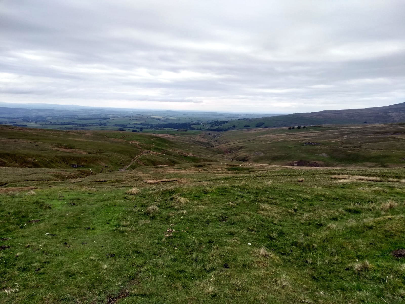
Looking west down to Haresceugh and Renwick

Colour at the roadside

The Eden at Armathwaite
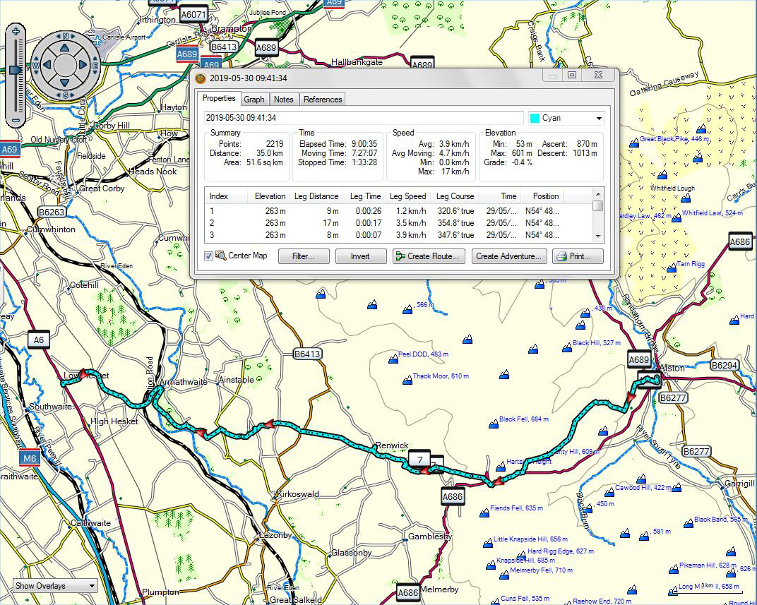
Alston to Low Hesket
Changing the plan ***with track and video***
May 31, 2019 § Leave a comment
One of the great advantages of ‘going it alone’ is that you aren’t tied to some fixed route. It’s never “…but I have to go along this particular path past that particular point as otherwise I won’t be able to say that I completed the ‘X to Y’.” Instead you can change your plan to do what seems right for the time.
The hostel in Langdon Beck was close to empty on Monday night. I woke early and looked out over the moors. Grey and overcast, with the prospect of rain – not at all the brilliant weather I’d had when I stayed here on the LEJOG three years ago. I decided therefore to cut across the hill to Cow Green Reservoir rather than go there via the Pennine Way as I’d originally planned. This would mean missing Cauldron Snout, but that seemed a small price to pay. “Seen one waterfall, seen ’em all. That’s wot I say!”
After breakfast I set off for Cow Green Reservoir. From there I followed the miners’ track northward around Backside Hill, climbing all the way. Now it was starting to drizzle; the wind was also getting up. I reached the road at the top and crossed the pass from the Tees to the Tyne. Nothing spectacular, just a boggy watershed, and boggy watersheds aren’t my thing when the immediate prospect is of getting seriously wet.
I looked from the road down onto the bridle path I’d originally planned to take along the South Tyne valley. Churned-up mud and peat and pools of water – definitely not for me today! I stayed on the road instead. Now it was raining properly and blowing hard. It was also getting unpleasantly cold. Staying on the road had definitely been the right decision, especially as that road was leading me downhill to Garrigill and the prospect of a nice warm pub at lunchtime. But of course the pub was closed, as too was the village shop. Lunch was therefore taken sitting on a bench in the shelter of a tree in the village centre. At least the rain eased off.
Then of all things the sun came out. I could dry off and warm up. What a day! No more moorland in the rain. Instead a straightforward path down the side of the South Tyne with not far to go to Alston. I reached there much earlier than I’d originally planned. Time for tea.

Cow Green Reservoir, looking south

The old barytes mine above Cow Green Reservoir

Looking back down the miners’ track

Another watershed, here between the Tees (in the far distance) and the South Tyne
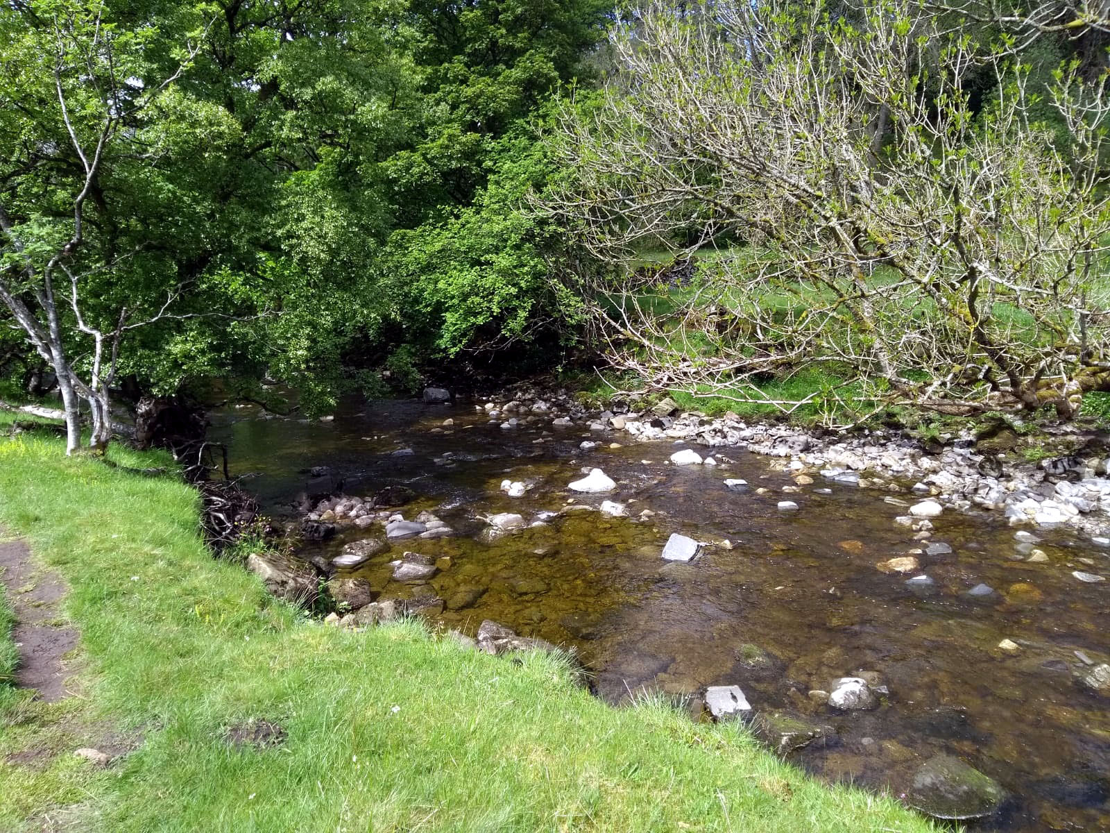
The South Tyne

Langdon Beck to Alston
A video taken from the miners’ track looking out over Cow Green Reservoir can be downloaded at:
That F word
May 30, 2019 § Leave a comment
On my way from Middleton-in-Teesdale to Langdon Beck I met Jeff and Sue. They’re doing the Pennine Way and were also booked in to stay at Langdon Beck. We chatted for a few minutes, then I went on ahead, saying as I did so that it was about ten kilometres to go to the hostel. When later we met up in the hostel lounge, Jeff commented that it had in fact been a good deal more than ten kilometres. He was right. Sorry!
I’ve found out on all of my walks that I tend to underestimate distances, usually by about ten percent. There’s an explanation for this, and no, it’s not just that I’m unduly slipshod. It’s simply to do with that F word.
When I’m planning the route for a day I start off with it on a map. I then transfer it to Google Earth for editing and refinement. The routes I finish up with are usually very detailed. They’re strings of hundreds of points, with an average point-to-point spacing of about fifty metres. It’s these point strings that I use to get my distance estimates.
Surely you can see where I’m going! If not you’d better enrol for the Mathematical Geology elective. The reason I underestimate the actual distances I travel is that my pace length is a lot less than fifty metres. The F word you’re looking for is Fractal.
Not quite what I’d expected ***with track, voice and videos***
May 29, 2019 § Leave a comment
My route on Sunday had taken me across the watershed between the Humber catchment and the Tees catchment. My route yesterday (Monday) was to take me up the Tees, from Barnard Castle to Langdon Beck. I’d expected, naively, a comparatively easy day, essentially a straightforward riverside walk. How wrong can you be?
The path started out in Barnard Castle as the Teesside Way, but after only a few kilometres metamorphosed into the Teesdale Way. That was a warning. Even on the Teesside Way it was difficult to form the impression of walking along a riverside – there is a curtain of trees for most of the way – and once you’re on the Teesdale Way you’re decoupled from the river completely. Well, not quite, because for a couple of kilometres shortly before Middleton-in-Teesdale the Tees has a steeply cliffed left bank, along which the Teesdale Way runs. I use the word ‘along’ advisedly here, because the path runs partly at the bank top and partly at the bank bottom. Fifty metres at the top, then 30 steep stairs down to the bottom, then 25 metres there, then stairs back to the top, then repeat this eight or ten times. You get what I mean. I was glad to reach Middleton.
Time for a pot of tea and a cheese and tomato sandwich, then off to Langdon Beck along the right bank of the Tees. This was following the Pennine Way, albeit a Pennine Way that was here showing its softer side. At last I found what I’d been expecting initially – a path through fields, with the river at my side. Very pleasant, especially as later the river narrowed and crossed the sill. Families aplenty there, all out to see the waterfalls and the rapids.
After High Force there was no one. Just me and the peewits. I reached eventually the point where my LEJOG path came in from the south, from the grouse moor and Hagworm Hill. Strange to think I’d been here before and had never expected to be back.
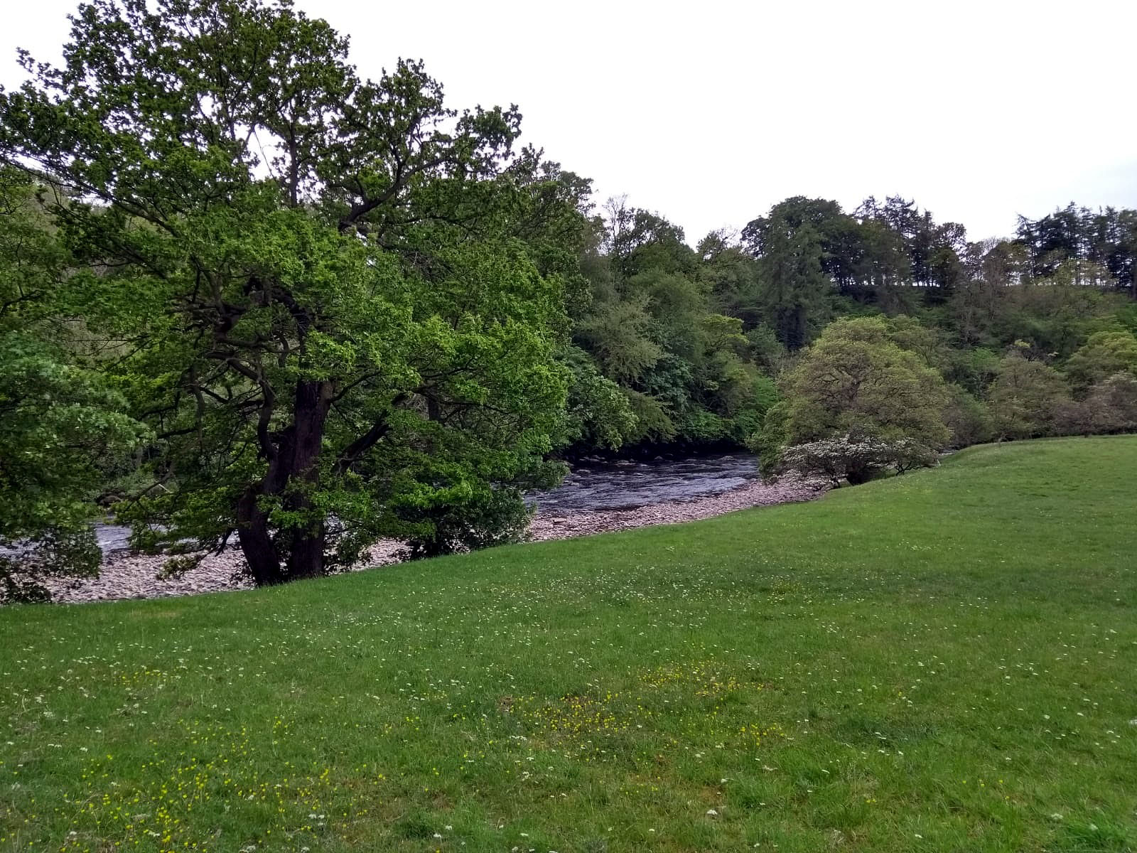
The Tees, between Barnard Castle and Cotherstone
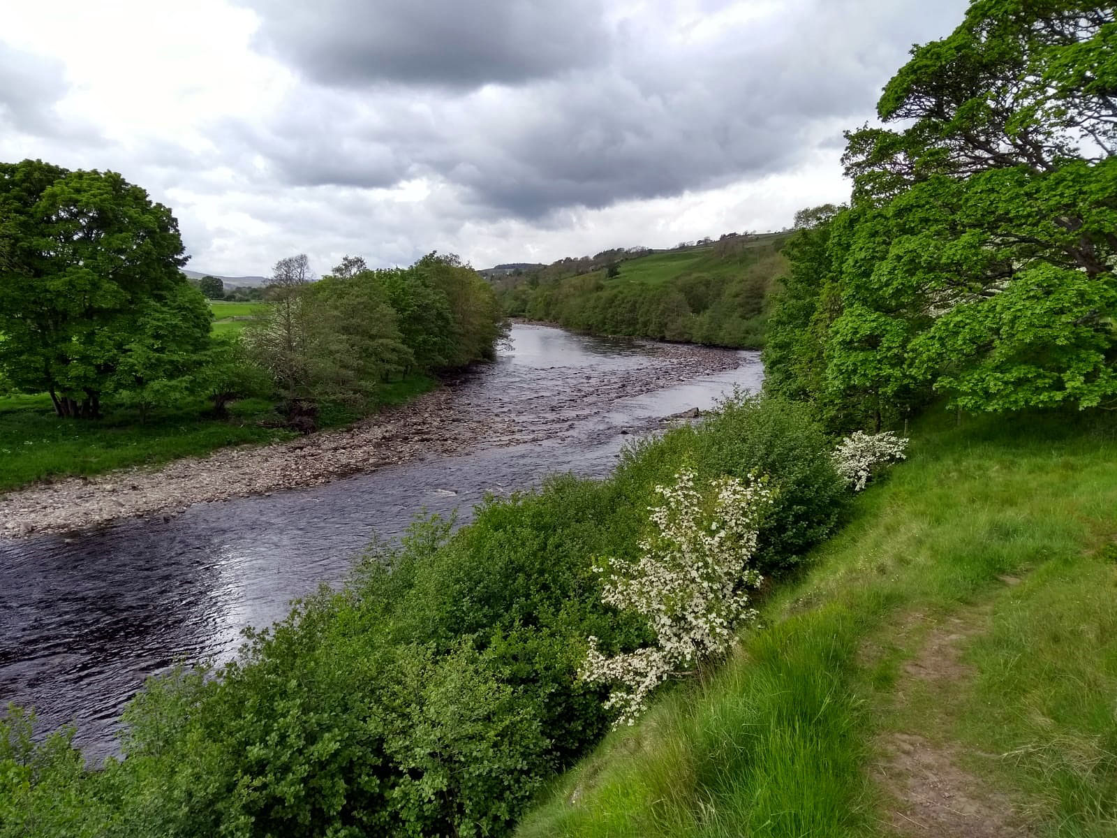
The Tees, between Barnard Castle and Middleton-in-Teesdale

The softer side of the Pennine Way, between Middleton-in-Teesdale and Low Force

The softer side of the Pennine Way, between Middleton-in-Teesdale and Low Force

Rapids on the Tees, below Low Force

Low Force

High Force: the limestone and the sill

Barnard Castle to Langdon Beck
A wind-affected voice recording made where my LEJOG path came in can be downloaded at:
https://app.box.com/s/etn07cmcoetcstt3rbtfvocmk3q846ft
A video taken from a viewpoint on the Teesdale Way near Cotherstone can be downloaded at:
https://app.box.com/s/jnk2c9tvyqlklcit05q3kocqxn5vv30a
Three videos of the rapids and the waterfalls on the Tees can be downloaded at:
https://app.box.com/s/r75xhly9illdb5brz49fiawp7lfqcdn2
and
https://app.box.com/s/bho25dx5tla14o9n0mj6xte3qwyz5mev
and
A mixture of everything ***with track***
May 27, 2019 § Leave a comment
I woke this morning (Sunday) to the sound of rain on the bunkhouse roof. Not the most promising of starts to a day, especially as it seemed to confirm the forecast I’d seen before going to bed. My spirits sank. I shaved and dressed and went over the road to get some breakfast materials from the shop. Strange, but now it was only drizzling. And wasn’t that a patch of blue sky I could see? My spirits rose. That was the weather story for the whole day – sometimes wet, sometimes dry, sometimes cloudy, sometimes sunny, sometimes cool, sometimes warm, sometimes with barely a breeze, sometimes with half a gale blowing. A real mixture.
The route for the day took me first into Richmond, passing the ruins of Easby Abbey on the way, then along part of the C2C to Marske, then northwards on the interestingly named Cordilleras Lane past a military firing range, then actually through a part of that range along some scarcely navigable public footpaths, then across grouse moor, then through farming land down to the River Greta, then finally along roads to my B&B in Barnard Castle. Another real mixture.
For most of the time I was by myself, apart of course from the wildlife. For one section, however, I had the delightful company of Nicole, a mathematician from California who generously refrained from discussing representation theory with me. I also got comments on the relative merits of the C2C and the Pennine Way, this time from two obviously experienced walkers. Again a real mixture.
Finally into Barnard Castle. Phew!
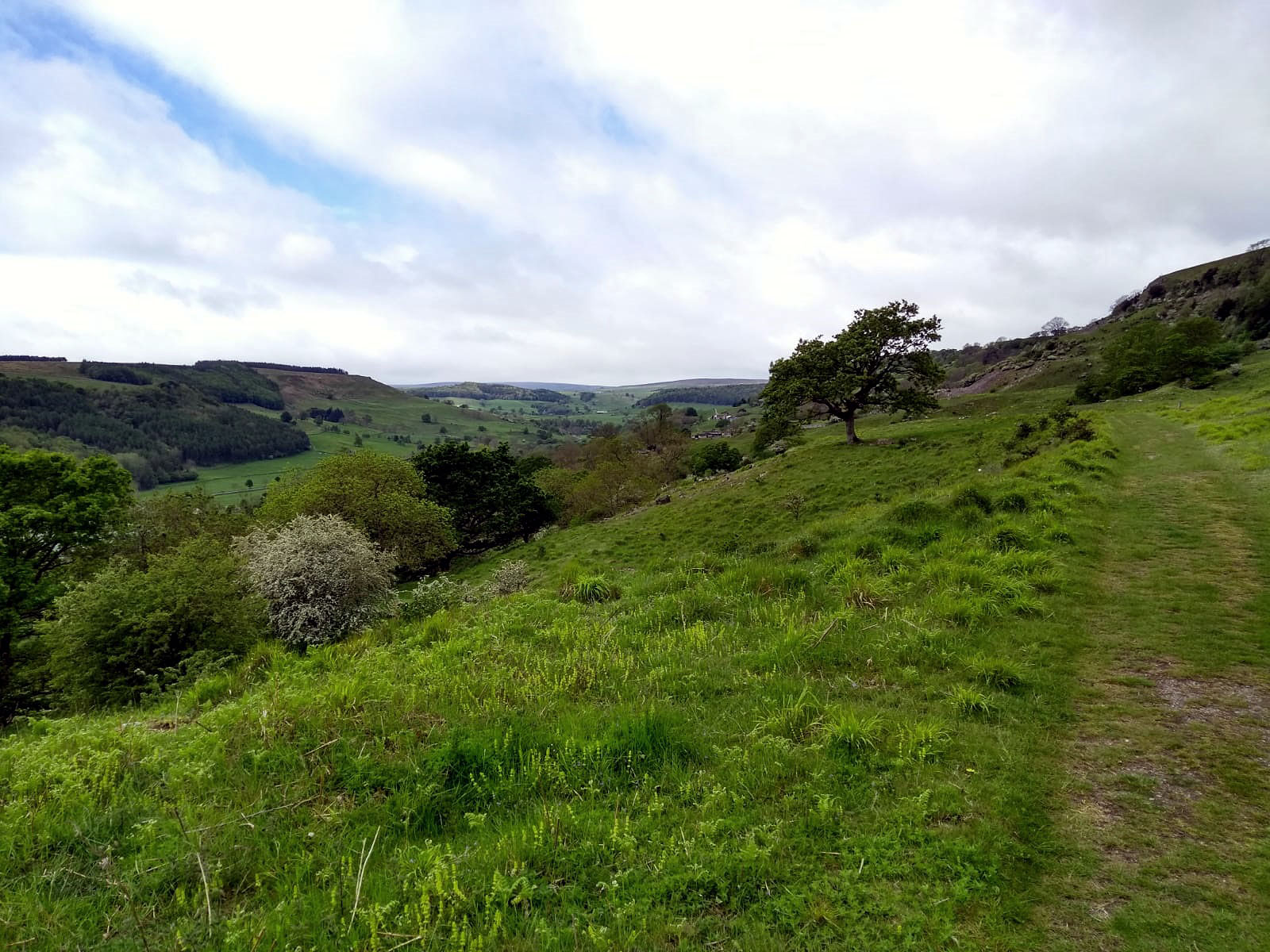
Above the Swale, between Richmond and Marske

Woodland at the start of the climb up Cordilleras Lane

A military range, and where’s the public footpath?
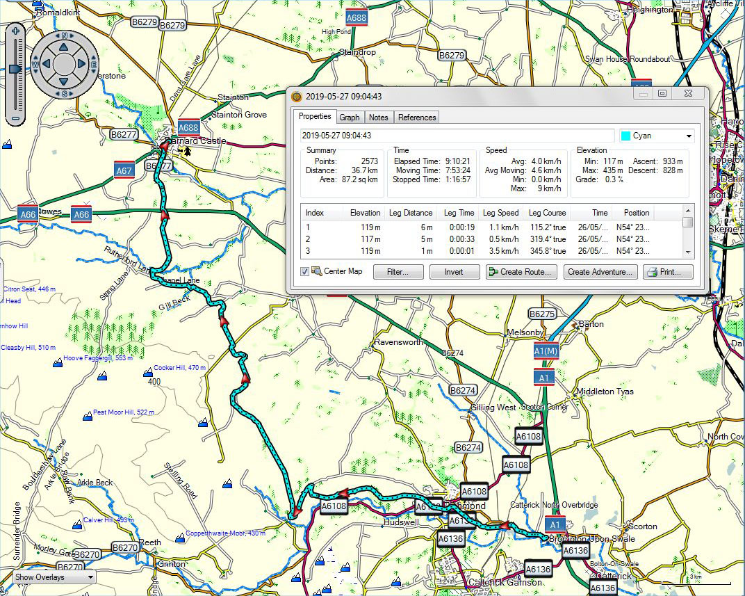
Brompton-on-Swale to Barnard Castle
Happy Anniversary
May 26, 2019 § Leave a comment
To Flicka, the loveliest lady in the whole wide world, with thanks for 46 precious years.
Coast-to-Coast ***with track***
May 26, 2019 § Leave a comment
Georg, who described himself as being from ‘somewhere between Hamburg and Bremen’, was sharing the same dormitory room as me in the hostel at Osmotherley. He was about to start the final stage of the Coast-to-Coast, across the North Yorkshire Moors. He described to me the preceding Coast-to-Coast stage, from Brompton-on-Swale to Osmotherley, as a ‘connection day’. It functions, for Coast-to-Coasters, as a day that links their walking through the Yorkshire Dales with their walking across the North Yorkshire Moors. This stage, at least according to Georg, is far from a thing of beauty in itself. I did that stage today, but in the opposite direction. Georg is absolutely right.
Actually I didn’t follow the exact C2C route. Instead I looped south to go through Northallerton. Why? Simple really! I no longer need my tent, so posting it back to Karen was a sensible idea, one that takes about two kilograms off my shoulders. The only problem was finding a Post Office somewhere – or at least a shop with a Post Office facility – that would be open when I was going by it. I’d hoped originally that there might be one in Osmotherley. No chance! A woman I asked said sadly that Osmotherley did indeed have access to a Post Office facility “but it’s in the Village Hall on Mondays and Tuesdays between 10 and 2.” Not impressive, so Northallerton it had to be.
On days like this I go into autopilot, especially when there’s lots of roadwork to do. The only time I was fully conscious was when I passed through a small village shortly before finishing. Yes, the church there was open and offering tea and coffee. St Mary’s Bolton-on-Swale, just like St Mary’s Newchurch and the Shepherds’ Church at Pyecombe. The same trust and the same feeling of peace.
It was drizzling for the last few kilometres. We’ll see what tomorrow will bring.

St Mary’s Bolton-on-Swale: a magnificent chestnut tree and a pleasant surprise in store
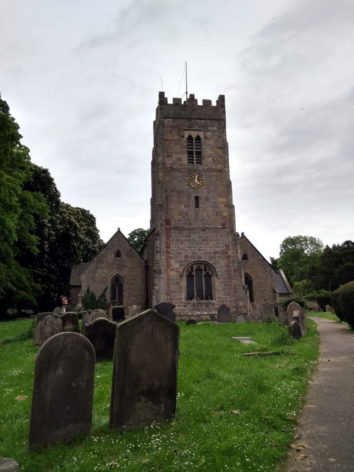
St Mary’s Bolton-on-Swale
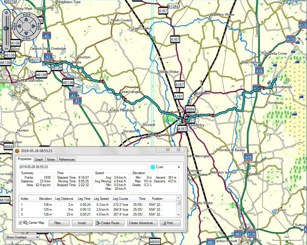
Osmotherley to Brompton-on-Swale
Now that truly was outstanding ***with track, voice and videos***
May 24, 2019 § Leave a comment
I camped last night at a site just outside a small village – Husthwaite – that nobody seems to have heard of. What a surprise then to discover that this same village boasts an excellent steakhouse. It therefore seemed to me only sensible to round off yesterday’s walk with an 8 oz rump steak with chips, onion rings and the house salad, accompanied by two pints of Black Sheep. I slept well.
Today (Friday) was an outstanding day in so many respects. Firstly there was the introduction – the owls calling to each other above my tent, shortly before the dawn chorus started. Secondly there was the weather – gloriously sunny, but with a breeze that kept me pleasantly cool. Thirdly there was the scenery – the Hambleton Hills, with the panoramic views out over the Vale of York and then to the Pennines. Fourthly there was the path – the Cleveland Way, which runs mostly at the hill edge. Fifthly there were the people – lots of walkers, all of whom gave a cheery greeting and most of whom wanted to stop and talk. Sixthly there was the bird life – in particular the curlews treating me to a low level flying demonstration that would have made that Eurofighter pilot gasp.
The final few kilometres were over moorland. I could look eastward and see the parts of those same moors I’d tramped over last year. This time, however, I’d no need to worry about adders.

Leaving Husthwaite

Closer now!

That climb was worth it! View from the White Horse

View to the west

Looking northwest towards Gormire Lake

Looking west from Sutton Brow
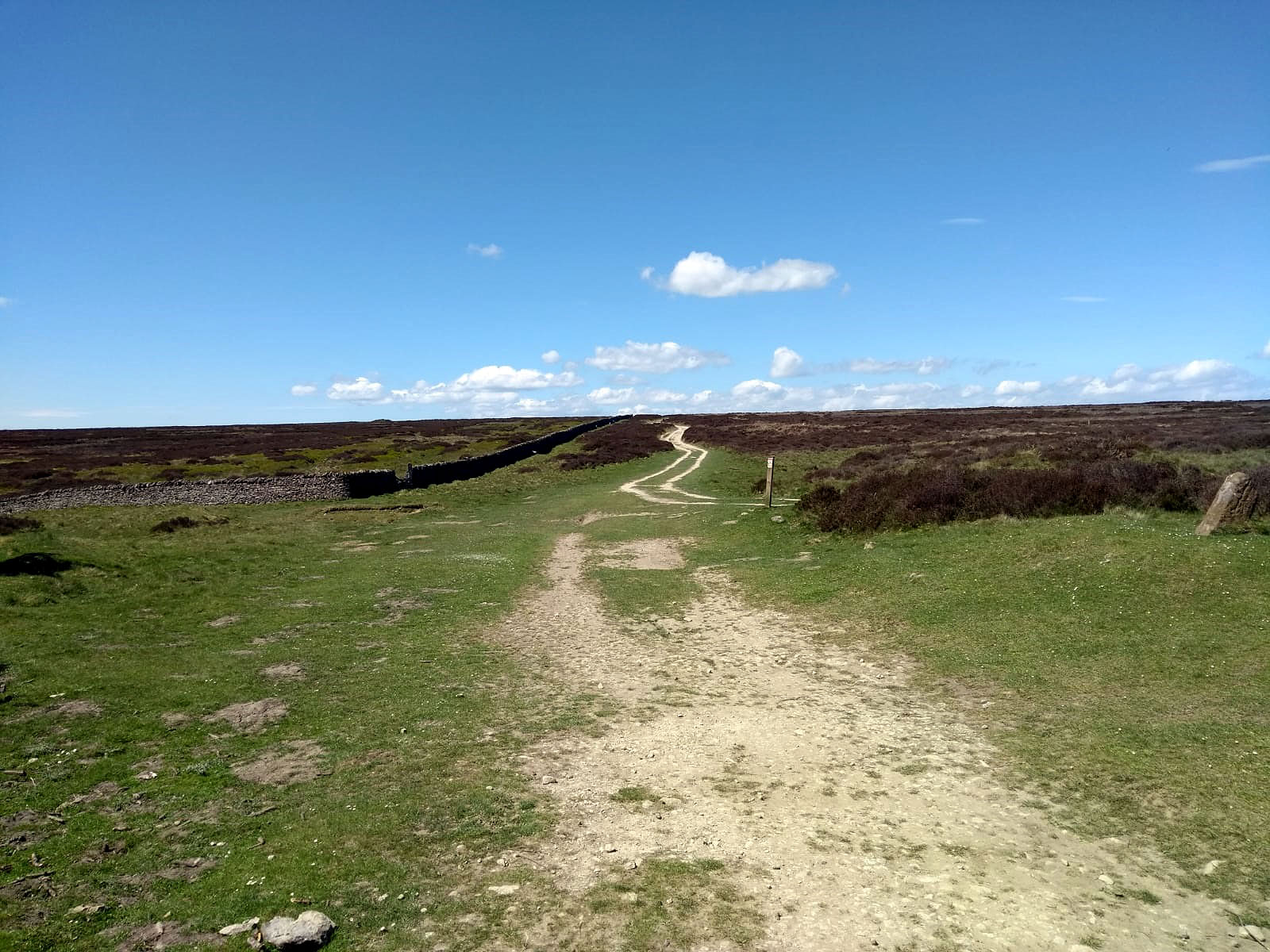
Out onto the moor. East of Kepwick

Moorland with quarries, northeast of Kepwick
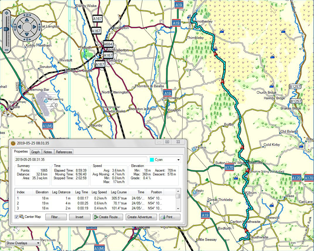
Husthwaite to Osmotherley
A voice recording of the owls can be downloaded at:
https://app.box.com/s/6yet2zd6z6cm65a638whmfa3pjmzikzp
Two more voice recordings can be downloaded at:
https://app.box.com/s/4tlig3wgoxtmibal1ormy8yhb6o4if28
and
https://app.box.com/s/ellw97meh1flzeel8sa4ks3xpzi76u6f
A video shot starting out from Husthwaite can be downloaded at:
https://app.box.com/s/g2iq824k3cx00e796xy65ox91m6nrp0e
A video shot from the White Horse can be downloaded at:
https://app.box.com/s/w1d3p19fmd8tfdmyjb2jykwbn9n53m9n
A video shot from Sutton Brow can be downloaded at:
https://app.box.com/s/p7e70err7jwh04q009wdgamm6aakmf4a
A video shot looking out westward over the moorland, towards the Pennines, can be downloaded at:
In welchem Land bin ich dann? ***with track***
May 23, 2019 § Leave a comment
Half way through today’s walk (Thursday), right in the middle of nowhere, there for all to read was a notice on a fence ‘Schon wieder ein Gallagher Zaun’. The manufacturer, originally from New Zealand, evidently has its European base in Ibbenbüren, near Steinfurt.
Apart from that there was nothing at all special about the day. Just more countryside. Oh, and it was relatively short – about 25 kilometres.
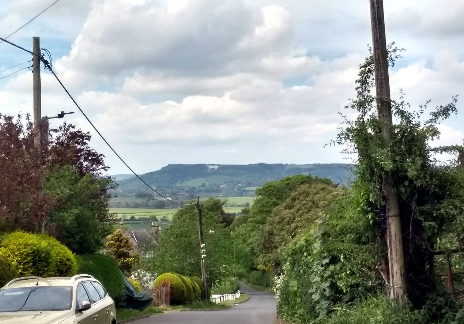
That’s for tomorrow. My first view of the White Horse, from Husthwaite

Castle Howard to Husthwaite
A bouquet, a trudge, some pedantry, and a strange blogger ***with track and video***
May 23, 2019 § Leave a comment
The arrangements at Millington Village Hall deserve to be copied in villages elsewhere. The Hall – once the village’s Methodist chapel – has as one of its present-day functions the provision of what is commonly called camping barn accommodation. This usually means you get provided with a bed or mattress in a weatherproof room, with bathroom and cooking facilities adjacent; you bring your own bed linen, your own soap and towel, and your own food. Millington does it very much better. The Hall is furnished, well heated and has a fully fitted kitchen. Breakfast materials are provided, although naturally you do your own cooking. A bouquet to the Millington community, especially to Peter for his warm welcome.
That’s the bouquet; now for the trudge. The first three kilometres from Millington were excellent. The path was on the hill edge looking down over the Vale of York. York Minster was shining in the morning sun. Then started the trudge – seemingly interminable kilometres on the flat, first across to the Derwent at Scrayingham, then along it via Kirkham Abbey to my destination at Castle Howard. The only bright spot was seeing the flash of blue as a kingfisher sped across the Derwent to trees on the far bank.
Now to the pedantry. I mentioned in an earlier post that ‘finely crafted’ is obviously a synonym for ‘built’. In the same way, ‘luxury executive houses’ are simply ‘houses’. So what does ‘outstanding’ mean in the context of ‘Area of Outstanding Natural Beauty’? Judging by the Howardian Hills, the AONB through which I walked today, nothing. This is just an area of thoroughly normal countryside.
Finally that strange blogger. He said his name was Charles. I met him wandering around the grounds at Castle Howard, muttering aloud that he’d been there before. Here’s a sample of his blog.
‘”I have been here before,” I said; I had been there before; first with Sebastian more than twenty years ago on a cloudless day in June, when the ditches were white with fool’s-parsley and meadowsweet and the air heavy with all the scents of summer; it was a day of peculiar splendour, such as our climate affords once or twice a year, when leaf and flower and bird and sun-lit stone and shadow seem all to proclaim the glory of God; and though I had been there so often, in so many moods, it was to that first visit that my heart returned on this, my latest.’
He does write well, doesn’t he?

St Ethelburga’s Church, Great Givendale
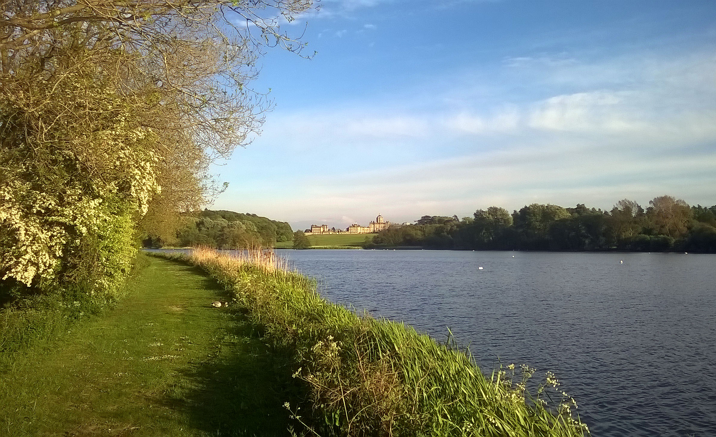
Castle Howard

Millington to Castle Howard
A video of the mill on the River Derwent at Howsham can be downloaded at:
Wolds – Who he? ***with track, voice and video***
May 22, 2019 § Leave a comment
Even those of you who’ve been awake in lectures will have missed me talking about the meaning of the word ‘wolds’. That’s because I haven’t ever talked about it. Indeed I haven’t ever thought about it, at least not until now.
I started off yesterday (Tuesday) from South Cave, following the Yorkshire Wolds Way. Thirty three kilometres later I left the Yorkshire Wolds Way and headed into Millington, the village where I’m camping overnight in the Village Hall. So what have I learned about Wolds in those 33 kilometres? Simply that they’re chalk hills.
The obvious question for a walker who’s gone across the south of England is if Wolds are the same as Downs. Have I in fact been following the Yorkshire Downs Way? ‘Jein’ – you can translate that yourselves. There are certainly some similarities, but there are clear differences. Nowhere on the Downs have I seen such magnificently developed dry valleys as on these Wolds, and nowhere on these Wolds have I experienced the sense of exhilaration you get when walking parts of the South Downs crest line.
Why then are there these differences? As you’ve suspected, this is a take-home question. Could it have something to do with how and when these different hills of chalk were formed? And do check the drainage pattern. That’s enough hints for now!
Finally, thanks to Graeme and Roan and Aidan for accommodating me in Hessle. All best wishes for the move!

From Little Wold looking south to South Cave
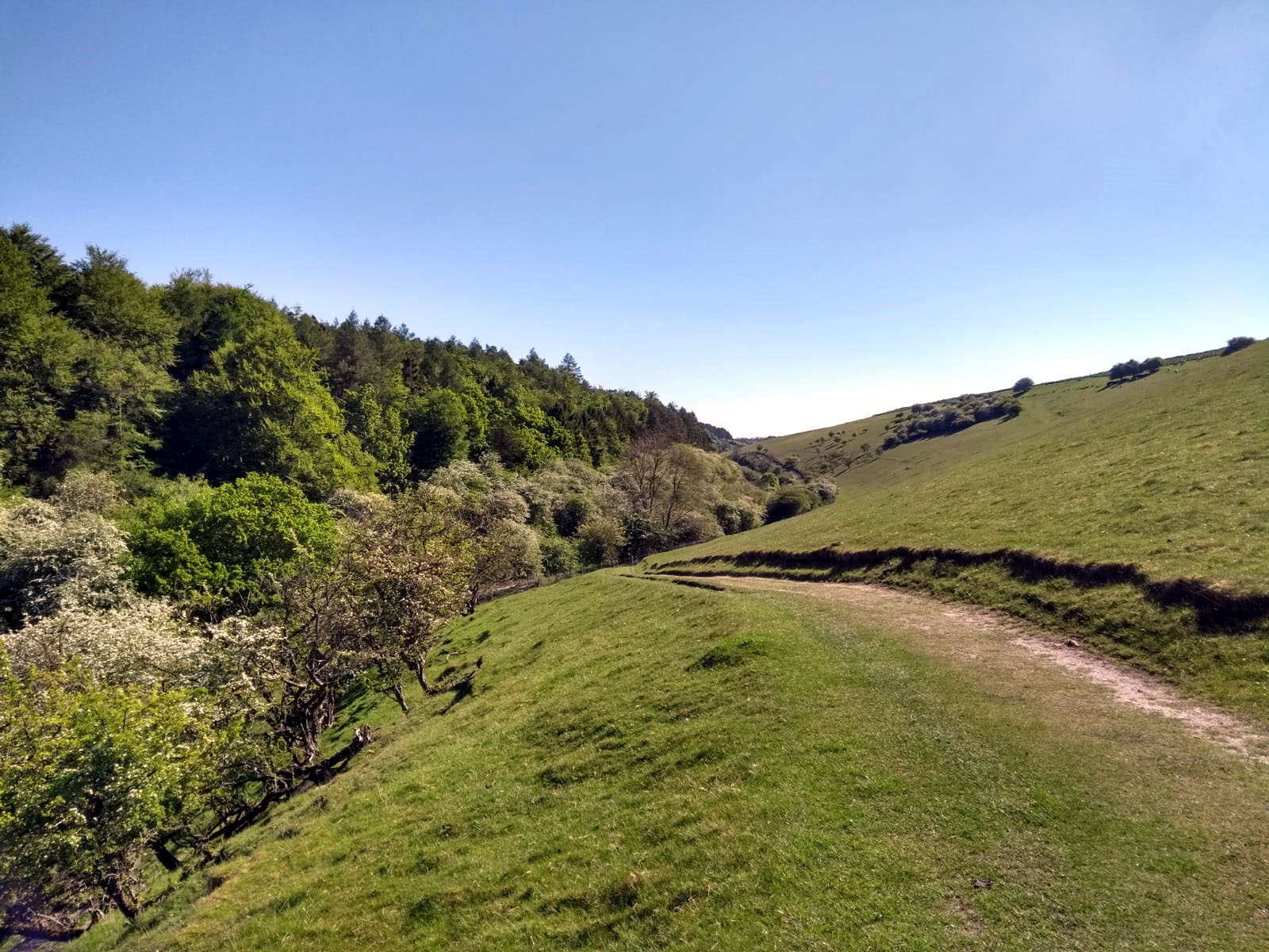
Looking east along Weedley Dale
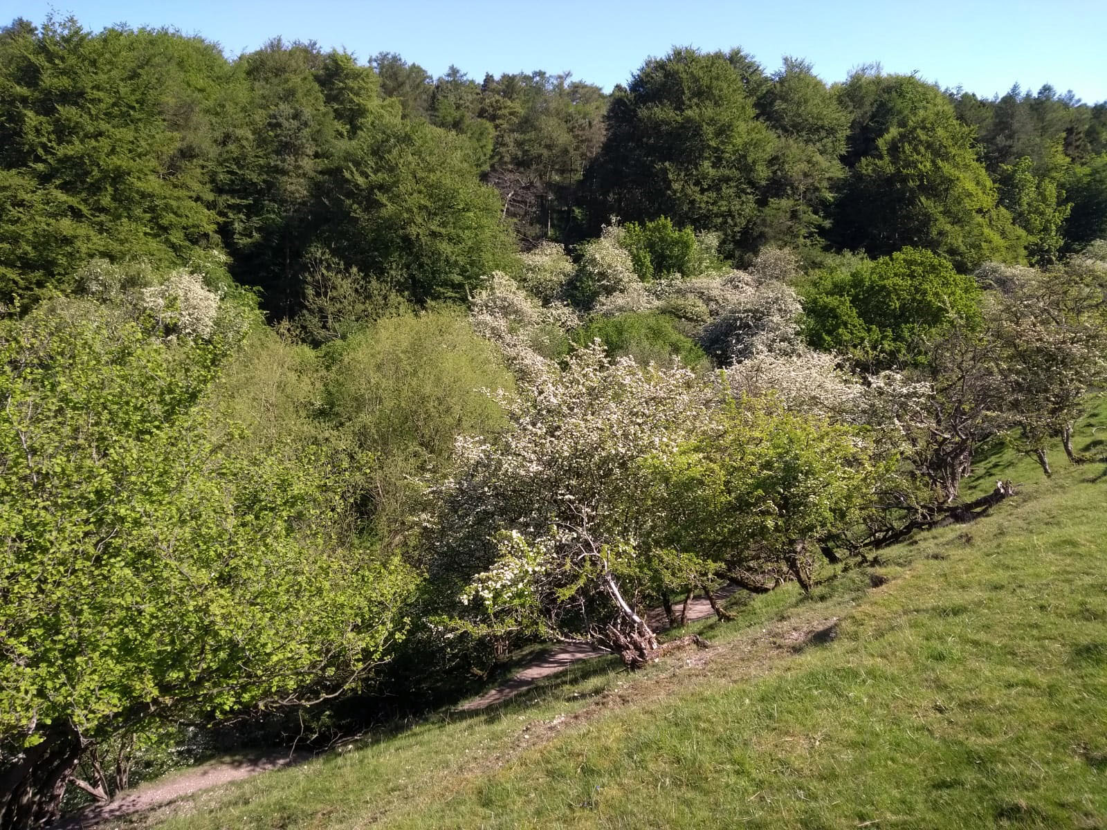
North side of Weedley Dale
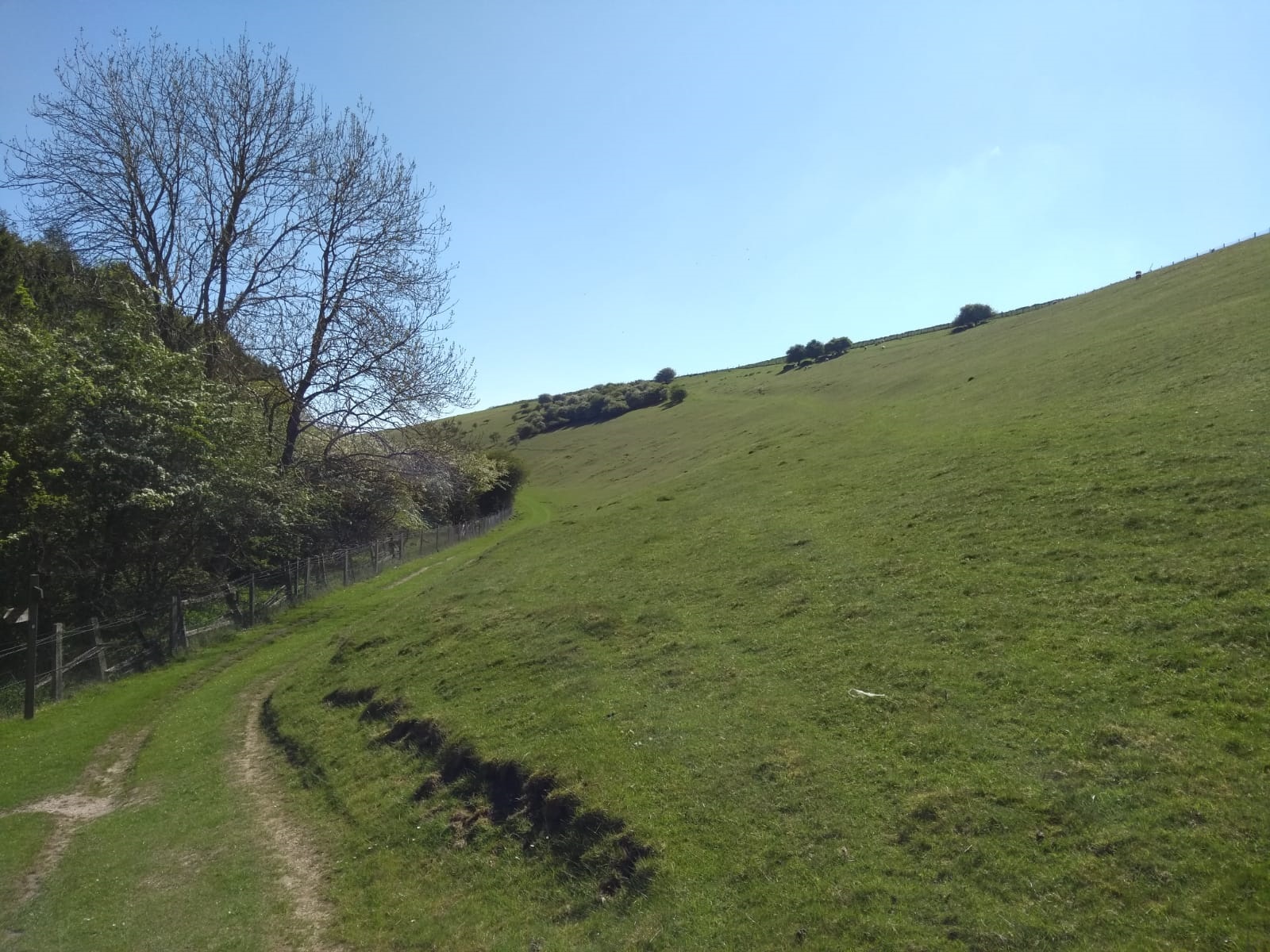
Looking east along Weedley Dale
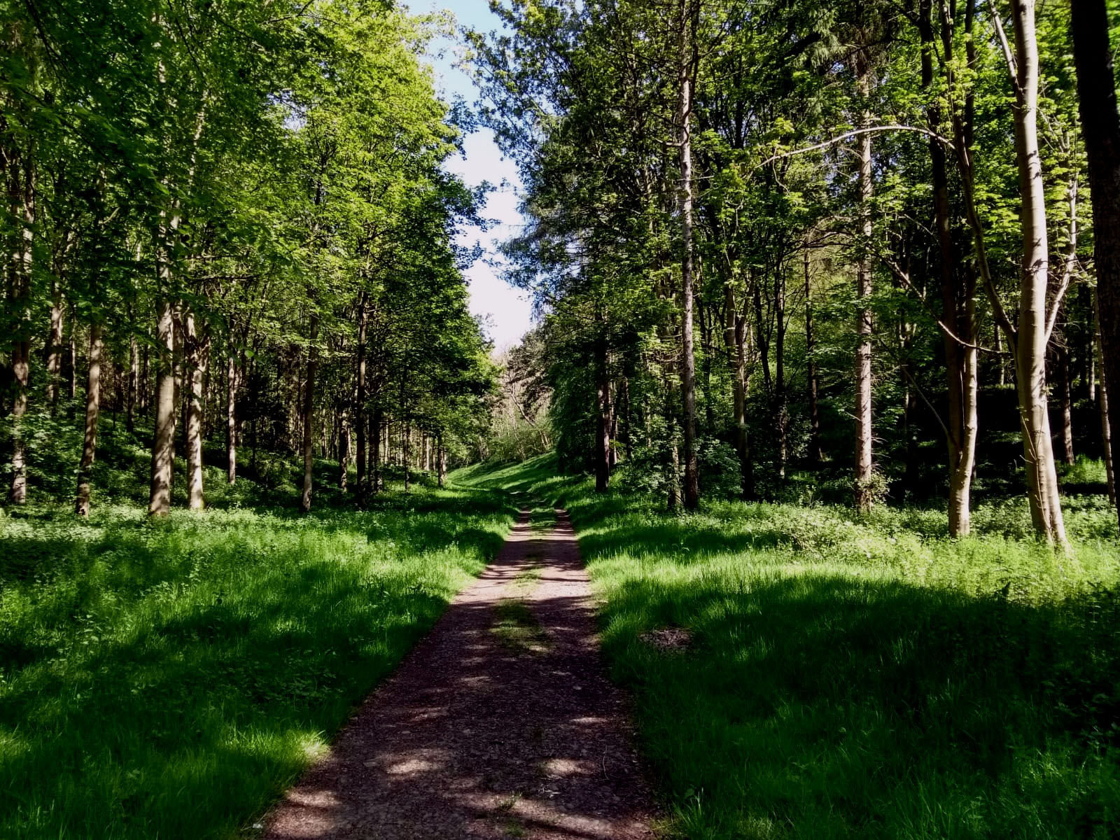
East Dale
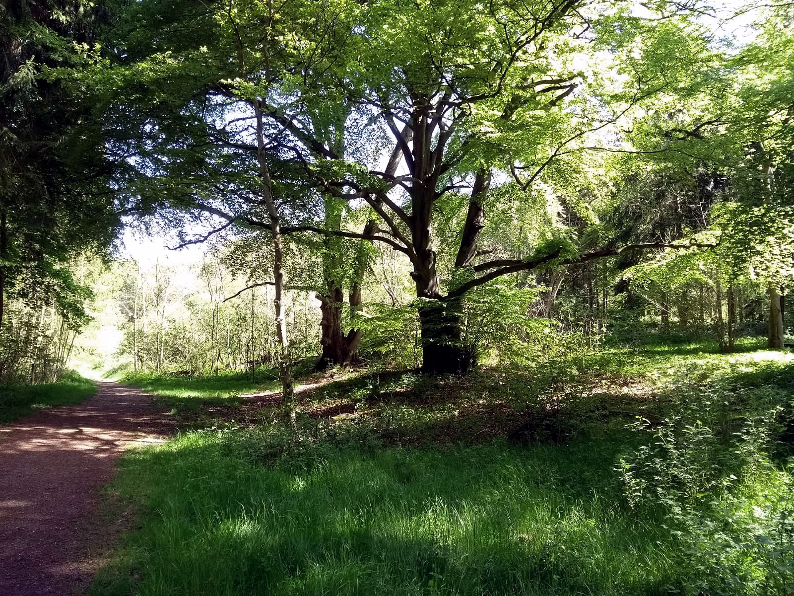
Beech trees in East Dale

On B1230 north of East Dale. What on earth is/was this?

North of East Dale
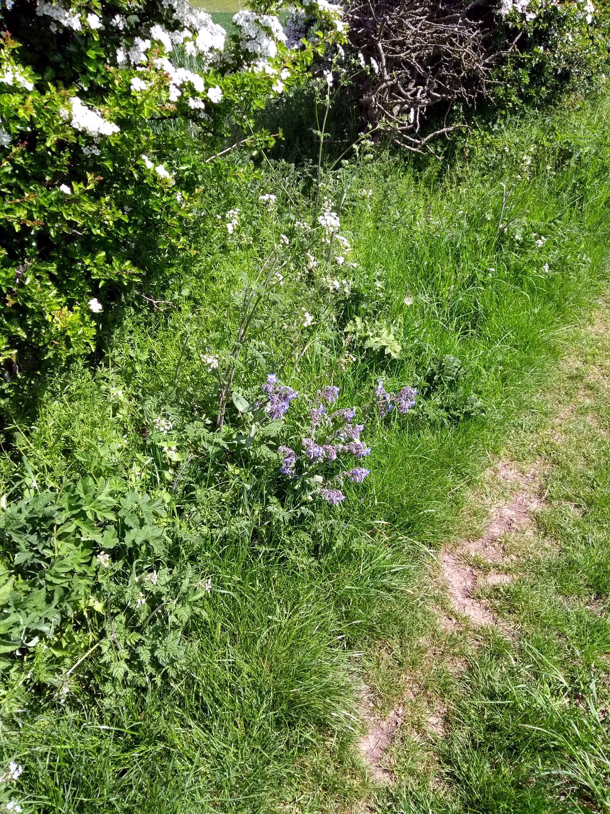
North of East Dale

Head of Swin Dale

Upper part of Swin Dale, looking north

Lower part of Swin Dale, looking west
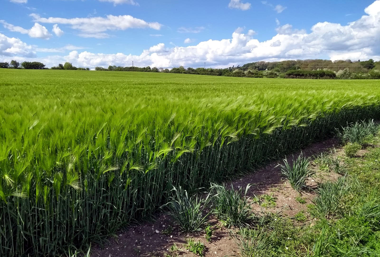
“…long fields of barley…”

Buttercups everywhere
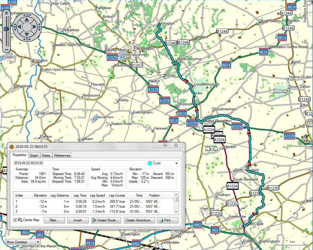
South Cave to Millington
A voice recording made in East Dale can be downloaded at:
https://app.box.com/s/yv092u5p1nzd8i8b1dzbn9mxp73q0amf
Two videos to show the day’s changing wind conditions can be downloaded at:
https://app.box.com/s/yqcsvbag1uojpwl1f0ydv42m2xhsqdhy
and
https://app.box.com/s/6s4czan5awm682ygmtrpq2ndeibnhw8e
A video taken looking west from the hill northwest of Nunburnholme can be downloaded at:
Restarting ***with track, voice and video***
May 20, 2019 § Leave a comment
That was a good rest, but like all rests it had to have an end. Today (Monday) I restarted, sensibly with a relatively short distance, the 17 kilometres out to South Cave. From there I bussed back to Hessle and my Airbnb.
I like variety in a walk, and the path I took from Hessle to South Cave certainly had that. It started in an established residential area near to the town centre of Hessle, it skirted large upmarket housing developments (with houses described as ‘finely crafted’ – presumably a synonym for ‘built’), it climbed relentlessly past a large and very visible chalk quarry, it crossed through woodlands reminiscent of the Kaiserstuhl, it switchbacked its way across downland, then finally it dropped past vineyards into South Cave village. The woodland section was for me the most impressive, particularly for the at times almost strident bird song. I went into David Attenborough mode and made some recordings. It reminded me of that day early on in the walk, the magically rural day from Amberley to Bucks Green.
Tomorrow I’ll bus out to South Cave and head north from there. More of the Yorkshire Wolds.

The Yorkshire Wolds Way leading down into Welton Dale

Above Brantingham

Hessle to South Cave
Two voice recordings made in the woods at the top of Welton Dale can be downloaded at:
https://app.box.com/s/x7jpdsimsw76w9vz90z7qg6mfynig2bc
and
https://app.box.com/s/iw3dnjcns2dzusbdte78xqse61xjypp4
Two voice recordings made on the roadside at Brantingham Church can be downloaded at:
https://app.box.com/s/v9cq87o6a9dhrxdzzbxd2hqbbi3ubic1
and
https://app.box.com/s/4af0pckj93duwne7wpeudsm00x6s5xyp
A video made in the woods at the top of Welton Dale can be downloaded at:
The rest day, with some assorted observations
May 19, 2019 § Leave a comment
So it’s Sunday, the day of rest. And for me this Sunday does mean rest. A lie in, a leisurely breakfast, a few telephone calls and texts, then a stroll down the road into the town centre of Hessle.
I’m now in South Yorkshire, where heels are high, skirts are short, and jeans are tight. I’m not complaining! It’s interesting though to compare the atmosphere here with that in Breisach, which has about the same number of inhabitants as Hessle but is surely more affluent. Here there are dozens of people out on the streets, young and old, there are shops that are open, there are pubs and cafes doing good business, and none of this is tourist driven. There is a genuine buzz.
Hessle was once a significant shipbuilding centre, and it has some historic buildings of note. One of these is All Saints Church, a Grade 1 listed building. I strolled past it and thought to look inside. It was locked, at 1315 on a Sunday! Perhaps I’ve misjudged Hessle: perhaps that buzz that I felt conceals the fact that there are gangs of thieves and vandals roaming the streets at lunchtime on Sundays. I think not. What we have here is evidence that the Church of England in this diocese has lost its way. Go back over the Humber to those villages with their little isolated churches, all of which have ‘Open’ notices outside; or go to the Shepherds’ Church at Pyecombe or St Mary’s at Newchurch. That is how it should be. How on earth can you be relevant to people when you lock them out?
Over the bridge ***with track, voice and video***
May 19, 2019 § Leave a comment
Yesterday evening (Friday) I’d had the problem of getting from Caistor to Barnetby. That was solved by bus and train. The reverse problem (of getting back to Caistor) wasn’t going to be nearly as easy. Yes, I could get a train into Grimsby and a bus back to Caistor, but this would mean either starting off from Barnetby at shortly after 6 or getting to Caistor at some time after 11. The solution turned out to be to book a taxi. Not a much more expensive solution either, because the train fare from Grimsby to Barnetby hadn’t been cheap.
I started off from Caistor at 0820, with another long day before me. Again it would be mostly along the Viking Way. I was going to try walking in the Trespass shoes I bought in Boston. This was because the Hoka shoes I’ve been using up to now as my principal pair are turning out to be a bit narrow. Either that or my feet are getting broader.
The section of the Viking Way from Caistor through to Barnetby was reminiscent of a section of it I’d walked previously. Nice countryside but unspectacular, with little villages and their churches. The exception was near Somerby, where sitting alone in the middle of a field was an extremely large stone column. Wikipedia describes it as follows. ‘The Monument was erected in 1770, and is an ashlar doric column topped by an urn. It was erected to commemorate 29 years of marriage for Edward and Ann Weston of Somerby Hall.’ All that for 29 years of marriage. I wonder what they did for their thirtieth.

Somerby, the ‘humble’ monument
I pushed on and reached Bigby. It was time for a break. Dave, who lives there, was standing at his gate talking to Ian, a cyclist. “No”, said Dave to me, “there isn’t a cafe here. The nearest one is two and a half miles away, in Barnetby. But would you like a drink?” So it’s coffee for me and the same for Ian. That really is a classic example of the very best side of this long distance walking thing – the splendidly generous people you meet. Thank you, Dave, and best wishes to you, Ian, on your Greenwich Meridian ride.
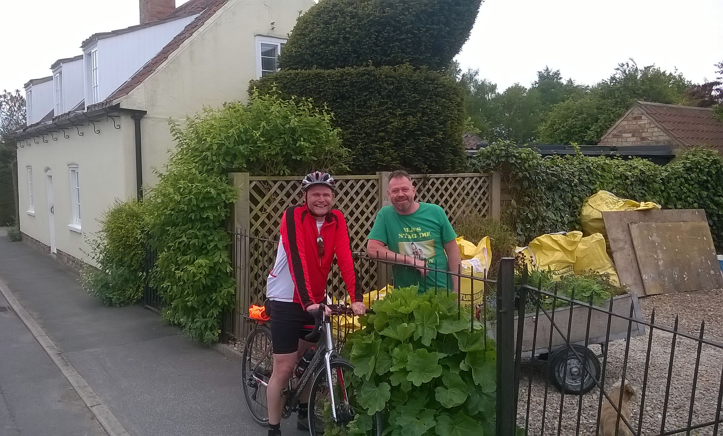
The splendid meeting in Bigby: Ian and Dave
I next reached Barnetby, passing the very spot where I’d waited for the taxi about three and a half hours earlier. That was an interesting feeling: on the one hand the speed and comfort of today’s transport, and on the other the chance contact with people such as Dave and Ian.
On then towards the Humber Bridge, still about 19 kilometres ahead. I trust you’ll forgive me if I skip over this bit, for it simply was a trudge. Finally I crossed the bridge. It’s a remarkably solid structure in comparison to the old Forth Road Bridge, which had given me so much pain four years ago. No problems this time.
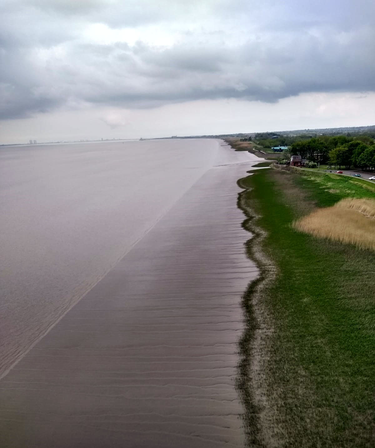
The Humber, with superbly developed tidal drainage rills
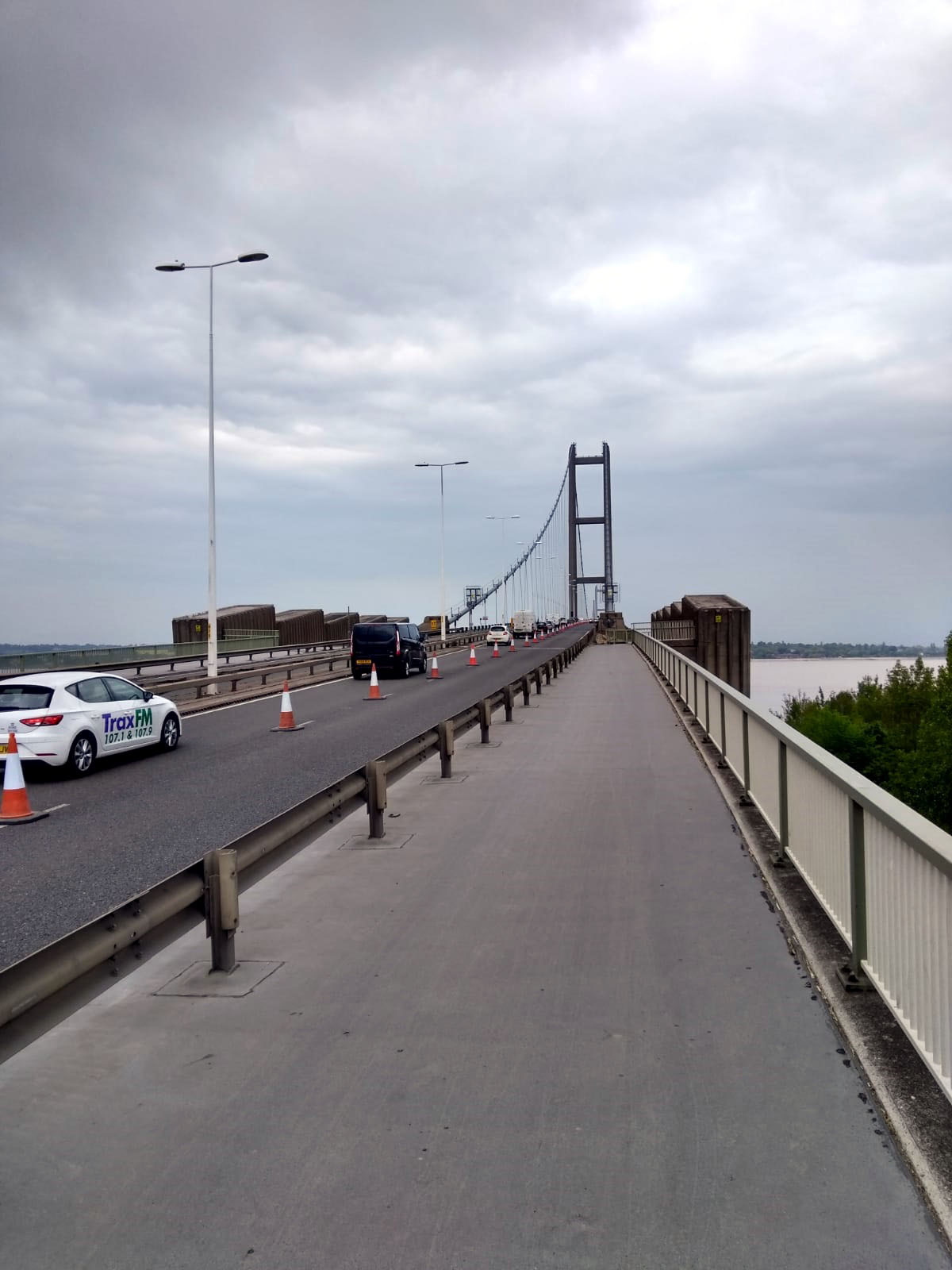
A very solid walkway!

Looking southeast from the Humber Bridge: flat, grey and brown

Looking northeast from the Humber Bridge: flat, grey and brown
Roan was waiting for me at the Airbnb. Tomorrow is a rest day. After 22 days of walking I need it.
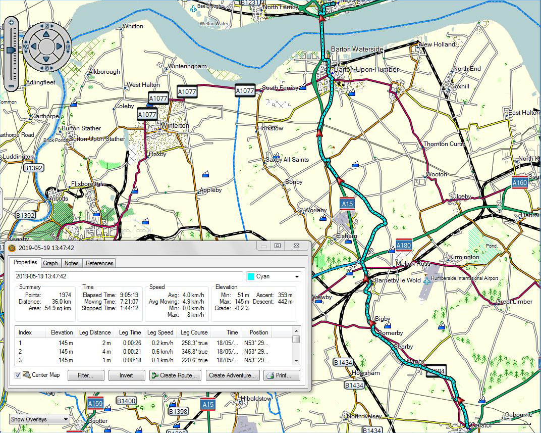
Caistor to Hessle
Two voice recordings can be downloaded at:
https://app.box.com/s/gbbuhb1guw4xeip7lxzq1lsio8iyz5vx
and
https://app.box.com/s/fsuco70ec5r911mmj8ii6npojo0e51eq
A video taken looking downriver from the Humber Bridge can be downloaded at:
A hard day ***with track and video***
May 19, 2019 § Leave a comment
I woke at about midnight to the sound of rain on the tent. Gentle rain, but still rain. This was worrying because the day ahead (Friday) was going to be a long one, and one that had a deadline to it. I didn’t want to have to do everything in waterproofs with a heavy wet tent in my backpack. Fortunately the sound of the rain sent me back to sleep.
I woke again a few hours later to the most magnificent dawn chorus – and to the realisation that it wasn’t raining any more and that the tent was dry. I still had the deadline to worry about, however, so I got up and broke camp immediately. Breakfast was bread and cheese and water.
It was one of those grey and overcast days that manage to make me walk without really noticing the places I’m walking through. Not that there was really much to miss, especially in the morning. The only exception was the tiny church tucked away in the wood at what I found out from an information board is the medieval village of Biscathorpe. What’s strange is that the church is obviously Victorian and the village was abandoned in the fourteenth century. Clearly someone had money to burn, as churches as elaborate as this tiny one wouldn’t ever have come cheap.

Church of St Helen, Biscathorpe, tucked into the woods
I walked on, following the Viking Way. Field followed field, track followed track, sometimes up and sometimes down, here a farm and there a village, and so it went on. Nothing particularly special. A good point, however, was that all of the villages seem to have pubs or cafes or shops. How pleasantly unusual! It could of course be that these are deliberately catering to walkers doing the Viking Way. Alternatively they could be the remains of a chain of pubs and cafes and shops that catered more than a thousand years ago to the itinerant Viking hordes. After all, you’d certainly need sustenance after all that pillaging and burning.
The final few kilometres were a slog. The paths through the fields seemed endless, and the herds of cattle didn’t help. Especially the one with the bull. However, I eventually got to Caistor in plenty of time to meet that deadline I’d been worried about. There was therefore time for sausage and mash at the White Hart before getting the bus to Grimsby.
Grimsby? Did my navigation fail me? No, I was due to overnight at Barnetby, not Caistor, and the only way to get there is via Grimsby. So Grimsby it was, with a pleasant conversation on the station and then the train to Barnetby.
A hard day.
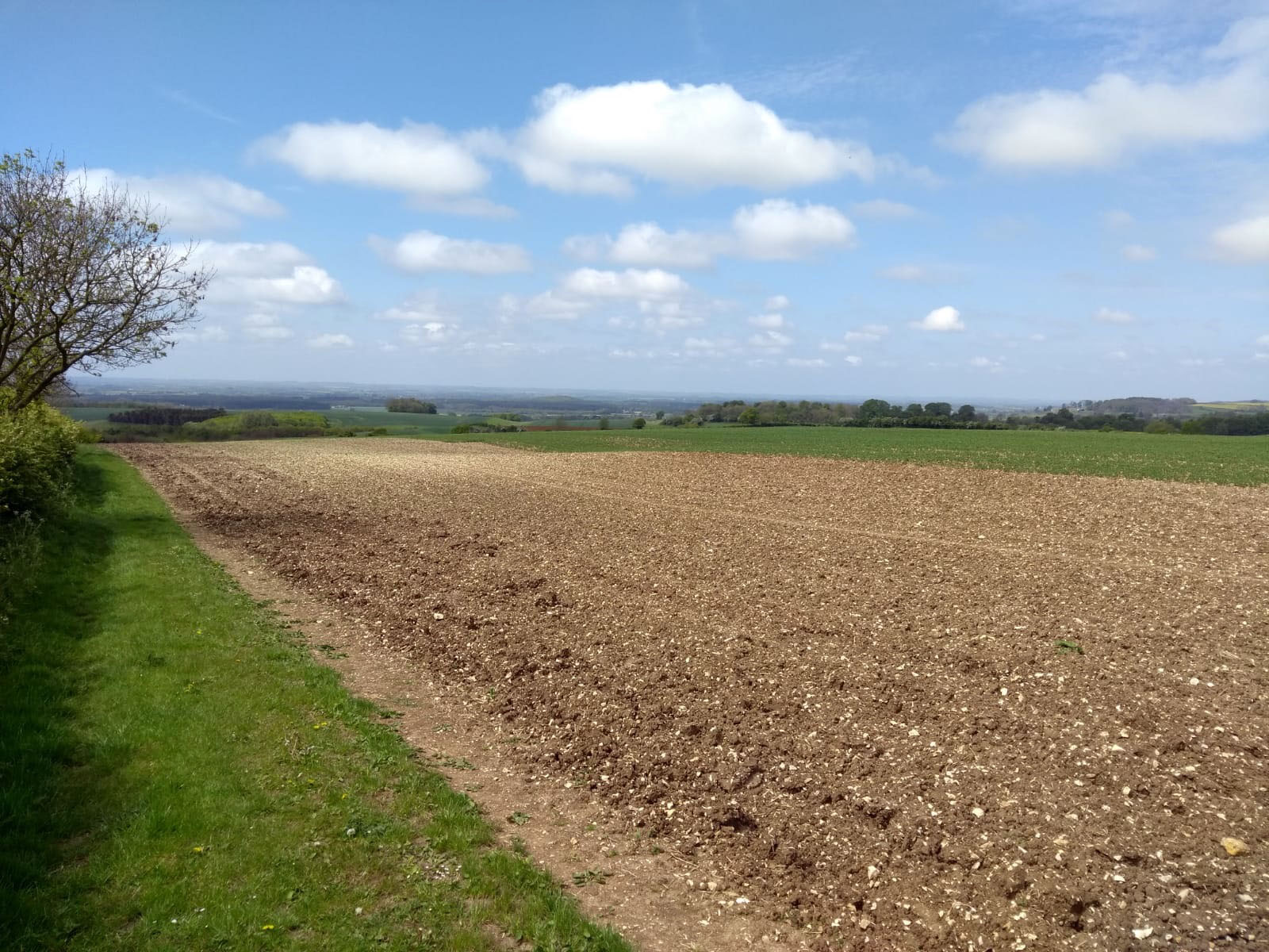
Lincolnshire Wolds landscape

Ford at Tealby
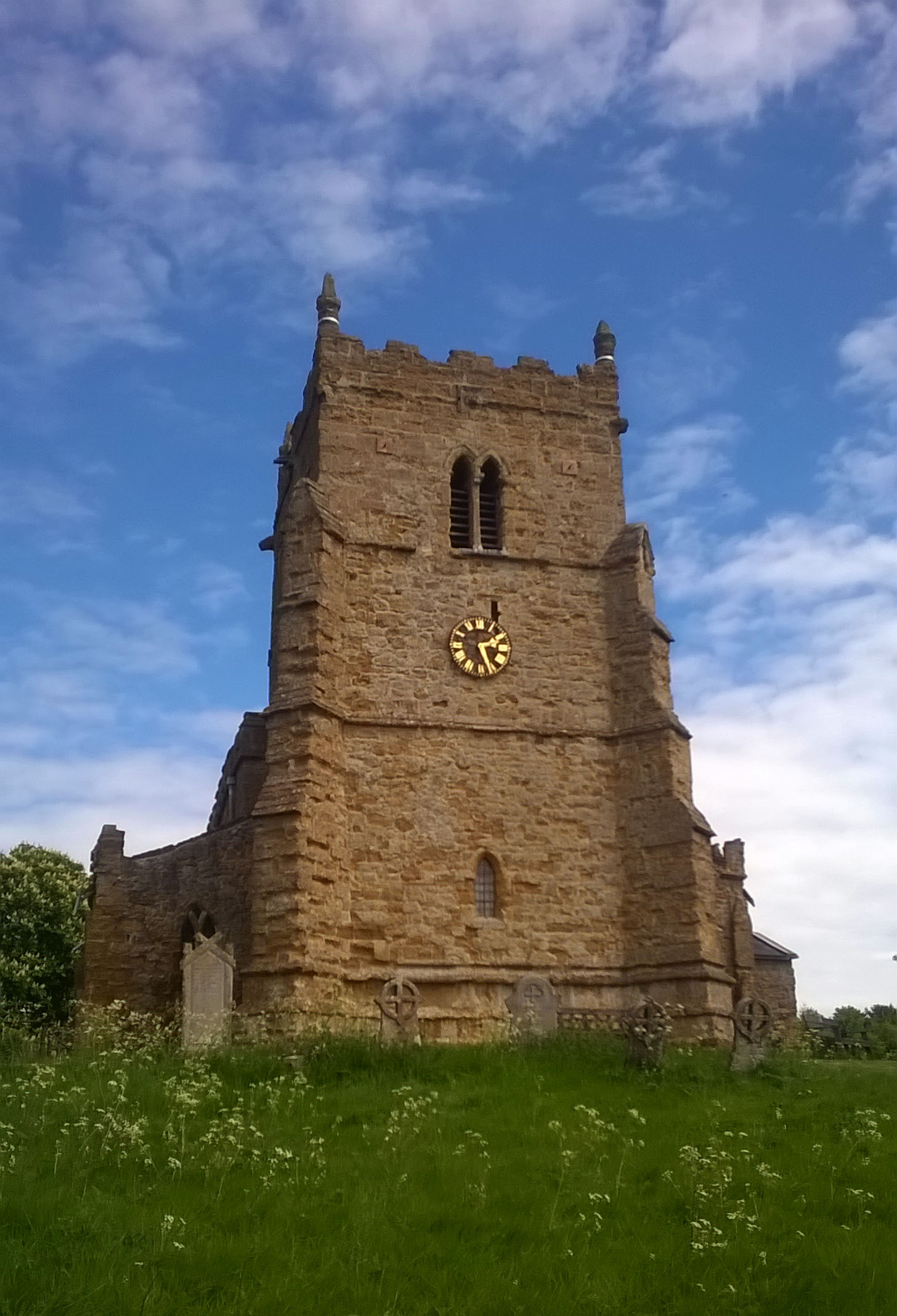
Walesby, the Ramblers’ Church
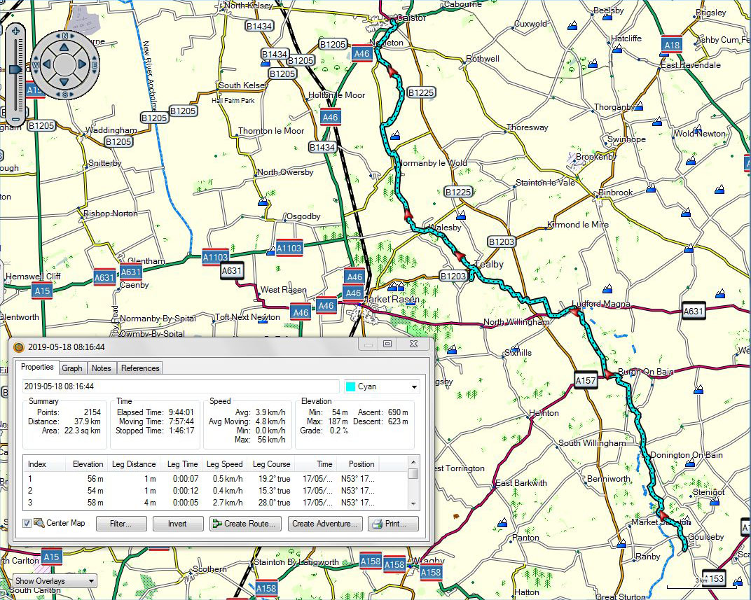
Goulceby to Caistor
A video looking west from the path can be downloaded at:
Whatever happened to Paddy Payne? ***with track and video***
May 18, 2019 § Leave a comment
You do remember Paddy Payne, don’t you? The Warrior of the Skies, with lines like, “Take that, you son of a sausage eater”, and “Bandits red five-zero. Got ’em, Skipper!”
Woodhall Spa and its immediate neighbourhood are steeped in WWII history. From the Dower House (the regimental HQ of one of the Airborne units prior to Arnhem), to the Dambuster cafe (where keeping the customer waiting has been developed into an art form), to the Lancaster Brasserie (where I had an excellent gammon steak with slices of tinned pineapple and a fried egg on top, all so sixties that it had me checking the menu for prawn cocktail and chicken-in-the-basket), the scent of the past is everywhere. I expected to hear at any moment the snarl of an open-topped MG driven by some dashingly handsome chap with a maroon silk scarf around his neck.
Everyday life in Woodhall Spa today is clearly very different. Chaps today don’t flourish maroon silk scarves and drive round in snarly MGs; instead they wear salmon pink cashmere sweaters and worry about their slices and hooks. That’s the impression I got as I walked out on the way to Horncastle. The path, which follows the track of the old Horncastle and Woodhall Junction Railway, passes right through the National Golf Centre. Fore!
Yesterday’s post (Wednesday) was centred on the unforeseen. That theme carried on today (Thursday). First there was another meeting with Chris and Sue, then there was one with four other LDWA members. Suddenly long distance walking seemed almost normal.
Time for a pot of tea in Horncastle, then further along the Viking Way. At last some gentle rising and falling, the southern edge of the Lincolnshire Wolds. Farming country again, but with a pleasantly natural feel.
And so it went on until at last I made it to my next campsite, at Goulceby. That was a long day, and I still haven’t found out what happened to Paddy Payne.
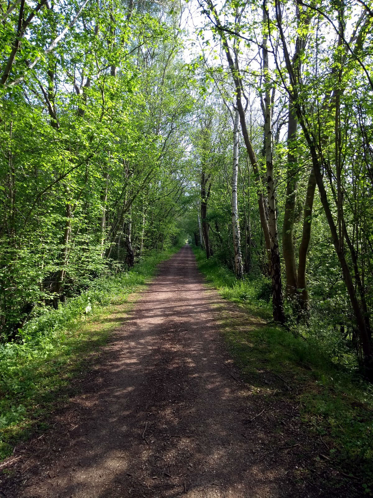
The Viking Way, northeast of Woodhall Spa

Meeting again! Chris and Sue on the Viking Way southwest of Horncastle

A first taste of the Lincolnshire Wolds, north of Horncastle
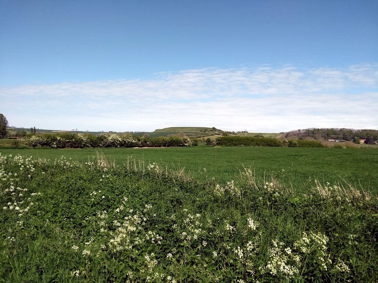
Between Horncastle and Goulceby. That looks suspiciously prehistoric to me!

Woodhall Spa to Goulceby
A video taken north of Horncastle can be downloaded at:
The unforeseen ***with track***
May 17, 2019 § Leave a comment
I suppose it had to happen eventually. One of my pairs of shoes (the old Roclites I’m using as backups) gave up the ghost. This was on my way to Boston. The first thing to do yesterday (Wednesday) was therefore to go into Boston to get a replacement pair. I opted for a pair of Trespass sneakers and will use them as backups only. And, yes, they don’t have red soles!
The result of this unforeseen shopping expedition was that I started off late on my way to Woodhall Spa. I took the footpath/cyclepath up the left bank of the Witham, expecting to cross the river at Langrick Bridge and then follow the cycleway along the roads to the bridge at Chapel Hill. All very boring, as well as being hard on the feet.
But what was this? A couple of walkers on the opposite bank, one of whom was carrying a map. Could it be that they knew of a footpath that I’d missed? We duly met up at Langrick Bridge, and yes there is a footpath along the right bank of the Witham right through to Chapel Hill. Thanks to this unforeseen meeting with Chris and Sue I avoided what would undoubtedly have been many kilometres of unpleasant roadside walking. What I got instead was the peace of a river bank.
Suddenly, however, this peace was shattered – and I do mean shattered! I was directly opposite RAF Coningsby and a Eurofighter was starting to practice its routine for an air show. Extremely fast and extremely maneuverable. Rolling, climbing, diving, looping, low level passing, upside down, accelerating, slowing. I stood and watched for ten minutes or more. My own private air show.
Eventually I reached my campsite at Woodhall Spa.

River Witham, between Langrick Bridge and Chapel Hill

Boston to Woodhall Spa
The rest of yesterday ***with track and voice***
May 15, 2019 § Leave a comment
The post about yesterday (Tuesday) finished with a thoroughly understandable rant about the vandalism that results when farms become agribusinesses. That rant covered the part of the day until I reached Fosdyke Bridge and crossed the Welland.
From then on things were different. Believe it or not, the reason for the change was none other than the Sea Bank! Not, however, the Sea Bank I had previously got to know. This was the old Sea Bank, built perhaps two hundred years ago and sitting now a distance from the present coastline, with farmland on each side. There is a footpath along the top of this old Bank, one that evidently is mown about twice a year. To judge by the height of the stinging nettles it’s due for mowing now!
Beautiful surprises on this path! A talented accordionist on a boat as I left Fosdyke Bridge; a kestrel flying out of the scrub no more than five metres ahead of me; another kestrel leaving a nesting box; an inquisitive fox; a bench exactly where I needed one. The difference between this old Bank and the modern one is that it is a living part of the countryside around. You feel it.
Eventually I reached Boston and found my B&B. It was a long and tiring day, especially as the sun had shone the whole time, but at least the better part had come at the end. Good memories.

The accordionist on his boat at Fosdyke Bridge
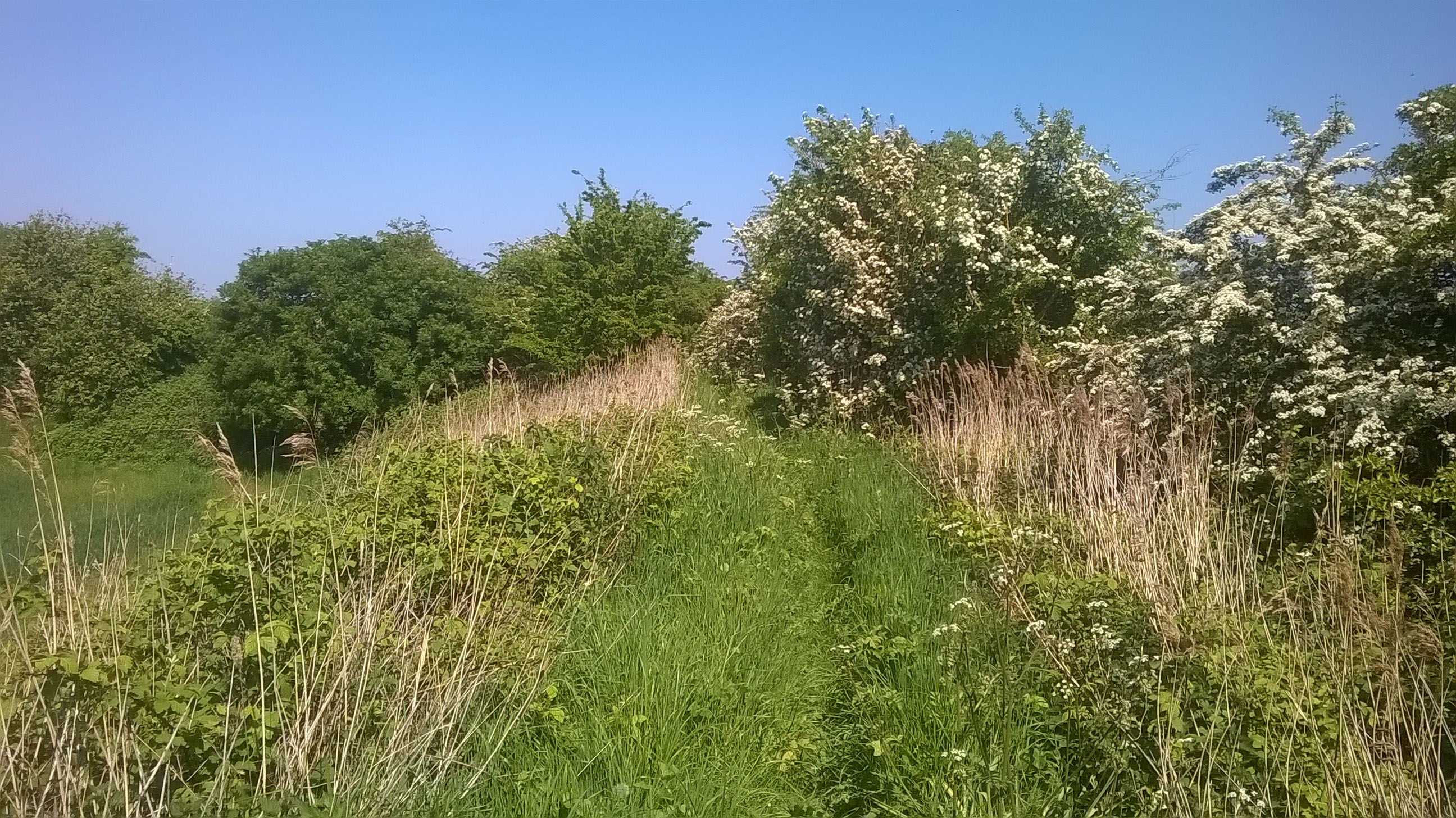
The path on the old Sea Bank north of Fosdyke Bridge

The path on the old Sea Bank north of Fosdyke Bridge
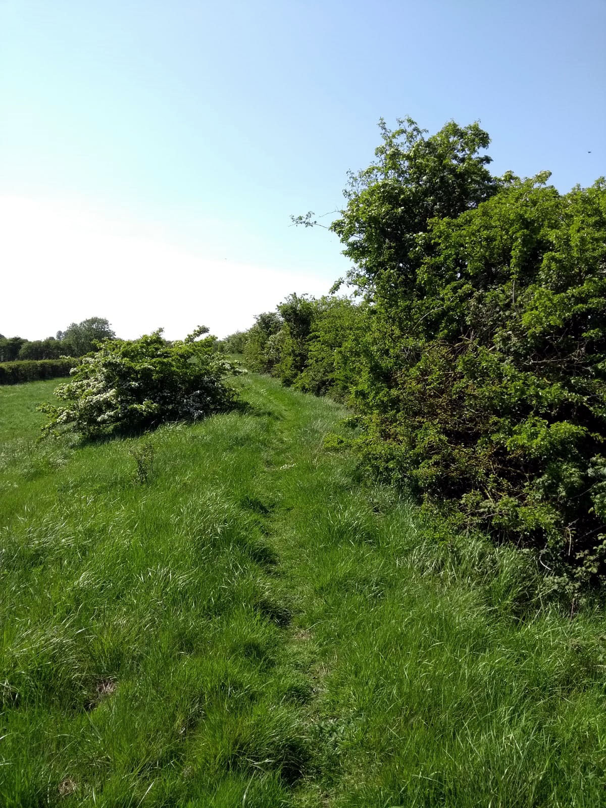
The old Sea Bank north of Fosdyke Bridge

Hawthorn, on the old Sea Bank north of Fosdyke Bridge

The old Sea Bank, now a natural part of the landscape

Holbeach Hurn to Boston
A voice recording of the accordionist can be downloaded at:
Two bouquets and a right royal brickbat ***with track, voice and video***
May 15, 2019 § Leave a comment
The first bouquet is for Helen, who hosts the Airbnb I stayed at for my two nights in King’s Lynn. I was looked after very well. A comfortable bed in a quiet house, lots of hot water in the shower, good breakfasts, a very central and convenient location, and always a friendly atmosphere. Thank you, Helen.
The second bouquet is for Dougie and the team at the campsite at Holbeach Hurn. The breakfast there was worth staying around for, just as I thought. I’d been told the previous evening that it would be available from 0900, which would have meant getting a rather late start. It would also have meant sitting around twiddling my thumbs for the best part of an hour as I’m generally ready to move off from a campsite by 0800. The long and the short of it was that I was indeed ready to move off at 0800 but decided to call in first at the bar (where the breakfast would be served) to see if there was any life. A good move, because the man doing the cleaning there immediately got me a coffee. Next the owner’s wife came in and told me I’d been the object of discussion among the locals the previous evening. (“How on earth is that great big guy going to fit into that teeny little tent?”). Then the owner himself came in. “I’ll get you your breakfast straight away.” Brilliant! A very well deserved bouquet.
My route onward from Holbeach Hurn was for the first part along roads. Why? Well there simply aren’t any footpaths until eventually you reach the coastal path along the Welland. This really is a horrible area. You start walking through it thinking of it as rural. You expect rural things – just as on that magic day in Sussex that started in Amberley. Then the realisation hits you that this countryside is industrial not rural. The farms are not farms, they’re agribusinesses. The fields are huge because huge is efficient. There are no hedges and trees and coverts because hedges and trees and coverts are inefficient. There are hardly any people about. The only birds are a few skylarks and pigeons. Otherwise it is empty. Notices tell you that tracks lead only to particular farms (‘Dodgy Farms Ltd’) and that access is available exclusively to ‘authorised persons’. The message is ‘This is a factory. Keep out!’
A brickbat is necessary, and it seems only right that this go to the head of an organisation that publicly vaunts its green credentials, yet clearly, from the roadside notices I saw here, is proud to be part of this vandalism – The Crown Estate. So, your majesty, here is a right royal brickbat for you. From your humble servant theendtoendblog.

Agribusiness
Holbeach Hurn to Boston
A voice recording can be downloaded at:
https://app.box.com/s/f4r08jbj3m7yyzgyznq6c5h0kp73pqdu
A video can be downloaded at:
I’m not sure what to call this post ***with track, voice and video***
May 13, 2019 § Leave a comment
There are times when you’re putting a blog post together under very difficult conditions. Sometimes it’s that you’re tired and desperate to crash. Sometimes it’s that it’s freezing cold and the fingers won’t type properly. Now I’ve found something even more extreme. I’ve had a rather frustrating day out in the sun, I’ve reached my campsite at Holbeach Hurn and pitched my tent, I’ve napped for about half an hour, I’m sitting at the bar in the campsite pub with a pint of John Smith’s, and now playing on the TV in front of me is ’20 Silly Songs of the 80s’. For instance, Ray Parker Jr, Divine, Musical Youth, Toni Basil, etc. Seriously strange stuff that is making coherent blogging very difficult indeed. I know you’ll understand.
In the last post I gave you the impression that there would be no more Sea Bank. Unfortunately that wasn’t to be. Today was more of it, starting out at Sutton Bridge and walking northwards along the west bank of the Nene. The story was the same as yesterday – flat, flat and more flat.
At lunchtime I was within striking distance of civilisation. A pub seemed a good idea. “Yes”, said the lady at the roadside, ” there’s a pub at the other end of the village. Oh, no, it doesn’t open on Mondays!” To be fair, that’s the first closed pub on Three Pierheads.
After a short break I headed back to the Bank. Red flags everywhere! It turns out that this part of the coast is a military target range. Fortunately the coastal path I was following is just outside the range boundary. There was therefore no danger of me being intercepted and marched away by a group of squaddies.
Finally I turned away from the Bank once more, heading inland towards my campsite at Holbeach Hurn. The route was not a particularly good one, the reason being that in the farming area inland of the Bank there are no good routes. The fields are very large, and they are commonly separated from each other by ditches. That means you are always forced to keep to the farmers’ preferred tracks. Normal public footpaths are a rarity. Walking here is tiring and at times frustrating.
Now the good news. The BBQ ribs were excellent and the campsite pub also does breakfasts.
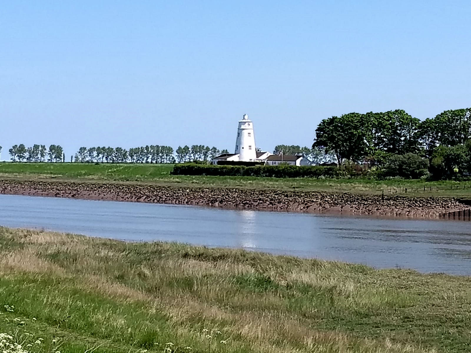
Peter Scott’s lighthouse, seen from the west bank of the Nene

Sutton Bridge to Holbeach Hurn
A voice recording can be downloaded at:
https://app.box.com/s/01d70nldrp7mr2uxxsbj96uhgkms9gt0
A video of another way of seeing the landscape can be downloaded at:
Something else I’ve now done enough of ***with track and videos***
May 13, 2019 § Leave a comment
After those 40 kilometres yesterday (Saturday) I definitely needed something shorter. How fortunate then that planned for today was simply a shortish stroll along the Peter Scott Walk from King’s Lynn to Sutton Bridge, followed by a bus ride back to King’s Lynn. Well that’s what it said in the book.
The Peter Scott Walk follows the Sea Bank around the coast. In winter it is evidently a mecca for bird watchers. Today there was only me. There were plenty of birds, of course, particularly egrets. These were shining a brilliant white in the sun.
The Sea Bank goes on, and it goes on, and it goes on! The land spreads out monotonously flat on both sides: cultivated farmland on the landward side and saltmarsh on the seaward side. You tend therefore to find yourself losing your sense of orientation. As I started out I could feel the Bank obviously leading me away from somewhere; then gradually that somewhere disappeared and I was simply being led. It was only when the lighthouses at the mouth of the Nene came into view, kilometres later, that I had the feeling of being led back to somewhere.
The final few kilometres into Sutton Bridge were on tarmac. I had half an hour to wait for the bus and a convenient riverside bar to wait in. The pint of Hen went down perfectly.
That was far from the shortish stroll I’d planned. Sea Bank? Been there, done that!

At the side of the Great Ouse
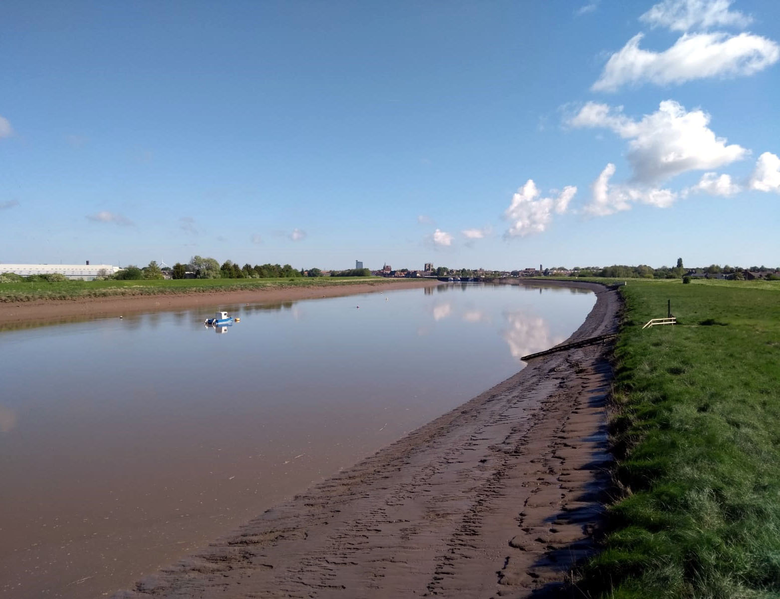
The Great Ouse, looking south from the Sea Bank back to King’s Lynn
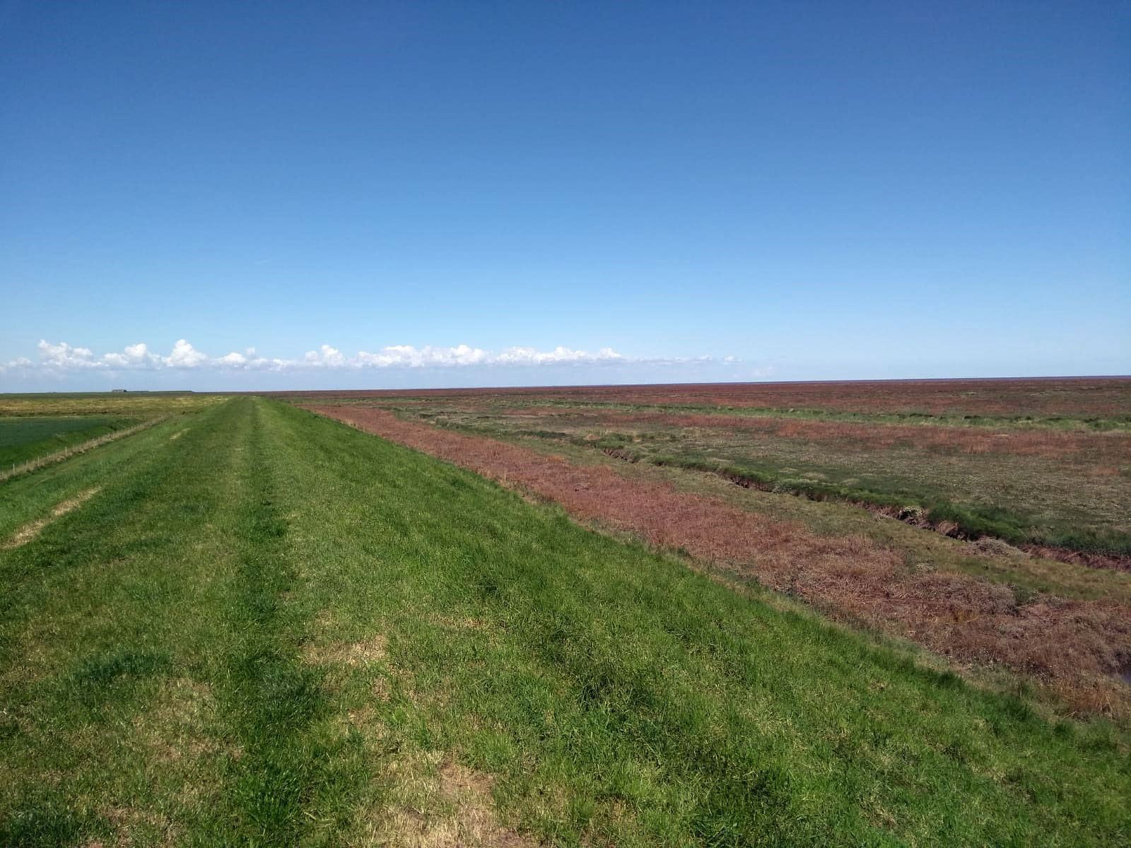
From the Sea Bank, looking out to sea

Peter Scott’s lighthouse, at the mouth of the Nene
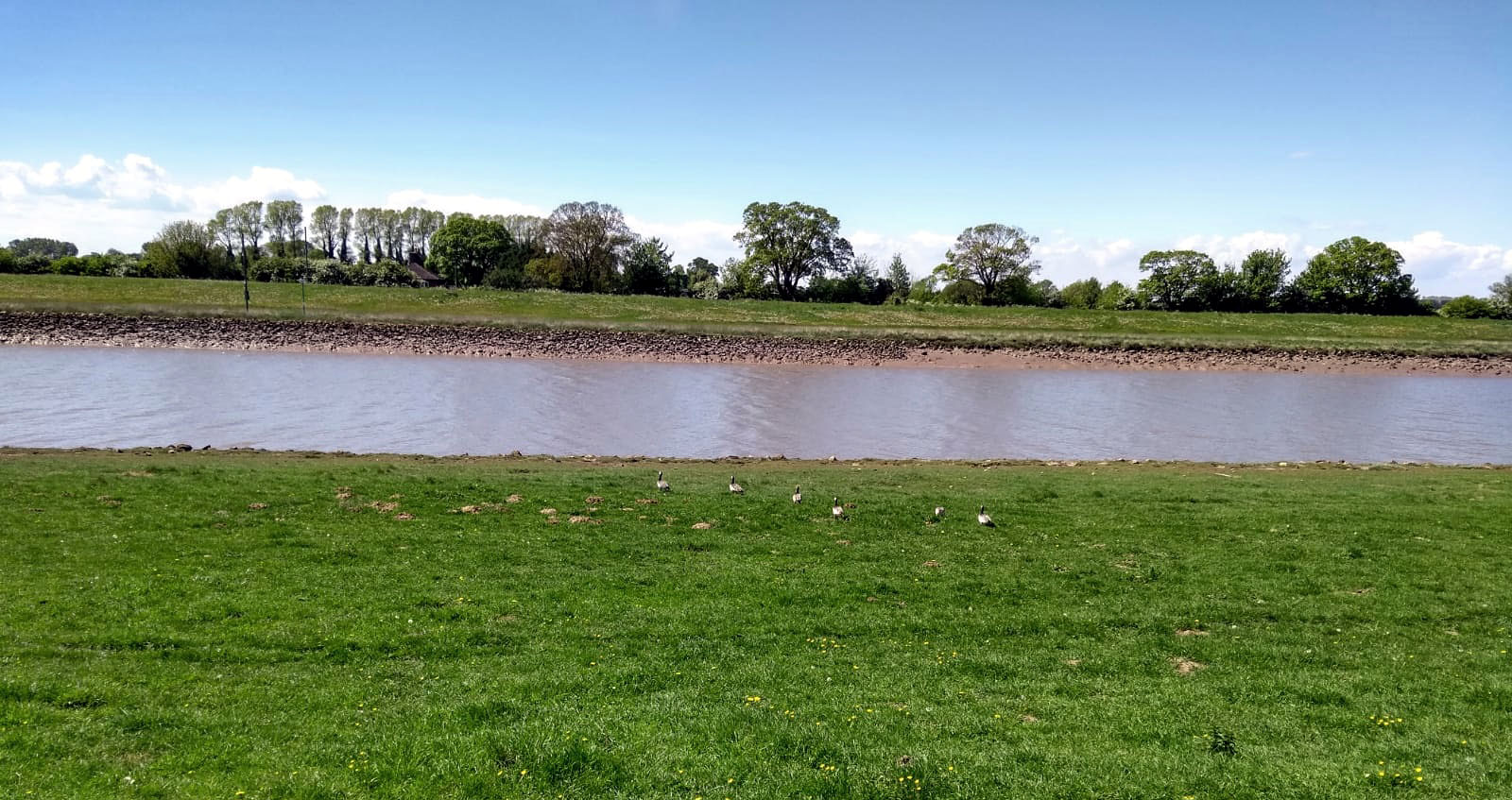
Looking westwards across the Nene, with the obligatory geese
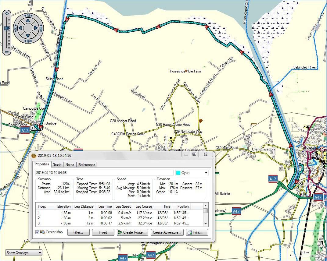
King’s Lynn to Sutton Bridge
A video shot from the Sea Bank near the mouth of the Great Ouse can be downloaded at:
https://app.box.com/s/2vvflm4tcre9s96d4o4irg3os1lrv77t
A video shot from the Sea Bank halfway along to the mouth of the Nene can be downloaded at:
https://app.box.com/s/qmciubje094ylog6biuo8py1pkgxmju4
Yes, those are indeed cliffs in the distance! They’re at Hunstanton, on the far side of The Wash.
A video shot from the Sea Bank even further along can be downloaded at:
https://app.box.com/s/80pt9dvskm735ajox7y15vu7ua30mu6y
Flat, oder?
A bouquet, a brickbat, and an extra long day ***with track and video***
May 12, 2019 § Leave a comment
The bouquet goes to Nolene, who hosts the Airbnb at Littleport in which I stayed. ‘Cosy little room with peaceful neighbourhood’ is the Airbnb description, but in fact the room isn’t little at all. Most importantly, the bed is comfortable and long enough to accommodate this walker. Add in the availability of a bath rather than just a shower and you have a splendid place to stop overnight. Thank you, Nolene, for accommodating me so well. I left Littleport relaxed and refreshed.
Which leads me immediately to the brickbat, for it was just as I left Littleport that I came across one of the most dangerous pieces of public footpath that I’ve ever encountered. You cross the Ouse and are then faced with walking about two kilometres along the A10, which there is seriously busy. There’s no footpath along the roadside, so you wonder, naturally, where the Fen Rivers Way has gone. The answer is that it’s along the top of the river dyke, thigh deep in soaking wet grass and cow parsley. Cambridgeshire County Council have been told several times that this path is unwalkable, yet they choose to do nothing about it. A brickbat is clearly in order.
The cynic in me suggests that the reason Cambridgeshire County Council ignores the state of the Fen Rivers Way north of Littleport is that it’s right at the edge of the county. It’s almost in Norfolk. Things get better almost immediately as you cross the county line: the path is on the dyke top and is mown, as it should be. (Having just reread that sentence, I realise it sounds American: “And I’m one step ahead of the shoe shine, two steps away from the county line.” Note, however, that it’s ‘dyke’ not ‘dike’!)
The walk along the Ouse was not visually memorable. It was also extra long – just over 40 km in total from Littleport to King’s Lynn. I think I’ve done enough fen rivers for now!

The obviously non-tidal Great Ouse, south of Ten Mile Bank

The Great Ouse, north of Downham Market
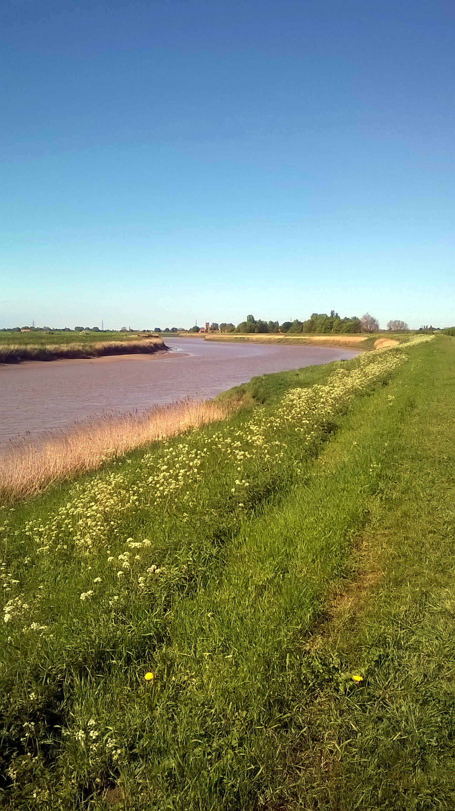
The now obviously tidal Great Ouse, immediately south of Wiggenhall St Peter

St Peter’s Church, Wiggenhall St Peter

St Peter’s Church, Wiggenhall St Peter

Littleport to King’s Lynn
Note added later, on returning home. Our Bavarian correspondent has written to remind theendtoendblog that we mustn’t ever confuse the Church of St Peter at Wiggenhall St Peter (http://www.norfolkchurches.co.uk/wiggenhallstpeter/wiggenhallstpeter.htm) with the Church of St Mary the Virgin at Wiggenhall St Mary (http://www.norfolkchurches.co.uk/wiggenhallstmary/wiggenhallstmary.htm) or the Church of St Mary Magdalene at Wiggenhall St Mary Magdalen (http://www.norfolkchurches.co.uk/magdalen/magdalen.htm) or the Church of St Germain at Wiggenhall St Germans (http://www.norfolkchurches.co.uk/wiggenhallstgermans/wiggenhallstgermans.htm). Obviously not! Thank you, Christian.
A video of – yes you’ve guessed – more of the fen countryside can be downloaded at:
The winning answers
May 12, 2019 § Leave a comment
1) The river is evidently the Lea, but I’ve started so I’ll finish…
“The battle of the River Lea took place in 895 between the English and Danes. A Viking sword believed to be of late 9th century date was recovered from the excavations for the Lockwood Reservoir in the old course of the River and may be associated with this battle. The primary sources are manuscripts of the Anglo-Saxon Chronicle:
‘Then that same year in early winter the Danes who were encamped on Mersea rowed their ships up the Thames and up the Lea … ‘, and
‘And in the same year the aforesaid army made a fortress by the Lea, 20 miles above London. Then afterwards in the summer a great part of the citizens and also of other people marched until they arrived at the fortress of the Danes, and there they were put to flight and four king’s thegns were slain. Then later, in the autumn, the king encamped in the vicinity of the borough while they were reaping their corn, and examined where the river could be obstructed, so that they could not bring the ships out. And then this was carried out: two fortresses were made on the two sides of the river. When they had just begun that work … the enemy perceived that they could not bring the ships out. Then they abandoned the ships and went overland … Then the English army rode after the enemy, and the men from London fetched the ships, and broke up all which they could not bring away, and brought to London those which were serviceable.’ ”
…phew!
2) The track was ‘Mash It Up Harry’ (https://www.youtube.com/watch?v=ErcvG2t8a7U) by the incomparable and late-lamented Ian Dury, and the character is Harry.
Thank you Roland. Your prize will shortly be winging its way to you.
The day after ***with track and videos***
May 12, 2019 § Leave a comment
The bare bones of yesterday’s walk (Friday) were as follows. Checked out of college. Caught bus to Waterbeach. Walked north along Fen Rivers Way. Reached Airbnb in Littleport. Needless to say, there was a lot more going on.
On leaving college I first went to the Post Office to send off the clothes I’d been wearing at the High Table dinner. I could of course have carried them with me for the remaining part of the walk, but a suit is not part of my normal dress code for walking. Perhaps it should be.
In Waterbeach my number one priority was to return the money I’d been given. I did so, and thanked the lady. She blushed with embarrassment. Obviously she hadn’t realised how kind she had been. What a wonderful person!
Next it was down to the Fen Rivers Way. This follows first the Cam and then the Ouse, finishing up at King’s Lynn. The section of it along to Ely can best be described as empty, flat and birdy. Empty because there was just me on it, flat because that’s what the fen landscape is, and birdy because there were birds to see and hear everywhere. This very amateur twitcher had the binoculars and the camera out regularly, particularly for the flocks of geese.
The flatness of the fens is emphasised wherever there is a building you can recognise from a distance, for instance the cathedral at Ely. This sat on my horizon, giving me a target to aim at. Then the target wasn’t there any more! What happened, and in a matter of only a few minutes, was that a savage little rain squall passed through. There is not a skerrick of protection for you then on the fens. You have simply to walk on through the wind and the rain. There is nothing else to do.
The sun came back out as I entered Ely. Clearly a pot of tea was called for. This duly arrived, accompanied by a wedge of carrot cake to keep that blood sugar level up! Then it was off again for the final leg of the day, the riverside path to Littleport.
I finished the day with a long hot bath, carry-out fish and chips, and a superbly comfortable bed. Excellent.

Fen landscape near Upware, with geese
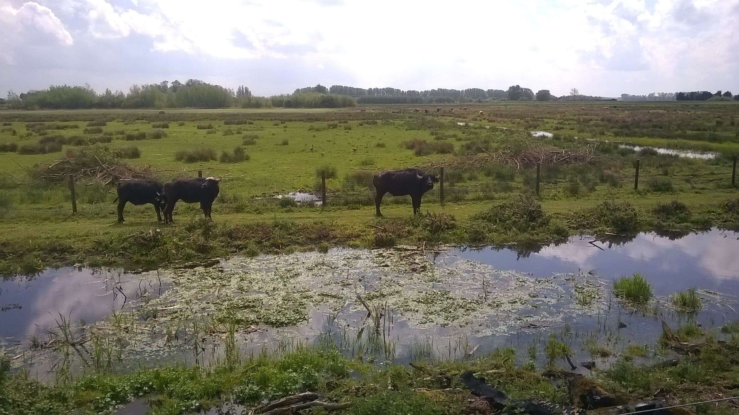
At Kingfishers Bridge Nature Reserve

Ely Cathedral on the far horizon
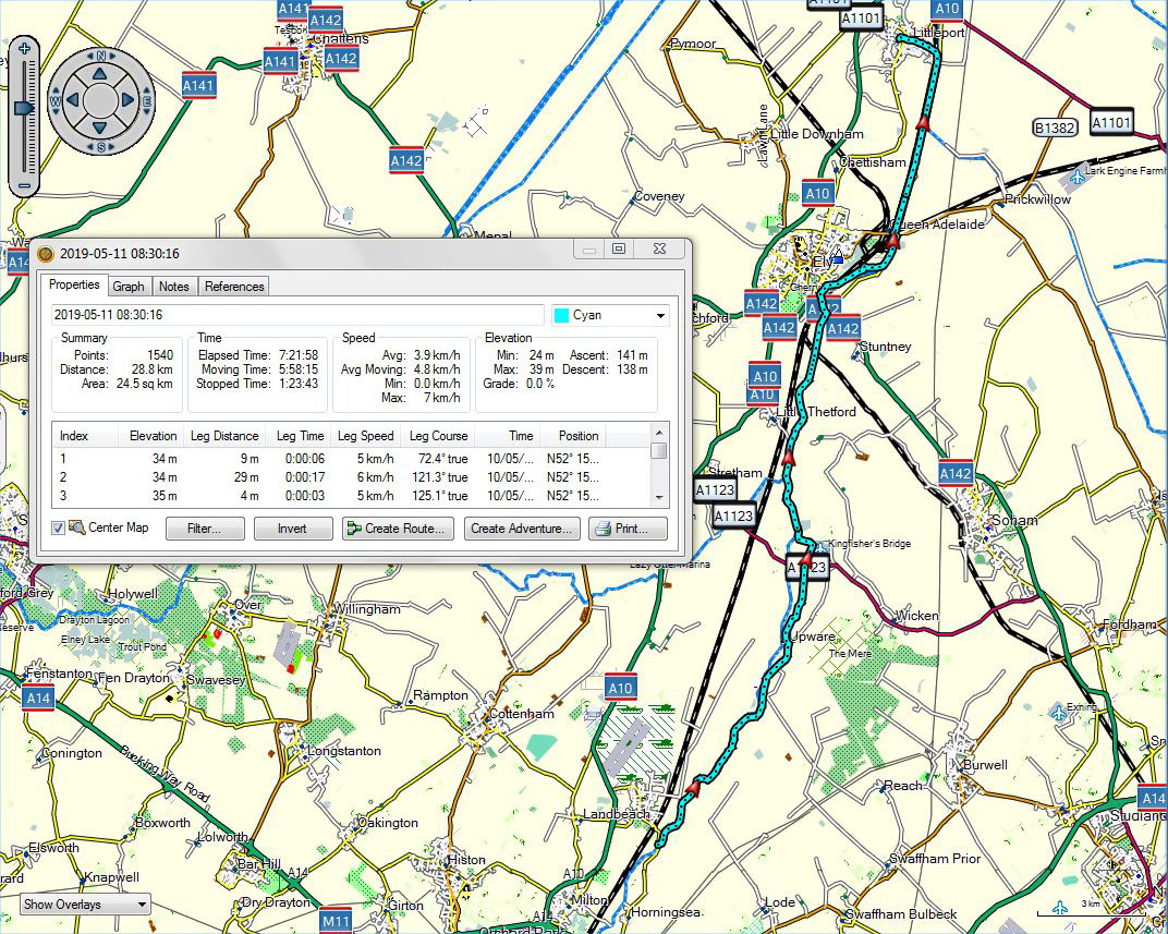
Waterbeach to Littleport
A video of the fen landscape near Upware can be downloaded at:
https://app.box.com/s/4d36fbohthg9zrloh65cpwavlwv4qfgq
Two videos showing geese flying at Kingfishers Bridge can be downloaded at:
https://app.box.com/s/fxozvxlhtpx3h9bhiqn9xc0g3u7z92d4
and
Unusual and unexpected ***with track***
May 9, 2019 § Leave a comment
When you’re looking back on a walk, or when you’re looking back on a particular walking day, how do you measure how memorable it was? For me there is just one question to answer. How unusual and unexpected were the events on it? Unusual and unexpected events are the spice of walking. Without them a walk is bland.
My stay here in Cambridge has let me dine for the very first time at High Table in college. (No, of course I didn’t turn up in walking clothes! I arranged that a suit and tie would be sent there for me.) I booked in for this dinner several months ago and was looking forward to it immensely. Then later I contacted Steve and he booked in too. What a marvellous evening it was. Two friends from a long time back enjoying all too briefly the very special hospitality of our college.
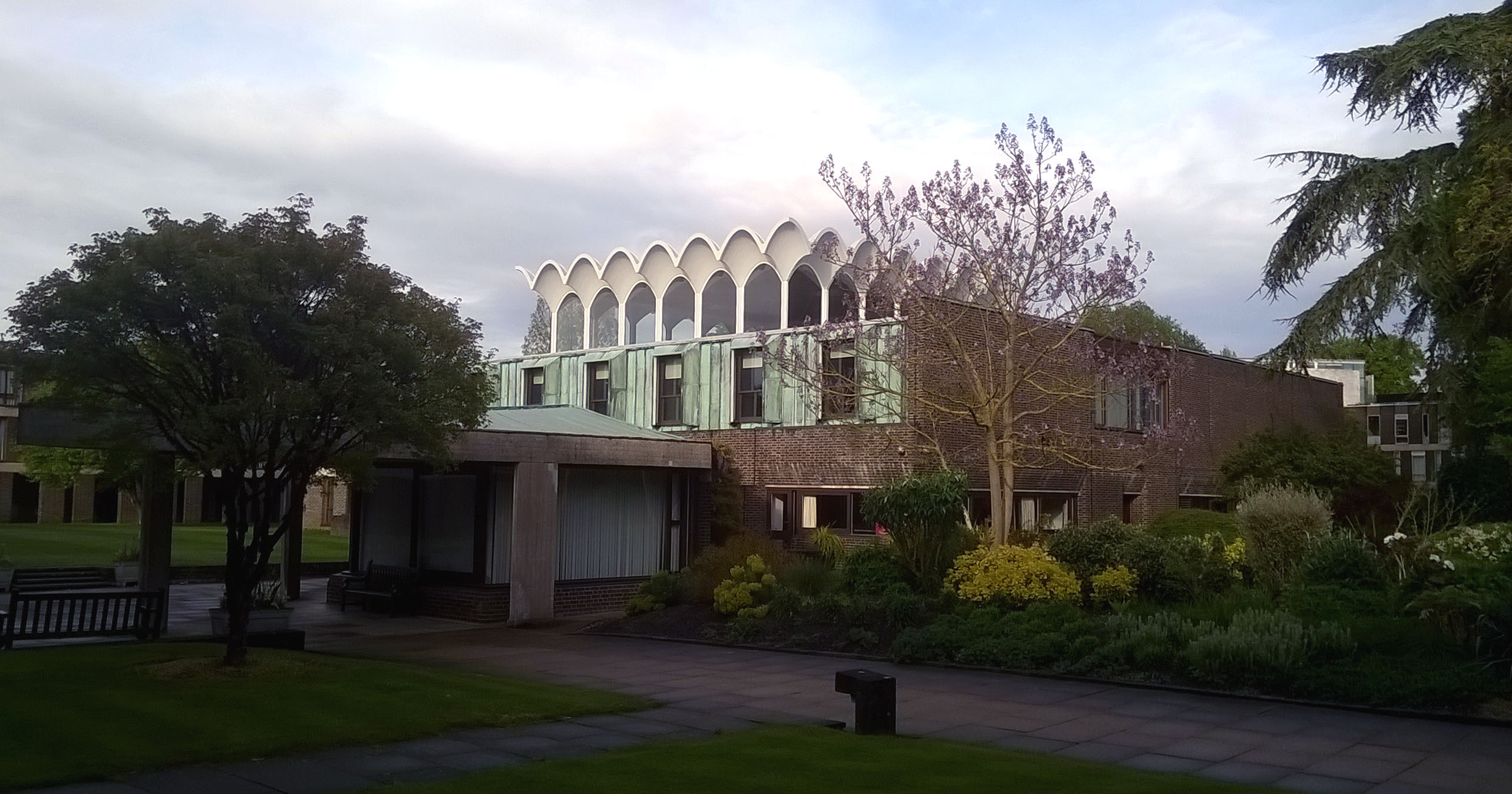
Fitzwilliam College. Lasdun’s hall roof.

My dinner companion
The following morning I walked out to Waterbeach, meeting David and Valerie on the way and joining them for lunch. Marvellous company as always.
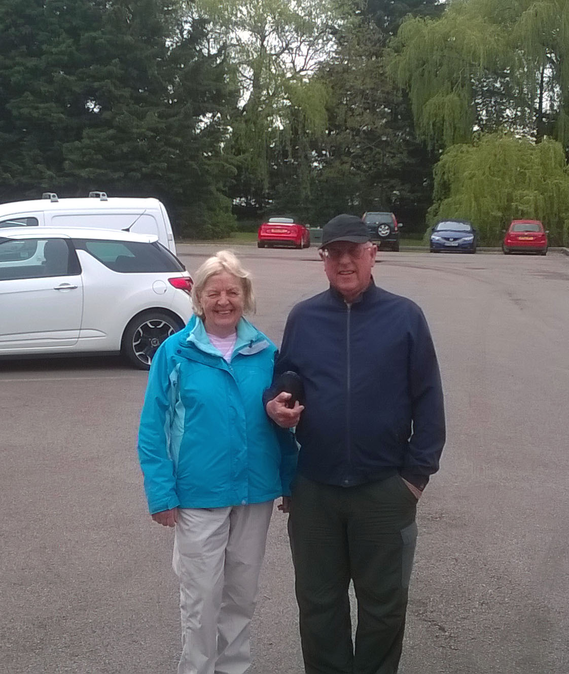
Once more!
Afterwards I went into the village store in Waterbeach to ask about bus times back to Cambridge and to get out some necessary money from the machine. “Sorry”, said the lady behind the counter, “but the machine doesn’t take credit cards. However, if you just need cash for the bus back to Cambridge I’ll give you some.” Yes, give! And she did. Ten pounds. Needless to say I’ll be going back to Waterbeach tomorrow to repay her.
That was a truly memorable evening followed by a truly memorable day. Thank you, Steve, for your company and for your logistic support. Thank you, David and Valerie, for joining me once more. And thank you, dear lady from Waterbeach, for your unbelievable humanity.

Cambridge to Waterbeach
The very necessary rain ***with track***
May 8, 2019 § Leave a comment
I woke this morning to find it raining – and I almost screamed with pleasure. It’s not often that rain makes this walker happy, believe me, but this time it did. The reason is that the fields are crying out for water. The earth is as hard as concrete.
Steve picked me up in college and drove me back to Shepreth. From there it was a straightforward walk through Barrington and Haslingfield to Grantchester, then along the river bank to Cambridge.
What a change from yesterday! Firstly, today’s walk was very much shorter; secondly, I was carrying only a day pack; thirdly, the paths were already softened by the rain and therefore far more comfortable. There was even a perfectly placed village store that provided me with a mug of coffee exactly when I needed one. The only thing I didn’t get right was my arrival in Grantchester. “Yet stands the church clock at twenty four minutes to one?” It doesn’t really scan, does it?

Yet stands the church clock…
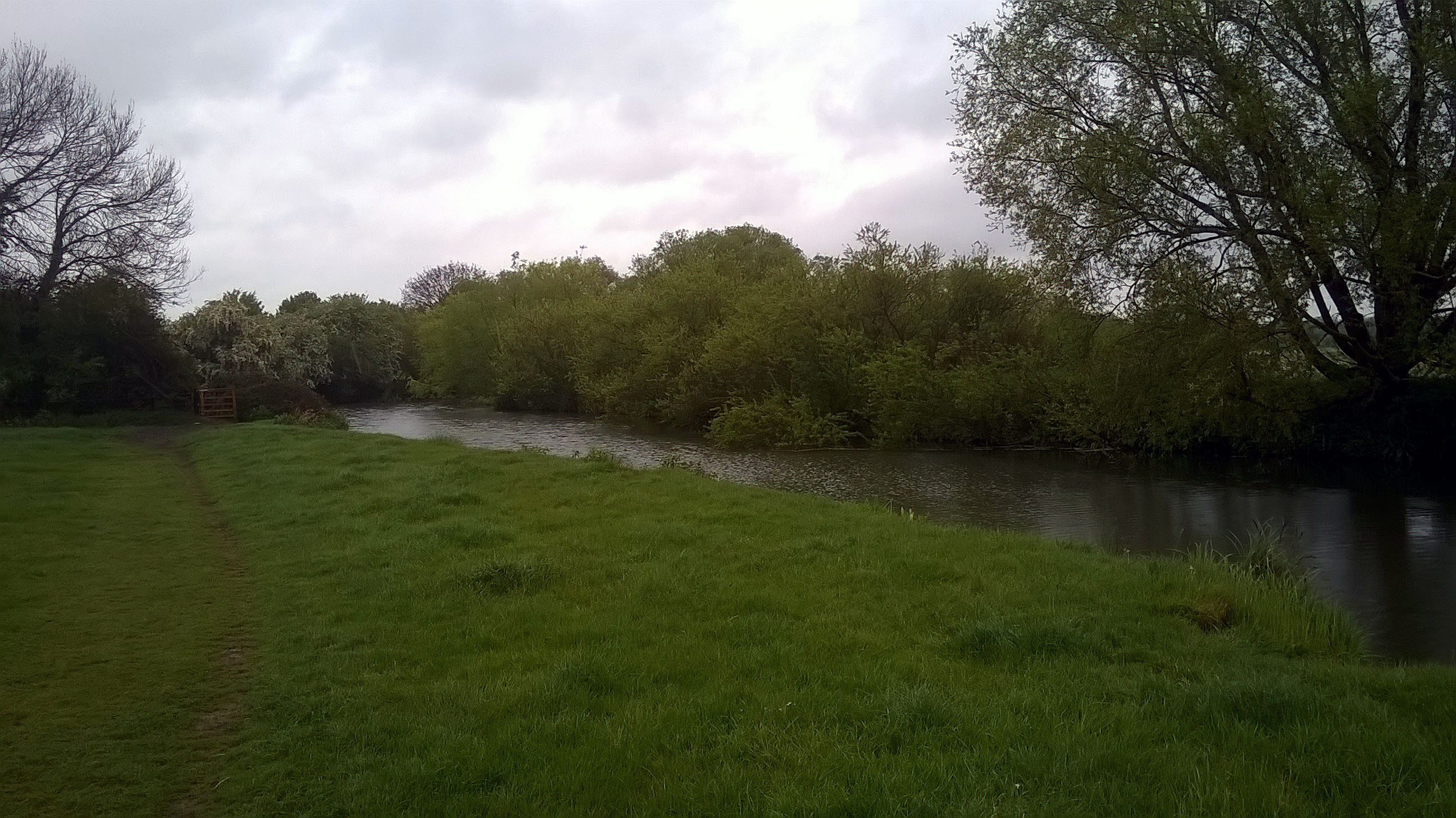
The Cam at Grantchester Meadows.

Shepreth to Cambridge
Long and unmemorable ***with track and voice***
May 8, 2019 § Leave a comment
The walk on Monday finished at a farm campsite just outside the small village of Ardeley. I was the only camper, the farm is big, and Ardeley is stuck out in the middle of nowhere. That should have been a recipe for a peaceful night’s sleep. There was just one small problem, namely that Ardeley turns out to be directly under the flight path into Luton Airport and not far from the flight path into Stanstead Airport. My little tent doesn’t do soundproofing, so it wasn’t the most peaceful of nights.
The campsite cafe produced a great ‘Full English’ for me the following morning (Tuesday), so I set off in good spirits nevertheless. That was just as well, because the route for the day was a succession of relatively unmemorable public footpaths, public bridleways, public byways and public restricted byways. What are the differences? Simply the categories of users. There is often no difference at all in the quality of the way.
My target for the day was Shepreth. From there I took the train to Cambridge, then walked to college and the comfort of a guest room. Tomorrow it’s back to Shepreth to restart.
That was a long day.

Tree in fields northwest of Ardeley

Back Lane – not Stane Street!

And this is officially a public byway! North of Cottered.
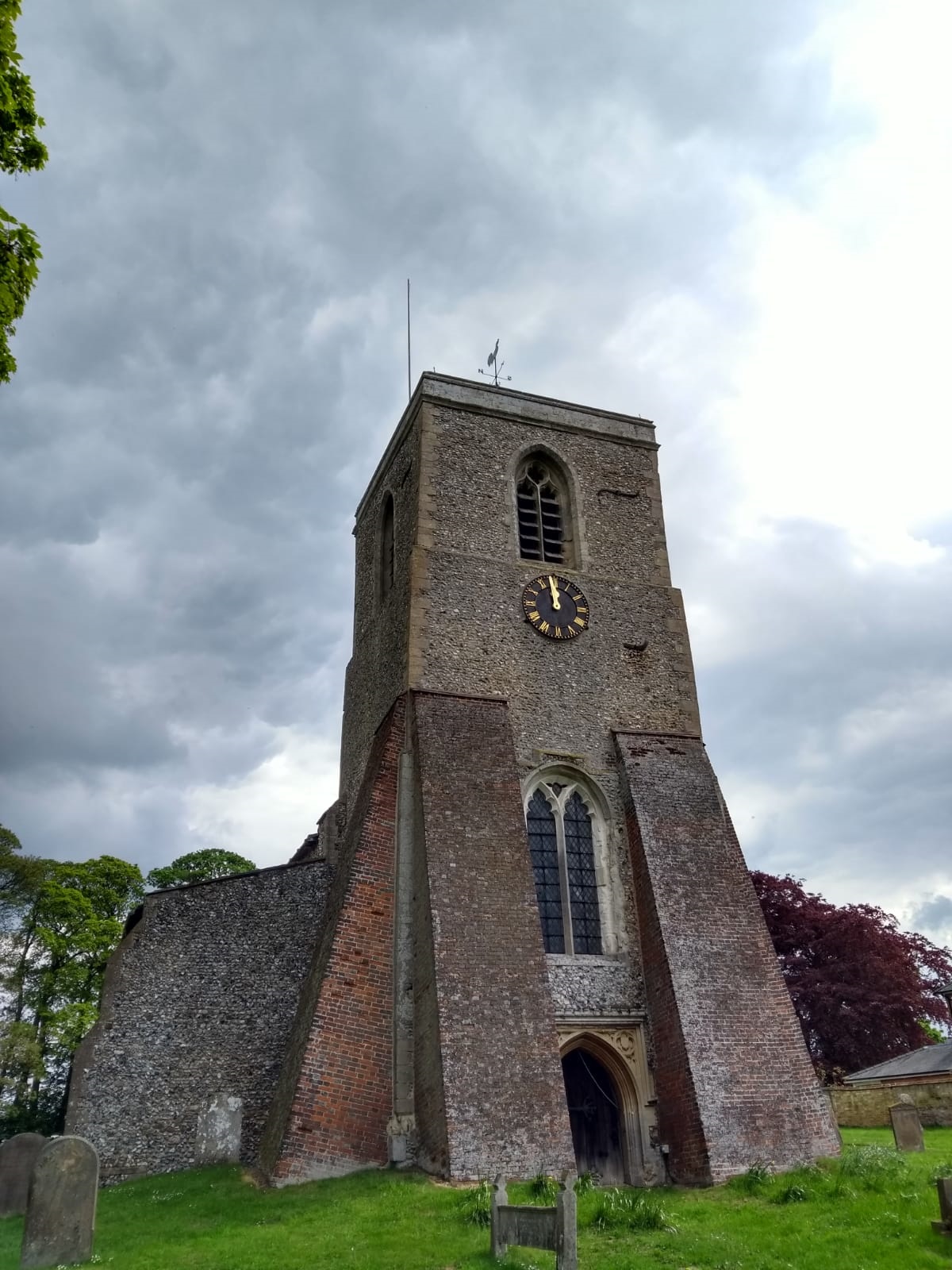
All Saints Church, Sandon. Now that’s what I call buttressed!
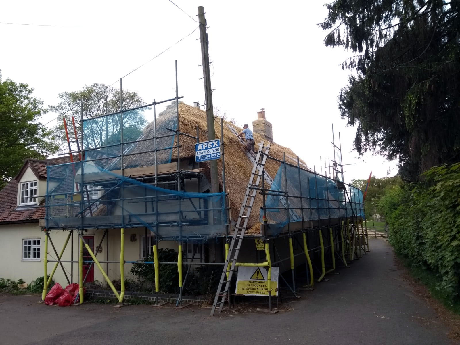
Thatcher at work in Therfield

Ardeley to Shepreth
A voice recording referring to Stane Street (which in fact turned out to be Back Lane) can be downloaded at:
Definitely not a pub quiz question ***with track***
May 8, 2019 § Leave a comment
It would be fair to say that I haven’t been inundated with answers to my second ‘pub quiz’ question. Obviously you’ve all got some work to do if you want to win the evening’s prize. I haven’t worked out yet what it’ll be, but you certainly won’t want to miss it.
Back to the Three Pierheads. Yesterday I miscalculated distances and speeds, with the result that I reached Cheshunt, my planned destination, at an absurdly early hour. I therefore compromised by walking on to Broxbourne, thereby shortening today’s leg. The route I’d planned to use from Broxbourne followed the Lea Valley Walk again, but I got sidetracked as I started by a sign promising me a river that was neither new nor a river. I was intrigued.
The New River is an aqueduct built more than 400 years ago to transport water from Hertfordshire to North London. It is still used today. What a difference both to a natural river and to a canal! No boats, of course, and a waterside path that is considered to be too narrow to allow cyclists. But still with all the water birds. A sort of walkers’ heaven.

The New River

The New River – obviously not for boats!
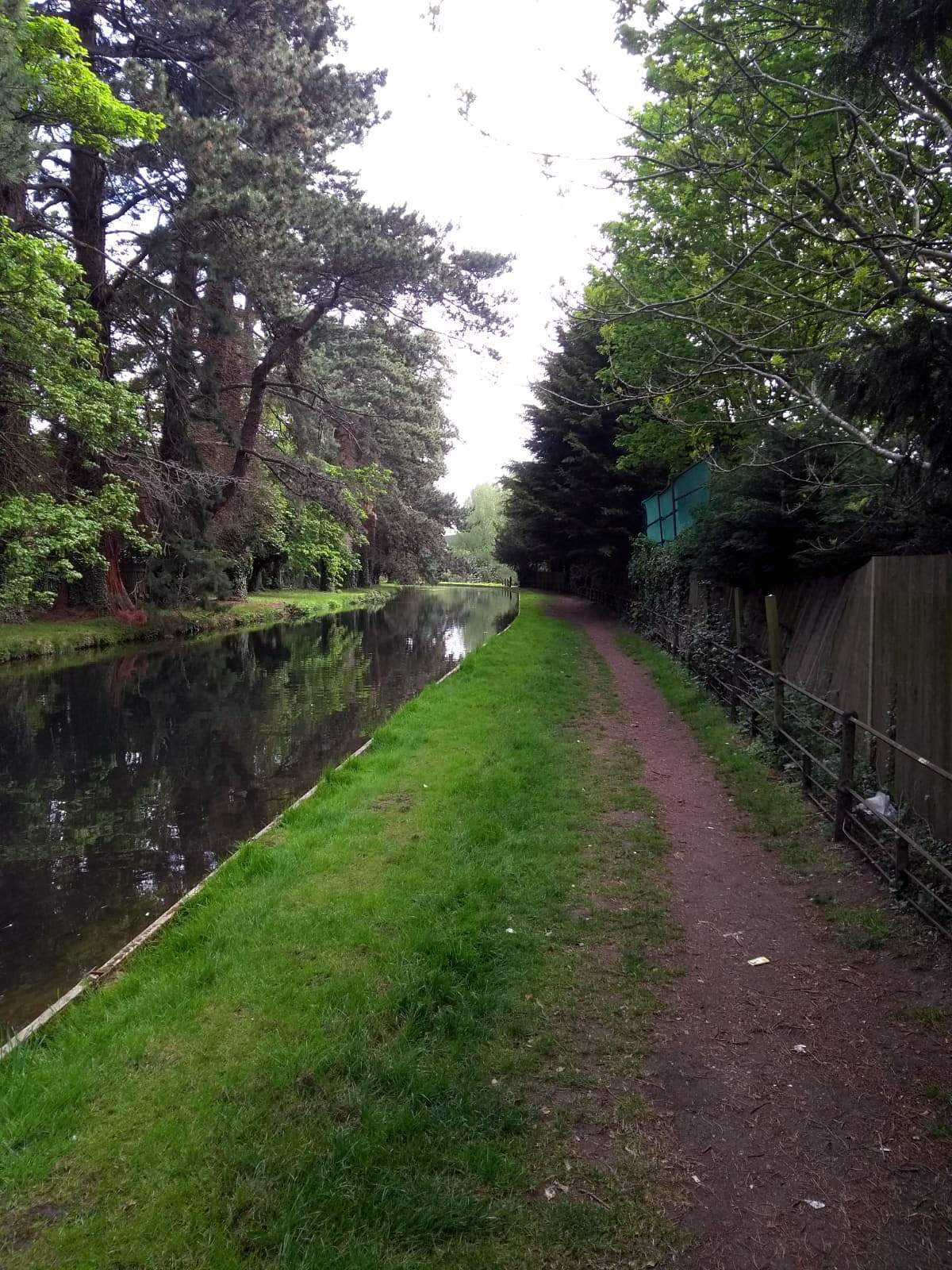
The New River
At Ware I left the New River Path. There was then several kilometres of road work to Wadesmill. After that it was (mostly) off-road walking right the way through to Ardeley, tonight’s destination.
The path through the fields northwest of Wadesmill follows what locals evidently call The Bourne. This is a steep-sided gully that in places is 20 metres across and up to 10 metres deep. It’s lined by trees and mostly difficult to see into. To some extent it is reminiscent of the Hohlwege on the Kaiserstuhl, but it is much longer and very much flatter. How did it form, and when? Man-made or natural? I’m still thinking about it, running through the various possibilities. So far I haven’t come across any explanation that completely convinces me.
This is definitely not a pub quiz question. What an excellent way to finish a day.

Looking down into The Bourne
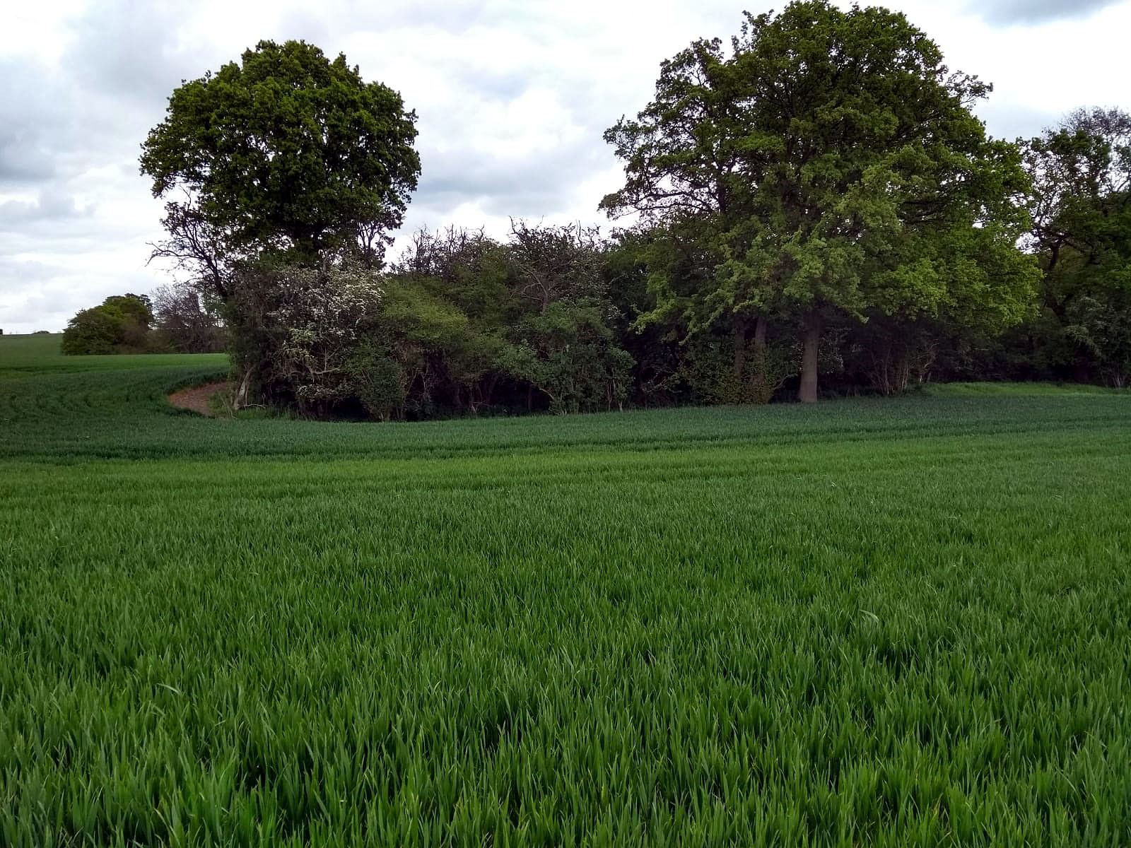
The Bourne (in the trees), looking northwest
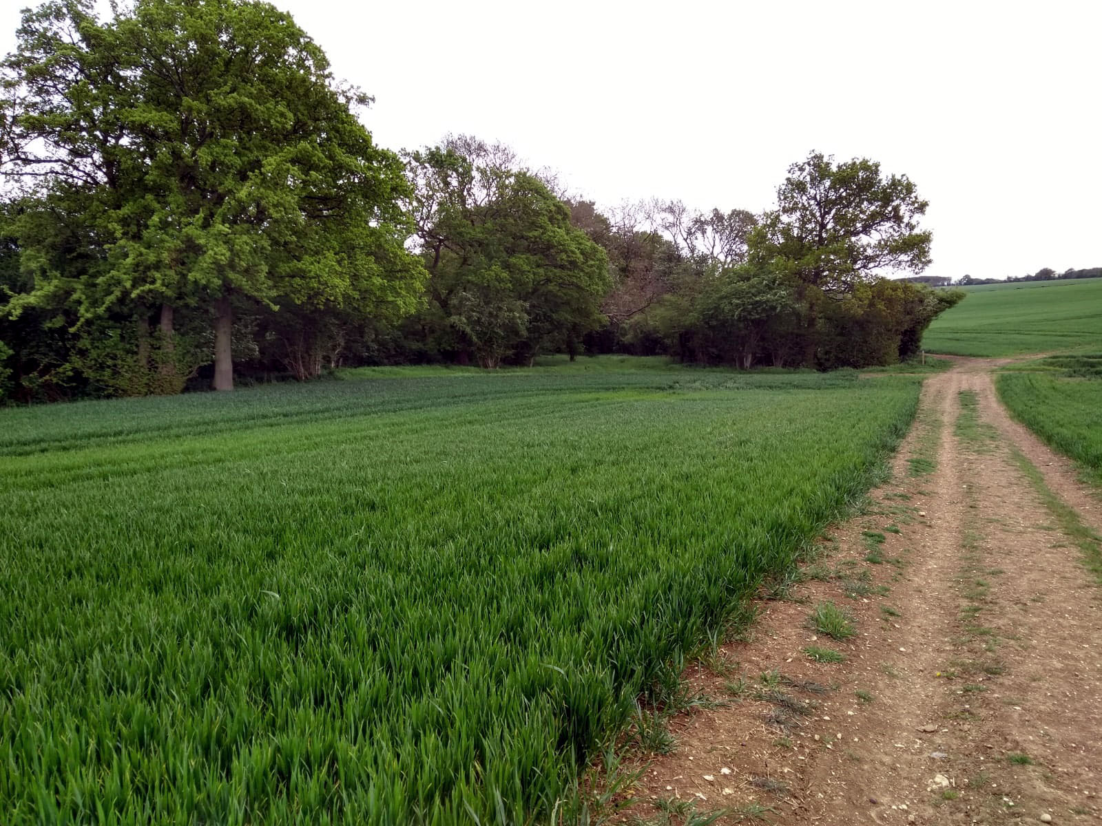
The Bourne (in the trees), looking southeast

Broxbourne to Ardeley
Two questions for your next pub quiz ***with track and video***
May 5, 2019 § Leave a comment
Today (Sunday) was also a navigationally straightforward one. It involved following the Lea Valley Walk from Hackney Wick to Broxbourne. A canal walk, with boats moored stem to stern for much of the way, with families and joggers and cyclists aplenty, with all of the obligatory water birds, and with coffee and carrot cake at the Lea Rowing Club cafe. All very satisfactory.
Now comes the first question. Sometimes it’s ‘Lea’ and sometimes it’s ‘Lee’. Which is correct? Well of course a pedant like me had to look this up when he was planning the walk. It appears that the river is Lee but the valley is Lea. All very curious, but at least there seems to be a rule. Now fast forward to today. There’s no rule at all! The Lee (river) can be Lee or Lea, depending on who’s been writing the sign – and it obviously doesn’t matter if the sign is an official one or not. The same goes for the Lea (valley). Evidently you take’s your pick.
I was pondering all of this when suddenly another sign came into view, with an arrow pointing to Ponders End. No, I’m not going to tell you that my pondering about Lee and Lea ended there. Instead I’m giving you the second question. In which track from which artist is reference made to Ponders End, and who is the character concerned?

Hedgerow at the side of the towpath

Hackney Wick to Broxbourne
A video of geese on the towpath can be downloaded at:
Through London ***with track, voice and video***
May 5, 2019 § Leave a comment
Yesterday (Saturday) saw me restarting along the Thames Path at Putney. There was a biting easterly wind, amplified wherever there were tall buildings for it to meet, for instance all those blocks of luxury executive apartments that now are such a Thames-side pestilence.
I headed ever further along the path, dodging the crowds of tourists wherever possible and eventually reaching the Millennium Bridge. I then crossed the river and headed into the City. This is where a part of my family comes from.
I wanted two photographs, of Wren churches. One of these had to be St Paul’s of course. The other was St Mary Somerset, of which only the tower remains. The contrast is extreme: the one still dominates the City skyline, the other is tucked in among new glass-fronted buildings. Both however have that same unmistakeable style and confidence.
I crossed through the City into Whitechapel, then out along the Mile End Road and the Bow Road. Finally I cut through to finish at the station at Hackney Wick.
I was glad to get back to Surbiton. It was a long cold day with long hard footpaths.
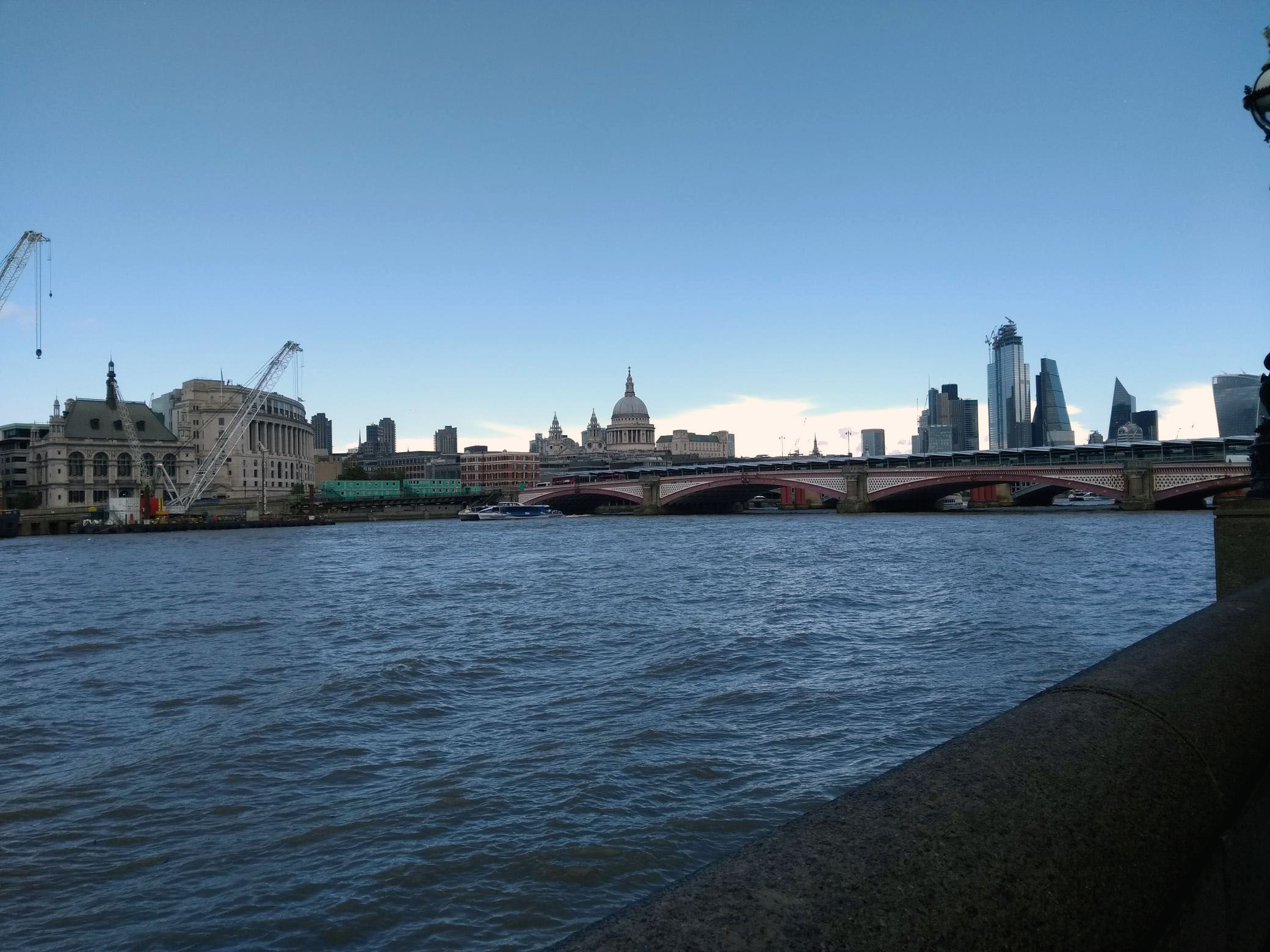
St Paul’s

St Mary Somerset
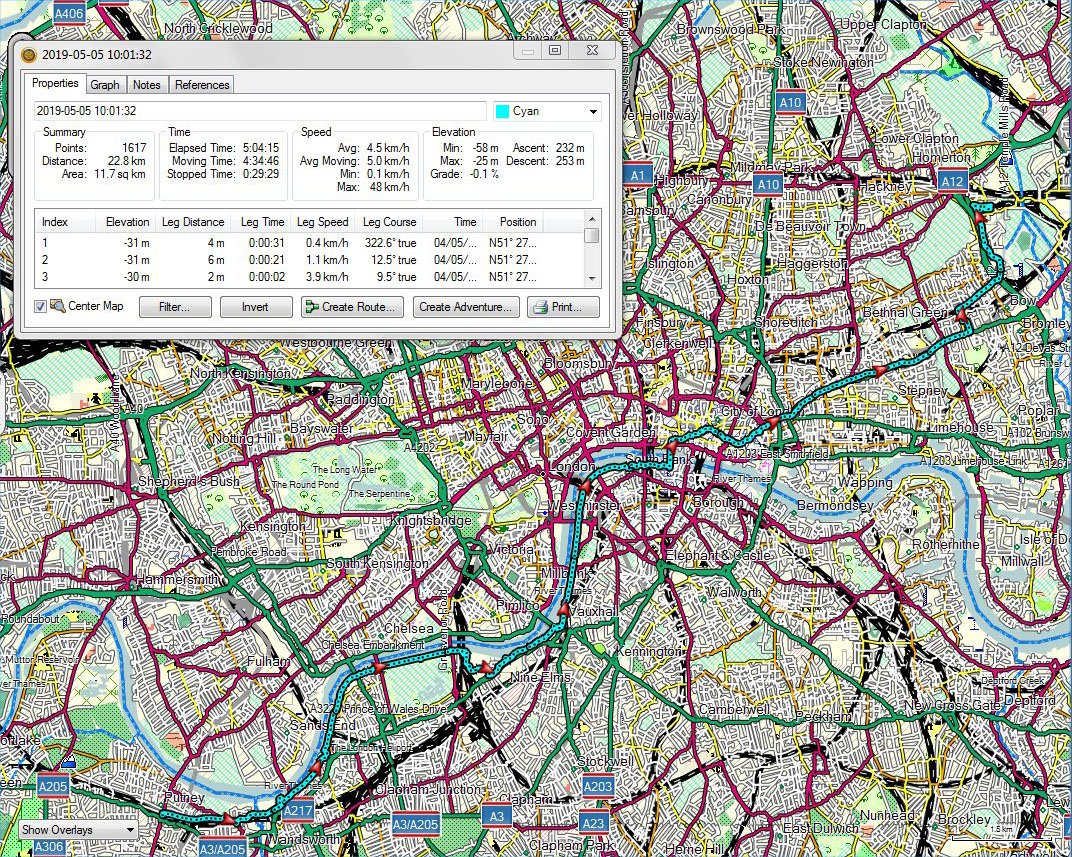
Putney to Hackney Wick
A voice recording made at the start of the day can be downloaded at:
https://app.box.com/s/jxro0wjxmqnhy2tyd142kq43czkl12jc
A video of geese in the churchyard of St Mary’s, Battersea, can be downloaded at:
Riverside walking ***with track, voice and videos***
May 5, 2019 § Leave a comment
Thursday’s walk finished at the Airbnb that Flicka and I are using in Surbiton. Then it was off down the road for an evening with John and Mell and Frankie.
The following day (Friday) was about as navigationally straightforward as a walking day ever could be: from Surbiton to the Thames at Kingston, then along the Thames Path to Putney. From there it was simply a case of getting the train back to Surbiton.
Riverside walking is something I enjoy. There is nevertheless riverside walking and riverside walking. The first is where the river is still some sort of normal natural phenomenon – like a hill or a wood. The second is where the river has been tamed. The Thames has been fully tamed in its lower parts. Its course is fixed. Its bounds are set by the places on its banks, many of which are now standard tourist destinations. The Thames Path is therefore nothing more than a linking together of these places, with a river at its side. Despite that it is a pleasant path to walk, especially because, at least on the stretch from Kingston to Putney, it is well served with watering holes. The riverside walker does need these.

Style

Des. res., with adjacent pub
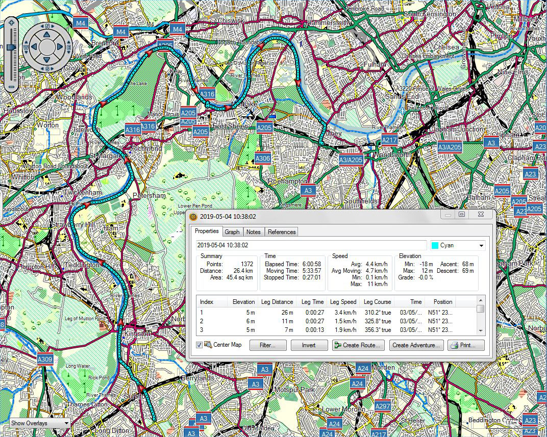
Surbiton to Putney
A voice recording made at the start of the day can be downloaded at:
https://app.box.com/s/z8tmzk72roj3tr9br5kq29ep9nk6rhme
A video of the peaceful riverside environment near Kew can be downloaded at:
https://app.box.com/s/6tmds8w83r45by3ejw1cchu9rdmxemk5
Two videos for the oarspeople among us can be downloaded at:
https://app.box.com/s/n34dlqofz7tyhbswd4rdvc5k5pu1z55i
and
A legionary’s perspective ***with track***
May 2, 2019 § Leave a comment
Tanners Hatch hostel is nestled in the North Downs. It’s secluded and still and evokes a feeling of the past. Leaving it I headed inevitably back into the present. Not for long, however, as I found that the path leading me up and around Box Hill was Stane Street – that same Roman road I had climbed along on the way to Amberley and that I had been carried along twice in the bus between Bucks Green and Horsham. (And if anyone is saying ‘Bus?’, yes it was, but only to get from and to Bucks Green at the end of a day and the beginning of the next. There’s no cheating on theendtoendblog!)
Anyway, there was this intrepid Roman legionary, half way from Chichester to London, marching along quietly minding his own business, when suddenly he hears, “Excuse me, but could you pass me my ball?” “Haltus quickus”, yells the centurion, and there, right in front of the column is this small spherical white object. And leaning over the fence is a native, clad in the obligatory native garb and clasping in his hand what appears to be a weapon of war – a stick-like thing with a curved metal end. “This is Tyrrells Green Golf Course”, he says.
The day as a whole wasn’t a memorable one. Simply a few less forgettable interludes in a sequence of ever more suburban experiences. More about some of those later.
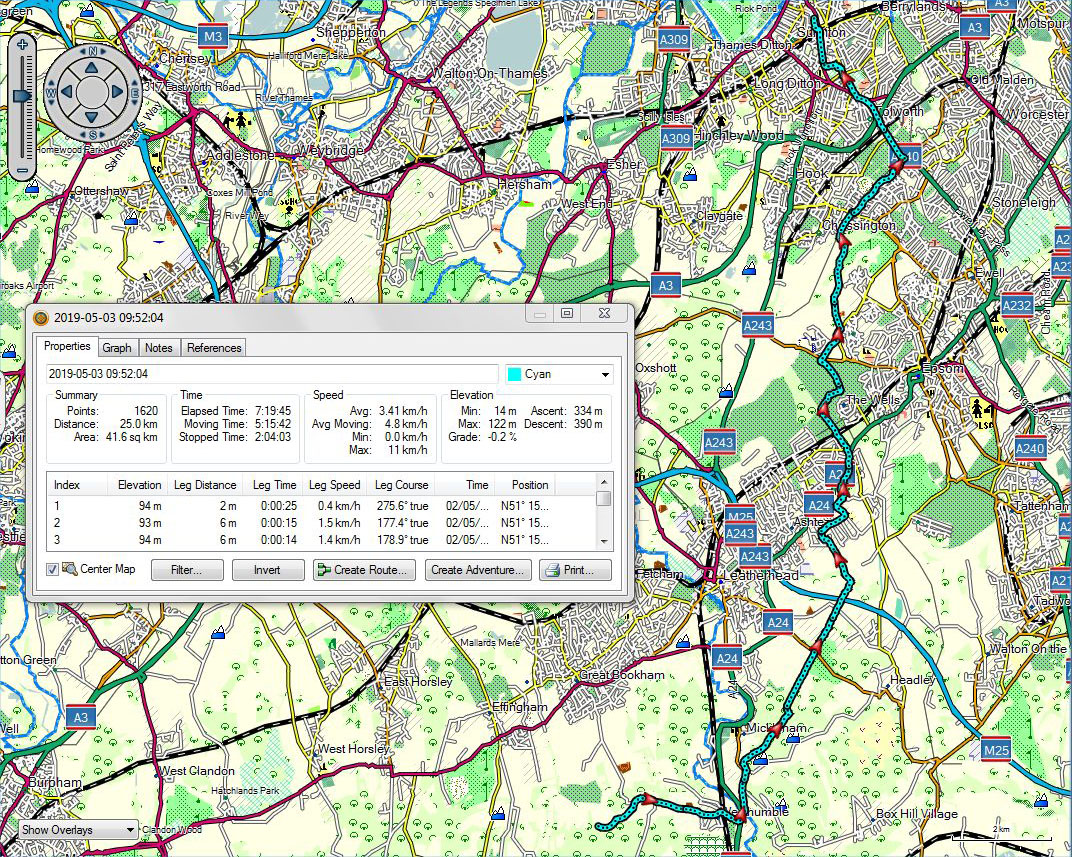
Ranmore to Surbiton
Those pictures from yesterday ***with videos***
May 2, 2019 § Leave a comment
Isn’t it amazing how much we now depend on a mobile phone connection?

South of Ewhurst

The tree

The tree
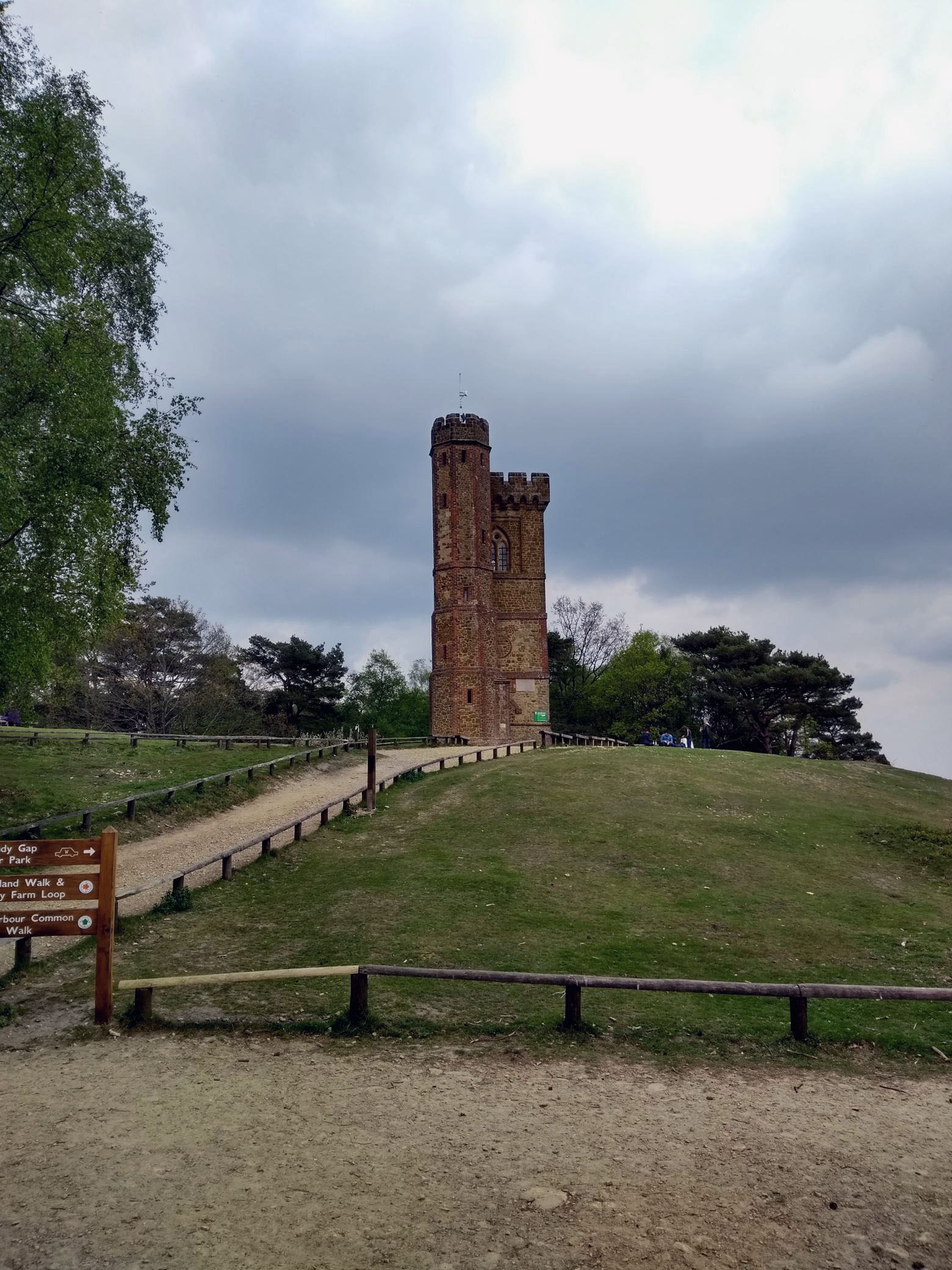
Leith Hill Tower

Belted Galloways, before the climb to Ranmore
A video of the estate landscape west of Ewhurst can be downloaded at:
https://app.box.com/s/hlc6iqv07wtmv4mgoq5k05bb6alko7if
A video taken from Leith Hill can be downloaded at:
Happy Birthday, Lauren Mary
May 2, 2019 § Leave a comment
With love to you and your lovely family, Dad
For those of you who forgot ***with track***
May 2, 2019 § Leave a comment
Today (Wednesday) was when I said farewell to my marvellous hosts in Chichester – Karen, Dan, and of course Arthur. Thank you so much for putting up so patiently with this strange house-guest.
I was looking forward to the walk today, chiefly because it wasn’t going to be another long one. It also promised to be pleasantly rural, with lots more of that birdsong that captivated me yesterday. One out of two. The length turned out to be right (just over 26 km) but the ruralness didn’t. Perhaps I was now expecting too much, but today didn’t live up to yesterday’s standard. Rural certainly, but something was different. It could have been that the farms were bigger or that there were more signs of obvious prosperity, or it could have been that there was no longer that lovely Wey South Path to follow, with the winding canal. But could there possibly also have been some other underlying reason?
Already I see some of you remembering that you didn’t get round to enrolling for the next Introductory Geology course. Don’t expect me to remind you every time in the future!
OK, so the underlying reason for the different countryside could be geological. Wealden Anticline? Asymmetry? River drainage? Essays please for the next tutorial!
Back to what was good today. Yes, there were birds there, and a couple too that weren’t on yesterday’s list. A woodpecker, to remind me of home, and a beautiful little tree creeper on the Greensand Way in the woods north of Leith Hill.
(Oh yes, there are photographs from today, but you’ll have to wait for them. I took them on my Android phone, for which I currently have no mobile signal. I’m overnighting in the Youth Hostel at Tanners Hatch. Not all of the networks have a presence here.)
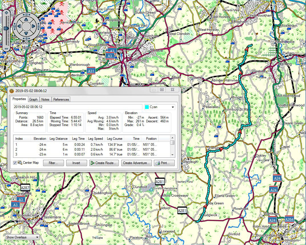
Bucks Green to Ranmore
A long rural day ***with track***
April 30, 2019 § Leave a comment
First let’s clear up what ‘long’ means. I have a scale for walking days: less than 10 km is extra short; 10 to 20 is short; 20 to 30 is medium; 30 to 40 is long; more than 40 is extra long. Today was just over 32 km, which makes it comfortably long. Not that ‘comfortably’ is the most appropriate word to use after you’ve just walked 32 km.
Anyway, the day went well. The most obviously pleasant aspect of it was that there was almost no road work. What a lovely change. The other obviously pleasant aspect was the countryside. This was rural England at its best on a sunny Spring day. The colours, the grasses, the trees leafing, the tracks through the woods and over the fields, the bluebells, the daisies, the wild garlic, the squirrels jumping, the butterflies, the birds everywhere.
It was the birds that I noticed most. First there was the pair of peewits on the flood plain shortly after leaving Amberley. Then there were the geese, the herons (grey and white), the mallards, the pheasants, the cuckoos calling, the buzzards soaring, the blackbirds in the hedgerows, the thrushes singing, the crows, the magpies, the pigeons, and all the others that I couldn’t come close to identifying. At times it was a choral concert. I have never before heard such continuous birdsong.
My route mostly followed the Wey South Path. This is a brilliantly conceived and implemented track. Bouquets to whoever was responsible. It’s based largely round the Wey and Arun Canal, long defunct but now being rebuilt. The group involved in the rebuilding are volunteers and they’ve clearly got stamina. That puts my ‘long’ day into its proper perspective.
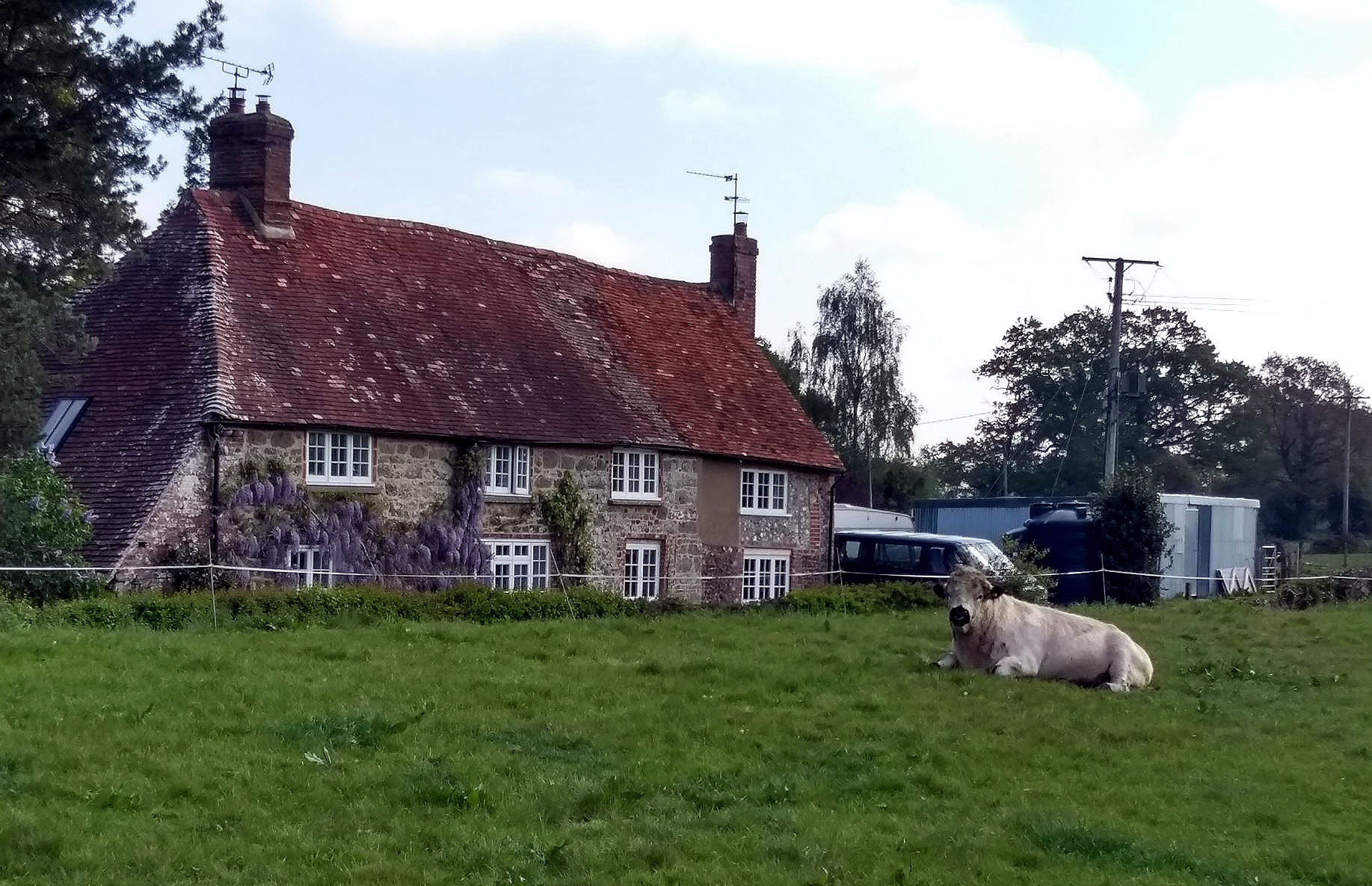
…and who do you think you’re looking at?
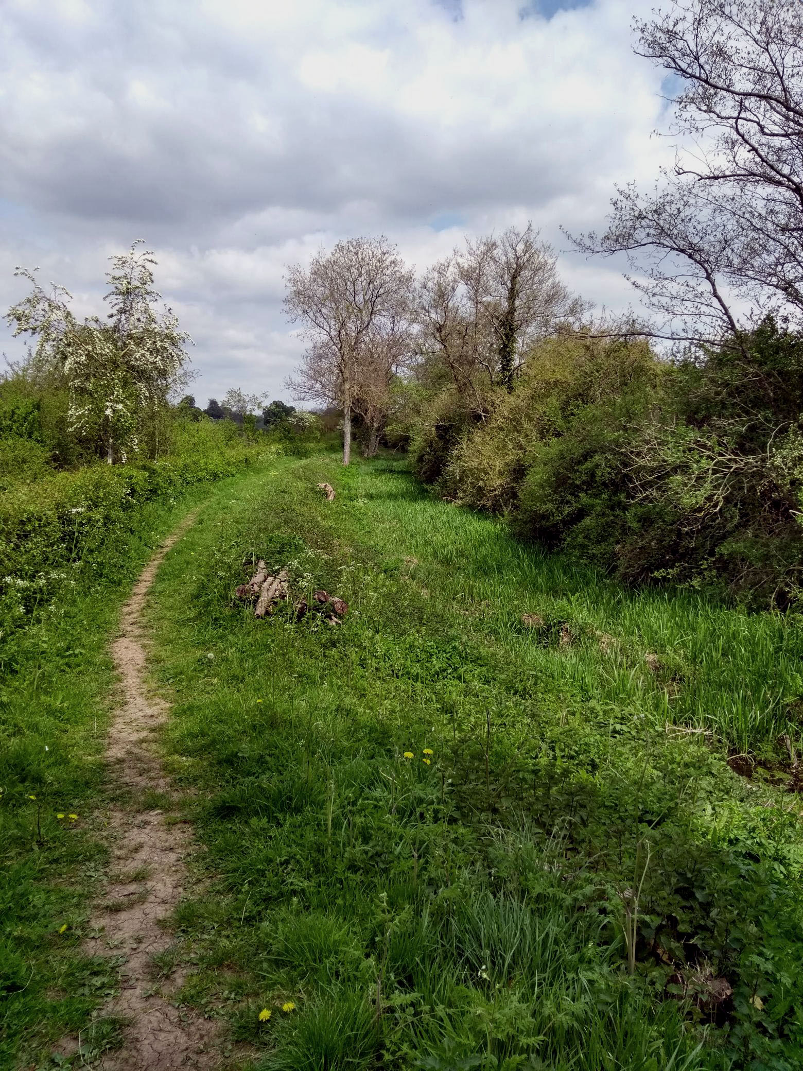
The Wey and Arun Canal, in need of some further work
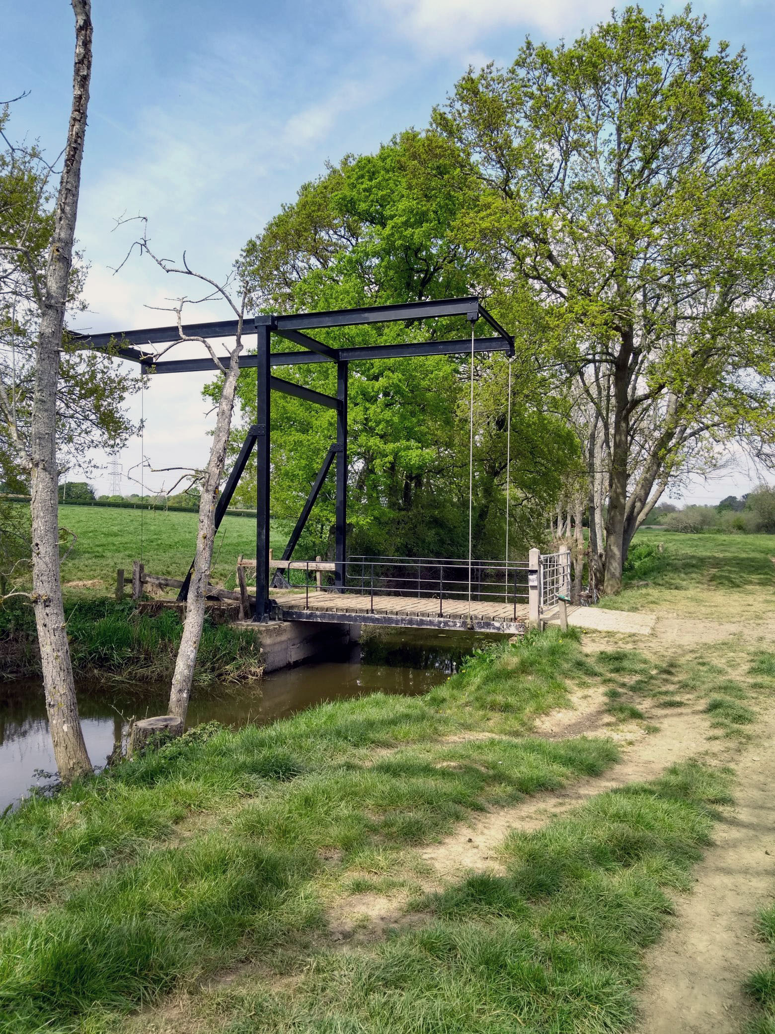
A newly built bridge on the Wey and Arun Canal

Woodland floor

Woodland floor

Spot the buzzard!

Amberley to Bucks Green
That was very much better! ***with track and voice***
April 29, 2019 § Leave a comment
The Garmin behaved itself perfectly all day, well almost. No problem with missing waypoints, so navigation was painless. The only strange thing was that the elevations are certainly not kosher – that is unless I’ve been walking along on the sea floor. Yes, the Garmin has been giving me negative elevation values.
The first part of the walk today is best overlooked: road work out to Tangmere, then over the A27 to Boxgrove. Things started to pick up after that. First there was the almost imperceptible rise in the land, then the wonderful Priory Church on the edge of Boxgrove village, then the vineyard, then the footpaths, then the ever-growing quietness.
Eventually I reached Stane Street. I’d been expecting something that was at least road like, albeit 2000 years ago road like. What I found was simply a track winding uphill, barely wide enough for one person. A sort of intimate Roman road. It widened later, becoming a proper raised road, then led me up onto the downland. Super walking. Memories of the Side-to-Side.
The day finished with a pot of tea in Houghton, then the last kilometre along the South Downs Way to the station at Amberley.

Boxgrove, Priory Church
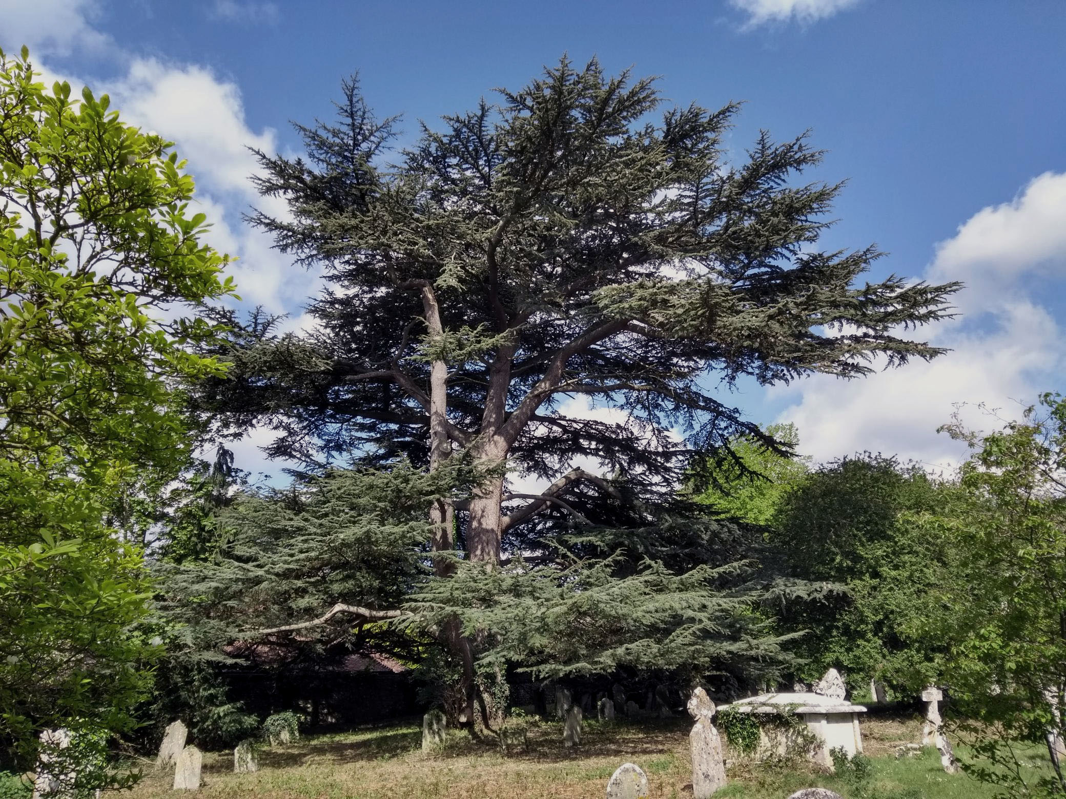
The cedar, Boxgrove

The stained glass window

The vaulting
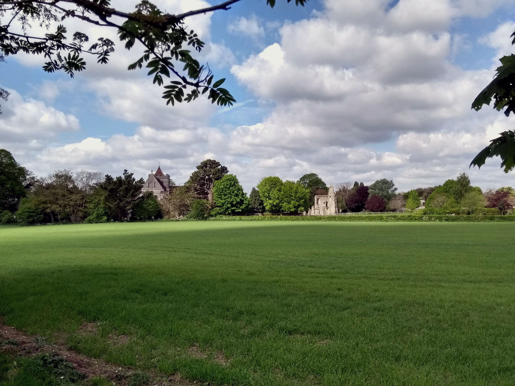
Boxgrove, Priory Church

The first part of Stane Street
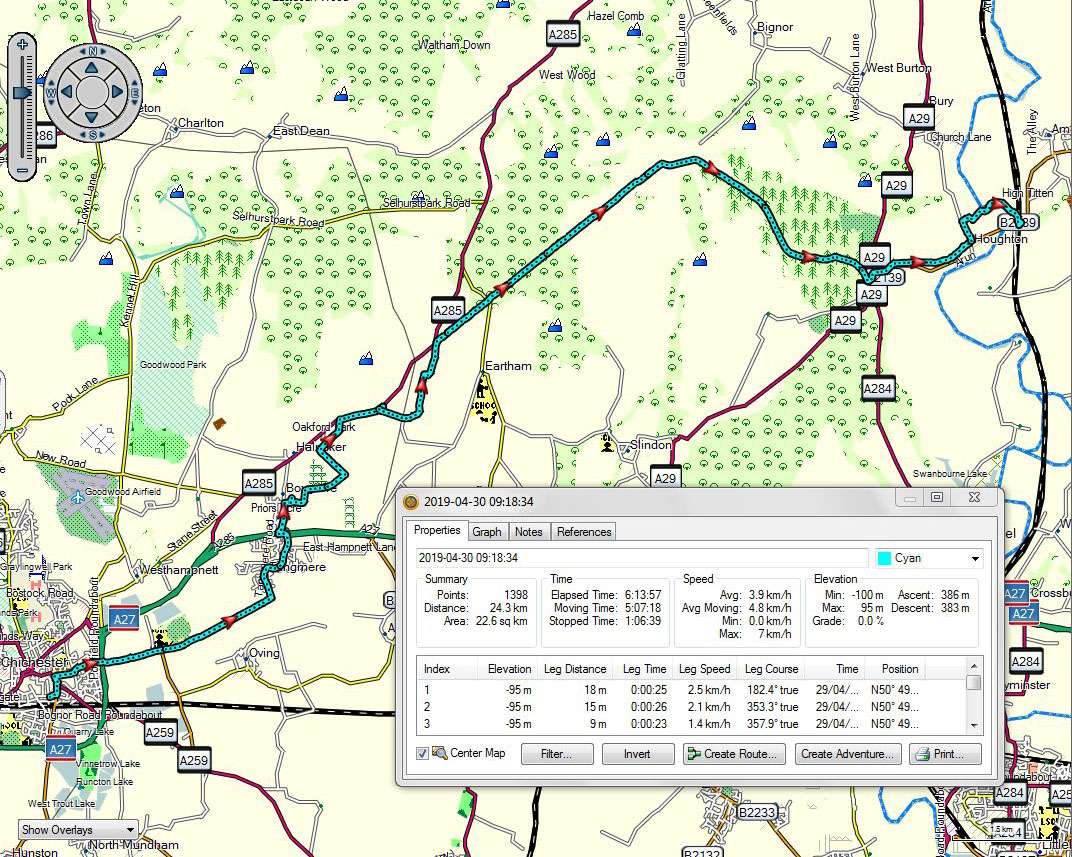
Chichester to Amberley
A voice recording made outside the church at Boxgrove can be downloaded at:
https://app.box.com/s/owk0w0f8hfga20526prpsyxxxp8trh1z
Voice recordings made in the woods on Stane Street can be downloaded at:
https://app.box.com/s/fr78fo3w264dw3iwdwb95iftdojxk8ln
and
A problem ***with track and video***
April 28, 2019 § Leave a comment
The second day started off well, or so I thought. There was a Rail Replacement bus that went straight to Havant Station, where I had finished yesterday, and it delivered me there exactly at the time I wanted. After that it was simply switch on the Garmin and go. But what was this? Maps OK, but no waypoints. Absolutely none. Nowhere. All gone. Which was a problem, of course, because it meant I couldn’t navigate effectively using the Garmin alone. I had therefore to use the screenshots of the maps on my phone instead. (N.B. Lots of brownie points for the walker who insists, even despite the good-natured scorn of his family and friends, on backing everything up on at least two separate pieces of kit!)
The upshot was that the day went less than smoothly. Lots of not quite knowing exactly where I was, and lots of deciding to take paths that realistically weren’t as good as the ones I’d originally planned to take. Not that I missed much, however, at least not scenically, for the landscape in the coastal area between Havant and Chichester can best be described as subdued, particularly when the tide is out. The photo looking south into one of the inlets summarises it perfectly.

Spot the cockler.
There was a lot of life about initially, especially near Emsworth. It’s obviously getting to that time of the year when you get your boat out onto the water, so the Tarquins and the Julias were all out in the boatyards making those last little necessary preparations. You know, making sure the blue on the hull is exactly the one that’s in fashion this year. Away from Emsworth there was much less going on. A few cocklers out on the flats, a few families, and a few dog walkers. And one beautiful swan.

Another lunchtime companion
I reached Chichester, pleased that I could hopefully fix that Garmin problem. And yes it is now fixed. The waypoints are back. Fingers crossed for tomorrow.

Havant to Chichester
A video of the swan can be downloaded at:
https://www.dropbox.com/s/r4kbjk5vs0i0wtl/The%20swan.mp4?dl=0
One down ***with track and voice***
April 27, 2019 § Leave a comment
I’ve finished the first day! That doesn’t sound much, bearing in mind that there are about 30 more to follow and that today was only just over 17 km (out of about 1000). But there’s still that feeling of having achieved something.
And how was the day? Overall, not bad at all. It started off with an unexpected lift down to Chichester Station (thank you, Karen), then a comfortable train ride to Portsmouth Harbour. I had pleasant memories of last being there two years ago, for the Mini-Side-to-Side across the Isle of Wight. The weather today was nevertheless not particularly favourable for walking. A strong wind blowing mostly from the west, gusty but above all cold. It was good to find by chance a convenient pub on the harbour side that did a good line in mugs of hot chocolate. Fortified, the intrepid adventurer headed onward.
Next stop was another pub, but this time for an arranged lunch. Kate and I hadn’t met since Southampton two years ago, so there was lots to catch up on. After that it was simply along to Havant and then the train back to Chichester.
An unexpected high point? The Talbot, in Fratton. A low point? The stretch of footpath along the north side of Langstone Harbour. This is barely ten metres from the A27, with noise levels you can only imagine in your worst nightmare.
All in all, a good day to start with.
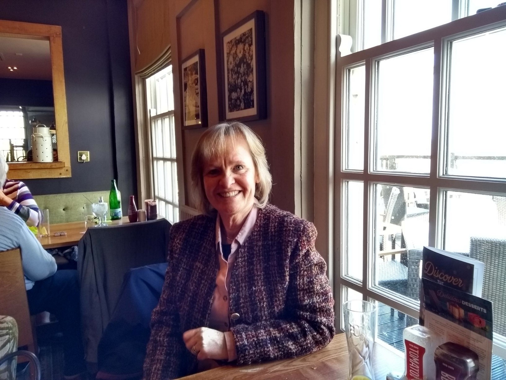
My lunchtime companion

The Talbot, in Fratton

Portsmouth to Havant
A voice recording can be downloaded at:
Final preparations
April 25, 2019 § Leave a comment
I seem very rushed this time. We’re due to start off for England today and I’m still working through those last things that need doing.
The preparation walks in the past few weeks went well, although they were done with just a day pack and were relatively short. The putting back together and testing of the kit also seems to have gone well. Hopefully I’ve forgotten nothing – at least nothing I can’t replace readily when I get started.
The only real hiccup was when I found out yesterday evening that a bus route that I’d planned on using wasn’t necessarily always there. It’s one of those strange rural routes where you have to book in advance, and hope! Fortunately there is Grimsby. More about that later.
Anyway, it’s now down to the kitchen for a last cup of coffee, then off into the wild blue yonder. Oh!
inov-8 Roclites: ‘How to trash your brand in one easy step’
April 8, 2019 § Leave a comment
This post (written in July 2018, shortly after I returned from the Corner-to-Corner) appeared originally on two walking forums. My purpose in writing it was not to complain about the particular shoes in question or about the company that produced them. Rather it was to warn people about trusting brands that in the past they’ve found trustworthy. See what you think.
——
I’ve often wondered why companies do it. Why do they take successful products and change them for the worse? I’m directing that question now at Inoveight Ltd: https://www.inov-8.com/. The product I’m referring to is part of their latest range of Roclite trail running shoes.
I’m a long distance walker who puts in a few thousand kilometres each year over a great variety of terrains – hard and soft, even and rough, wet and dry, muddy and rocky, flat and steep. I bought my first pair of Roclites four years ago and since then have used Roclites everywhere. I’ve been very satisfied with them. Until now.
I returned last month from another long trek – just over 1000 kilometres through Wales and Northern England. For about 950 kilometres I wore the pair of Roclite 305s I bought shortly before starting. This is the fifth pair of Roclites I have owned. To say I was disappointed with them would be a gross understatement. These shoes are a travesty.
Let’s make one thing absolutely clear to start with. The faults with these shoes are not faults with this particular pair. Far from it. They are faults with this particular model, perhaps even with the entire new Roclite range. They are the result of desperately poor design. inov-8 have taken a shoe that worked perfectly well beforehand – several thousand kilometres of my trekking testify to this – and they’ve butchered it, one presumes simply to make it look flashier and therefore easier to sell to gullible customers at a higher price.
The most obvious of the faults concerns the uppers. These are essentially inflexible right from the back of the shoe through to the level of the front lace-holes. It’s only there that the shoe has any chance to flex, so it’s hardly surprising that it’s there that the uppers split. And split they do! On both sides! Completely! Right through to the inner padding! You don’t have to be a rocket scientist to realise that if you allow something to flex only in one place it is there that the flexing stress will be concentrated. And if you are going to allow flexing only in one place you then have to ensure that the material you use is strong enough to withstand that stress. The material used for the uppers forward of the front lace-holes is nowhere near strong enough. It is boosted on the inov-8 website as being ‘super durable’, but in reality it is not fit for purpose. inov-8 describe the Roclite 305 uppers as follows: ‘Built around the natural anatomy of the foot, the new ADAPTERWEB met-cradle adapts to the natural movement and swelling of the foot in motion.’ Yes, these uppers certainly do adapt – by splitting!
The next fault concerns the tongues. inov-8 describe the shoe as having ‘an integrated tongue gusset’. That certainly sounds impressive. However, what it means in simple English is that the tongue on the shoe is firmly stitched to the uppers. Yes, stitched on both sides, from top to bottom! The result of course is that the distance across the top of the shoe is not adjustable at the individual lace-holes. Whereas in the past – I look back with pleasure at my old Roclite 295s, now no longer available – you could readily adjust the fit of the shoe at each lace-hole independently, making this one a little looser here perhaps and that one a little tighter there, now you get only what the inov-8 designer wants. You don’t fit the shoe to your foot; you fit your foot to the shoe. Oh, and there’s another result too – something your mother drummed into you every day when you were putting on your shoes to go to school! Because the tongue is completely stitched in, the opening through which your foot goes when you’re pulling the shoe on is fixed in size. There is thus none of the flexibility that you get automatically with a normal loose tongue. Getting the shoe on in the morning is now a nasty exercise in stretching and squashing. “Wayne, how many more times do I have to tell you to loosen the laces and pull up the tongues when you’re putting your shoes on?” Clearly the future shoe designer wasn’t paying attention.
The most serious fault concerns the soles. Put simply, they become unsafe fast. You rapidly finish up with shoes that are potentially dangerous, especially on wet surfaces. Some people will of course say that I’m being unrealistic here and that 950 kilometres is a good distance to get out of any pair of trail running shoes. I disagree entirely. Remember that this is my fifth pair of Roclites. I can therefore compare them against my previous pairs. My trekking habits haven’t changed, and with each of those four previous pairs I routinely got the best part of 2000 kilometres. Twice as much as with this latest pair! One possible reason is that the rubber compound now being used for the soles is inferior to that used before – this may well be the case. There’s another reason, however, one that is far more important. It has to do with the cleats on the sole. On these new Roclites there are significantly fewer cleats than before – again I compare with the Roclite 295s. The individual cleats are now also much larger in their surface area. That means automatically that the sole gives much less grip. Again this is not rocket science! The grip that a cleated sole gives is generated primarily at the edges of the cleats, not on their surfaces. That means that the best way to get a sole with the best possible grip is to maximise the cleat edge length, not to maximise the cleat surface area. inov-8 have done exactly the opposite. The cleats on these new Roclites are large, rounded, and have bevelled off edges. A recipe for disaster if ever there was one! Once these cleats have started to wear you’re rapidly left with a sole that has no worthwhile grip in its centre. This is not what you want under you, no matter whether you’re running or walking, especially if you’re on wet rocks or wet grass. These shoes are potentially dangerous – and by that I mean slip-over-and-break-your-leg dangerous.
There’s nothing more to say. inov-8 have taken a successful brand – Roclite – and in one easy step have trashed it.
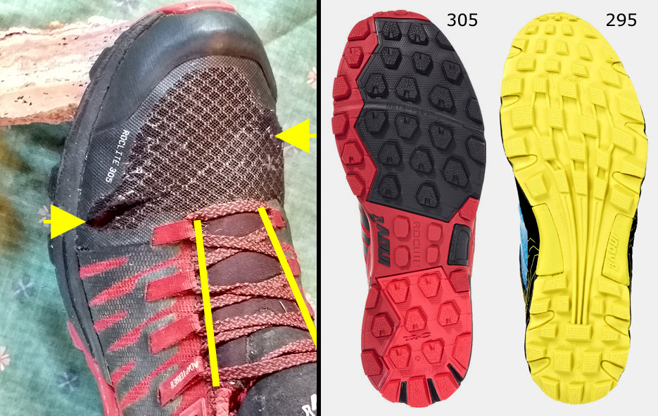
Left: Roclite 305 after 950 kilometres. Arrows show splits in the upper. Yellow bars show lines where the tongue is stitched in.
Right: Cleat patterns on Roclite 305 and Roclite 295.
——
What’s new?
April 3, 2019 § Leave a comment
This is now the fifth year in succession in which I’ve been doing this strange long-distance walking thing. How time flies! What I still find amazing is the durability of much of the kit I’ve been using. OK, I was accustomed to durability in the kit I used in that previous existence of mine – geological fieldwork, sometimes in distinctly unpleasant conditions – but that kit was always semi-heavy duty, for obvious reasons. The durability was understandable. Not so for the walking kit I’ve been using: it’s lightweight (sometimes ultra-lightweight) and at first sight seems almost hopelessly flimsy. The materials are nonetheless truly durable. There are several pieces of kit that are as good today as when I bought them four years ago. Scuffed or scratched, perhaps, and faded, but otherwise fine.
Needless to say there have been replacements. The most urgent one has been a new sleeping mat. I don’t like foam mats, so I originally bought an Exped Synmat inflatable mattress. That was great for those first few days with the Big Agnes tent (the one that was stolen in the first year of the LEJOG) but it was too long to fit comfortably into the Mountain Warehouse tent that I got as the replacement. I was mulling over changing it for a shorter mattress, but then, close to the end of the Corner-to-Corner, it made the decision for me. Put simply, it exploded. No, it didn’t burst and deposit me on the ground. Instead its internal partitioning gave way. This meant that instead of lying on an almost flat pad I was perched on top of a long sausage-like balloon. And I promise you that’s not the most comfortable place to sleep!
I’ve now bought another Synmat, but this time a much shorter one. My feet will be firmly off the end, but when you’ve been my height for as long as I have you’ve got used to that!
The second replacement is my shoes. No, I’m not going to tell you I’ve been using the same pair of shoes for the whole four years! What I mean is that I’m staying with fell running shoes but switching brands. So far I’ve used Inov8 Roclites, without much of a problem. They’re strong and have great grip on most surfaces. Above all they’re light – your legs don’t feel exhausted at the end of a marathon day. I’m now switching away from Inov8 – the reasons you’ll see in my next post – and trying instead the Torrents from Hoka One One. They’re absurdly light (250 grams per shoe as opposed to 305 grams for the Roclites and about 1300 grams for my old fieldwork boots) and very flexible and grippy. Like the Roclites, they’re not waterproof, which is what I want. We’ll see how they go!
The latest article
April 3, 2019 § Leave a comment
As promised in the previous Strider article, here’s my take on Google Earth, fresh off the press.

Strider, Number 143, April 2019
To make the article legible, simply click on the photo. If that doesn’t work, here’s the text.
““Google”, spluttered Sherlock Holmes, “don’t talk to me about Google, Watson. They’re a bunch of villains.” (From Sherlock Holmes and the Internet Entrepreneurs, a seldom-read story published privately in the mid 1890’s.)
Many people will have a deal of sympathy with Holmes in this matter, for Google is not by any means a universally popular company. There is nevertheless one Google product that is very widely praised – Google Earth. It is fair to describe its introduction as a game-changing event, particularly for go-it-aloners. What they had lacked was a practical means of viewing the walks they were planning. With the introduction of Google Earth they had it.
Most readers of Strider probably have at least some familiarity with Google Earth. Some will indeed be experts. There will nevertheless be others for whom it is a complete unknown. To them I say, if you’ve got a desktop computer or a laptop, download Google Earth Pro now. You can get it from https://www.google.com/earth/desktop/. There are several tutorials that come with the download, and it’s sensible to work through these.
OK, we’ll assume you’ve got Google Earth up and running. We’ll assume too that you’re a go-it-aloner planning a walk. You’ve obtained maps of the areas you’ll be walking through, and now you want to know what Google Earth can do for you. The answer is that it can act as an extraordinarily valuable supplement to your maps. The easiest way to see this is to compare maps and Google Earth images using those four key points about maps that I noted last time. Firstly, maps aren’t intended to be replicas of the areas they cover; Google Earth images are. Secondly, objects on maps are not shown as scaled-down versions of their real selves; objects on Google Earth images are. Thirdly, objects on maps are shown as far as possible in their correct relative positions; objects on Google Earth images are shown as far as possible in their correct absolute positions. Fourthly, maps don’t necessarily show all the objects present in the areas they cover; Google Earth images do. Google Earth clearly has much to offer.
Now for the bad news! Google Earth images do have shortcomings. These arise as a direct result of the way in which the images are constructed – they are mosaics assembled from snapshots taken by cameras in satellites and aircraft. These shortcomings can be serious.
The most obvious shortcoming of Google Earth images is that they don’t always show the ground surface everywhere. They show it only where it was visible from the camera being used at the time at which the snapshot concerned was being taken. Where the surface was obscured by cloud, only cloud is seen; where it was covered in snow, only snow is seen; where it was forested, only treetops are seen; where it was in shadow – for instance in a steep-sided valley – only shadow is seen; where it was blocked from the camera by an obstruction – for instance a building – only the obstruction is seen.
The second shortcoming of Google Earth images is that they are beguilingly realistic. You think you are looking directly downwards at the ground surface, as if from an aircraft. You aren’t! To appreciate this you have only to look at an image covering something like a wind farm. Look for instance at an image covering Coal Clough Wind Farm – you pass this on the Pennine Bridleway, just before you turn down into Shedden Clough. Look at the turbine towers there. These are vertical, therefore only their tops should be visible on the image. You shouldn’t be able to see their bases at all. Yet you can. Now measure the positions of the tops and the bases. These should be identical, yet according to Google Earth they aren’t: the tops and the bases are typically ten metres apart on the ground. This image is evidently not at all what it seemed initially – a single downward-looking snapshot of the ground surface. Instead it is a composite picture constructed from a number of separate snapshots, each one taken from a different viewpoint.
The construction of this picture proceeds in two stages. Each snapshot is first rectified, i.e., it is projected onto a model of the ground surface topography. This ensures that every piece of information in the snapshot is allotted its correct map position. Then the rectified snapshots are assembled into the mosaic. The rectification process can be effectively error-free if the topography of the ground surface is known with sufficient accuracy. If this isn’t the case, for instance if the terrain is rugged or the surface is heavily forested or built up, then there are likely to be rectification errors. The rectified snapshots will then not match where they join or overlap. Any such mismatches have to be removed, as otherwise the mosaic will appear discontinuous. This is done using so-called rubbersheeting algorithms. These remove mismatches successfully, but in doing so they automatically distort the image.
The third shortcoming of Google Earth images is that they are in places hopelessly defective. My favourite example is of a main road in Scotland that Google Earth shows as suddenly jumping 16 metres sideways. (Strange, because the Rob Roy Way runs parallel to this road and I don’t remember ever having to jump sideways there!) Why does the road jump? Was there an earthquake? No, it’s simply that the snapshots of the area concerned were taken by different camera systems, at different times, and from different heights. There was a very substantial mismatch between some of these snapshots, which wasn’t ever removed. Clumsy!
The implications of these shortcomings for go-it-aloners are clear. Firstly, don’t expect to be able to see everything you want on a Google Earth image. Secondly, never assume that a Google Earth image shows exactly how the ground surface is, no matter how realistic that image seems. Thirdly, always be on your guard when you’re using Google Earth. It’s an extraordinarily valuable tool for planning your walks, but it’s very far from perfect.”
At last!
February 22, 2019 § Leave a comment
My last post, from December 16 last year, promised optimistically that I would be putting up details of the next walk “in the coming weeks”. Well, yes, I suppose you can argue nitpickingly that ten weeks is covered by this. Really, however, it isn’t. I meant to get the details up sometime in January, but it’s now the last week in February. Sorry!
Anyway, the details of the proposed route and its schedule are at last on one of the side pages of the blog. You can also download them from the following Dropbox link:
https://www.dropbox.com/s/e5rb4yrckoi36hl/CtoC%20days%20for%20blog.docx?dl=0
Now to the timing. For various reasons, I’m this year not starting out on my birthday, St George’s Day. The start from Portsmouth is planned instead for Saturday 27 April. If all goes according to plan I should reach the Scots Dyke by the end of May.
Needless to say, there’s still flexibility in this plan. So if anyone wants to walk with me for a day or for days they’ll be more than welcome. The same goes for meeting up during the day or in an evening. All suggestions gratefully received. The overnight accommodations are in most cases provisional bookings.
So that’s Three Pierheads as it presently stands. Remember that you’re invited, personally. Let’s do it together!
Christmas and New Year Greetings, and a little something extra to tickle the palate
December 16, 2018 § Leave a comment
It’s that time of year again, so once more it’s best wishes to you all for Christmas and the New Year from theendtoendblog.
“OK”, you say, “but what’s that ‘little something extra’?”
Simple! Will it surprise you if I say I’m planning another walk for next year? Probably not. And in that case it has to be obvious that the ‘little something extra’ is a taster of what’s in store.
Starting at the pierhead at Portsmouth, walking up to and through London, stopping in Cambridge for High Table Dinner in College, then north to and round The Wash, up through the Lincolnshire Wolds to the Humber Bridge, northwards to Cleveland, crossing the Pennines to reach Carlisle, with a finish at the Scots Dyke north of Longtown. Thirty three walking days and goodness knows how many hundreds of kilometres.
Oh, did I say you’re invited? Of course!
To make sense of this strange route you have to look further ahead. In 2020 I’d like to be able to re-start at the Scots Dyke, walk up across the Southern Uplands to Glasgow, follow the West Highland Way to Inverarnan, then cross to the pierhead at Oban. Next a short side-trip to Mull, with a walk across it to Erraid, the tide-isolated island on which Robert Louis Stevenson let David Balfour land. Back to Oban, then finally a trek across Scotland to finish at the pierhead at Peterhead.
Three pierheads over two years, Deo volente.
The start this coming year is planned to be on Saturday the 27th April; the planned finish is Thursday 30th May. I’ll be posting details in the coming weeks. As always, I’m hoping to meet up with you, either to walk or simply to meet. Again, as always, there’s a massive amount of flexibility in the plans. Please get in touch if you’ve any ideas or wishes.
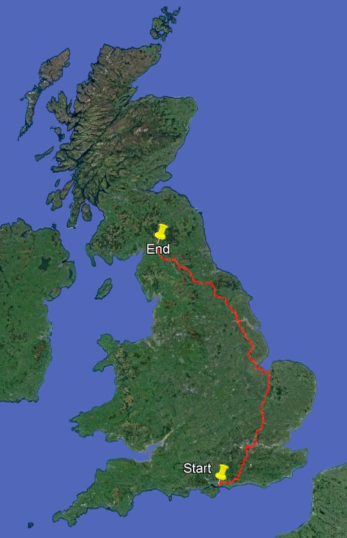
The planned route for 2019
Ich wünsche Euch ein gesegnetes Weihnachtsfest und einen guten Rutsch ins neue Jahr.
Yet another…
December 10, 2018 § Leave a comment
The latest Strider has come off the press. And, guess what!

Strider, Number 142, December 2018
As before, to make the article legible you simply click on the photo. If that doesn’t work, here’s the text.
“What is a map? Every walker surely knows the answer. It doesn’t matter if it’s on paper or if it’s electronic, a map is a map is a map!
There are of course dozens of definitions of ‘a map’. They range from the practical to the philosophical, from the commonplace to the sophisticated, from the straightforward to the convoluted, and from the general to the specific. Most walkers will probably be happy with this one – it’s from Merriam-Webster, slightly modified. A map is a picture showing the relative position of some or all of the objects present in the area it covers. These objects can be anything at all. In the walking context they might be houses or villages, or roads or fence lines, or stream junctions or railway bridges, or trig points or cairns, and so on.
So far so good, but let’s dig deeper. There are four key points to note. First, a map is not intended to be a scaled-down replica of the area it covers; it is a picture, nothing more. This is true for even the most professionally produced maps. Second, the objects shown on a map are not shown there as scaled-down versions of their real selves; instead they are represented by symbols. These symbols are often greatly exaggerated in size, particularly on small-scale maps. Third, the objects shown on a map are shown as far as possible in their correct relative positions; their absolute positions are not maintained. Fourth, not all of the objects present in an area are necessarily shown. Objects that are too small or too intricate in shape to be shown clearly at the chosen map scale are omitted; either that or they are combined and shown together as some generalised object.
It’s worth pondering these points, not because they indicate that maps are inherently faulty or unreliable, but rather because they suggest that maps are not always all they’re cracked up to be. Put simply, maps have their shortcomings. Might it not be sensible therefore to get away from maps completely, to look for a better alternative?
The most obvious course of action for any walker would seem to be to switch to using all that high-quality absolute positional information that is now so readily available. Hand-held GPS units and mobile phones can give you information on your absolute position that is accurate to within a few metres; the maps you can obtain online from government mapping agencies are typically quoted as having metre-scale accuracy. Surely all you need to do when planning a walk is (1) to decide where you want to go, (2) to identify the points you want to go through, and (3) to get the coordinates of these points from one of those online maps. You can then load these coordinates into your GPS and be prepared to let it tell you exactly what to do. Left foot, right foot. Simple really!
Please promise me you’ll never do that, particularly if you’re thinking of going it alone. Going-it-alone, especially over long distances, is not some kind of elaborate orienteering exercise. You’re always going to need a proper map. This is because walking of the sort that go-it-aloners do always involves navigation by relative position, not absolute position. To see what this entails, think back to that characterisation of a map as a picture. Now imagine you’re out walking somewhere, map in hand. If you can see and identify any of the objects shown on that map, and if you can say how you are positioned relative to them, even if only roughly, then you know where you are. You walk on; you lose sight of some objects but others come into view; you identify these and say how you are your positioned relative to them; again you know where you are. You keep doing this, continually. You are effectively walking through a picture of which you are an integral part.
This sounds great in theory, but does it work in practice? Yes, undoubtedly, provided you ensure you always remain part of the picture. This means you’ve got to concentrate on your navigation. If you don’t – for instance because you spend too much time walking along exchanging text messages with your friends – then you’ll soon find yourself out of the picture. You’ll realise you don’t know where you are any more. In that case there’s nothing else for it but to get out the GPS or the compass.
The simplest way of ensuring you always remain part of the picture is to pick out on your map some object or objects that will fix your position unequivocally – so-called handrails. You do this as you’re planning your walk. As an example, imagine the walk will take you over part of the Monadhliath, from Kingussie to Coignafearn. You don’t need to be able to identify the various hills there – this is just as well because their tops are far from distinct. Nor do you need to know grid references or compass bearings. All you need to know as you head those last few kilometres down into the valley of the Findhorn is that the Elrick Burn will serve there as your handrail, first on your left and then (after you’ve crossed it by the bridge) on your right. Once you’ve found the Elrick Burn you’re home.
That’s enough about maps, at least for now. Obviously I like them. However, let me stress that information on absolute position is important too. Imagine you’re isolated on some rocky hillside miles from anywhere in conditions of zero visibility. It will certainly then be more than comforting to be able to say exactly where you are, especially if, miraculously, you’ve also got a mobile phone signal. You’ll stay put of course; you won’t even think of trying to move; you’ll hunker down as best you can until things get better or help arrives. You might also then have time while you’re waiting to read the next issue of Strider – I’ll be dealing there with Google Earth.”
A wonderfully unexpected reply
August 3, 2018 § Leave a comment
I’ve said many times that it’s the meeting with people that makes these walks so worthwhile. Yes, definitely!
It was Thursday, the 3rd of May. I’d overnighted in Hay-on-Wye and was walking to Kington along the Offa’s Dyke Path. I wrote afterwards (see “An off-the-peg day”):
“The walk itself was nothing special. Pleasant countryside to be sure, with views initially back onto the Black Mountains, but nothing special. Until Newchurch. This is no more than a knot of houses next door to a small church. At the church gate was the smallest of handwritten signs – ‘Tea, coffee and biscuits’. Remembering the Shepherds’ Church at Pyecombe, I went in. Sure enough, there was refreshment again. An open door, a place to rest and prepare for the next stage, and everything on the basis of trust. That is St Mary’s Newchurch.”
What I didn’t write was that while I was in St Mary’s I’d talked with Adrian and Betty. They’re from the parish and were checking that all the refreshment facilities were working properly. I told them about my walk, and that I hoped to reach Berwick eventually. “Send us a postcard when you get to the end”, they said. “We ask people to do this, but most of them unfortunately don’t.” I didn’t manage to send my promised card directly from Berwick, but I did send it when I finally got back home. With best wishes and memories of St Mary’s.
A few days ago I received a most unexpected reply – this card, with best wishes in return from Adrian and Betty, and all written in perfect German!
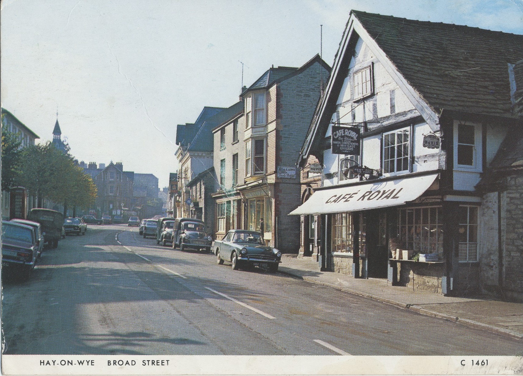
The delightful postcard
Thank you both. What a memorable place St Mary’s turned out to be.
Number three!
July 23, 2018 § Leave a comment
It’s time for the next instalment of ‘Going It Alone’!

Strider, Number 141, August 2018
As before, to make the article legible you simply click on the photo. If that doesn’t work, here’s the text.
“I suggested last time that there were three basic types of go-it-aloner: those who stick largely to well documented paths, those who develop paths of their own, and those who simply go off and explore. All of them depend to some extent on published path information. Only a complete and utter idiot – I use the word very advisedly – would go out and walk without finding out beforehand at least something about where he or she was going. The Unlikely Pilgrimage of Harold Fry is a thoroughly entertaining story, but that’s what it should remain.
Getting information on almost any topic today is much like picking your way through a jungle – there’s so much available from so many different sources and you don’t know what you can trust. Getting the information you need to plan a long distance walk is no exception. That’s why so many people go on organised walks and tours: they want to be led by someone who has all the necessary information about the area being walked through and the paths being taken. Things are different when you’re going it alone: relying on someone else to have the necessary information isn’t then an option. If you’re planning to use well documented paths, published guides are certainly the most obvious source of information, either printed guidebooks or files you can download from the internet. Which guide? Don’t ask me! Go instead to any of the major sources of published path information: (1) our own LDWA (https://www.ldwa.org.uk/), or (2) the Ramblers (http://www.ramblers.org.uk/), or (3) WalkHighlands (http://www.walkhighlands.co.uk/). Each of these has details of published guides; they also review new publications and report path changes. Most importantly, they’re reputable sources, therefore you can trust them.
Now suppose you’re not planning simply to follow well documented paths. In that case you have to collect and assess all the information yourself. Clearly you could be letting yourself in for a lot of work, especially if you’re the obsessive type! Remember that you’ll be the one who’ll suffer if you miss anything important. Here’s a summary of the major points to take into account in collecting and assessing walk-related information. I’ll cover some of them in more detail in subsequent contributions.
1) The type of information—By far the most important type of information that the long distance walker needs is positional information – you need always to know where you are. Related to this is directional information – you need always to know where you’re going. Additionally there is descriptive information. This can be anything you want, for instance accommodation possibilities, local pubs, sights worth seeing, bus timetables, and so on.
2) The presentation and form of the information—Walk-related information is almost always visual. It may be analog in form and presented on paper, e.g., a conventional printed map or guidebook, or it may be digital in form and presented on a computer screen, a mobile phone or a GPS handset. Old-style analog information has the advantage of requiring no special equipment in order to be used; there are, however, significant limitations on what can be done with it. Digital information (e.g., text files, picture files, video files) is considerably more flexible; it does, however, require special equipment, which has to be kept working. There’s nothing more useless in the field than an information-filled mobile phone with a flat battery, except perhaps a state-of-the-art GPS handset without proper satellite reception. Clearly there is a strong case for using analog and digital information together.
3) The quality of the information—Whenever you’re collecting walk-related information, ask yourself the following three questions. How accurate is it? How precise is it? Above all, how much can I rely on it when I’m out by myself in the field, miles from anywhere, and the sky is falling in?
4) The age of the information—It hardly needs saying that latest is best, but is it? Certainly you want the information you’re collecting to be as up-to-date as possible. Thus you want the latest information on path re-routings, on river crossings, on newly created trails, and so on. Some things don’t change, however, and many of the old guidebook descriptions are as good now as ever they were. Similarly, some old maps are as good as some new ones – indeed some are even better. Don’t forget all that old information!
5) The source of the information—Walk-related information comes from sources of many different kinds. These include national and local government agencies, commercial publishers and websites, walking organisations and societies, personal websites and blogs, internet forums, and so on. The quality of the information from these different sources is very highly variable, often for no obvious reason. Be suspicious! Firstly, don’t believe that information from ‘official’ sources is automatically correct; secondly, don’t believe that information sold commercially is necessarily good; thirdly, don’t believe that information from amateur-looking personal websites is not to be trusted.
6) The ownership of the information—Very little walk-related information is completely in the public domain. There’s usually some kind of ownership hook somewhere, even if it’s a rather innocuous one – the copyright on some photographs, for instance. Knowingly taking and using information without the legal owner’s permission is stealing. There’s only the very remotest chance that you’ll ever be stopped somewhere on your walk by one of the boys in blue – “Excuse me, Sir, I need to check what’s on your GPS memory card” – but it’s always better to be legal!
7) The availability of the information—There’s a mass of walk-related information that isn’t generally available. Included in this category is proprietary information (e.g., some map sets), information that in practice is inaccessible (e.g., many out-of-print guidebooks), and information that for most people is simply too expensive to acquire (e.g., digital elevation data). Don’t worry! You can’t get everything, and you probably don’t need it anyway.
Next time it’s maps.”
It’s red carpet time again!
July 5, 2018 § Leave a comment
Yes, it’s the Lejog Blog bouquet festival again – now for the fourth time. Step out onto the red carpet please!
This is the occasion on which I get to hand out bouquets to all of you, my family and friends. You’ve made this amazing journey possible, you’ve made it bearable, and you’ve made it above all enjoyable. Without you it would have been nothing. Thank you, from the bottom of my heart!
Bouquets first to my marvellous family, for having put up with me and for having put up without me:
Flicka
John, Mellissa and Francesca
Lauren, Darren, James and Emily
Karen
Bouquets next for those of you who were with me on this Corner-to-Corner and who thereby kept me going:
Rich and Jude
Martin S.
Robin and Pat
Ken and Janet
David and Valerie – the fourth year in a row!
Jonathan – twice now
Martin and Brenda – twice now
Bouquets next for the messengers of support and understanding who helped keep my spirits up:
Andy and Barb
Christa
Christian
Erika
Eva H.
Eva K.
Fiona and Ross
Giancarlo and Eva
Gisela
Helen
Ian and Janet
Ian and Sabine
Janet
Jean and Michael
Jenny and John
Joanne
Jocelyn
Joe and Irina
Kate and John
Keith
Kerstin
Lana
Manuela
Margo
Mary W.
Michael and Christa
Norma
Owen and Helena
Penny
Shizuko
Ute and Hadi
Bouquets finally for all of the marvellous people I encountered on the walk and for all of you everywhere who’ve been with me in spirit. You know who you are!

Footpath near Bishops Wood
A very sad event
June 28, 2018 § Leave a comment
Martin has just emailed me to tell me about the Saddleworth Moor fire. He and I walked across much of this moor as we were heading up from Hollingworth to Greenfield: see the post ‘Company again’, published on May 13th. It’s tragic to think that much of that wonderfully natural environment has now been destroyed. It will re-establish itself eventually, but in another form, and then only after decades.
A photo that I took from within the now-burnt area shows what it was like as we were walking across it. A short video taken from the same point can be downloaded at:
https://www.dropbox.com/s/7x9c1ys2bdj40ih/WP_20180512_15_24_25_Pro.mp4?dl=0

The red area shows the extent of the fire. The photo of the area prior to the fire was taken from the yellow point, looking south. Image credit: BBC, Google

The now-burnt moor
All right, pay attention please!
June 10, 2018 § Leave a comment
This is simply another of those routine posts. It’s to tell you that I’ve tidied up the blog and posted the Corner-to-Corner record on one of the side pages. Yes, I know many of you have read all this before, but there are several new readers who haven’t. So this (quoted largely from the analogous post last year) is for them.
“I’m sure most readers of theendtoendblog appreciate that all of the posts in it describing my long-distance walks were created originally in computationally non-optimal situations. There I was, pecking away one-fingered on my little smartphone, either when I was sitting in a pub having a meal in the evening, or when I was back at the B&B or the bunkhouse, or when I was lying half awake in my tent. I don’t have access to a computer of any sort when I’m walking, nor do I have continual access to WiFi. This means I can’t readily use blog-editing software. The posts you get to read – those you get sent as emails – are therefore best described as raw.
These raw posts are all tidied up when I get back home. That doesn’t mean simply that typos are corrected and grammatical errors removed. It means also that photographs are processed (or in some instances are replaced or deleted), that track files are edited and screenshots of them made and loaded, and that links to videos and voice recordings are inserted. It’s a lot of work, but work that’s worthwhile in the end. What you finally have on the blog is a fuller and far more readable account of how the walk in question went.
Now to the important point: WordPress doesn’t send you out an email every time a post gets tidied up! Thank goodness, as otherwise everybody’s inboxes would rapidly fill up. The down side, however, is that if you do want to find out more about how a particular walk went – and obviously many of you do – you have to read the blog itself. Go on, try it! You know you want to!
I’ve now done all the tidying up for Corner-to-Corner. All of the relevant posts are now marked, for instance with ***with track and video***; all of the photographs in them are now captioned (and hopefully are now of acceptable quality); and all of the videos and voice recordings I made now have Dropbox links. The first relevant post (‘The first day’) was on April 25; the last (‘The final day’) was on June 1.
There have to be caveats and health warnings, don’t there? Yes! Firstly, please remember when you read this blog that it isn’t meant to be a professional journalistic record; it’s a blog that’s there to let you know something about what’s going on – what I’m doing, what I’m seeing and hearing, who I’m meeting and talking to, what I’m thinking and feeling, and so on. Oh, and it’s also a blog that’s there for me; it’s a supplement to my own unrecorded memories. Secondly, please remember that I’m not a professional photographer, or even an amateur with a proper camera. All the walk-related photos you see on the blog were shot on my phone, often quickly and in rather poor conditions and always by letting the phone pick the focus and exposure settings it wanted. Thirdly, please remember that I’m not a Steadicam operator. Many of the videos were shot in extremely windy conditions and on exposed hillsides and cliff tops; they’re consequently far from cinema or TV quality. Fourthly, please remember that I don’t have a script when I’m making a video or a voice recording. What you see and hear is me, warts and all.
Finally, just a few notes for those of you who might need help:
- The blog address is https://theendtoendblog.wordpress.com
- To enlarge any photograph, left-click on it. To return to the post, left-click on your browser’s ‘Back’ button.
- To download a video or voice recording, left-click on the link; this is in bold letters. You’ll automatically get routed to a Dropbox page with a button labelled ‘Download’ in the top right-hand corner. Left-click on this button and you’ll get two options: ‘Direct download’ and ‘Save to my Dropbox’. Left-click on ‘Direct download’. Eventually (this may take a few moments) your browser will ask whether you want to open the video or voice recording directly or instead save it to your computer or phone. I strongly suggest you always save it (you can then open it later any time you want), as otherwise the video or voice recording quality can be adversely affected.
- To get back to me with any comments or criticisms or notifications of things that don’t work, email me either at johntde(at)hotmail.com or at the address you normally use for me. You can even send me a text. All feedback is gratefully received.
You’ll find the records for Corner-to-Corner on one of the left-side pages. These comprise the day-by-day statistics, the track files, and a summary map.”
Now all I have to do is get out the invitations to the next Lejog Blog bouquet festival. You’re invited, of course, so you’d better start checking out your wardrobe now. Will it be Versace this year, or perhaps Saint Laurent or Balmain? Have fun!
Must do better!
June 4, 2018 § Leave a comment

My Kelso host and hostess
Once again I’m late, this time with the usual return-to-Earth post. Sorry!
Martin and Brenda looked after me magnificently in Kelso, even to the extent of providing two evenings of mesmerising live folk music. These brought back memories of field trips to Dingle in the dim and distant past. On Friday then it was time at last to head away. Flicka met me off the plane. I was home again.
These past few days have been days of adjustment, as would be expected. Things have been a little different this time, however, because as chance would have it I synchronised my homecoming with our village’s annual wine festival. That’s not something that even the most exhausted returnee-to-Earth would miss. I’m putting that forward as a reason for the lateness of this post. I know it’s not a very convincing reason, but it’s the only one I can think of other than that I’m suffering from post-walk laziness.
What a wonderful experience this walk has been. Great places (mostly), great weather (mostly), and great people (mostly). It’s the people especially I’d single out. You read and hear so much in the media about the nasty side of the human race. It’s tempting to think that everyone is like that. But walk long distances mostly by yourself, through farms, through villages, through towns and cities; talk to strangers, to people of all backgrounds, in all circumstances, at the roadside, in pubs and shops, at campsites, in all weathers; do things for others and let them do things for you. You learn very quickly that the overwhelming majority of people are good and kind and helpful and honest. You return to Earth with an unbelievably deep-seated feeling of love and hope.
The final day ***with track and video***
June 1, 2018 § Leave a comment
First my abject apologies to all those of you who’ve been waiting impatiently for a post announcing that the walk is finished. Yes, I know I’m two days late in posting. It’s just that it’s difficult to keep everything up to date when all you want to do is stop. Anyway, here’s that post you wanted.
The walk finished on Tuesday, exactly as planned. The two intrepid adventurers crossed the England-Scotland border on the coast path north of Marshall Meadows and were duly met by the waiting paparazzi. A massed pipe band then escorted them to the waiting helicopter, which flew them immediately to the TV studio.
Sorry, wrong story. Let’s start again.
Martin and I met up the previous evening with David and Valerie and Jonathan, and they joined us in the morning to walk the first few kilometres along the coast path. The haar was thick and the grass was soaking wet. Despite that there was a team of men out watering one of the golf courses we passed. “That’s strange”, we thought.
The five of us walked together through the haar to the point on the coast path where Jonathan had left his car. An ice cream van was parked forlornly there. The assistant was hunched up in the back of it desperately trying to keep warm. Obviously he wasn’t expecting any customers. We made his day by ordering five 99s. “That’s strange”, he must have thought.

Five 99s please!
David, Valerie and Jonathan left us there, and Martin and I walked on to Berwick. The haar hadn’t lifted, so we were cold. Time then for a warming drink and a slice of sweet and sticky cake. Courgette and avocado – I’ve not had that before. After that it was on to the final leg of the walk, the part along the coast path leading up to the border.
The first few kilometres of this final leg can best be described as a visual nightmare – a succession of mobile home parks overlooked by housing estates and rows of commercial buildings. The path was a nightmare too – wandering and irregular. Only when we reached Marshall Meadows was there any sign of order. From there to the border the path was like a strip of neatly mown lawn. I wonder why.

A difficult water trap on the golf course south of Marshall Meadows

100 metres to go and it’s like a lawn!
We crossed the border, congratulated each other, then walked back to where Brenda was waiting in the car for us. The walk was duly over.

From the English side

From the Scottish side
David, Valerie and Jonathan, thank you for your company today. Martin, thanks for the fantastic last four days.

Beal to border
A video showing the border being reached can be downloaded at:
https://www.dropbox.com/s/8v1bwet3ndyhs86/WP_20180529_15_17_51_Pro%20Target%20reached.mp4?dl=0
The coast path that isn’t ***with track***
May 31, 2018 § Leave a comment
Martin and I overnighted in North Sunderland. Ahead of us was the penultimate day of the walk.
It’s my experience that at this stage in a walk you start to get itchy feet. You want to get those last few kilometres over and done with as quickly as possible. You also get ever more conscious of the weather forecasts. So far the weather had more or less played along. Wouldn’t it be nice if it continued to do so!
Things didn’t look too good initially, for all we saw when we looked out from our room in the morning was the haar, the cold wet mist that plagues this part of the coastline. Martin and I became used to it in our time in Edinburgh. Walking in the haar is not especially pleasant – that’s an understatement – so the prospect for the day was not particularly positive. We nonetheless did have something in our favour, namely that the route we were planning to take for most of the day was going to lead us away from the coast and therefore probably also away from the haar. We accordingly started off a bit more hopeful than we might have been.
We first cut inland from North Sunderland, thereby avoiding the coast around Bamburgh. Then at Spindlestone we rejoined the official coast path. From there northward this is nowhere near the coast; it runs instead on the nearby hills. By taking this route we quickly left the haar behind. After that it was shirtsleeve walking in bright sunshine. Only when we were nearing our destination at Beal did we meet the haar again. It was then rolling in inexorably from the sea.
Obviously we’d taken a route that was excellent from the weather aspect. It was also excellent from the walking aspect. Firstly it was mostly off-road, with a mixture of tracks and trails; secondly it was well waymarked and easy to follow; thirdly it passed through attractive open countryside. Interestingly it was nowhere like what I thought it would be when I was planning this walk. For some reason I’d then had visions of continually having to negotiate narrow paths across scruffy farmland and through scruffy woodland, with ditches to cross and fences to climb and nothing to see. The reality was very different. This is lovely land.

Seahouses to Beal
A brilliant Sunday ***with track and videos***
May 30, 2018 § Leave a comment
Four things made yesterday a totally brilliant one – the conversation, the scenery, the geology, and the kippers.
The conversation? Is it a wonder that Martin and I have a lot to talk about? We’ve known each other for almost forty eight years and haven’t seen each other since the LEJOG.
The scenery? The coastline shining in the sun, with bays and beaches and headlands, and with the waves rolling in. It brought back memories of that stretch of the Cornish coast along which I was walking at this time last year.
The geology? First a few large isolated boulders on the rock platforms at the foot of the cliffs; then more and more instances of systematically disturbed bedding; finally a host of textbook examples of columnar jointing. A sill fit for a castle.
The kippers? How could any pair of self-respecting walkers possibly go through Craster at lunchtime without having kippers! We couldn’t.
A totally brilliant Sunday.
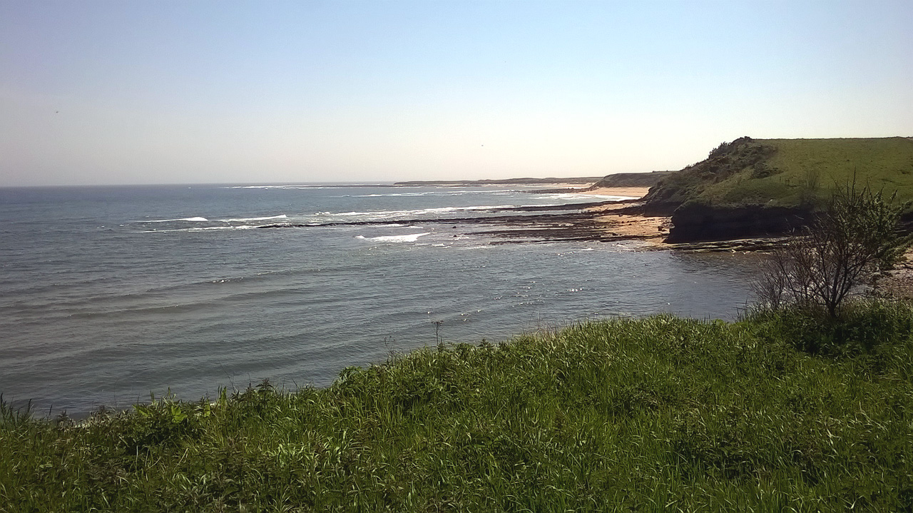
Coast view

The Whin Sill

The approach to Dunstanburgh Castle

Dunstanburgh Castle
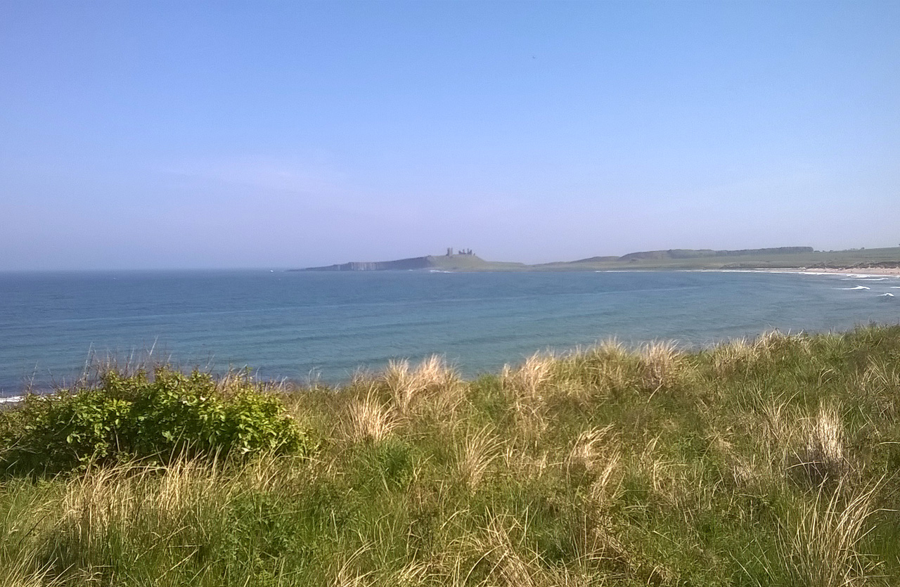
The last view of Dunstanburgh Castle

Alnmouth to Seahouses
Videos showing the Northumbrian coast and the view back to Dunstanburgh Castle can be downloaded at:
and:
Walking together again (with observations on the mindlessness of the Arriva bus company) ***with track***
May 29, 2018 § Leave a comment

Ken and Janet
All good things come to an end! The home comforts had to be left behind. It was Saturday – time to move on. Thank you, Janet and Ken, for your great hospitality.
Ken dropped me off at Cresswell and from there I followed the coast path northwards around Druridge Bay. I wasn’t overly impressed. Flat, with low dunes hiding the sea. I wondered if this was all the much-vaunted Northumbrian coast path would turn out to offer. Fortunately it wasn’t.
I had arranged to meet up with Martin (ex-Edinburgh Martin, not Matlock Martin) on the coast path east of Red Row. It was great to see him again. The last time we walked together was on the LEJOG, including a memorable day skirting Ben More. This time the plan is to walk together right through to the finish, at the border north of Berwick.
The day had started out grey, with a chill onshore wind. It got steadily better, however, and by the time we reached Amble we were walking in shirtsleeves. My impression of the coast path also improved markedly, for it took us past some great coastal scenery. There was even time for a bit of sightseeing.
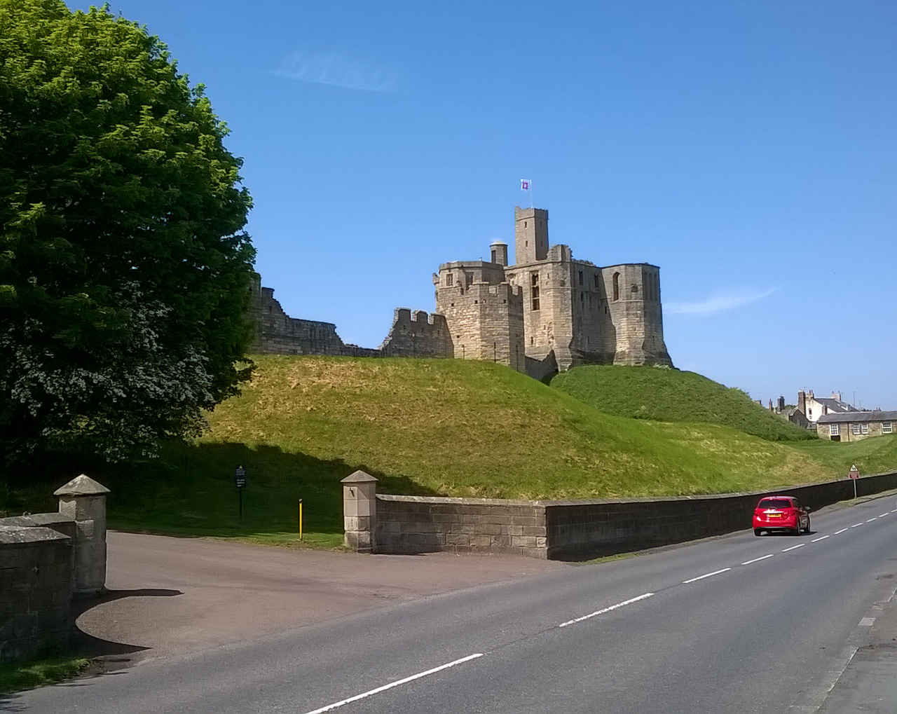
Warksworth Castle
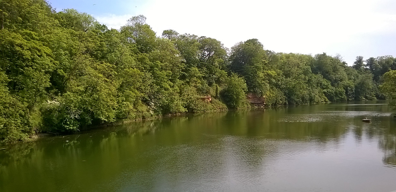
River Coquet at Warksworth, with a bit of outcrop for those who might be interested

Trackside flowers at Warksworth
Our target for the day was Alnmouth, which we reached comfortably by mid afternoon. The plan was then to get the bus to Alnwick, the main town just a few kilometres inland, where I’d booked us a B&B. We looked at the bus timetable at the bus stop in the centre of Alnmouth village and found we had well over an hour to wait. OK, sit down in the sun and relax.
But hold on! I’d been sure that the buses to Alnwick ran hourly. I’d also been sure they ran seven days a week, whereas the timetable at the bus stop showed only a six day service. Something funny was going on. I checked the Traveline website and found that there were indeed frequent buses from Alnmouth to Alnwick – but not from the village itself. They left instead from a stop on the outskirts. We dashed there and caught one with only a minute to spare.
It turned out that what was going on was that Arriva, the company operating the Alnmouth-Alnwick service, had recently changed its route plan. Some buses still go into Alnmouth village (but only on Mondays to Saturdays). Most, however, now loop around a small roundabout at the village edge. This change, according to Arriva, was made ‘to increase punctuality’, a pathetically weak excuse if I ever heard one. We were told that the locals hate this change, as do the drivers. Clearly visitors like us won’t be too happy either. Well done, Arriva, you’ve managed to maximise the inconvenience for the maximum number of people!
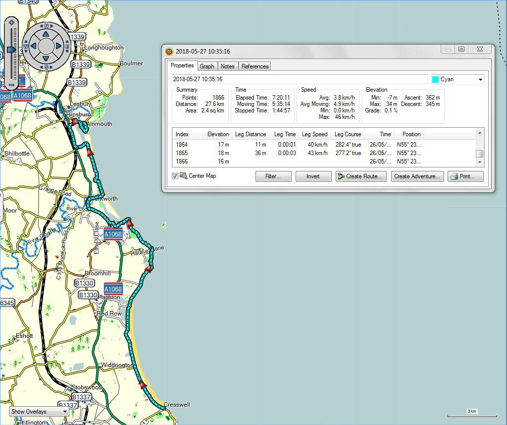
Cresswell to Alnmouth
Home comforts ***with track and video***
May 28, 2018 § Leave a comment
Ken picked me up at Monkseaton at the end of my walk from Sunderland and whisked me off to home comforts. I certainly needed them after such a long day – one of the longest I have ever walked. That night I slept the sleep of the dead. The following morning Ken drove me back to Monkseaton. I then had the prospect of a relatively easy day before me. It was going to be essentially flat and mostly off road. Most importantly it was going to be considerably shorter than the day before!
I headed north from Monkseaton along a trail that follows a section of the extensive waggonway system built in this part of Tyneside to move coal from the various pits in the area. It was excellent walking, partly in woods and partly across open farmland. It also passed the Holywell Pond Nature Reserve. This trail gave way to bridle paths and footpaths and minor roads, and these led me around Blyth to Bedlington. There, relatively suddenly, the weather changed. So far it had been fine and sunny; now it started to drizzle. What had looked at the start to be a pleasant prospect began to look considerably less attractive. Fifteen kilometres of walking in the rain is not something I relish.
I pushed on through Ashington towards Cresswell, my target for the day. Sometimes the drizzle was heavier, sometimes it was lighter, sometimes it stopped entirely. In parts I was on tracks, in parts I was on lanes, in parts I was on roads. Finally I reached Cresswell. Ken picked me up again and whisked me off to yet more home comforts. This is how walking should be done!

Holywell Pond, with geese and a peewit

Monkseaton to Cresswell
A video showing the geese and the peewits on Holywell Pond can be downloaded at:
https://www.dropbox.com/s/x4meatzc4jt8ntc/WP_20180525_11_12_31_Pro%20Holywell%20Pond.mp4?dl=0
The very long way round ***with track***
May 27, 2018 § Leave a comment
Robin and Pat entertained me magnificently in Clara Vale. Thank you both so very much! Then the following morning Robin chauffered me back to Sunderland to restart the walk.

Pat and Robin
My target for the day (Thursday) was Monkseaton – not a million miles away from Sunderland as the crow flies, but considerably more difficult to get to from Sunderland if you’re a walker. The problem of course is the Tyne, which has only a limited number of foot crossings. The obvious one to use in this case would usually be the Tyne Pedestrian and Cyclist Tunnel, from Jarrow to Wallsend. This, however, is currently closed for renovation. The alternative is the Millennium Bridge, from Gateshead to Newcastle, approximately five kilometres further upstream. Using this adds about ten kilometres of road work to the journey. Not nice!
I’d identified this problem when I was planning the walk, and had therefore contacted Alastair, the engineer in charge of the tunnel renovation project, to see if by any chance there might be a possibility of my being allowed through the tunnel. He thought there might be, using the old escalators for access to it. These would be stationary and therefore possible for me to use.
The bad news came on Wednesday afternoon. Alastair called to say they had a safety issue with those escalators – they are effectively museum pieces – and would only be able to let me through the tunnel via the lifts. “And I know that won’t work for you”, he said. (I’d explained to him previously that walkers like me are not permitted to use any forms of mechanical transport.)
The upshot was that I had to use the Millennium Bridge alternative. It was a very long way round!
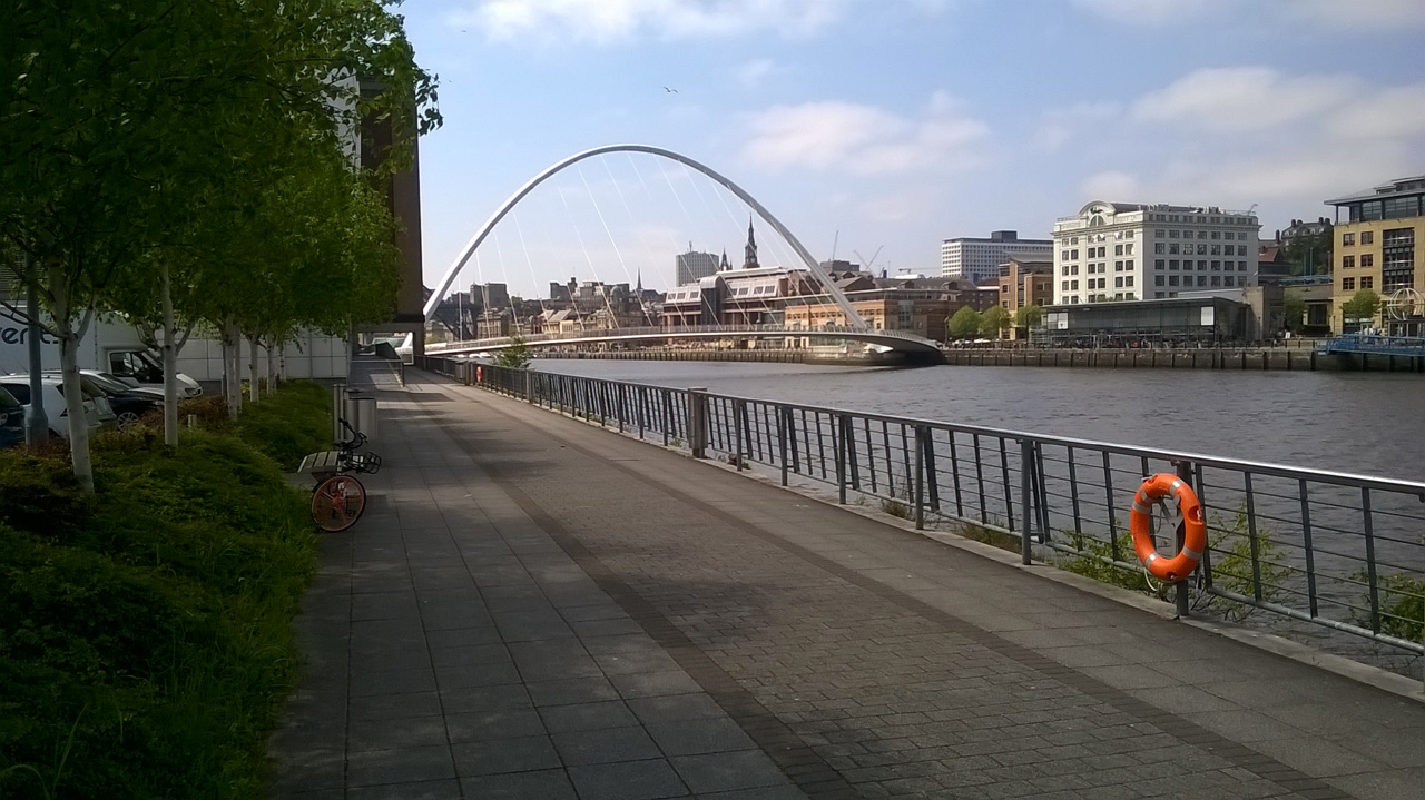
The Millennium Bridge at last!

Sunderland to Monkseaton
But where was Charlie? ***with track***
May 26, 2018 § Leave a comment
I was feeling understandably positive as I set off yesterday (Wednesday). All the indications were that it was going to be a very comfortable day. Firstly, I was going to have about three kilometres less to walk than I’d originally planned: this was because I’d overnighted in Horden rather than Blackhall Colliery. Secondly, the weather had improved markedly overnight and there was now only a light breeze. I had not been fancying a day on the cliff tops battling into a strong northeasterly wind. Thirdly, my route was going to follow the coastal path. A day to look forward to.
Everything did indeed click. There was a good grass surface for much of the way, with roads only when I reached Sunderland; there was a cafe in Seaham just when I needed a pot of tea and a chocolate brownie; and there was a chauffeur service from Robin at the end.
That cliff top walk was memorable. I found myself thinking of how hellish it must have been there no more than three decades ago. Filthy and noisy – a thoroughly unhealthy place, especially for the workers and their families. There were collieries on those cliffs – even a blast furnace on Nose’s Point – and all of the waste was dumped straight onto the beaches or piled on the land. How things have changed! The dark satanic mills have gone, replaced completely by a green and pleasant land.
I found myself also thinking about a previous cliff top walk – the days I spent last year with Bert and Helen on the Isle of Wight. The same low cliffs, the same cliff profiles, the same landslips (although here not as prolific as there), the same deeply cut back inlets (there they are chines, here they are denes), the same treeless grassy tops. There was only one difference. Where was Charlie?

Railway bridge over Hawthorn Dene

Railway bridge over Hawthorn Dene

Blast Beach, looking north to Nose’s Point

Blast Beach, looking south from Nose’s point

Horden to Sunderland
The next bouquet
May 24, 2018 § Leave a comment
It’s bouquet time again.
My experience yesterday with Chimneys has led me – understandably I think – to be even more suspicious than I previously was about some of the accommodation descriptions you find on the internet. A place that sounds good can turn out to be truly awful.
There are nevertheless some gems, and one of these is the Bell, the guesthouse I was fortunate to find in Horden. Its rooms are comfortable, clean and quiet, its breakfasts are excellent, and it has a good bar. These are the things the tired walker needs, especially after an exasperating day. What’s also impressive about the Bell is the attitude of the staff – friendly, helpful and above all competent. In particular I single out Kim.
This next, very well deserved bouquet goes to the Bell at Horden: http://www.thebellguesthouse.com/
The ultimate closed pub story ***with track and video***
May 23, 2018 § Leave a comment
Yesterday (Tuesday) saw a change in the weather. Cloudy skies instead of bright sunshine, and a chill wind from the north east. I bussed back to where I’d finished the previous evening, the RSPB centre at Saltholme, and went off to see the seals. Sure enough, there they were, some of them swimming, others simply lying out on the tidal flats. Those are big beasts!
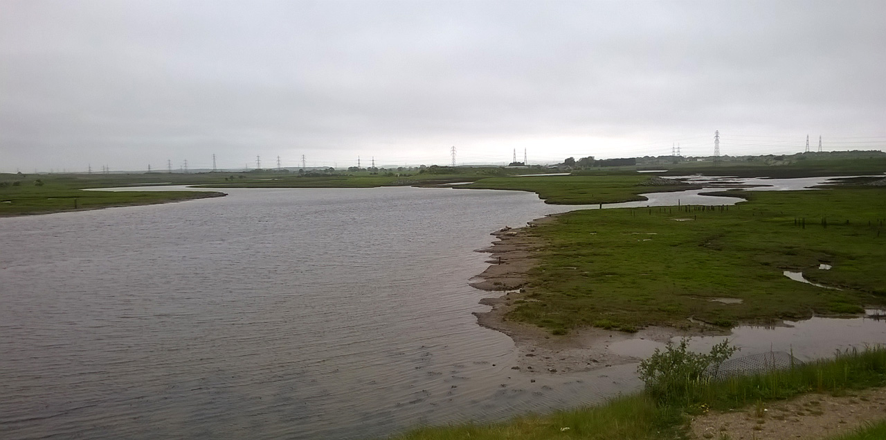
Seals at Saltholme
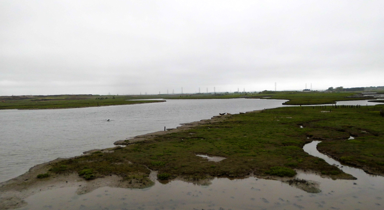
Seals at Saltholme
The rest of the day had no such high points. The route headed inland then curved back towards the coast. It was a pleasant combination of minor roads, small villages, and footpaths through farmland. I reached the coast at Crimdon Dene and joined the coastal path again. Strange to think that this is the same path that I left after that horribly wet night in Newgale, almost four weeks ago.
From Crimdon Dene it was only a short distance to my day’s destination, Blackhall Colliery. I reached there shortly after three and what did I find? Yes, a closed pub. This, however, was different in that it was where I’d booked to stay. Not a welcome sight!
Some of you are naturally saying that I’d simply arrived before check-in time. At first I thought that too. No, the place really was closed. All doors firmly locked, car park gate locked, no answer to door bell, both telephone numbers unobtainable, website unreachable. I walked up the street to the nearest shop. “Oh yes”, said the man there, “Chimneys has been closed for months.” Closed, closed, closed.
The overriding problem clearly was to find alternative accommodation close by, if possible within walking distance. I was lucky in that a guesthouse in Horden, about three kilometres up the road towards Sunderland, still had a suitable vacant room. I booked it and an hour later was there. Problem solved.
There was nevertheless still the matter of my original booking at Chimneys. This had been made through Eviivo and paid in full. Obviously the shyster running Chimneys was using his Eviivo software to collect money for a business which either had already gone out of operation or which he knew would shortly go out of operation. That sounds remarkably like fraud to me.
So what about my money? An initial telephone call to Eviivo was not promising. The recorded message told me that they were only a booking agency and that all matters concerning refunds had to be taken up with the accommodation provider. A little persistence paid off, however, and eventually I managed to speak personally to someone in the company who clearly realised the potential seriousness of the matter for Eviivo, i.e., liability for negligence in a criminal case. He immediately arranged to refund the money.
I went down to the bar of the guesthouse in which I was staying. There were several locals there, one of whom who had once stayed for a night in Chimneys and all of whom who knew of its evidently unsavoury reputation. The unanimous opinion was that I was lucky not to have been able to stay there. It would have been worse for me if it hadn’t been closed!

Saltholme to Horden
A video showing the seals at Saltholme can be downloaded at:
https://www.dropbox.com/s/6feth7ob2vnvgik/WP_20180522_10_23_14_Pro%20Saltholme.mp4?dl=0
Blogger meets blogger
May 23, 2018 § Leave a comment
Some people – indeed many people – have suggested that my preparations for these walks border on the obsessive. They might just be right. My view, however, is that it’s always sensible to check out as much as you can beforehand.
It was while I was trying to work out a route that would get me from the North Yorkshire moors to the Durham coast that I came across a blog with a description of a short walk in Hartlepool that would take me through the Seal Sands National Nature Reserve. It sounded interesting so I contacted the blogger for more details. Getting information from a locally based source is always a good idea.
The blog concerned is Restless Jo: https://restlessjo.me/. It’s definitely worth a look, especially for the ‘Monday Walks’.
The two bloggers – Jo and I – finished up meeting for a drink in Seaton Carew after my own Monday walk. It would have seemed churlish to have come so close and not to have said hello. So blogger met blogger. A delightful time with some great conversation. Thanks, Jo.

Restless Jo
Twelve mental snapshots ***with track and video***
May 22, 2018 § Leave a comment
1) The countryside in all its glory – Kildale
2) The hill to avoid – Roseberry
3) The village with the famous son – Great Ayton
4) The poshness and the wealth – Nunthorpe village
5) The estates – Marton Beck
6) The new town – Coulby Newham
7) The schools and colleges – Saltersgill Avenue
8) The inter-war semis – south of Albert Park
9) The inner city streets – west of Albert Park
10) The redeveloped industrial area – Billingham Reach
11) The residential island – High Clarence
12) The brine fields – Saltholme
This was my Monday. I have seldom experienced a day like it. How can you put so many different things into one and the same story?

Cleveland, looking south from above Kildale
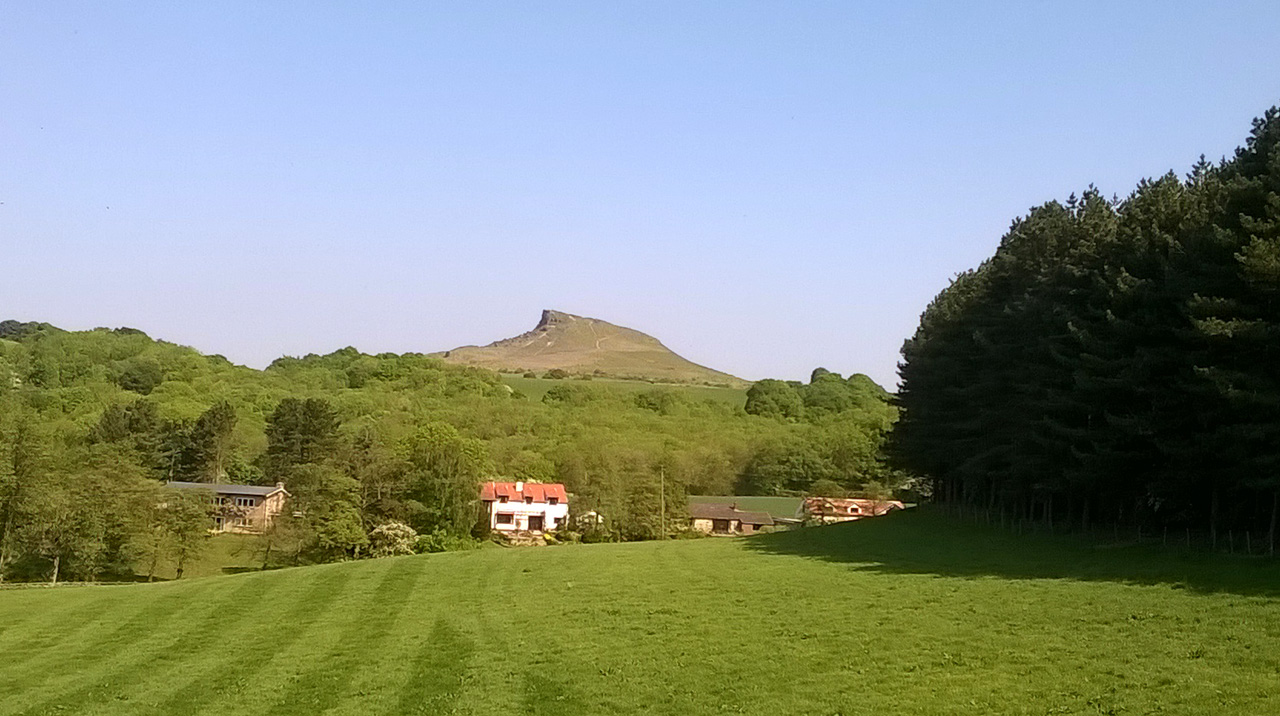
Roseberry: I honestly don’t see the point of climbing this
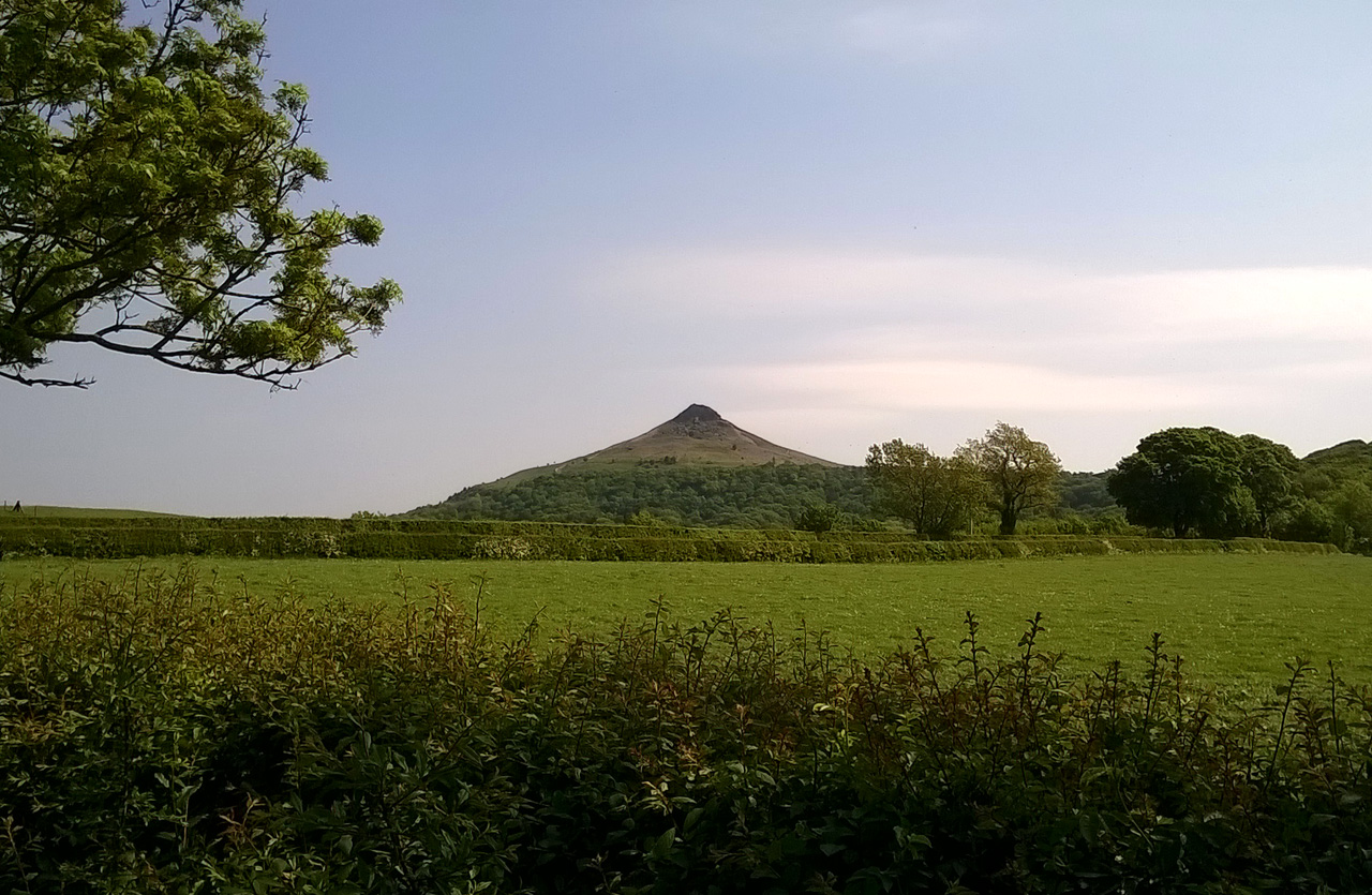
Roseberry again, this time from Great Ayton

Kildale to Saltholme
A video showing the view out over Cleveland from above Kildale can be downloaded at:
Food and drink, and a bouquet
May 22, 2018 § Leave a comment
One of the critical issues to address in planning any long-distance walk is the matter of food and drink. This doesn’t pose too much of a problem if the walk is in Britain, because it’s usually possible then to design the route so that every day there’ll be somewhere to get one proper meal. If that isn’t possible, you’ve got to carry food. And food means weight.
The sub-optimal food-and-drink situation I was talking about in the previous post involved carrying food for two whole days. It also involved carrying enough water each day to minimise the risk of dehydration – and this was a real risk for that amount of exertion in those temperatures. My food bag contained muesli bars, plain chocolate, sticky pastries, cheese, apples, and a large pork pie. Enough effectively for a succession of cold snacks. Each day I started off with one litre of water. Not much, I know, but the apples supply extra fluid.
What’s it like coming to the end of a long, tiring day when all you’ve got to look forward to is another cold snack washed down with water? Not the best, believe me! Imagine then my delight on reaching the barn at Kildale to find that I was alone in a spacious four-bed room with its own kitchen facilities. Even better, the farm sold various food items. My evening meal therefore went gourmet. The pork pie was served covered in a microwaved tomato and basil pasta sauce. Accompanying it was a can of cold 7-Up. To follow, a mug of hot coffee. That was the way to end a day.
Kildale Camping Barn (https://kildalebarn.co.uk/) gets the second of this walk’s bouquets. Good, comfortable accommodation at an excellent price, with lots of unexpected extras thrown in. What more can the walker want?
Walking across Botany Bay ***with track***
May 22, 2018 § Leave a comment
Yesterday (Sunday) was a very long one, as I’d predicted, but it turned out well in the end. I crossed the North Yorkshire moors from my campsite at Scawton, just south of Rievaulx, to the camping barn at Kildale. This is about 36 kilometres, which is more than enough with a full pack on a warm and sunny day. Especially when the food-and-drink situation is looking distinctly sub-optimal. More about that in the next post.
The first section of the walk took me past Rievaulx Abbey, then along the high road to the turn-off at Newgate Plantation. From there I followed the bridle path at the foot of what in this part of the world is termed a ‘bank’. Don’t be fooled! Elsewhere it would be called a [expletive deleted] hill.

Rievaulx Abbey

Ayton Bank and Easterside Hill (for the Yorkshire Lass), from Little Roppa
Next came the interesting section – about six kilometres of open moorland with only the faintest of tracks to follow. In places these were marked with cairns; in others you were left to your own judgement and instinct. Everywhere it was heather and bracken, which doesn’t make for comfortable walking. I wasn’t alone, however, as dozens of curlews and grouse were there to keep me company.

One of many cairns
I was understandably relieved when I finally reached one of the few small roads on the moor. There was a notice board there. Evidently the area – Bransdale Moor – is an SSSI with among other things ‘a healthy population of adders’. Yes, I’d been thinking along those lines as I was going through that all heather and bracken. Keep to the tracks; watch immediately ahead of you; tread heavily!
Bransdale is one of the steep-sided valleys that dissect the uplands of these moors. On the one hand they provide welcome relief from what otherwise would be rather monotonous walking; on the other they have to be crossed, which certainly is not welcome relief! The path I had to take to get up out of Bransdale was truly exhausting. I was even starting to question whether or not I would manage to get to Kildale as planned. What kept me going was the realisation that Bransdale was in fact the last climb of the day. After that there was just distance.
And so it turned out. There was a vehicle track for the rest of the way, essentially straight and running on the moor crest. Not by any means the most interesting walking, but just what I needed. Finally I dropped down over the fields to the Kildale barn.

Cleveland silhouette, looking back from above Kildale
So what’s all this about walking across Botany Bay? I didn’t see any trace of Cronulla or Mascot or La Perouse, and certainly there were no signposts to Randwick Racecourse. Had my navigation failed me? No, for Botany Bay is a small piece of the moor I walked across shortly before reaching that Bransdale road. How did it get the name? Search me! James Cook’s boyhood home was the village of Great Ayton, which is only a few kilometres away. But there’s nothing at this Botany Bay to suggest that Cook was ever there. I’m baffled.
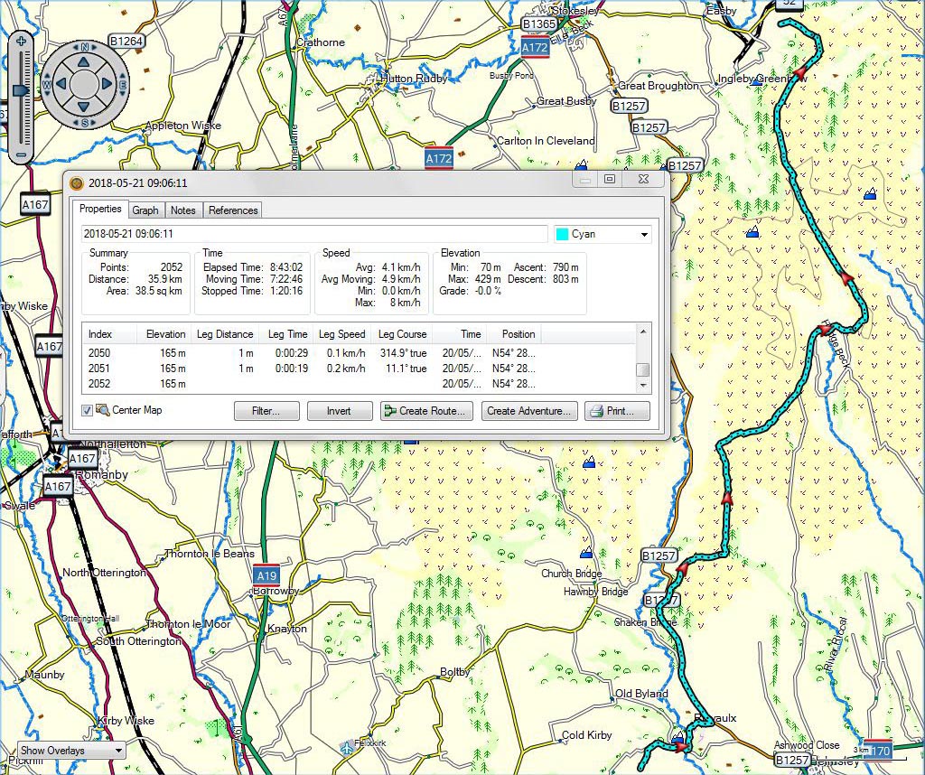
Scawton to Kildale
Introductory Geology – today’s field trip
May 20, 2018 § Leave a comment
I’ve no doubt that all of you who struggled up that bridle path with me today were pondering the obvious questions: Why on earth does Whitestonecliffe exist? When did it form, and how? Why is it still there? Why isn’t the whole escarpment a scar?
Let’s talk about the various possibilities in the next tutorial. Hint: Gormire Lake looks interesting, doesn’t it?

Gormire Lake, looking southwest from above Whitestonecliffe
Nimrod ***with track and voice and videos***
May 20, 2018 § Leave a comment
The rest day was over. It was time to get back to business.
Today (Saturday) was much shorter than average – less than 20 kilometres – for no other reason than that I couldn’t find any affordable accommodation a little bit further on. That means tomorrow is going to be correspondingly longer than average. We’ll sort that when we come to it!
Having this short day today turned out to be an excellent idea, for three reasons. Firstly – most obviously – it eased me back gently into the walking business. Secondly it gave me time to spend in Felixkirk, the small and still peaceful village from where some of my forebears came six or seven generations ago. Thirdly it meant that what is probably the steepest climb on this whole walk – Whitestonecliffe – would be carried out on what will probably turn out to be the walk’s shortest day.
That climb was seriously strenuous. It was up a bridleway – still a bit muddy – that presumably had originally been used by trains of pack horses. As I struggled up it I found myself wondering just what sorts of animals those pack horses were, and what sorts of loads they were carrying.
The climb was up through thick woodland, and it was only as I neared the top that I could see any hint of sky. But then suddenly the climb was over. I emerged onto the almost flat top of the escarpment, bare entirely of trees, with a magnificent panorama back over towards Thirsk and Ripon and the distant Pennines.
Strange, but I found myself unconsciously humming Elgar’s ‘Nimrod’. What my mind had done was to parallel the climb I had just finished with the hunt that Elgar was portraying. First the gentle introduction, then the action getting more and more intense, then the climax, then suddenly the majestically tranquil finale.
I watched a YouTube performance of Nimrod in my tent later in the evening: https://m.youtube.com/watch?v=sUgoBb8m1eE Daniel Barenboim conducting the Chicago Symphony Orchestra. It brought tears to my eyes, just as it always does. Now it will also remind me of that wonderful climb.

St Felix, Felixkirk
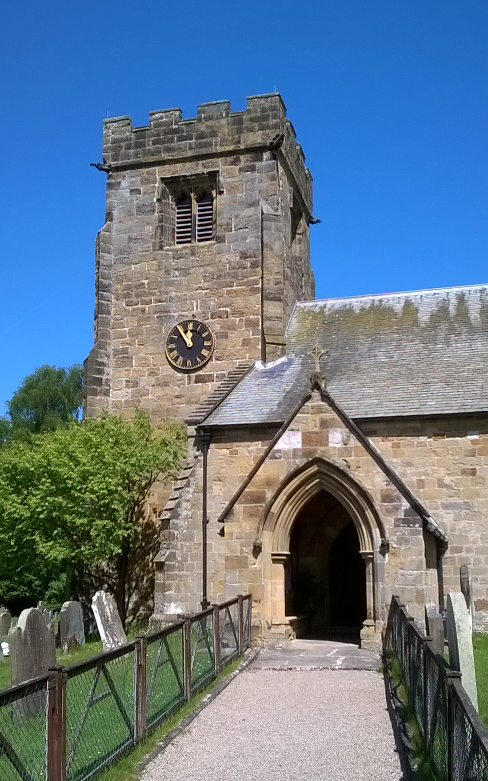
St Felix, Felixkirk

Roadside near Felixkirk

Whitestonecliffe

Whitestonecliffe

Escarpment top above Whitestonecliffe, looking northeast

Thirsk to Scawton
Videos looking out into the Vale of York, one taken in Felixkirk and the other taken from the windy top of the escarpment above Whitestonecliffe, can be downloaded at:
and:
A voice recording made in Felixkirk can be downloaded at:
https://www.dropbox.com/s/huu8utbiqx501z5/180429_0189.WMA?dl=0
A real rest day
May 18, 2018 § Leave a comment
There are rest days and rest days. This one (Friday) has been a real rest day.
Surely you’re not expecting a post!
Another prize competition ***with track***
May 18, 2018 § Leave a comment
The campsite at Markington was idyllic, and not only because it was next door to the village pub. I was the only tent camper, so I had a small, secluded lawn all to myself. Well almost to myself! In fact it was also a playground for a dozen little rabbits.
I woke with sun on the tent – always a good way to start the day. The rabbits evidently thought so too, and they duly entertained me with their antics. Then along came the next entertainment – two RAF jet trainers doing aerobatic exercises overhead. Watership Down meets Top Gun.
Then the day got serious.
Do you remember my post about the problem of getting from R to T, with the motorway in the way, the two river bridges and the main roads? If not, you’ll find it on 24th July last year. (The first correct identification I received of R and T came from Roland – he wins the prize of a large G+T next time we meet.) R and T are Ripon and Thirsk respectively. Today (Wednesday) was the day I was going to have to solve that problem.
I opted for the southern of the two bridges over the Ure, the one at Topcliffe. This meant a lot of road walking, zig-zagging to avoid the major roads. Most unpleasant, especially when the old riverside path at the end turned out not to be reachable after all. It was a very long day – about 37 kilometres – and I was exhausted when eventually I reached Thirsk.
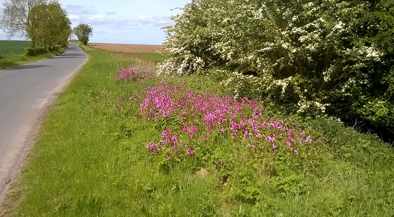
At last a quieter road
Two particular things struck me as I was plodding on and on. The first is the dearth of signposted public footpaths in this part of Yorkshire. The second (in the various villages I passed through) is the complete absence of the usual threatening notices about cleaning up after your dog. Elsewhere these have sprung up like mushrooms, with threats to the dog-owner varying from death to dismemberment to transportation to Botany Bay.
Clearly there’s something fundamentally different about this part of Yorkshire. What is it? There’ll be a prize for the most creative answer!

Markington to Thirsk
Wuthering Heights ***with track***
May 16, 2018 § Leave a comment
The fish and chips yesterday evening was exactly what I needed to start me off today. It was big, which meant that it could compensate for my substantially insubstantial breakfast this morning – a muesli bar and a mug of coffee.
The weather had changed overnight. It had rained a little in the early morning, but the greatest difference to yesterday was the temperature – single figures instead of high teens. There was also a penetrating wind. All the more reason to start off with a full stomach.
I climbed up out of the genteel civilisation of Bolton Abbey not knowing what to expect. What I found was a large area of open-access moorland – Barden Fell – with a gravel track leading me on and on and up and up. I was utterly alone except for the peewits and the red grouse.
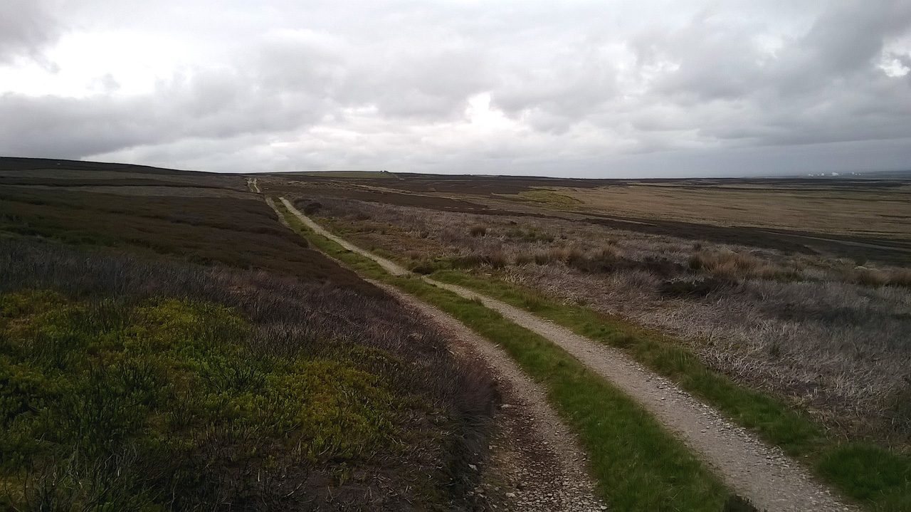
The track up onto Barden Fell
My target on the moor was a place marked on the map as ‘Rocking Hall’. What a place this is! Two old buildings, each of them still intact, standing out by themselves on the highest point of the moor, completely isolated. I have seldom visited a place with an atmosphere that grabs you so totally. The weather played its part too, for the wind was now strong and cold. I had visions of Heathcliff, with of course Kate Bush singing in the background ‘Out on the wild, windy moor…’ It wouldn’t have been nearly the same had the sun been shining.

Rocking Hall
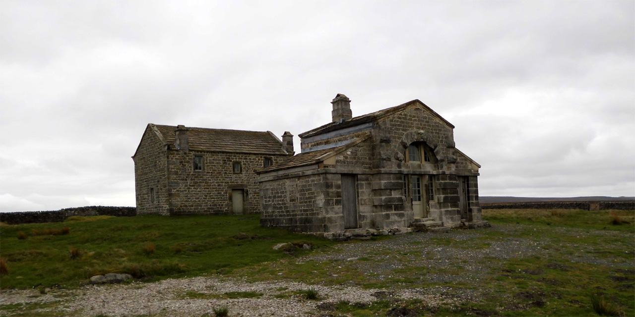
Rocking Hall

Rocking Hall

Rocking Hall

Rocking Hall

Thruscross Reservoir, with Rocking Hall 5 km away on the far horizon
After that the day was an anticlimax. Oh, except that close to the end I saw two of my favourite birds within the space of 500 metres – a red kite and a wren.

Bolton Abbey to Markington
Not much to report ***with track***
May 16, 2018 § Leave a comment
Just as were the days to Dunston Heath and Hollington, so the days to Bolton Abbey and Markington were planned as cross-over days. Today, starting at Colne and finishing at Bolton Abbey, was essentially a final farewell to Lancashire and a hello to Yorkshire.

Farewell to Lancashire
The sun shone again, the paths were dry and well signposted, and I made good progress. Apart from that there wasn’t much that’s worth reporting. It was a walk through farming country.
There were a few cyclists about, but the only walkers were dog walkers. At one point my route joined the Pennine Way and followed it for all of 50 metres. I remembered the load-carrying types that Karen and I had met on the Pennine Way in Northumberland. I had a second memory of that LEJOG too as I crossed the Leeds and Liverpool Canal south of Skipton. I’d walked that towpath with Ian.

Not an overloaded backpacker in sight!

This seems familiar!
I reached the campsite at Bolton Abbey and pitched my tent there. My evening meal was at the Devonshire Arms in the village. A massive piece of haddock, beautifully cooked, with the obligatory chips and peas, accompanied by two very necessary pints of Landlord, all served with a refreshing lack of political correctness. Thank you, Kelly.

Colne to Bolton Abbey
…and what a day that was! ***with track and voice and videos***
May 15, 2018 § Leave a comment
Take a beautiful area of countryside, bathe it in sunshine, dry out all of the paths, add in some nature and some history and of course some geology, then serve. That was the recipe for today.
First, however, there was the climb out of Todmorden. That was seriously steep. It led nevertheless eventually to a top track where the views more than made up for the exertion. Next came an amazing stretch of open road – a perfectly maintained two-lane highway following the hill crest, with wide verges, superb visibility and hardly any traffic. This road, the so-called ‘Long Causeway’, is evidently ancient in its origins. But that alone would surely not excuse the small fortune that must have been spent in getting it up to its present standard. I smell pork.

Climbing up out of Todmorden, looking south

Mount Cross, on the edge of Stansfield Moor above Todmorden
I left the Long Causeway at the Coal Clough wind farm and joined the Pennine Bridleway again. This too was perfectly maintained – a far cry from the log bridge that Martin and I had had to cross on Saturday. The Pennine Bridleway led down into Shedden Clough, where an informative noticeboard let me into the secret of the hushings. I’ll let you search for that yourselves!

Hushings at Shedden Clough
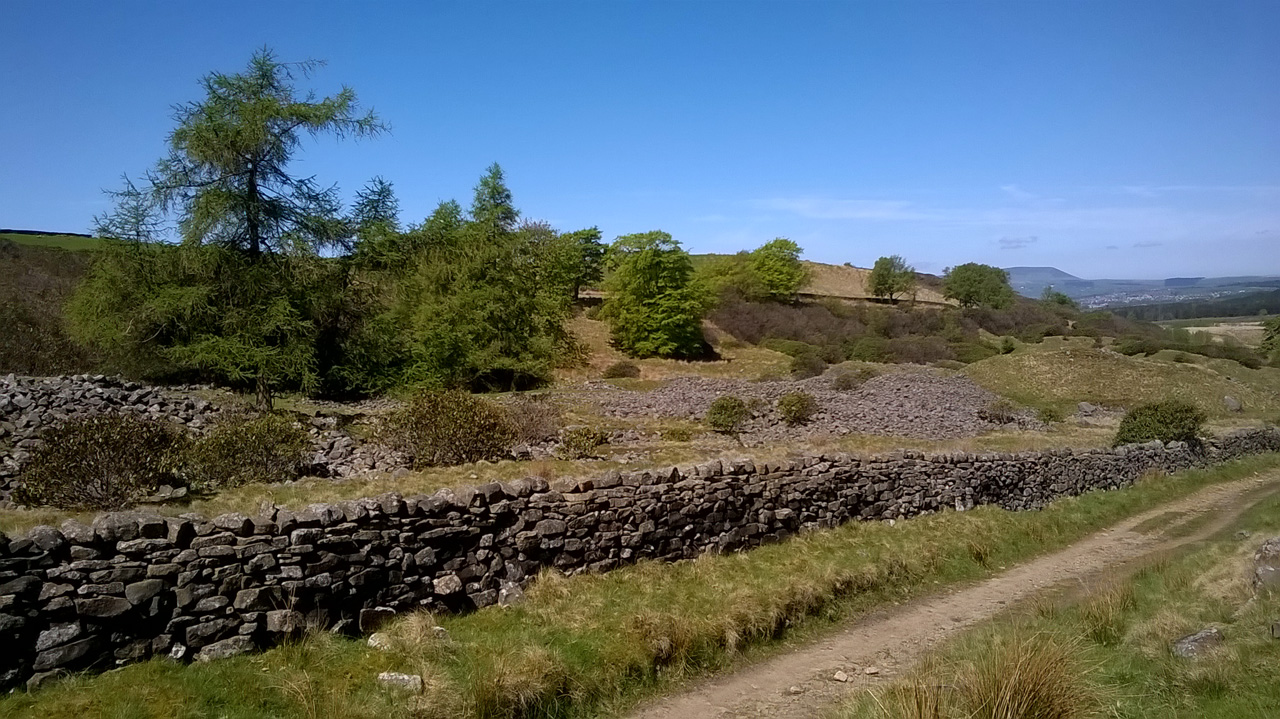
Hushings at Shedden Clough. Somewhere over there was the cuckoo!
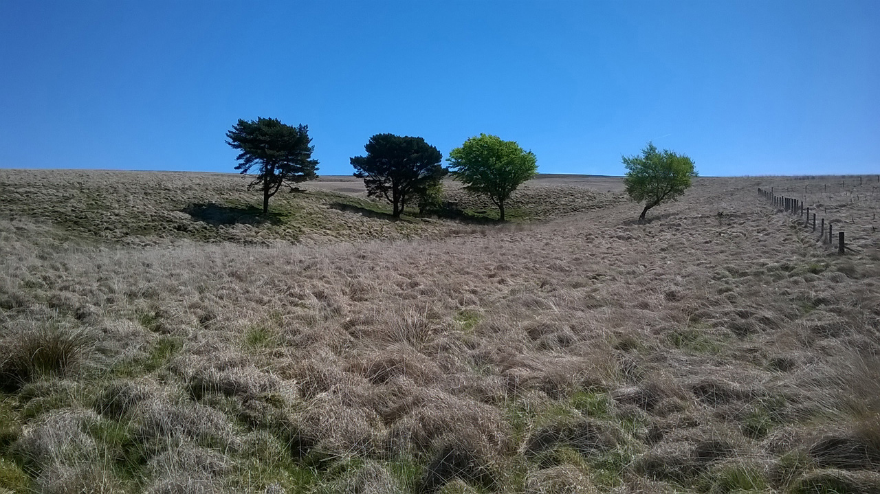
Shedden Clough, looking towards Worsthorne Moor
Then it was on to Hurstwood Reservoir. Hushings once more, but this time on a truly grand scale. How different this must have looked three hundred years ago – a mining wasteland. Nowadays this whole area is protected open moorland, grazed by a few sheep but otherwise empty. The single exception I came across was a most surprising one – a herd of thirty Belted Galloways!

Hushings above Hurstwood Reservoir

Pennine Bridleway, with Belted Galloways
The Pennine Bridleway led me on and on, snaking down into the valleys then back up on to the hills, always with views of the whole horizon. I was almost always alone. Just occasionally there were mountain bikers, and once there was an old man who’d come to photograph the solitary remaining gable end of New House Farm, on the hill above Thursden Valley. We talked for a few minutes about what life must have been like on the moor when that farm was inhabited. No four-wheel-drive to get you to your homestead; no quad bike with which to round up your sheep; no private wind generator to power your house.
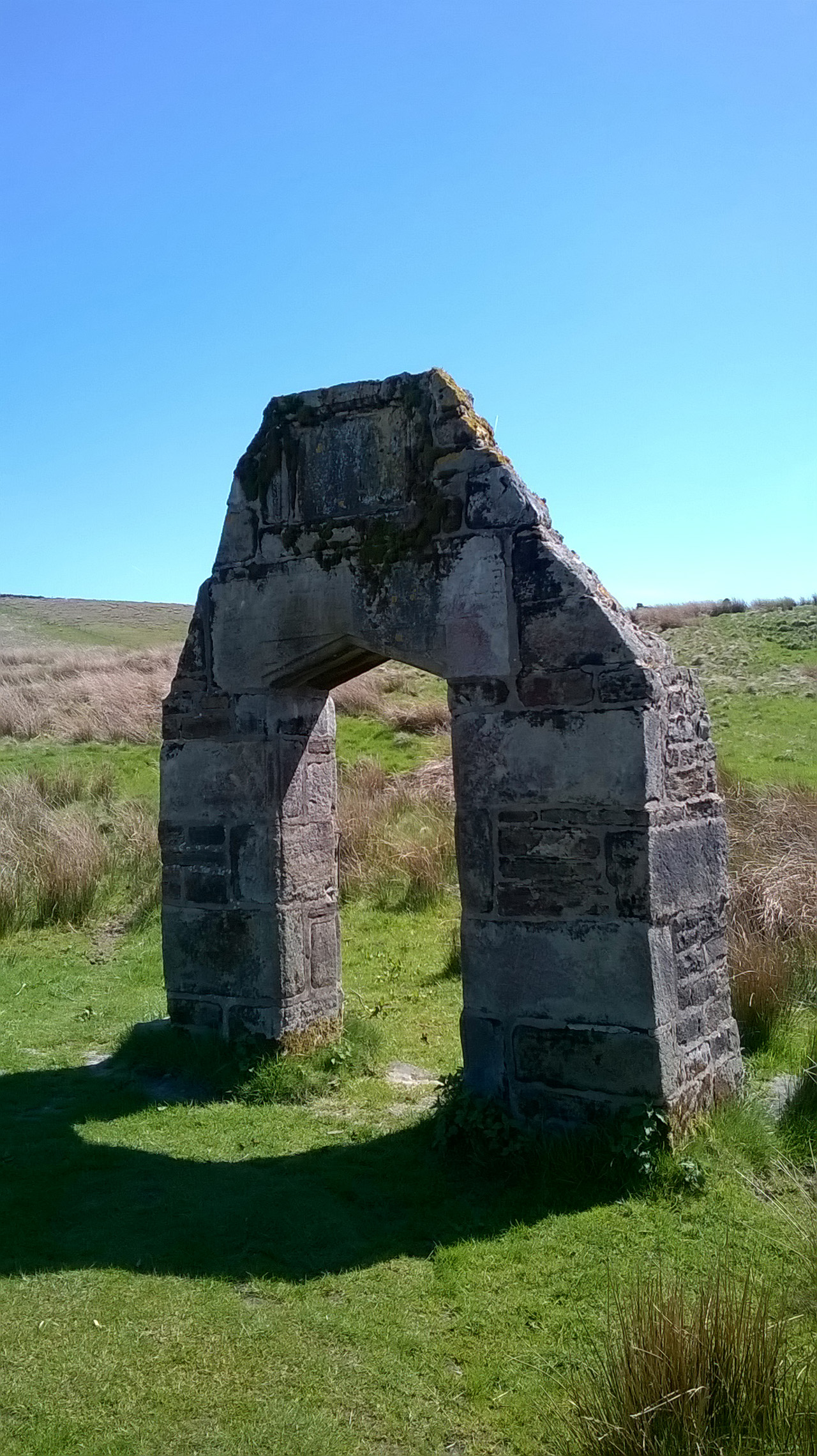
The sole remains of New House Farm
I came down off the moor into Trawden, then followed the riverside path from Cotton Tree to Colne. The sun still shone. What a day it had been.

Todmorden to Colne
A video taken on the top track above Todmorden can be downloaded at:
https://www.dropbox.com/s/xqy40jap21tbap9/WP_20180514_10_22_22_Pro%20Above%20Todmorden.mp4?dl=0
Videos taken on the Pennine Bridleway, firstly of the Coal Clough wind farm and secondly of the hushings above Hurstwood Reservoir, can be downloaded at:
and:
A voice recording made above Todmorden can be downloaded at:
https://www.dropbox.com/s/3btgk44271gtn7p/180429_0186.WMA?dl=0
A voice recording – with a real live cuckoo – made in Shedden Clough can be downloaded at:
https://www.dropbox.com/s/c483idegigqxnot/180429_0187.WMA?dl=0
Just me ***with track***
May 14, 2018 § Leave a comment
Thanks first to Fiona and Duncan and Euan and Erin. Super hospitality!
The first solo day after one in which you’ve had company is always a bit strange. This one (Sunday) was no exception. It had so many different parts, none of which appeared to stand out individually.
There was the steady pull up from Greenfield; then the succession of small reservoirs; then the procession of other walkers and cyclists; then the hills themselves, with the tracks contouring cleverly around them; then the M62 slicing across the landscape; then the families at Hollingworth Lake; then the LEJOG cyclist in the pub at Littleborough; then the geese on the Rochdale Canal; and so on.
I’ve found in the past that on days like this I take hardly any photographs. All of what I experience is recorded only in my memory. What is marvellous is the unbelievable detail and intensity of that record. I will wake up some night in the future and there in front of me will be that particular stile I climbed today, or that particular farm building I walked past, or that particular corner I turned. I will be there again.

Hanging Lees Reservoir
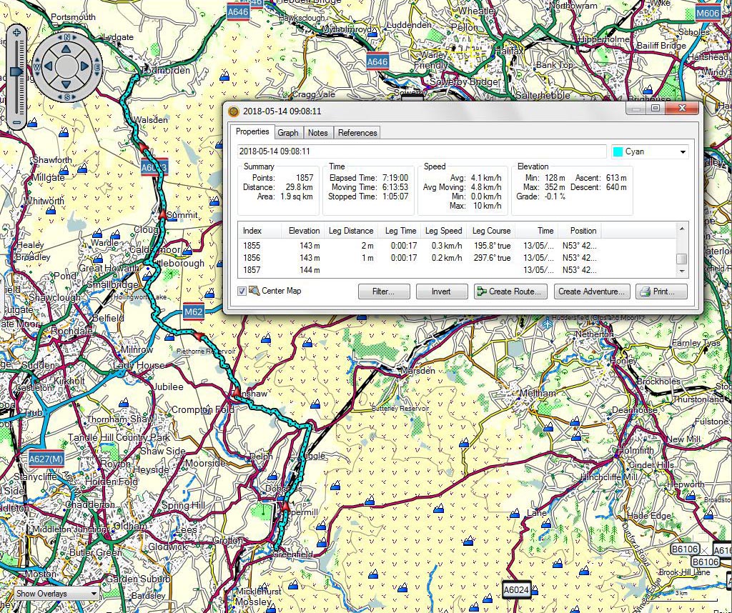
Greenfield to Todmorden
Company again ***with track and voice and video***
May 13, 2018 § Leave a comment
With the rest day over it was time to get back to walking again. Fortunately it was another day with Martin as company. That meant once again the presence of a knowledgeable and experienced guide.
Martin and I met at lunchtime at the Gun Inn in Hollingworth. Prior to that I’d bussed from Whaley Bridge to Thornsett, my starting point for the day. From Thornsett I’d walked on a pleasant mixture of back roads and lanes and tracks and fields. An interesting mixture too, with a Pistol Farm next door to a Gun Farm, and with an official ‘Public Footpath’ sign immediately adjacent to a sign promising ‘Bull in field’.

Coombes Edge. Note the deep rotational slides.
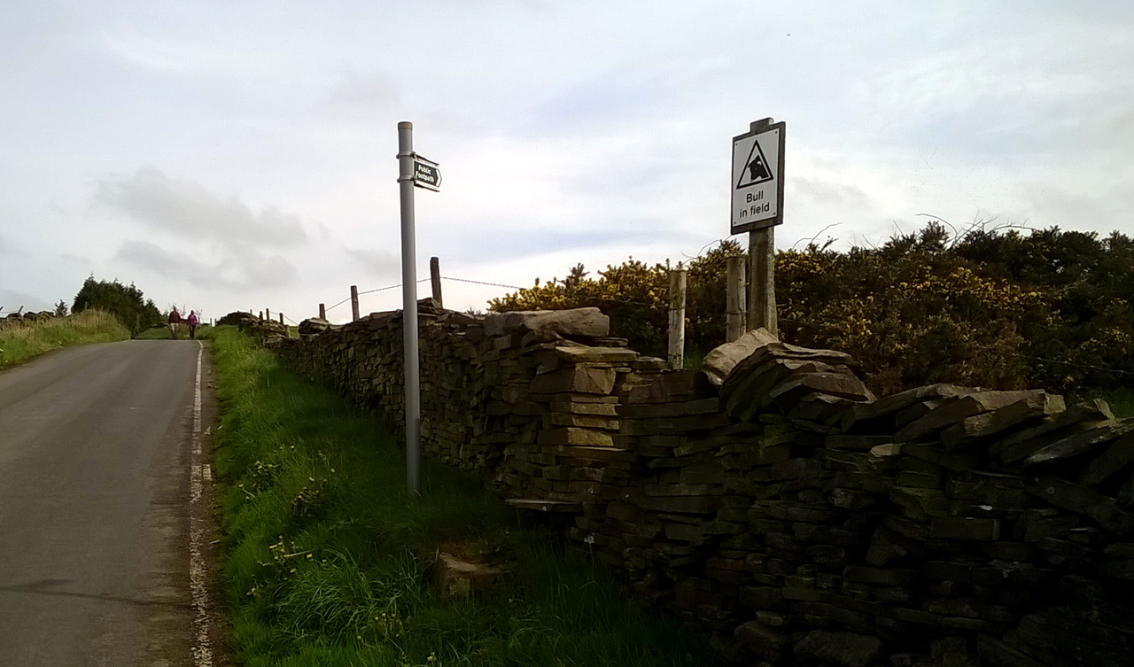
Interesting!
Lunch at the Gun Inn was beef and horseradish sandwiches with chips and salad – remarkably well done, I thought. Our after-lunch path, in contrast, was remarkably poorly done, at least at the start. A footbridge had been partially demolished by a falling tree and replaced simply by a log. Path maintenance like this is completely unacceptable, especially when the path concerned – the Pennine Bridleway – is a National Trail. Would the person responsible please take note!
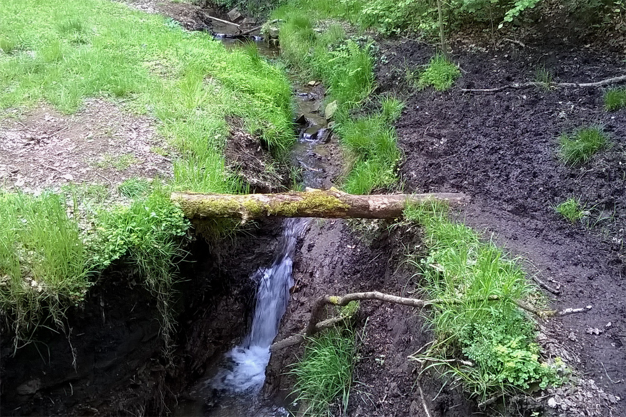
Replacement bridge on the Pennine Bridleway
Martin then took us up Ogden Clough and across the moor to the path above Chew Brook. What wonderful walking this was. Firstly the surface was sufficiently dry to be springy rather than squelchy. Secondly the views into the distance were magnificent, even though the air was somewhat hazy. Was that the Wrekin? Were those the Welsh hills? To tell the truth, it really didn’t matter. What mattered was being there.

Dovestone Reservoir and Saddleworth Moor
The path led along the brow to the trig point on Alphin, from where we dropped down to Greenfield, family comforts, and a carryout from the chippy.
A brilliant day. Thank you, Martin.

Thornsett to Greenfield
An important note! Those of you who are both eagle-eyed and suspicious will already have noticed that on the track from Thornsett to Greenfield there is a suspiciously straight section about 2.5 kilometres long. Does this indicate that Martin and I walked in an absolutely straight line for that whole section, or does it indicate that we engaged Turbo-Boost and flew? Worse, could it possibly suggest that a bit of cheating might have happened? In fact all it indicates is that I didn’t notice for all of that time that the battery of the Garmin had given out. And no, I’m not going back there to walk those 2.5 kilometres again, even if you ask me nicely!
A video taken from the hilltop path above Chew Brook (with a special guest appearance) can be downloaded at:
https://www.dropbox.com/s/rqyupbvgyvqe2yx/WP_20180512_16_09_17_Pro%20Above%20Chew%20Brook.mp4?dl=0
A voice recording can be downloaded at:
https://www.dropbox.com/s/8bbikyv9i0cf45d/180429_0185.WMA?dl=0
Introductory Geology, with an exercise for you
May 11, 2018 § Leave a comment
Those of you who re-enrolled in Introductory Geology this year will have realised that the walk so far has been one long field trip. Your field notebooks should therefore make interesting reading. Remember that they have to be handed in at the end for marking!
Think back on colours. For instance the reds of the northern Brecon Beacons and the reds of south Staffordshire. Then think back on paths. For instance the springy turf we’ve walked over in places. Then think back on names. For instance that lexicon of signposts in the Welsh Borderland – Aymestry, Bringewood, Downton, Ludlow, Wenlock. Then think back on plants. For instance the holly in the hedges. Then think back on age. So far we’ve crossed almost everything from late Precambrian to Triassic, with also of course the glacial and post-glacial overprint.
Which brings me to your exercise. Here are two outcrop photographs of the same sedimentary structure. What is the critical difference between them – and I do not mean that one of them has a Turkish actress for scale? Answers in time for Monday’s tutorial, please.

Field example 1. Lud’s Church.
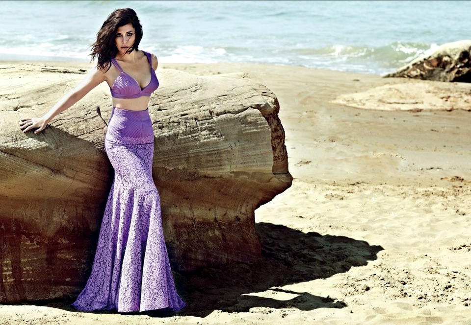
Field example 2. Deniz Akkaya for scale.
The ‘rest’ day ***with track***
May 11, 2018 § Leave a comment
The walker is exactly half way through the Corner-to-Corner plan. Seventeen walking days over; seventeen walking days ahead. A proper rest day is certainly appropriate. But what’s this? He’s evidently still been out walking today! Can’t he stop?
Yes, I admit it!
What I did today was cut about nine kilometres off what otherwise would have been an appallingly long tomorrow. I walked from Whaley Bridge to Thornsett then got the bus back. Tomorrow I’ll bus out to Thornsett then start from there.
Actually that’s not strictly true. Yes, I did walk to Thornsett, but I then made a detour to see the Mass Trespass site at Hayfield – I blogged about this a few months ago. It was thus from Hayfield that I bussed back to Whaley Bridge.
The site at Hayfield has an impressive bronze plaque. The bakery in Whaley Bridge has an equally impressive notice board.

Bowden Bridge Quarry. Start point for the 1932 Mass Trespass.
False advertising indeed!
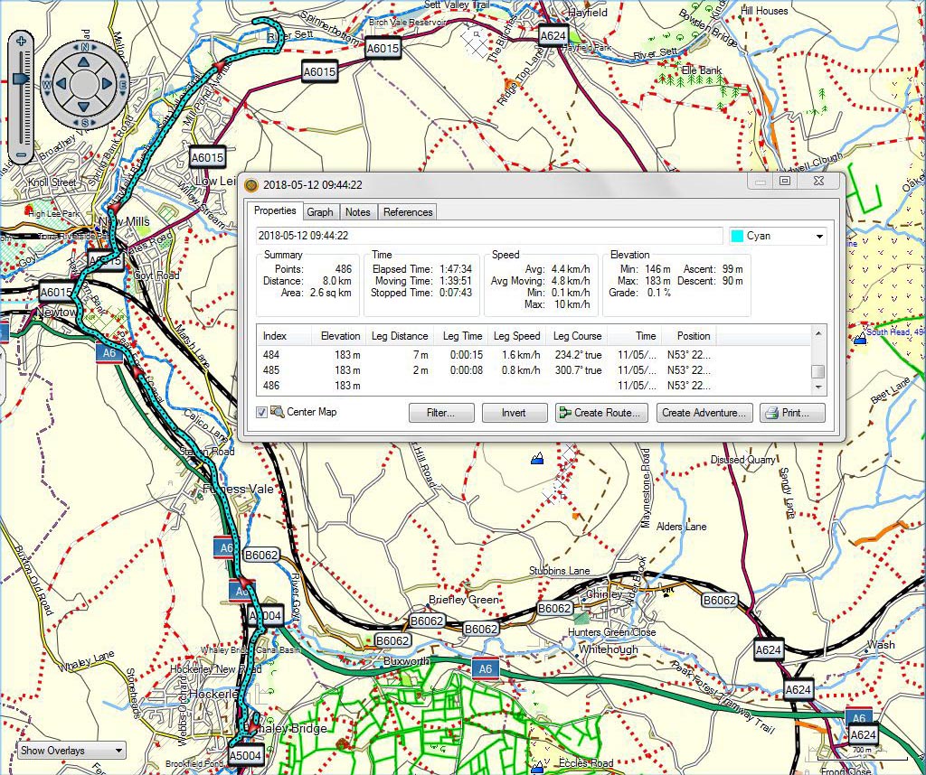
Whaley Bridge to Thornsett
Company ***with track and video***
May 11, 2018 § Leave a comment
I don’t know what else was in that beef stew, but I was soon ready for bed. I slept well too, waking only once in the night to the sound of rain on canvas. Fortunately that rain had stopped by the morning and I could pack up camp in the dry.
The day (Thursday) was going to be a very pleasant change in that I was going to have company for part of the day. Martin was going to join me at Roach End and walk with me to the Cat & Fiddle. What a boost company gives, especially when they’re experienced and local to the area.
I headed up over the Roaches and was only a few minutes late for our rendezvous. We then walked on towards Gradbach, passing of course through Lud’s Church to pay our compliments to the Green Knight. (Go on, look it up! Don’t, however, believe everything on the geology of Lud’s Church that you read in Wikipedia.) From there it was along to Three Shire Heads, our lunchtime stop.
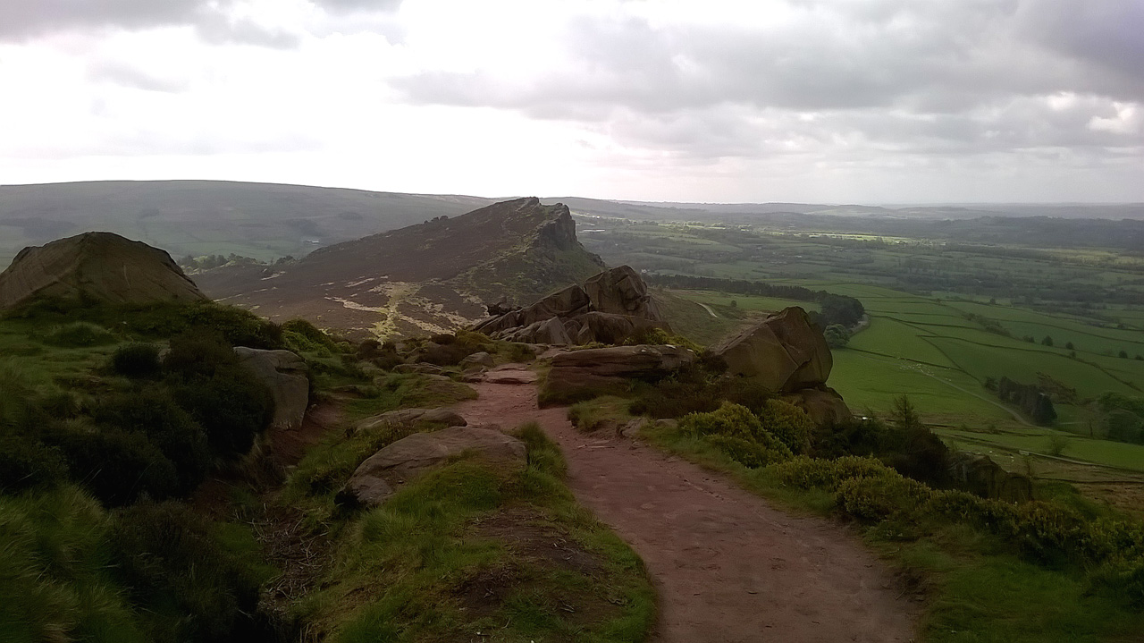
Hen Cloud, looking south from the Roaches
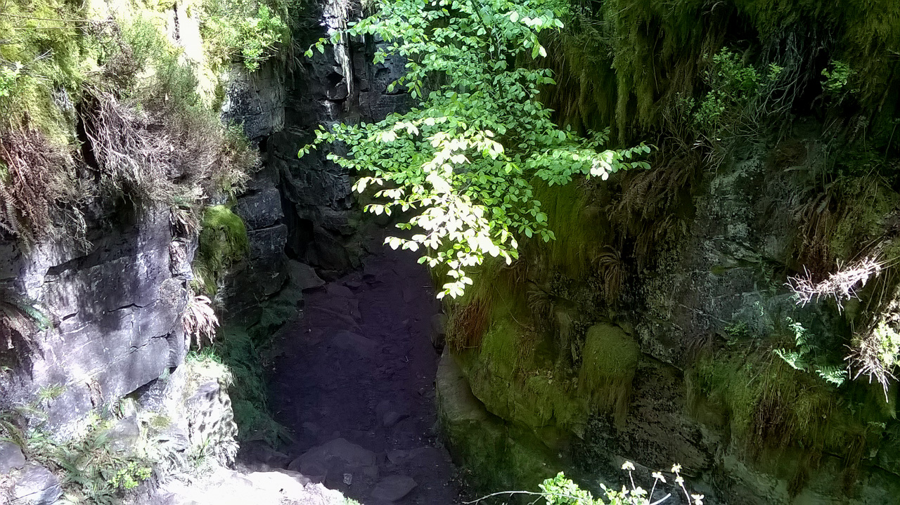
Lud’s Church: the first view in

Lud’s Church: the Green Knight

Sir Gawain in Lud’s Church, about to do battle with the Green Knight
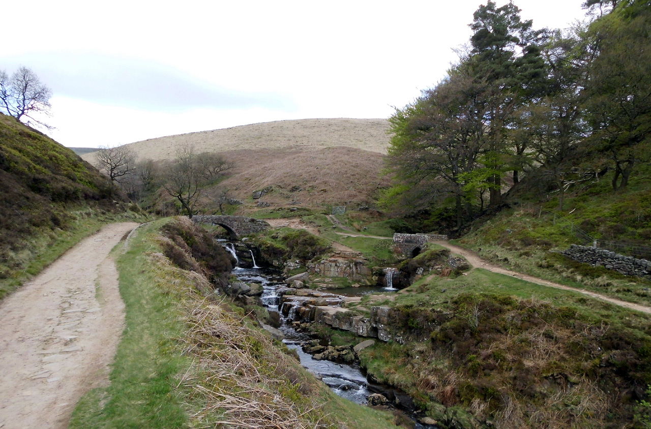
Three Shire Heads. From left: Cheshire, Derbyshire, Staffordshire
After lunch we climbed up to Danebower Hollow, passing the old mine shafts and quarries on the way, then over to the Cat & Fiddle. (Closed, but don’t get me on to that topic!) Martin left me there. What a great time it had been for this walker. I’d effectively been on a personalised and expertly guided tour.
I decided to take the ridge path from the Cat & Fiddle. That was in one respect a good idea – you get brilliant views into the far distance, with the Wrekin on the horizon. In another respect it was a bad idea, for the path from Shining Tor to Pym Chair has been paved all the way with irregular flagstones. I understand why this was done, but surely there were more natural alternatives. Not to mention more comfortable ones.
Finally I reached Whaley Bridge. It’s a rest day tomorrow.
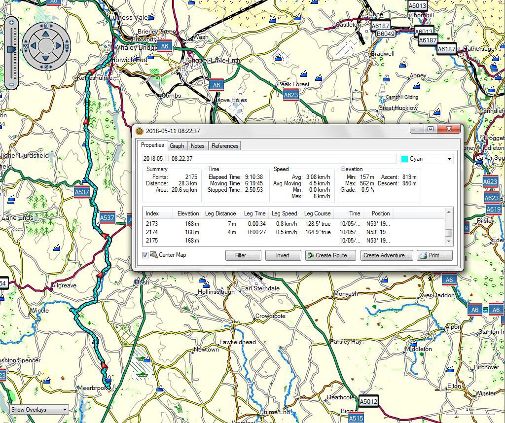
Upper Hulme to Whaley Bridge
A video taken on a very windswept Shining Tor can be downloaded at:
https://www.dropbox.com/s/1o5iewsvidqtire/WP_20180510_14_58_32_Pro%20From%20Shining%20Tor.mp4?dl=0
Going north ***with track and video***
May 11, 2018 § Leave a comment
It had been cool and damp when I turned in on Tuesday night. A nice surprise then to wake up early on Wednesday morning to find the sun shining. I packed up, then popped back over the road to the pub for a full breakfast. My route for the day was taking me northwards, up towards the Peak District. I’d had two days of relative flatness; now it was going to be hills and valleys. That breakfast was going to be necessary.
I spent much of the morning following the Staffordshire Way, which took me down through Hawksmoor into the valley of the Churnet. There I picked up the towpath of the Caldon Canal, which I followed to Cheddleton.
I’d never heard of the River Churnet before, let alone of the Caldon Canal. That’s not surprising because they’re not exactly major thoroughfares today. When you follow the canal, however, you realise just what an important traffic route that small valley once was. A river, a canal and a railway line – all competing for space. For more information than you could possibly ever want, see https://en.m.wikipedia.org/wiki/Caldon_Canal

Roadside flowers, north of Hollington

The Staffordshire Way in the Churnet Valley NE of Hawksmoor

The Caldon Canal, with a very narrow bridge
Next there came a new twist on the ‘closed pub’ theme. I was queued up at lunchtime at the bar of the Black Lion, an obviously popular pub on the Caldon Canal towpath. I only wanted a drink, but ahead of me were several hungry people ready to order their meals. Suddenly a man appears from out of the kitchen and shouts to the barmaid, “We can’t do any more food. No more orders.” There were some pretty unhappy people about, to put it mildly!
From Cheddleton I cut across to Upper Hulme, avoiding Leek. Most of the route was along the A53, which conveniently has a footpath all the way. I’d checked that out beforehand on Street View.
Finally I reached the campsite at Upper Hulme. It’s actually a farmer’s field, no more than that, with Hen Cloud behind it and a superb view to the west in front. There were three other tents there, each of them dwarfing my little one. Two guys were sitting in front of one of them, eating. We got talking. “Do you fancy a bowl of this beef stew? It’s been simmering here for the last couple of hours. Oh, and it’s got half a bottle of Malbec in it.” An invitation that it would have been rude to refuse! Thank you, Ryan and Steve.

Hollington to Upper Hulme
A video taken in the Churnet Valley can be downloaded at:
https://www.dropbox.com/s/t14o0pk77nmu66f/WP_20180509_11_11_43_Pro%20Churnet%20Valley.mp4?dl=0
Bookends ***with track and video***
May 11, 2018 § Leave a comment
The campsite at Dunston Heath was out in the countryside. It was an ideal place to stay – small and quiet. What was strange, however, was that at night it seemed to get louder. The other campers in their caravans and mobile homes might not have noticed this, but the guy in his tiny tent certainly did. What was happening was that the site noise got less at night but the background noise stayed the same. This came from the M6, only a couple of kilometres away. I really hadn’t realised how continuous the traffic is on a busy motorway at night.
I left Dunston Heath and made my way onward. Today (Tuesday) was also a bit of a cross-country day, but unlike its predecessor had a stretch of canal walking in the middle. I like canal walking for three reasons. Firstly, there aren’t any hills; secondly, you can usually expect an open pub somewhere along the towpath; thirdly, canals tend to have little surprises.
I reached the towpath of the Staffordshire and Worcestershire Canal at Milford and followed it to where it joins the Trent and Mersey Canal at Great Haywood. Remember Sasha, the pet Eagle Owl I met on the side of the road last year? Well this time it was two Harris’s Hawks sitting on their perch on the top of a moored narrow boat. Beautiful birds, but not what you expect in the English Midlands!
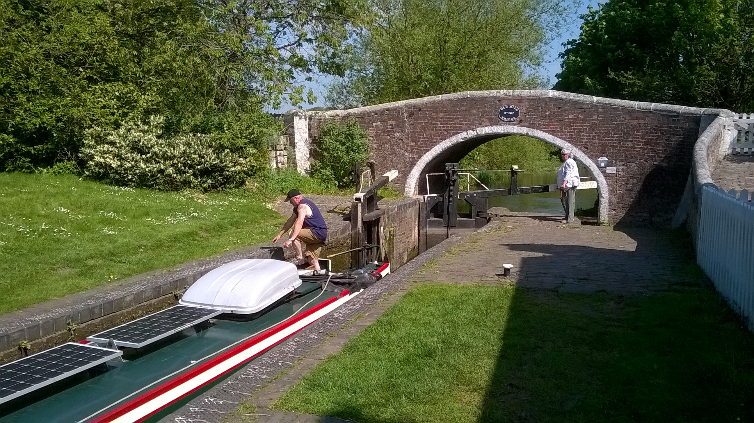
Lock on the Staffordshire and Worcestershire Canal

The two Harris’s Hawks
The weather had up to now been a repeat of yesterday. It gradually started to cloud over, however, and soon the only question was whether I’d make my evening’s campsite in Hollington before it started to rain. I didn’t.
OK, gentle reader, I’ve taxed your patience long enough. Why on earth is this post entitled ‘Bookends’? No, there’s not some subtle Simon and Garfunkel reference that you’ve missed. It’s simply that this long and tiring day had a perfect start and a perfect finish – two bookends to remember.
I’d just finished packing up my tent at Dunston Heath. Ben walks by and we start chatting. (He was camping there with his family while their house was being renovated.) Back he goes to their caravan, then shortly afterwards out comes Laura. “I’m just getting the children ready to go off to school but I’ve put the kettle on for a cup of tea for you. And here’s a bottle of frozen water – you’ll need it today.”
I was the only camper at Hollington. I pitched in the field there, immediately next to the weights room. (This is the only campsite I’ve ever seen with a fully fitted-out weights room.) Tim was exercising there. He told me he was a stonemason; I told him I was a geologist. About as close together professionally as you can get, so we talked for a bit. He finished exercising and went away; I finished pitching, showered, then went across to the pub for a meal. The girl behind the bar says, “Oh, Tim left me this for you”. She holds out a ten pound note. I’m flabbergasted. It’s half into the charity box then a pint of the Reverend James to drink your health, my friend!
Thank you, Ben and Laura; thank you, Tim. Two perfect bookends.

Dunston Heath to Hollington
A video showing that the two Harris’s Hawks aren’t simply carved wooden figures can be downloaded at:
https://www.dropbox.com/s/dazpm3ysmz3tgfk/WP_20180508_11_35_14_Pro%20Harris%27s%20Hawks.mp4?dl=0
